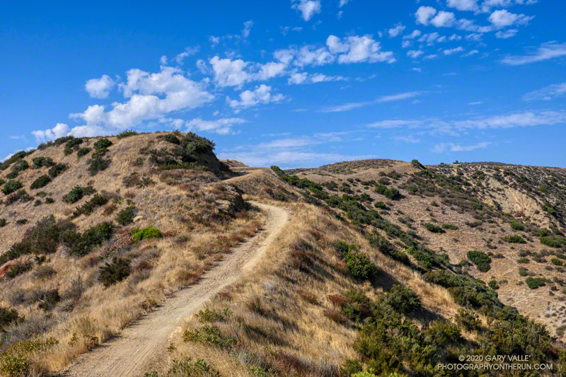
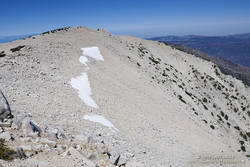
Rocky Peak Fire Road between the Chumash Trail and Fossil Point
Update of a post from December 30, 2006.
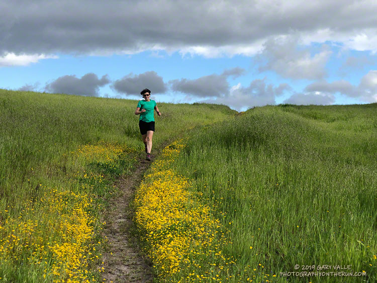
The Chumash-Las Llajas Loop is a scenic 9.3 mile trail run in the eastern Simi Valley. Run counterclockwise, it combines a strenuous climb on a single-track trail and fire road with a fast-paced 4-mile downhill on a dirt road. The cumulative elevation gain/loss on the loop is about 1600′.
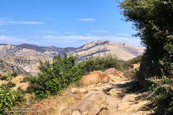
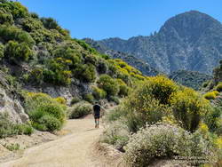
Nearing the top of the Chumash Trail
I like to do the loop starting at the Las Llajas Canyon trailhead on Evening Sky Drive. A short jog up Evening Sky Dr., then across a field, and you’re on your way up the Chumash Trail. From this point, it’s an approximately 1000′ climb over 2.7 miles of rocky trail to Rocky Peak fire road.
After turning left (north) on Rocky Peak fire road, a short downhill is followed by three-quarters of a mile of climbing to “Fossil Point.” A short detour off the main fire road leads to a cairn marking the high point. From here there is a panoramic view of Oat Mountain, San Fernando Valley, San Gabriel Mountains, Santa Monica Mountains, Simi Valley, Boney Mountain, Channel Islands, and Ventura Mountains.
Exposures of fossil shells are found near the high point. According to the area’s Dibblee geology map, these may have been deposited in shallow marine lagoons a couple million years ago.
From the high point, the loop continues north on Rocky Peak Road. At first, it descends steeply, then climbs to a hilltop with a few valley oaks. Partway up the hill, a roadcut reveals the long roots of the chamise plants on the hillside.
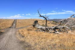
Road connecting Rocky Peak Road to Las Llajas Canyon.
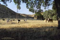
Some of the wildlife, and not-so-wild animals, I’ve encountered on the loop include rattlesnakes and other snakes, deer, longhorn cattle, roadrunners, and a kangaroo rat. Although others have seen mountain lions in the area, I’ve only photographed their tracks.
The loop ends with a short, steep climb up a paved road. At the top of the hill, turn left to return to the trailhead.
Explore the scenery and terrain on the Chumash-Las Llajas Loop trail run using our high resolution, interactive, 3D viewer. The imagery is so detailed, it’s almost like being there! To change the view, use the control on the upper right side of the screen, the CTRL key and your mouse, or touch gestures. Track and placename locations are approximate and subject to errors. Poor weather, and other conditions may make this route unsuitable for this activity. (It is also possible to start the loop at the Chumash Trail trailhead at the end of Flanagan Dr.)
The title photo is a section of Rocky Peak fire road between the top of the Chumash Trail and Fossil Point. It is from a run on October 6, 2020.
One of the things I’d been curious to see when running the Kodiak 50K in mid-August was how the summit snow band on San Gorgonio Mountain was holding up. The answer turned out to be fairly well. Now, a few weeks later, I was back on Gorgonio, chugging up the South Fork Trail, and on my way to see if any snow remained on the mountain.
Runoff from thunderstorms during the week had left the trail rocky and rutted. From the views of the mountain I’d glimpsed from the trail, I wondered if the rain had also washed away any remaining patches of snow.
Snow band near the summit of San Gorgonio Mountain on September 7, 2019.
In addition to that question, I also want to follow up on my earlier “field checks” this Summer and see how much water there was in Dry Lake, and if any snow remained in the avalanche debris above Dry Lake.
I was about a quarter-mile from the Dry Lake – Dollar Lake junction at South Fork Meadows, making decent time, when I heard footsteps behind me. I stepped to the side so he could pass, and we talked as we worked up the trail. Kevin said he’d been climbing in the Sierra just about every weekend and was really well-acclimated.
I asked him what route he was doing to the summit, and he said the Dry Lake route. I told him I was doing the Dollar Lake Trail route up and the Dry Lake route down. He was clearly moving faster than me and said he was shooting for a time of 4:20 to the summit. I mentioned the Dollar Lake route was shorter and faster, and depending on the number of stops for photos, I expected to get to the summit in around 3:45. We talked about some Sierra peaks and being in the mountains, and after a couple of minutes, he began to pull away.
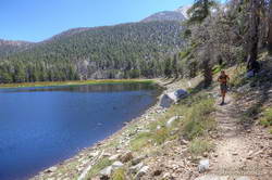
Dry Lake on September 7, 2019.
The early morning temperature had been a little more chilly than my earlier trips up Gorgonio this Summer. I debated pulling on my sleeves, but by the time I was in the sun on the Dollar Lake Trail, the temperature had warmed to a comfortable 50-something — perfect for ascending the peak.
The summit of San Gorgonio was a very busy place when I arrived. I’d estimate 40-50 people were on or around the summit. Most were part of one huge group that had come up Vivian Creek.
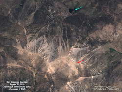
Copernicus Sentinel satellite imagery of snow on San Gorgonio Mountain on August 27, 2019.
Kevin caught up to me on the descent of the Sky High Trail. We’d both made the summit within a couple of minutes of our projections, leaving little doubt that the Dollar Lake Trail is the fastest route to the summit from the South Fork Trailhead.
I didn’t see any snow remaining in the avalanche debris above Dry Lake. The lake itself was in great shape, and the streams at South Fork Meadows were flowing nearly as vigorously as they had been a month ago.
Update November 26, 2019. A small amount of snow from the 2018-19 season has survived on San Gorgonio Mountain until the first persistent snow of the 2019-20 season! Copernicus Sentinel satellite imagery from November 17, 2019 showed small patches of snow in two areas. The first winter storm of the season brought snow to the mountains a couple days later, and more snow is expected over the Thanksgiving holidays.
Runners working up Josephine Fire Road from the Clear Creek Aid Station.
The race was going well. We’d made the 3:05 p.m. cutoff at West Fork (Mile 26.5 of the 50K) with an hour to spare and I was feeling good. One reason was that temps for the race were not nearly as hot as in 2017 and 2018. For the most part heat had not been an issue. Even so, with the clear sky and strong sun, it had still been toasty on the climb up to Lawlor Saddle and descent from Red Box.
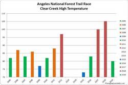
High at Clear Creek for the 2005-2019 ANFTR/Mt. Disappointment races. Click to enlarge.
On the way down from Red Box, I’d started running with German, who was running the Angeles National Forest Trail Race (ANFTR) as his first 50K. He’d run the Los Angeles Marathon a few months before and was curious to see what ultras were all about. He knew he’d picked a good one. I told him the ANFTR/Mt. Disappointment 50K was a favorite, and one of the best organized races that I had run.
Born in the ingenious mind of RD Gary Hilliard in 2005, the ANFTR/Mt. Disappointment races are unique. Most mountain ultras start low, climb to one or more high points, and eventually descend to the finish. The ANFTR/Mt. Disappointment courses do the opposite. They start on top of Mt. Wilson, and many miles later, finish with a grueling 5.5 mile, 2600′ climb from West Fork back to the top of Mt. Wilson.
We’d refilled at West Fork, taken a couple of minutes to cool down, and then had continued west on the Gabrielino Trail, jogging the level stretches and avoiding the poison oak prevalent on that section of trail. Reaching the Kenyon Devore Trail, I said something like, “The fun begins!” and we headed up the steepening trail. Both of us had done Kenyon Devore recently in training, and I’d done it many times in previous ANFTR/Mt. Disappointment races.
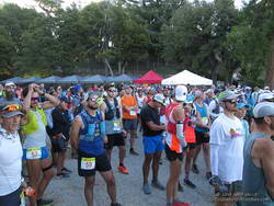
60K, 50K and 25K runners at the Starting line for the 2019 Angeles National Forest Trail Races.
I felt the first twinge around mile 29. Just a little flicker in an adductor. I’m used to this. Although I’ve not had any chronic mechanical issues with my knees and feet, in about two-thirds of my 50K and longer races I’ve been hit with leg cramps. Researchers refer to this type of cramping as Exercise-Associated Muscle Cramps (EAMC).
EAMC is no fun at all. The cramps, usually in the active leg muscles, can be intense and painful. They often occur late in a race — right around the time you’re getting excited about finishing and want to pick up the pace on the final few miles of the course. They are disconcerting and frustrating.
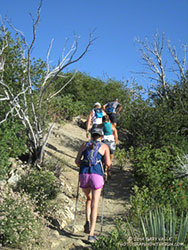
Working up the San Gabriel Peak Trail on the first uphill of the ANFTR course.
I’ve researched EAMC for many years, followed the science, and tried many remedies and solutions. Everyone has their favorites. Two of mine are pickle juice and jalapeño chips. Nothing I’ve tried has worked reliably and the research I’ve reviewed suggests there is no magic bullet for dependably preventing this type of cramping.
Much has been written about EAMC. Following are links to a couple of papers that summarize some of the research:
Like many who experience EAMC, I seldom get cramps in training runs — even very long and difficult training runs. For those of us that are prone to cramping, there are a multitude of interrelated factors that determine if cramping occurs, and if it does, how severe the cramps will be.
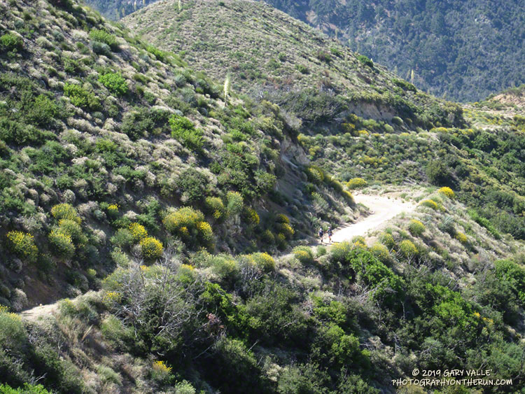
Strawberry Peak looms in the background as a runner works up Josephine Fire Road.
The most common scenario for me is that somewhere in the last few miles of a race I will feel a twinge in an adductor or hamstring. I’ll stretch; drink more water; maybe take an electrolyte tab or two and continue. Sometimes that will be that, but more often than not, the twinges develop into a familiar cycle of disruptive cramping — a sequence of the adductor and hamstring muscles in one leg cramping, followed sometime later by the adductor and hamstring in the other leg.
Once cramping starts, I walk. In my experience, walking usually helps to alleviate the cramping, particularly on level and downhill sections. If I can keep moving the cramps will often resolve in a few minutes. Then I can continue more or less normally, and can go back to running. Once the cramps have cycled through both legs, they usually don’t reoccur.
This time around I’d continued to feel various twinges, and then around mile 30, WHAM! It felt like every muscle in both legs cramped at once. I had no choice, but to sit down in the middle of the trail.
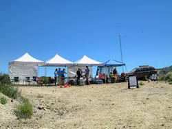
Josephine Aid Station
I’d been telling German about my cramping woes, so he wasn’t caught totally off guard. In the middle of all the drama, I kept saying I had to get up and get moving — not because I was worried about the time — but because I thought it would help resolve the cramps. At one point the cramping started to subside, but just trying to stand up was enough to trigger them again.
Eventually I was able to stand and slowly start hobbling up the trail. It seemed like I had been sitting for a long time, but according to my GPS track, we were only stopped for about 5 minutes.
At first, I had to be very careful about re-triggering the cramps. There were a few places where the trail steepened, and I could feel I was on the brink of cramping again. Keeping a constant, easy pace that didn’t overtax any individual muscle group was key. Gradually, I was able to resume a more normal gait. Not wanting to cramp again, I kept the pace slow.
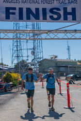
German and me at the Finish. It was German’s first 50K.
My legs behaved for the remainder of the climb, and German and I happily reached the top of Mt. Wilson and crossed the finish line with a smile. We even jogged the last few steps! I congratulated him on finishing his first 50K and thanked him for hanging with me through the cramping episode. After finishing, I walked around for about 10 minutes. In my experience this helps to keep the post-race cramps at bay, and they didn’t reoccur.
As in every race in which I’ve cramped, I’ve asked myself what I might have done differently. I was heat-acclimated. I did several ANFTR-specific training runs starting and finishing at the top of Mt. Wilson. Maybe these runs could have been longer, done at a faster pace, or in combination with another strenuous run — with the idea of being more fatigued on the climb back up the peak. My fueling and hydration seemed to be pretty good, but maybe I need more carbohydrates and fluids than I think. I tapered normally, but have noticed in other races that less of a taper may help with cramping. One thing that might have really helped on this course is the use of trekking poles.
Follow-up December 2019: I had no cramping at all during the Kodiak 50K in August, but did have some moderate leg cramps during the Rocky Peak 50K in October.
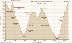
Elevation profile of the 2019 ANFTR/Mt. Disappointment 50K.
This was my twelfth finish of the ANFTR/Mt. Disappointment 50K. It is a challenging, superbly organized race on a spectacular course. Many, many thanks to RDs Gary & Pam Hilliard; the aid station and ham radio volunteers; Sierra Madre SAR; Angeles National Forest; the race sponsors; and all those that make this such an outstanding event.
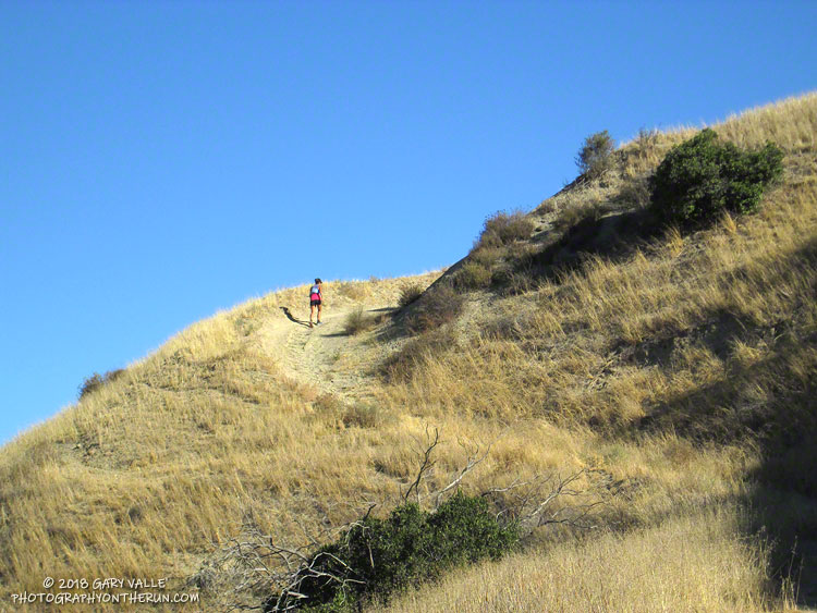
Many of my weekday runs are on the trails of Upper Las Virgenes Canyon Open Space Preserve (formerly Ahmanson Ranch).
In the wake of the Woolsey Fire and our wet rain year, the hills of Upper Las Virgenes Canyon Open Space Preserve have been covered with a dense carpet of green that has recently transitioned into a sea of mustard yellow. The grasses have now gone to seed and the hills will soon turn a summery-blond.
At first glance, just about all you see at Ahmanson Ranch is the green and yellow. But if you look closer, intermixed with the black mustard and other introduced plants are a variety of wildflowers.
In a few areas of the Preserve, there are large patches of native wildflowers, but it is more common for the native flowers to have to battle introduced plants for growing space. Some species are more successful than others.
Here is a slideshow of the wildflowers I’ve been seeing on my weekday runs, along with some comments and the date the photo was taken. Some of my weekday runs extend into Cheeseboro Canyon, so wildflowers from that area are also included. Additional photos may be added as the season progresses.
The yellow flowers along the trail on which Lynn is running are goldfields. As of April 10, there were still patches of goldfields blooming in the Lasky Mesa area.
I had the date wrong! I thought the Rocky Peak 50K was the Saturday following the Skyline to the Sea trail marathon and had decided I wouldn’t be able to run it. When I got back from Santa Cruz, I checked some upcoming races on UltraSignup and discovered Rocky Peak was on October 20th, rather than the 13th. That meant there would be 12 days between the races, instead of 5.
Five days or 12, my legs weren’t quite on board with the idea, and they had a point. With about 6000′ of elevation gain/loss, steep ups and downs, and rocky roads and trails, Rocky Peak is not an easy 50K. I had a few more days to convince them, and hoped my legs would come around.
It did help that the Start line is about 10 minutes from my front door. I’ve hiked, run and explored the Rocky Peak area for more years than I care to admit, and was very excited when Randy & Sarita Shoemaker organized the first Bandit Trail Run in 2009. The 50K was added in 2011 — the additional mileage gained by doing the Chumash – Las Llajas loop twice! The out and back to Tapo Canyon was substituted for the second loop in 2013. The Rocky Peak 50K course is essentially the same as the 2013 – 2016 Bandit 50K courses.
The week before the race, I still had to go through the pretense of not knowing if I was going to enter. My legs continued to complain during training runs, and it looked like yet another heatwave was going to peak on Friday or Saturday. None of that really mattered because I’d already decided I was going to run. Thursday, I signed up; and at dawn on Saturday, I toed the Start line in Corriganville, hoping that Rin Tin Tin might come to my rescue.
I encountered no valiant German Shepherds on the “warm-up loop” around Corriganville, and much to my leg’s chagrin soon faced the mile-long, 860 foot climb up the Corridor Trail to Rocky Peak Road. One of my main takeaways from doing this course many times is that you can go up the Corridor Trail climb too fast, but it’s almost impossible to do it too slow. At least that’s what my legs tell me. It’s been my experience that going a little slower on this first steep climb pays significant dividends later in the run. That seemed to be the case again this year.
The weather was nearly identical to last year’s race with moderate Santa Ana winds and warm temps. (The high at the bottom of the Chumash Trail was 88 °F.) Like last year, the low humidity and wind kept the “feels like” temperature relatively comfortable for most of the race. But somewhere around mile 27, near Rocky Peak, the wind stopped and things got toasty. Maybe not middle of the summer hot, but warm enough to notice it.
All in all, the run went well. For sure, my legs were a little tired from Skyline to the Sea. I was a bit slower running back up the canyon from the Tapo turnaround and also going up Las Llajas Canyon. But I can’t complain. I had no cramping (yahoo!) and felt good nearly all of the run.
Many thanks to Trail Run Events, LLC and New Basin Blues Running Club who co-managed the race, all the volunteers, and to Ventura County SAR. For more information see the Trail Run Events web site and Facebook page. All the 50K and 30K results are posted on UltraSignup.
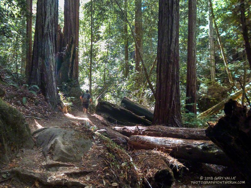
There’s a reason that Skyline to the Sea is Pacific Coast Trail Run’s biggest event. Close your eyes and picture your ideal trail. The trail of your dreams might be hard-pressed to match the appeal of the Skyline to Sea Trail.
There is something magical about running in an old-growth redwood forest. Established in 1902, Big Basin Redwoods State Park was the first state park in California. It’s redwoods reach 2000 years in age, 328 feet in height and 18.5 feet in width!
The Skyline to the Sea Trail has a net elevation loss, but enough uphill to get your attention. Many miles of the trail are as smooth as a carpet, but some are rocky, root-strewn and technical. It is often cool under the dense forest canopy, but it can also be warm and humid. I was surprised to see an “Emergency Water” stash a mile before the last aid station. In some years it is well-used and much appreciated.
The Park supports a vast variety of animal and plant life. Some plant species can only be found in the Park and a seabird (Marbled Murrelet) nests in its old-growth conifers.
In some years one park species can add extra adrenaline to the race. This year Brett (my son) and I were counting down the miles to mile 4.0 of the Marathon. The R.D. had reported encounters with the beasts at that point of the 50K on Saturday. About 20 yards before mile 4.0 Brett saw what looked like a “cloud of dust” and shortly after that we heard agitated voices from the runners ahead.
In it for the full experience, we — and several other runners — plowed headlong into the cloud. The yellowjackets didn’t like that. A number of us were stung; some several times. The day before a runner in the 50K was stung 18 times.
Yellowjackets or not, running the Skyline to the Sea Marathon was like running a 26 mile nature trail and one of the finest courses I’ve done.