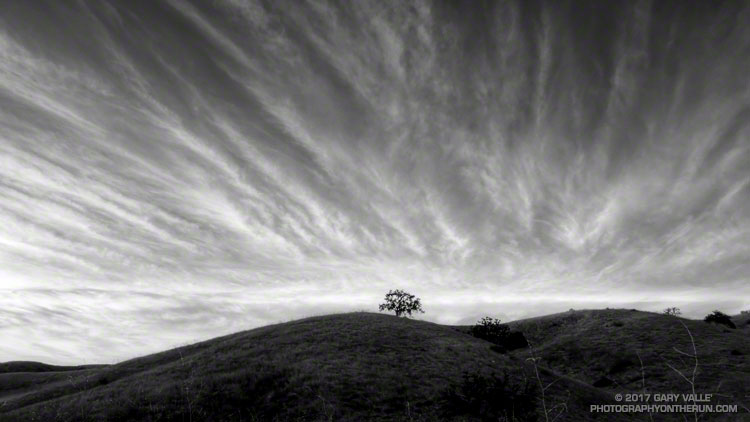
From a recent run at Ahmanson Ranch.

From a recent run at Ahmanson Ranch.
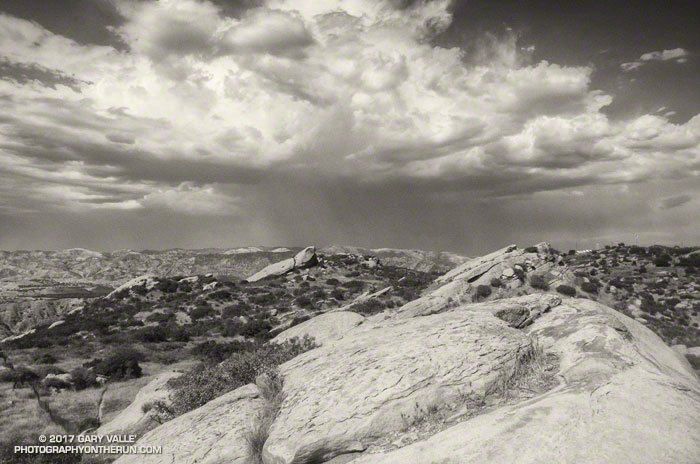
The photo above is from an afternoon run at Sage Ranch Park on August 31, 2017, during our recent heat wave. The thunderstorm in the distance is over Santa Clarita.
Around the time the photo was taken the temperature at the Cheeseboro RAWS was 110 °F, with an “in the sun” fuel temperature of 119 °F. The temperature at Ahmanson Ranch, where I often run on weekdays, was probably higher. I was running at Sage Ranch to try and take the edge off the heat — even if the reduction in temperature was only a few degrees.
During the heat wave the high temperature at Pierce College in Woodland Hills in the West San Fernando Valley exceeded 100 °F on nine consecutive days (August 24 to September 3) and exceeded 110 °F on five consecutive days (August 28 to September 1). Numerous temperature records were broken in Southern California and across the state. On September 1, Downtown San Francisco set a new all-time record high temperature of 106 °F.
At my West Hills weather station the high temperature for the month of June was 109 °F; for July 111 °F; for August 112 °F; and so far this September the high has been 113 °F. If I’m not heat-acclimated by now, I never will be.
Note: The Mt. Disappointment Endurance Run is now the Angeles National Forest Trail Race.
The heat was oppressive. The air was sweltering and still, reminding me of hot nights in the South, when heat lightning flashed on the horizon, and any movement was an effort. An adductor muscle in my left leg started to cramp and I jumped up from the reclining chair. Heat, and more heat had been the theme of this day. I had returned home from running my eleventh, and hottest, Mt. Disappointment 50K, only to be caught in a widespread power failure caused by a transformer explosion and fire in a Northridge distribution station.
How hot was it for the 2017 Mt. Disappointment races on Mt. Wilson?
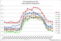
– Between 11:00 a.m. and 5:00 p.m. the in the sun temps recorded by the Clear Creek RAWS (on the 50K course) ranged from 115 °F to 121 °F. Out of the sun temps ranged from 94 °F to 98 °F.
– Between 10:30 a.m. and 4:30 p.m. an ANF portable weather station adjacent to the Mt. Wilson Observatory recorded in the sun temps ranging from 106 °F to 114 °F. Out of the sun temps ranged from 92 °F to 96 °F.
– The temperature (inside a ventilated instrument housing) on Mt. Wilson at CBS Radio reached a high of 103 degrees. This appears to be the highest temperature at that location since it came online in 2008 and may have been the hottest temperature on Mt. Wilson in several decades.
– Downtown Los Angeles (USC) reached a record high for the date of 98 degrees, breaking a 131 year old record.
Even more remarkable than the weather were the performances of the top runners. Ruperto Romero was the overall winner of the 50K with an astounding time of 4:38:44. This was only a couple of minutes slower than his winning 2015 time — when temps were 20-30 degrees cooler. In what must have been an exciting finish in the Women’s division, Elizabeth Ochoa cranked out a 6:19:45, just edging out Ana Guijarro by eight seconds. Victor Martinez won the 25K in 2:08:01, with Jay Nadeau taking the top women’s time in 3:05:13. All the Mt. Disappointment results are available on UltraSignup.
The heat continued to build past noon, peaking between 1:30 p.m. and 4:30 p.m. This made for a long day for those of us in the back of the pack. At 1:00 p.m Red Box Road was a blast furnace, facing directly into the sun. I was very glad to have scouted the final seven miles of the course last weekend. The creeks crossing the road really helped to keep from becoming over-heated. Strayns Creek on the Kenyon Devore climb also helped me to cool down.
Many thanks to Gary and Pam Hilliard and all the Mt. Disappointment staff, volunteers, sponsors and runners. The aid station personnel were phenomenal, and all their assistance was much appreciated. The efforts of the Forest Service were also much appreciated. ANF personnel were on the trails and at the aid stations, helping runners.
Some related posts: The Kenyon Devore Trail and Mt. Disappointment 50K, Mt. Disappointment 50K Returns, Mt. Disappointment 50K 2012 Notes
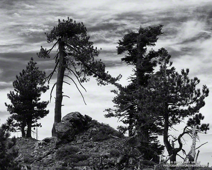
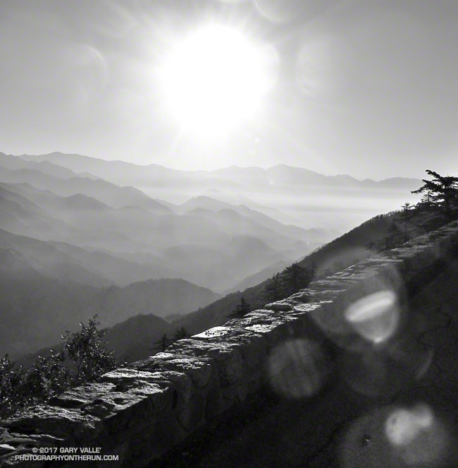
I rounded the corner, driving from deep shade into the golden glare of the rising sun. There was almost no traffic on Angeles Crest Highway. Up ahead, in the shade of some trees, there was something in the road. Was it a rock or a pine cone? Driving into the sun it was hard to tell. At this time of the morning — before the CalTrans truck has swept the road — one small rock can ruin your whole day. Getting to the trailhead unscathed is always the first challenge of the day.
Today, Craig and I were planning to do a point to point run from Inspiration Point to Islip Saddle — one of the best stretches of trail in the San Gabriel Mountains.
PCTA volunteer Ray Drasher often takes care of clearing the trees from this section of the Pacific Crest Trail. It’s quite an undertaking to get the required stock and equipment to the trailhead and then cut trees spread over several miles of trail. Because of conflicting reports, Ray wasn’t sure whether there were trees still on the trail or not. We’d let him know after the run.
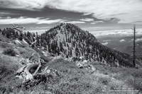
On the drive up you could see it was going to be a spectacular day in the Angeles high country. A low pressure trough moving through central California had pulled in the marine layer and a tumultuous ocean of cloud reached from the south-facing canyons far out over the Pacific.
I drove through the double tunnels at Mt. Williamson and then around a left-hand curve. Up ahead I could see the northwest ridge of Mt. Islip dropping down to Islip Saddle. What the heck? Orange cones? The gate is closed? The HIGHWAY is closed? That didn’t make sense; the Winter closure had ended weeks before.
After parking, I talked to a hiker who said it was closed for “road work.” I assumed there must have been a rock slide in one of the problematic areas between Islip Saddle and Vincent Gap. Later I learned the problem was a “sink hole” west of the Grassy Hollow Visitor Center.
After Craig arrived we discussed route options to Mt. Baden-Powell. Either we did the South Fork loop, which I’d done a couple weeks before, or we did an out and back on the PCT. We opted for the out and back.
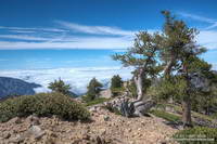
The run was as spectacular as expected. The visibility above the deck of stratus was at least 100 miles. San Bernardino Peak, San Gorgonio Mountain and San Jacinto were easy marks to the east and Owens Peak and the Southern Sierra could be seen to the north. Before it was immersed in a tide of cloud, the summit of Santiago Peak (Saddleback) had been visible to the south. High clouds and a gusty westerly wind kept the temperatures moderate. Only one very small patch of snow remained on the trail.
I’d hoped to be able to tell Ray the trees had been cleared from the trail, but no — they were still there. He said the next time I ran there, they would be gone. Thanks Ray!
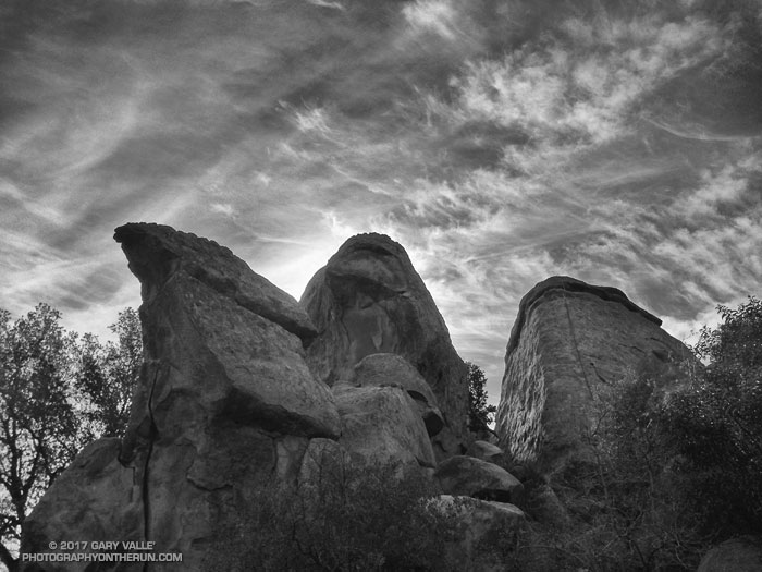
From Sunday’s Bulldog Loop in Malibu Creek State Park.