Brett was down for a few days, and as an initial run we did a loop from the Victory Trailhead of Ahmanson Ranch, through part of Las Virgenes Canyon, up onto Lasky Mesa, and then back to the trailhead.
Upper Las Virgenes Creek still flowed. Valley oaks were full with new leaves. The green grasses of the rain season had finally turned, and rare May cumulus clouds were painted on postcard skies.
The direct out and back trail run from the Victory Trailhead at Ahmanson Ranch through East Las Virgenes Canyon to the Upper Las Virgenes Canyon Trailhead is about 3 miles each way.
This variation bypasses most of East Las Virgenes Canyon. It climbs up to Lasky Mesa and then descends “The Beast” to East Las Virgenes Canyon about 0.4 mile before it joins the fire road in Upper Las Virgenes Canyon. This fire road can be followed south to the Upper Las Virgenes Canyon Trailhead, the turnaround point.
Depending on the exact route, the trail run totals about 7.5 miles, with about 825 feet of cumulative elevation gain. The Beast is the longest continuous hill and is about 0.8 mile in length.
When it rains a lot, sections of East Las Virgenes Canyon can get really muddy. This route avoids the worst of the gooey, stick-on-your-shoes mud.
Update January 17, 2023. With the additional rainfall this January the “best” route up to Lasky Mesa is on the dirt road. The single track is wet and muddy in spots. The lower half of the Beast is eroded and somewhat muddy. I have a pair of shoes that I use in the muck and wet. They haven’t dried out for weeks.
With vaccinations on the increase and Covid on the decline, it was wonderful to once again be able to visit family.
As we always try to do, Brett and I got in a couple of runs. We usually do at least one run that is new to me, and there are certainly plenty from which to choose in the Bay Area.
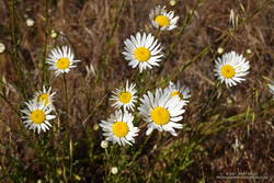
Oxeye Daisy along the Old Ranch Trail
Our first run was on San Bruno Mountain. We’d previously done the Ridge Trail, so this time opted to do a variation of the Summit Loop. The parking lot at the base was was closed, so we started the run using the Old Ranch Road Trail. This was a plus because it added a little mileage and there were a lot of wildflowers along the trail, including monkeyflower, iris, lupine, yellow paintbrush, daisy, and foxglove.
The next day, after watching a spirited youth soccer match, we headed south on 280. On the way, Brett filled me in on the runs he likes to do in Windy Hill Open Space Preserve and Huddart Park. We couldn’t go wrong with either choice but finally decided to save Huddart Park for another day.
Razorback Ridge Trail
Windy Hill Open Space Preserve is on the northeast-facing slopes of the Santa Cruz Mountains above Portola Valley. We parked near the Alpine Trailhead and ran up the road to the Eagle Trail. Corte Madera Creek was running, but low. Although the grasses along the trail were green and the undergrowth was relatively lush, I suspect the conditions were more like July than May. Open hillsides looked mid-Summer dry and the lichen on the trees was drab and desiccated.
Like the rest of California, the Santa Cruz Mountains have seen well below average precipitation this rain season. One station near Windy Hill, Woodside 3.4 S, recorded only about 28% (12″) of normal precipitation from October 1 to May 19. Another station, Skyline Ridge Preserve, recorded about 41% of normal (16.5″) from October 1 to May 3.
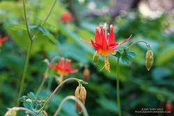
Western columbine
From the Eagle Trail/Private Road we turned onto the Razorback Ridge Trail. According to my Garmin track, the Razorback Ridge Trail gains 1000′ or so over 2.4 miles to its junction with the Lost Trail. It’s all runnable, switch-backing up a thimbleberry and fern-lined trail, shaded by California bay trees.
While the Razorback Ridge Trail continues up another 0.4 miles to Skyline Blvd., we turned right onto the Lost Trail. This trail parallels Skyline as it works in and out of the tributary ravines of Jones Gulch, on its way over to the Hamms Gulch Trail. Along the way there were views across the valley to Mt. Diablo, some 40 miles distant. Western columbine was blooming along the trail, its bright red color complimenting the green theme.
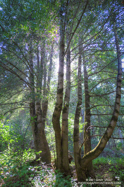
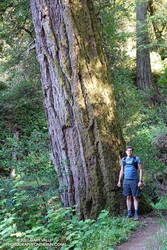
Large Douglas-fir along the Lost Trail
At the top of Jones Gulch, there is an impressive, old-growth Douglas-fir. At chest height, it is about as wide as Brett is tall. This would put its diameter at over 72″ and its circumference at over 220″, suggesting an age in the neighborhood of 350 years.
The run down the Hamms Gulch Trail was as good as the run up Razorback Ridge. Given the weather was nearly perfect for a hike or run, we were surprised to see only a dozen or so people on the trail.
From where we were parked the run worked out to about 8 miles, with about 1500′ of gain/loss. Here is a trail map of the area, and here is an interactive, 3D terrain view of my GPS track of the loop. The interactive map can be zoomed, tilted, rotated, and panned. To change the view, use the control on the upper right side of the screen.
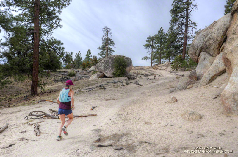
Snow — if there has been snow — disappears quickly from the middle elevations of the San Gabriels this time of year. Activity increases with the rising snowline, as visitors eye their favorite trails and peaks.
I was driving up Hwy 2 to Three Points to do a run with Skye. In a normal year we would be doing the Three Points – Mt. Waterman Loop, but for the second time in 11 years, the trails in the Mt. Waterman area had been closed by a wildfire. In 2009, the Station Fire burned 160,557 acres in the San Gabriel Mountains, and just last year, the Bobcat Fire burned 115,796 acres. In several places, including Mt. Waterman, the Bobcat Fire burned terrain that had been burned in the Station Fire.
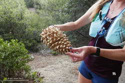
Coulter pine cone, heavy with resin
With entry prohibited in most of the Bobcat Fire burn area, the Three Points Loop around Mt. Waterman was out for now. Instead, we decided to do a segment of the traditional AC100 course from Three Points to Chilao, and then return to Three Points using the Silver Moccasin Trail.
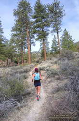
On today’s run we followed the Pacific Crest Trail northbound from Three Points toward Sulphur Springs Trail Camp. Just before the camp, the PCT splits. We followed the left fork (uphill), and then around to the South Fork Little Rock Creek drainage and Sulphur Springs Road. The PCT parallels the road for about a half-mile, then crosses the road. At this point we left the PCT behind and continued up the road (5N04) to Alder Saddle and forest road 3N17. We continued left (south) on 3N17, bearing left on Santa Clara Divide Road at a fork, and going uphill to Rosenita Saddle.
At Rosenita Saddle we turned right (southwest) onto the Mt. Hillyer Trail. The trail starts at the back of a small parking area. The trail climbs to the high point of Mt. Hillyer, and then descends through large granite boulders in the Horse Flats bouldering area. (If you are a rock climber, bring your shoes!) The Mt. Hillyer Trail intersects the Silver Moccasin Trail near the Horse Flats Campground.
To add a little mileage and elevation gain, we turned right (south) on the Silver Moccasin Trail and continued to Chilao Campground. After saying hi to Chilao, we turned around and followed the Silver Moccasin Trail north, back to Three Points.
The trail run was a little over 13 miles, with a cumulative elevation gain of about 2100′. The high point was about 6200′, on Mt. Hillyer. The route-finding on the loop can be a bit tricky the first time around.
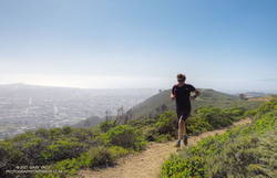
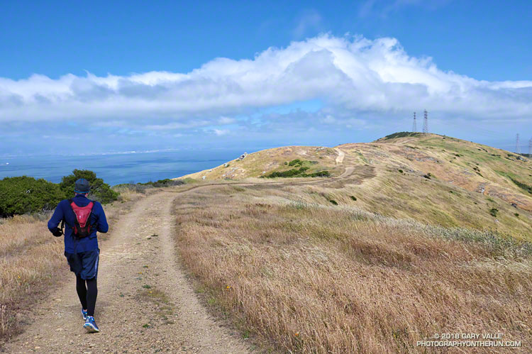
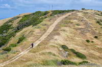
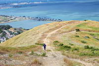
I staggered in the wind gust. It had to have been at least 45 mph. The views along the undulating ridge to the Bay were spectacular, but the wind was ferocious.
Hill on the San Bruno Mountain Ridge Trail.
Brett and I were running on the San Bruno Mountain Ridge Trail. We’d started at the summit parking lot and weren’t exactly sure where we were going to turn around. We’d know when we got to it.
The NWS forecast for San Francisco had called for “breezy” conditions:
.TODAY…Mostly cloudy in the morning then becoming partly
cloudy. Breezy. Patchy drizzle in the morning. Highs in the mid
50s to lower 60s. West winds 20 to 30 mph.
Continuing down, down, down the ridge.
That forecast was for the city — and of course up on the peak the wind was even “breezier.” The SF Giants beanie I borrowed was the right call. So were the gloves, extra shirt and wind shell.
We continued along the ridge past the second set of loudly singing power lines and continued downhill. It became one of those, “let’s just go down to that next overlook,” and then the next one, and the next one. Not only were we losing a lot of elevation, but we’d be running into the wind on the way back.
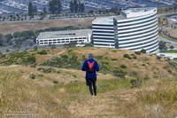
San Bruno Mountain Ridge above the 101 and Sierra Point
We eventually turned around a little above Bayshore Blvd., at the “Sierra Point Reset” benchmark marked “487” on the topo map. As is often the case, the return wasn’t nearly as torturous as envisioned, but I was glad to get back to the car!
San Bruno Mountain is an invaluable island of open space, about 20 minutes from downtown San Francisco. For more information see the San Bruno Mountain Watch website.