Category Archives: photography|trail running

San Gorgonio Mountain: Falls Creek Loop October 2015

Falls Creek Trail near Plummer Meadows on San Gorgonio Mountain

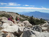
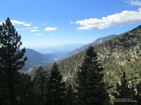
It was a little past noon and Downtown Los Angeles was about to hit a high of 100°F for the second consecutive day. From my vantage point I couldn’t quite make out Downtown; it was 80+ miles away, somewhere in the light haze to the west. Across Banning Pass Mt. San Jacinto loomed, massive and pyramidal, and down the spine of the range stood Mt. Baldy, surrounded by its siblings.

Patty and Ann on the summit of San Gorgonio Mountain.
Summit of San Gorgonio Mountain

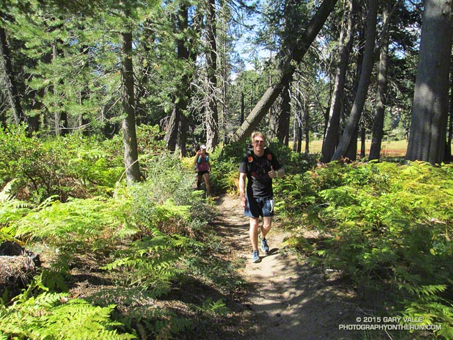
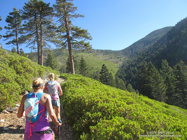
Ann, Patty and I were enjoying the summit of 11,503′ San Gorgonio Mountain following a 13+ mile run and hike from the Momyer Creek trailhead in Forest Falls. Although it is nearly four miles longer than the Vivian Creek route and gains an additional 1000′ of elevation (6500′ vs 5500′), this superb alternative is a more runnable way up the mountain, with more of backcounty feel and alpine flavor.

Alpine terrain on the Divide Trail above Little Charlton - Jepson saddle
Alpine terrain above Little Charlton – Jepson saddle

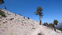
It was cool on the summit, but I was still warm from running what I could of the final couple of miles up the peak. In that last stretch the trail contours around Jepson Peak, passes the Vivian Creek and Sky High Trail junctions, and then works its way up to the blocky summit of Gorgonio — the highest point in Southern California.

Cones of the Lodgepole pine are much smaller than cones of the Limber Pine
Lodgepole and Limber Pine cones.

Despite the record-setting hot weather, the temperature on the way up the mountain had been pleasant. Our pace had been conversational. Among other topics Ann told of her amazing experiences running the UTMB and Patty talked about photography and her trip to Zion. I spoke of lapse rates & compressional heating, Chinquapin nuts, and Lodgepole & Limber pines . At least for me, the miles passed with distracted ease.

The 31,359 acre Lake Fire overran San Bernardino Peak Divide in the area of Shields Peak.
The Lake Fire burned over the divide near Shields Peak.

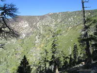
From the switchbacks above Plummer Meadows you could see where the Lake Fire overran San Bernardino Peak Divide in the area of Shields Peak. The 31,359 acre Lake Fire started the afternoon of June 17 near the Forsee Creek trailhead southwest of Jenks Lake and burned a huge swath through the San Gorgonio Wilderness. The fire burned to within 0.4 mile of the summit, near the C-47B “Gooney Bird” crash site on the Sky High Trail. Here is a Google Earth view from the west along the crest of the San Bernardino Peak Divide showing part of the burn area and another view along the divide from the east. Much of the north and east side of Gorgonio is within the Lake Fire Closure Area.

Mill Creek Canyon from the Vivian Creek Trail

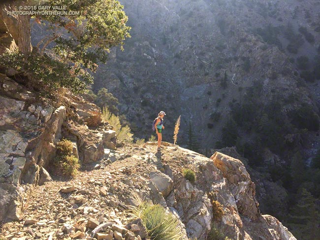
After about 15 minutes on the summit it began to get chilly and it was time to head down. The descent of the Vivian Creek Trail is as much of a challenge as the ascent of Falls Creek. Although I’ve run it many times, I conveniently forget just how convoluted, rocky, and technical it is. Part way down a double-fall of huge trees completely blocked the trail. One tree had broken on impact and the route choice was to either squeeze through the fracture or go the long way around.

We had become spread out on the descent, but were now running together on Valley of the Falls Drive. This 1.4 mile stretch on pavement connects the Vivian Creek trailhead to the Momyer Creek trailhead, completing the 24 mile loop. A short distance past the Fire Station we reached the gravel parking area. No longer obscured by trees, the view opened to a panorama of mountains that looked impossibly rugged and tall. Had we really just been up there?

My legs would answer that question following the two  hour drive home.

Some related posts: Falls Creek Loop August 2013, Falls Creek Loop 2012

Kodiak 50 Mile 2015

Runners in the 2015 Kodiak 50 mile race on the Siberia Creek Trail

Dazzlingly bright and a day from full, the moon rose above the trees along the Snow Summit skyline. Ahead of the moon, Pegasus flew effortlessly across the eastern sky. I asked to borrow his wings, but in response heard only our footfalls and the wind in the pines.

2015 Kodiak 50 mile elevation profile
Kodiak 50M Elevation Profile.
(Click thumbnails for larger image.)

We were on the Skyline Trail above Big Bear Lake and about 44 miles into the Kodiak 50 mile — one of four ultra-length running races organized by Matt Smith and crew for this Friday and Saturday.

The Kodiak 100 milers had started their circuit of Big Bear Lake at noon yesterday, and after running through the night, the fastest of the fast had finished the course this morning!

Dawn on the Gray's Peak Trail about 20 minutes into the 2015 Kodiak 50 Mile run.
Dawn on the Gray’s Peak Trail.
(Click thumbnails for larger image.)

The Front 50K runners started on the heels of the 100 milers and ran the first 31 miles of the course — including the ascent of 10,000′ Sugarloaf Mountain. They finished yesterday evening at the Wildhorse aid station. Runners doing the Back 50K — the last 31 miles of the 100 mile course — started at Snow Valley at 8:30 this morning and most had finished by mid-afternoon.

We had started the 50 mile before sunrise at the Gray’s Peak trailhead, near Fawnskin, on the north shore of Big Bear Lake. Though warmer than normal, the temperature before sunrise was still in the 40s, and many shorts-clad runners huddled around the wheel wells of running cars trying to keep warm before the 6:00 am start. Continue reading Kodiak 50 Mile 2015

South Fork Adventure

South Fork Trail, between Islip Saddle and South Fork Campground

I asked Skye what her watch had for the mileage. Had we gone two miles yet? We were running down the South Fork Trail from Islip Saddle and hoping to do one of my favorite adventure runs in the San Gabriel Mountains. The 23.5 mile loop descends to South Fork Campground,  then climbs to the summit of Mt. Baden-Powell via the Manzanita Trail and PCT; and then continues on the PCT back to Islip Saddle.

Rock slides on the South Fork Trail between Islip Saddle and South Fork Campground.
Rock slides on the South Fork Trail

A few days before there had been a report on Facebook that the South Fork Trail “was gone” about two miles down from Islip. With the heavy rains we’d seen in July that was certainly a possibility. Even without the rain it was a possibility. The South Fork Trail is under constant bombardment and it is normal for some sections of the trail to be covered by rock slides. I can’t think of an “official” trail in the San Gabriel Mountains with a more primitive character.

The condition of the South Fork Trail wasn’t the only possible problem. Earlier in the week I’d run the Manzanita Trail most of the way to South Fork Campground to be sure that if the South Fork Trail was passable, we would be able to complete the loop. There were two things to check. Was the spring running 1.4 miles from Vincent Gap? It was. And had the heavy July rain washed out the trail in the landslide area above Paradise Springs? It hadn’t. So if we could get to South Fork Campground we were good to go.

As things worked out the condition of South Fork Trail was about the same as it always is. I’ve seen it in better condition and I’ve seen it worse. With care it was passable — but that isn’t a recommendation. It’s the kind of trail some love and others hate.

Elevation profile of the Islip Saddle - South Fork - Vincent Gap - Mt. Baden-Powell Loop
Elevation Profile

Once down at South Fork Campground the adventure isn’t over. There are some rock and boulder strewn washes to navigate and there’s the small matter of the nearly continuous 10 mile, 5000′ climb to the top of Mt. Baden-Powell. Having recently completed the Angeles Crest 100 and climbed Mt. Whitney, the tough climb from the South Fork was a piece of cake for Skye. On the other hand, I was very happy to round the final corner and see Baden-Powell’s busy summit come into view. On the way up  we ran into Mt. Disappointment race organizers Gary & Pam Hilliard, getting in a little work after doing the Julian Station Full Moon run the previous weekend. Next year will be Mt. Disappointments’ 10th running.

Regrowth of lodgepole pines along the PCT near peak 8426 following the 2002 Curve Fire.
Lodgepole pine saplings

Between Baden-Powell and Windy Gap the weather was cool and the running comfortable on the PCT. Perhaps because of the heavy July rain the pines and firs seemed to be especially green. In several areas young, healthy trees grew in nursery-like stands amid the bleached trunks of trees burned in the 2002 Curve Fire.

I was just about out of water when we pulled into Little Jimmy Spring, and as always, the water was clear, cold and rejuvenating. Another 2.5 miles and the loop would be done. Although it’s difficult for its length, it’s also very enjoyable. If the weather holds I’ll probably do it again this Fall before Winter settles in.

Some related posts: Trail Running Weather, San Gabriel Mountains Running Adventure, Islip Saddle – Mt. Baden-Powell South Fork Loop

Showers on the Strawberry Peak Circuit

Craig on the Colby Canyon Trail segment of the circuit around Strawberry Peak.

Did the circuit around Strawberry Peak with Craig this morning. There was a little rain on the last few miles of the run, but the changeable weather just made the run better.

Tour du Conejo Dos Vientos

Runners working their way up Conejo Mountain on the Tour du Conejo Dos Vientos

The first stop on Ann Ongena’s excellent end of year “Tour du Conejo Dos Vientos” was Conejo Mountain. In keeping with run’s theme, it was a bit breezy on top — maybe 45-50 mph.

This warm-up (warm up?) was followed by a fun circuit linking trails in the Dos Vientos Open Space trail system.

Kodiak 50 Mile 2014

Sugarloaf Mountain from the Skyline Trail near Big Bear Lake
Sugarloaf Mountain from the Skyline Trail

The contrast in temperature was remarkable. On a run at Ahmanson earlier in the week the temp had been over 100. Here on the north shore of Big Bear Lake it was about 60 degrees cooler.

It was 4:45 am and 54 two-legged runners, and one four-legged runner (Lacey) were scattered around the Meadow’s Edge Picnic Area. Some runners were sitting in cars with the motor on and heater running, some were checking in and picking up their bib numbers and making last minute preparations. One bare-armed runner in shorts and a singlet had appropriated a bathroom in lieu of a jacket.

At about 5:00 am were were on our way. The stars glittered brightly on an inky background of mountain sky. Surrounded by a frame of pines the iconic Winter constellation Orion ran across the southeastern sky, the brilliant dog star Sirius following at his side.

Sunrise at Mile 10 of the 2014 Kodiak 50M.

There were many changes and improvements for the 2014 edition of the Kodiak 100M & 50M. In addition to the 50M beginning at Meadow’s Edge and starting an hour earlier, nearly all of the miles to Rim Nordic (~ mile 23) were on dirt road. As much as I like single track, there were some significant benefits to this. Most importantly, it got us to Rim Nordic earlier in the day and in better shape to deal with the difficulties of the Siberia Creek section of the course.

The loss of the PCT single track on the first part of the 50 mile course was offset by the addition of the Skyline single track following the Siberia Creek climb. The Skyline and Siberia Creek Trails are both spectacular. When combined they are among the most challenging, aesthetic and rewarding trails in Southern California. Thanks to the trail work by the Big Bear Valley Trails Foundation and Kodiak volunteers the Siberia Creek Trail was in better shape this year.

Idyllic running about 0.5 mile below the Lodgepole Aid Station.

The weather was outstanding! Once the sun was up, my sleeves came off and it was shorts and short-sleeves for the remainder of the day. Reflecting the good weather, the changes in the course, the improved aid stations, and perhaps a better understanding of the character of the course, the finishing rates for both the 50M and 100M were up significantly from last year. Half of the runners that started the 100M finished and about 85% of the 50 milers finished.

Here are some photos taken during the 50 mile. The 50M/100M mileages mentioned in the descriptions are approximate.

Many thanks to R.D. Matt Smith and all of the event staff, volunteers, sponsors and runners! For more photos, stories, results and info checkout the Kodiak web site and Facebook page.

P.S. Lacey and her “Dad” Aaron Sorensen both finished the 50 mile in fine style!

Related post: Kodiak 100 & 50 Mile Ultramarathons 2013