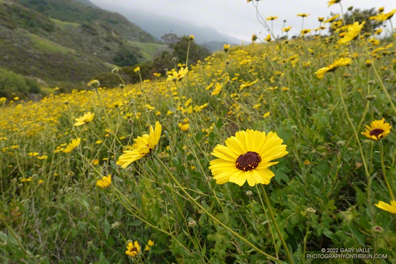
The bush sunflowers (Encelia californica) above are along the Secret Trail in Calabasas. While there have sometimes been showy displays of bush sunflowers along this trail, I don’t recall any quite as prolific as this. There were many other wildflowers as well (slideshow).
It’s been another bizarre rain year. While California water managers worry about water supplies, chaparral plants in the Santa Monica and Santa Susana Mountains seem quite happy with this season’s rainfall. There is a lot of new growth and plants appear to be playing catchup from last year’s dismal rain season. From the trail it looks more like an above average rain year, rather than the somewhat below normal rain year actually recorded.
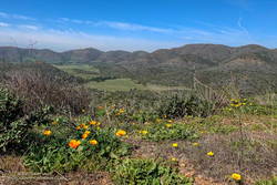
Serrano Valley and Canyon had been on my run list for a few weeks. I was curious to see how December’s rainfall had affected Serrano Canyon. Runoff from those storms had (once again) washed out sections pf the Blue Canyon Trail and Upper Sycamore Trail. Had the Serrano Canyon Trail also been damaged?
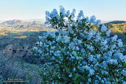
Greenbark Ceanothus along the Old Boney Trail
It was a good day to visit Serrano — I was looking to do a longer run; the weather was perfect; the meadows green; and many wildflowers were in bloom.
There are a couple of ways I like to run to Serrano Valley from the Wendy Drive Trailhead. Both do the initial 1.6 mile, 900′ climb up the Old Boney Trail from Danielson Road. At the top of the climb, one route goes up and over Boney Mountain’s western ridge to the Backbone Trail, and the other continues on the Old Boney Trail. Both routes join at the Chamberlain junction of the Backbone and Old Boney Trails. I’d done the western ridge of Boney Mountain recently, so opted for the Old Boney route.
Prickly phlox along Overlook Fire Road
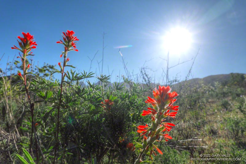
Wildflowers were everywhere. The December rain and February heat wave seems to have encouraged many plants to bloom — among them blue dics, Encelia, clematis, California poppy, greenbark Ceanothus, shooting star, nightshade, paintbrush, poison oak, milkmaids, prickly phlox, hummingbird sage, and larkspur.
Serrano Valley was Spring-green and spectacular. Serrano Creek was gurgling away, and the Serrano Canyon Trail had survived December’s storms. After a pleasant run down Serrano Canyon, I stopped to get some water from the faucet at the junction of the Serrano Canyon Trail and Sycamore Canyon.
A right turn here — up Sycamore Canyon — produces a run of about 20 miles. Today I was looking to do a little more than that, so turned south and ran about a quarter-mile down Sycamore Canyon and picked up the Fireline Trail. This trail gains about 700′ in elevation on its way up to Overlook Fire Road.
La Jolla Valley from Overlook Fire Road
Overlook Fire Road leads northwest to the top of the Ray Miller Trail. I was feeling good and briefly debated descending to the Ray Miller Trailhead. I did a quick estimate of the mileage. I was at about mile 14. Descending Ray Miller would add about 2.5 miles, and then the run back from the trailhead to Wendy would add another 12 miles. Hmmmm… nearly 29 miles. My legs were way ahead of my brain, and were already continuing up Overlook Fire Road.
I followed the usual route back — Overlook -> Hell Hill -> Wood Canyon -> Two Foxes -> Sycamore Canyon -> Upper Sycamore -> Danielson Road -> Satwiwa. The paved part of Sycamore can be a bit tedious and it helped when I happened upon a couple of friends.
Here is an interactive, 3D terrain view of the GPS track of my route. The map can be zoomed, tilted, rotated, and panned. To change the view, use the control on the upper right side of the screen. Track and placename locations are approximate and subject to errors. Poor weather, and other conditions may make this route unsuitable for this activity.
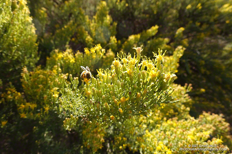
If you’re a bee in the Ahmanson Ranch area, your Fall menu of wildflowers is usually pretty sparse; particularly when the previous rain year has been below normal.
But life has a way of carving out a niche for itself in the toughest of circumstances. One plant you’ll find blooming in the oak grasslands of Ahmanson Ranch following a long, hot, dry summer is goldenbush. In the case of the title photo, it’s Palmer’s goldenbush.
From mid Summer into Fall, the vibrant yellow flowers of rabbitbrush add a refreshing hit of color to the greens, grays, and browns of the San Gabriel Mountains.
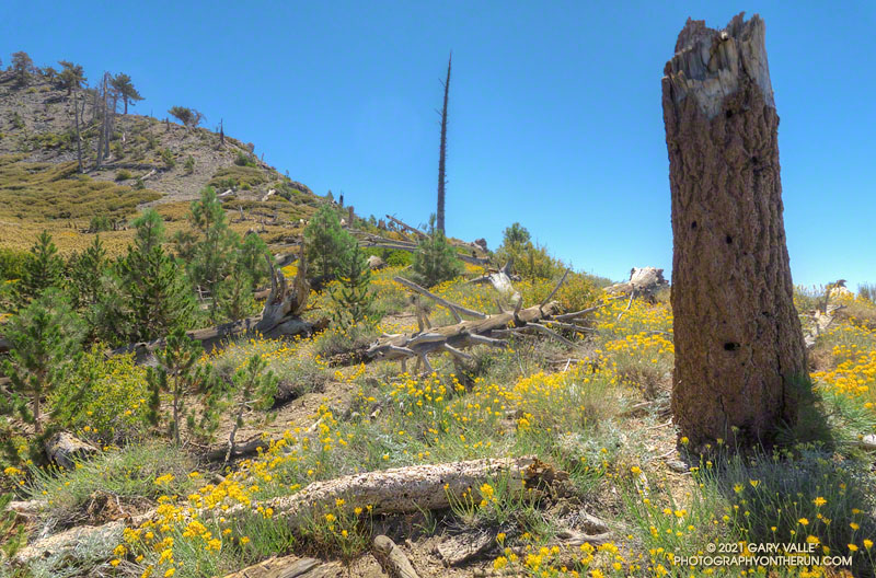
The title photo was taken along the PCT, at an elevation of about 8600′, near Mt. Hawkins. The area was burned in the 2002 Curve Fire. Here, and elsewhere in the burn area, new trees — now in their teens — are slowly replacing some of the trees lost in the fire.
With vaccinations on the increase and Covid on the decline, it was wonderful to once again be able to visit family.
As we always try to do, Brett and I got in a couple of runs. We usually do at least one run that is new to me, and there are certainly plenty from which to choose in the Bay Area.
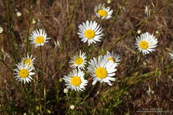
Oxeye Daisy along the Old Ranch Trail
Our first run was on San Bruno Mountain. We’d previously done the Ridge Trail, so this time opted to do a variation of the Summit Loop. The parking lot at the base was was closed, so we started the run using the Old Ranch Road Trail. This was a plus because it added a little mileage and there were a lot of wildflowers along the trail, including monkeyflower, iris, lupine, yellow paintbrush, daisy, and foxglove.
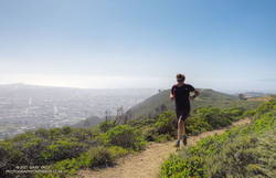
The next day, after watching a spirited youth soccer match, we headed south on 280. On the way, Brett filled me in on the runs he likes to do in Windy Hill Open Space Preserve and Huddart Park. We couldn’t go wrong with either choice but finally decided to save Huddart Park for another day.
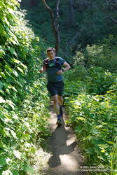
Razorback Ridge Trail
Windy Hill Open Space Preserve is on the northeast-facing slopes of the Santa Cruz Mountains above Portola Valley. We parked near the Alpine Trailhead and ran up the road to the Eagle Trail. Corte Madera Creek was running, but low. Although the grasses along the trail were green and the undergrowth was relatively lush, I suspect the conditions were more like July than May. Open hillsides looked mid-Summer dry and the lichen on the trees was drab and desiccated.
Like the rest of California, the Santa Cruz Mountains have seen well below average precipitation this rain season. One station near Windy Hill, Woodside 3.4 S, recorded only about 28% (12″) of normal precipitation from October 1 to May 19. Another station, Skyline Ridge Preserve, recorded about 41% of normal (16.5″) from October 1 to May 3.
Western columbine
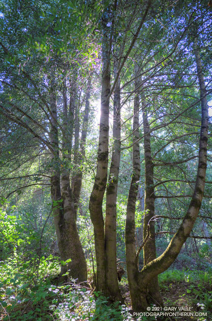
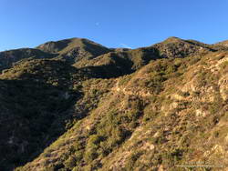
From the Eagle Trail/Private Road we turned onto the Razorback Ridge Trail. According to my Garmin track, the Razorback Ridge Trail gains 1000′ or so over 2.4 miles to its junction with the Lost Trail. It’s all runnable, switch-backing up a thimbleberry and fern-lined trail, shaded by California bay trees.
While the Razorback Ridge Trail continues up another 0.4 miles to Skyline Blvd., we turned right onto the Lost Trail. This trail parallels Skyline as it works in and out of the tributary ravines of Jones Gulch, on its way over to the Hamms Gulch Trail. Along the way there were views across the valley to Mt. Diablo, some 40 miles distant. Western columbine was blooming along the trail, its bright red color complimenting the green theme.
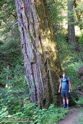
Large Douglas-fir along the Lost Trail
At the top of Jones Gulch, there is an impressive, old-growth Douglas-fir. At chest height, it is about as wide as Brett is tall. This would put its diameter at over 72″ and its circumference at over 220″, suggesting an age in the neighborhood of 350 years.
The run down the Hamms Gulch Trail was as good as the run up Razorback Ridge. Given the weather was nearly perfect for a hike or run, we were surprised to see only a dozen or so people on the trail.
From where we were parked the run worked out to about 8 miles, with about 1500′ of gain/loss. Here is a trail map of the area, and here is an interactive, 3D terrain view of my GPS track of the loop. The interactive map can be zoomed, tilted, rotated, and panned. To change the view, use the control on the upper right side of the screen.
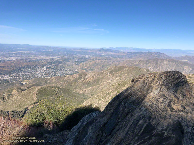
View west from Mt. Lukens, across the Crescenta and San Fernando Valleys.
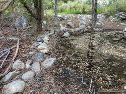
It was a chilly 45 degrees in the canyon, and I had already resigned myself to having to wade across Big Tujunga Creek. But I didn’t even get my shoes wet. The water level was low enough that the large rocks placed across the creek were high and dry.
Low water made it easy to cross Big Tujunga Creek.
It was a good start to what was to be an excellent run and hike. As I gained elevation, it was evident there had been recent work on the trail. Trimmings from the brush along the trail were still green, and in several spots the tread had been freshly manicured. The higher I climbed, the more work had been done. In a couple of places, substantial washouts had been repaired.
Last year, the trailwork ended abruptly about halfway up the trail. Not so this year. An impressive amount of work had been done to clear the trail of a tortuous mix of dead scrub oaks and thorny brush. Without having to crawl over, around, and through those snarls, my roundtrip time to the summit and back was a full hour faster than last year. Many thanks to whoever worked on the trail!
Here’s an interactive, 3D terrain view that shows a GPS track of the route up and down the Stone Canyon Trail on Mt. Lukens. The view can be zoomed, tilted, rotated, and panned. Placemark and track locations are approximate and subject to errors.