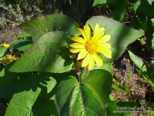
Canyon sunflower (Venegasia carpesioides) tends to grow along cooler sections of chaparral trail. Its rich green leaves and yellow composite flowers are a refreshing sight on a thirsty run.
This canyon sunflower is on a north facing section of the Chumash Trail at an elevation of about 2350 ft. The canyon sunflower population in this area expanded following the 2003 Simi Fire.
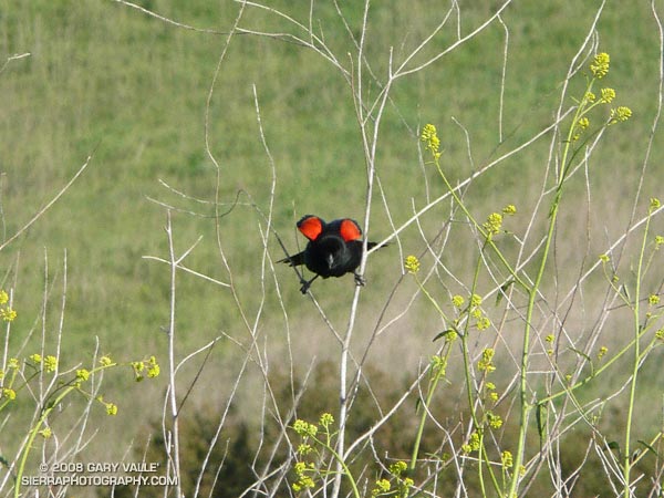
On a separate note, it’s that time of year again — at the end of my run this Southern Pacific Rattlesnake was in the street at the Chumash Trailhead on Flanagan Drive in Simi Valley, California.
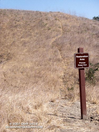
With little new growth this Spring and Summer, coyote paths at Ahmanson Ranch have become so well worn that several have recently been posted with “Restoration Area – Please Keep Out” signs. Whether the canny coyotes will choose to cooperate remains to be seen.
Note: Ahmanson Ranch was acquired as open space in part to protect several sensitive species and their habitats. Some (human) use trails have evolved and “Restoration Area – Please Keep Out” signs are a reminder that the area is a preserve.
From a recent run at Upper Las Virgenes Canyon Open Space Preserve (formerly Ahmanson Ranch).
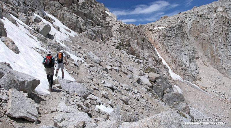
The sky was brightening in the east, and sunrise was approaching when I met Miklos and Krisztina at the Denny’s in Sylmar. We were already wasting light. The plan was to drive from near sea level up to Horseshoe Meadows, at about 10,000′ on the Sierra east side. The hike/run we had in mind was a keyhole loop from the Cottonwood Lakes Trailhead up (old) Army Pass and then down New Army Pass. If we felt OK at the top of Army Pass, we would also do Mt. Langley (14,026′).
The weather forecast looked good. There was a chance of some gusty southwest winds in the afternoon, but temps were warm and there was virtually no chance of T-storms. With a record low Southern Sierra snowpack, there was almost no chance that an ice axe would be required on Army Pass. I was familiar with the route on Langley and down from New Army Pass, and expected to be back to the car well before sunset. But, just in case, the moon was about half full.
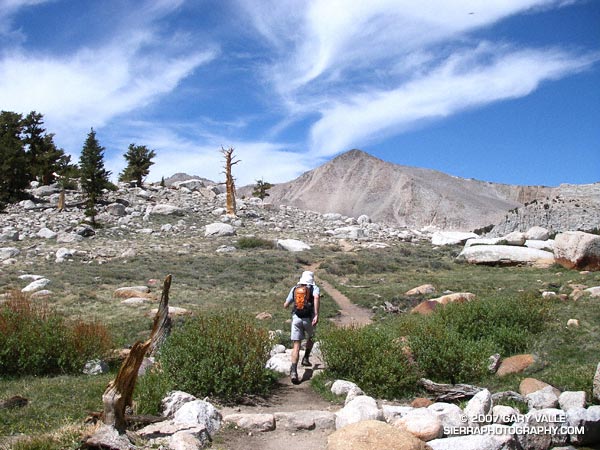
Low snow year on Army Pass. June 23, 2007.
In fact, there had been very little snow on Army Pass, or anywhere else. We reached the pass relatively quickly, and decided to continue to Langley. Now, after another hour of hiking, we were above a prominent rock band that extends across Langley’s south face, and making good progress.
I’ve been convinced for some time that pursed-lip breathing helps me at higher altitudes, particularly when I’m not well acclimated. There’s a skill to it. There seems to me an optimum blend of heart rate, respiratory rate, and the amount of resistance created on exhalation. When all these factors are in balance, the breathing technique is almost automatic and effortless, and it really does seem to help. It certainly seemed to be helping me now.
I topped out a few hundred yards west of the summit, and ambled over to the high point of the peak. On a scale of 1 to 10, I felt pretty good — maybe a 7. Making an effort to stay hydrated, consume plenty of calories, and not push the pace too hard seemed to have worked — at least this time.
The view along the crest to Mt. Whitney and the peaks of the Kings-Kern Divide was telling. It was remarkable just how little snow there was at the highest elevations of the Sierra. A week before I had been paddling the Kern River. Now I could see why the flow on the upper Kern was dropping so fast.
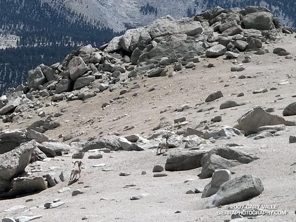
Big horn sheep on the slopes of Mt. Langley. June 23, 2007.
Miklos and Krisztina joined me on the summit, and after taking a few summit photos, we headed down. Screeing down the slopes below the rock band, we were startled when a herd of perhaps 20 big horn sheep rumbled across the slopes below us. They flowed across the rough landscape like quicksilver. Graceful and robust, they moved effortlessly between the rocks and up a small slope. In the moments it took me to react, grab my camera, and turn it on, all but two large rams trailing the group, had disappeared.
Energized by the sight of these fleet-footed animals, we continued down to the saddle at Army Pass, and then up and over New Army Pass. Before sunset we would be back to the car, and before dark, eating dinner at Lone Pine. Before midnight we would be back in L.A. Here’s a Google Earth image and Google Earth KMZ file of a GPS trace of our route.
Note: Going to higher altitudes without properly acclimating can result in very serious, life-threatening illnesses. There is much information available on the Internet regarding altitude sickness and acclimatization. As a starting point see UIAA Medical Commission – Advice and Recommendations and Wikipedia: Altitude sickness.
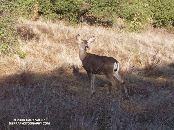
About ten feet in front of me, there was a flash of brown as a large animal leaped across the trail. In the balloon of time that accompanies a surge of adrenalin, I thought of the possibilities. The last time an animal startled me, I was running on a dirt road through ten foot tall chaparral in the Simi Hills. In that case a large bob cat had bolted from the brush.
Lingering in my mind was a trail runner’s recent encounter with a mountain lion while running at Whiting Ranch in Orange County. The last place I had seen mountain lion tracks was on a muddy nature trail, not far from where I was now. That was more than a year ago. It had rained overnight, but so far I had only seen tracks of coyote, dogs and deer.
Today, I was on the Musch Trail, doing one of my favorite cool weather runs — an approximately 12.2 mile, fire roads out, trails back course from the end of Reseda Blvd. to Trippet Ranch, in Topanga State Park.
As time warped back to normal, I saw the animal wasn’t a bob cat or mountain lion, it was a mule deer. A doe had stopped just a few feet from the trail. That was unusual. Also, it was strange that her full attention wasn’t on me. Instead, she seemed concerned about something behind her, uphill from the trail. I stood quietly and watched.
She appeared to be evaluating the situation, and after about 15 seconds seemed to calm. Still alert, another 15 seconds passed, and following some unseen cue, a six or seven month old fawn was suddenly at her side.
Now her big ears, and more of her attention, were focused on me. With the fawn at her side, she obviously didn’t like being out in the open. She scented the ground, checked her fawn, and then looked back up the hill. I couldn’t see any more deer from my position, but they could easily be hidden in the surrounding cover. Almost a minute and a half after the encounter began, the doe and fawn moved into the brush.
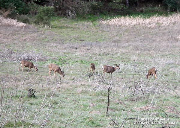
Slowly moving a few feet along the trail, I glanced up the hill and discovered two more members of the group, waiting for me to pass. I continued walking down the trail, and after few yards, picked up the pace, and resumed my run.
Snapshot of deer at Malibu Creek State Park. This group was in about the same location on consecutive weekends. Malibu Creek State Park is about 30 minutes from downtown Los Angeles.