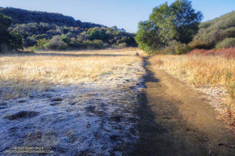
As I approached Musch Camp, a scrub jay flew from a trailside faucet and into a nearby eucalyptus. There had been a little rain the day before, but the birds at the closed camp were still thirsty. Less than a quarter-inch of rain had fallen, and nearby creeks were still dry.
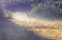
Melting frost “steaming” at Musch Meadow
I was doing a run from the “Top of Reseda,” and on a warmer day would have topped off my water bottle at the camp. I stopped at the faucet and briefly turned on the spigot. Maybe that would make it easier for the jay.
In another mile I reached the Trippet Ranch trailhead, and then begin the six mile run back to the Valley. At several points on the run there had been wintry views of the local mountains. On the way back the best view of the snowy mountains was from the Hub, where Mt. Baldy could be seen gleaming white in the morning sun.
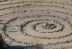
Updated June 26, 2023. The spiral has been periodically removed and rebuilt over the years. Google Earth historical imagery shows that it was removed sometime between March 2021 and February 2022. As of June 25, 2023, it had not yet been rebuilt.
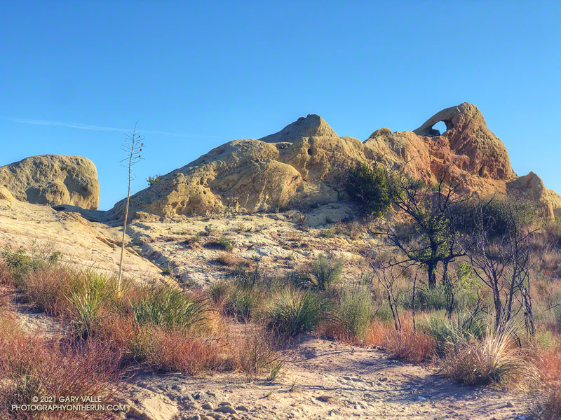
Instead of struggling to escape a tar pit, this “mammoth” seems to have been caught up in 25-30 million-year-old sandstone.
The beast can be seen along the Backbone Trail, east of the Corral Canyon Trailhead. When running/hiking/riding east from the trailhead, the trail climbs over two steep steps and up to gap in the rock. In the photo above, the gap is on the left and the mammoth figure is on the right. From the gap, the trail descends a rock corridor to Mesa Peak fire road.
A closer look at the mammoth reveals that it is pockmarked and there are rocks embedded in the sandstone. The embedded rocks are cobble from an ancient river and the pockmarks are where rounded rocks have fallen out of the eroding sandstone.
Spiral labyrinth along the Backbone Trail
Stream cobble that has eroded out of sandstone formations in this area has been used to construct a spiral labyrinth on the north side of Mesa Peak Fire Road. The cobble was tumbled and smoothed by streams that drained a range much older than the Santa Monica Mountains.
The title photo is from this morning’s run of the Bulldog Loop.
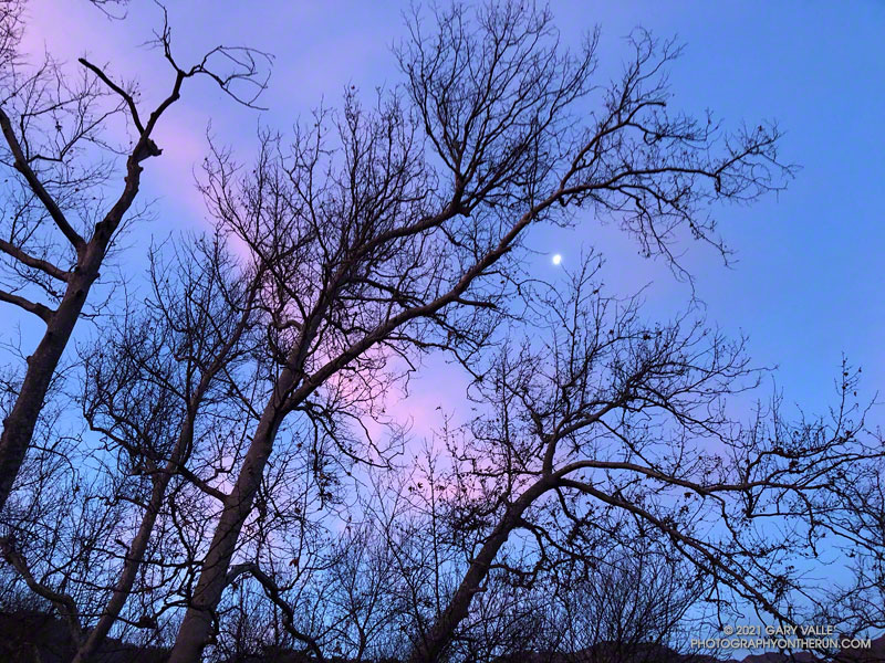
The photograph Moon and Sycamores was taken at dawn, near Malibu Canyon and Piuma Road, at the start of this morning’s Bulldog Loop trail run in Malibu Creek State Park.
A quarter-mile from the top of the Bulldog climb.
According to the Tempe sensor on my pack, the temperature ranged from a chilly 32° F along Malibu Creek to around 65° F on the crest. It was a near perfect morning to be outdoors.
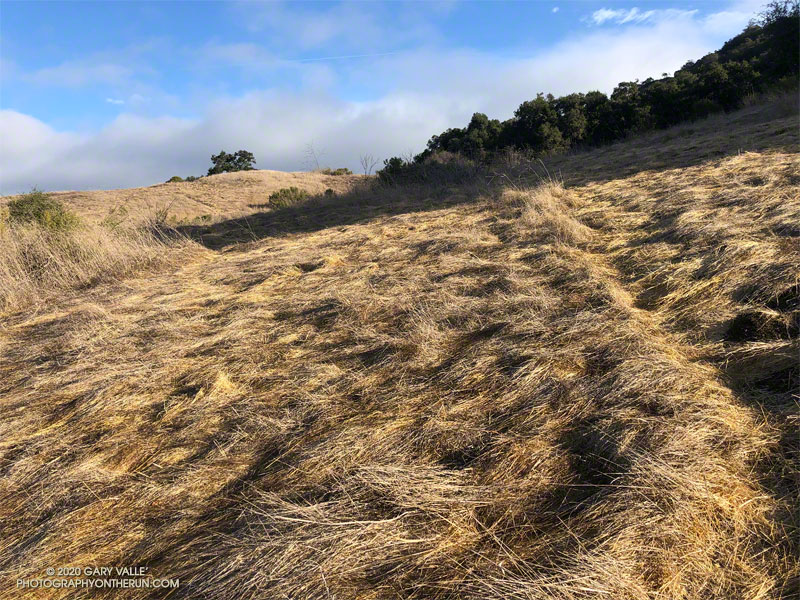
From the top of the hill, the blue-sky view extended all the way to Saddle Peak and the Pacific. The gray-green chaparral was brittle and dry, and the grasslands sun-bleached. Rain was in the forecast, but for months, little had fallen. It was the day after Christmas, and I was near the northern border of Upper Las Virgenes Canyon Open Space Preserve. Fourteen years ago, nearly to the day, I had run to the same hill. That rain year had also been dry, and the area had looked much the same.
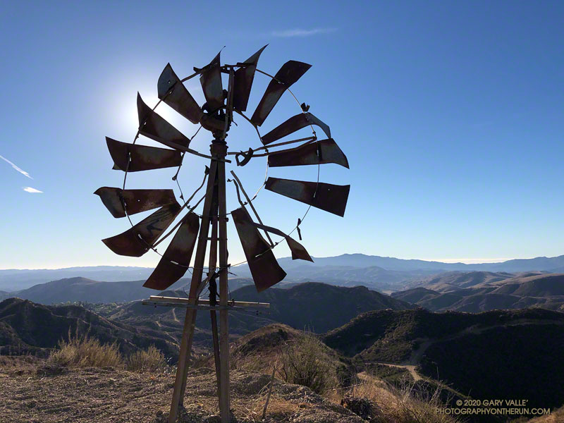
Steep fire road to “windmill hill.”
Today’s run had started at dawn at the Victory Trailhead. It had been cold in the canyons for the first few miles — in the low 30s — but eventually temps had warmed. I had run west in East Las Virgenes Canyon, taken a connector trail to Las Virgenes Canyon, and then run north on the Upper Las Virgenes Canyon fire road past Bell Canyon to “windmill hill.”
The hill is labeled with an elevation of 2124′ on the 1967 Calabasas topo map. The top of an old windmill has been placed on its summit. The windmill wasn’t there in 2006, and I wondered if it was from the infamous Runkle Canyon well. From the top of windmill hill I could see the high point of Upper Las Virgenes Canyon Open Space Preserve, a quarter-mile or so to the northeast.
High point of Upper Las Virgenes Canyon Open Space Preserve
Located at its northeastern corner, the point with the highest elevation in the Preserve is a hilltop that’s just south of “hill 2160” on the Calabasas quad. Marked by a prominent pine tree, hill 2160 is on Santa Susana Field Laboratory property. It overlooks an area of the SSFL where a partial meltdown of an experimental reactor occurred in 1959.
Leaving windmill hill behind, I ran east down the hill, and then north along the fire road toward Albertson Mtwy. I was still debating whether to do the side trip to the Preserve’s high point. There was no path or trail to the high point, and the upper part of the slope was thick with brush. After running past the hill and nearly to Albertson Mtwy, curiosity finally got the better of me. I turned around and ran back to a place on the fire road where I could access the high point.
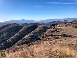
View south from the high point of Upper Las Virgenes Canyon Open Space Preserve
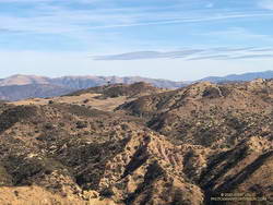
The side trip to the high point and back took about 20 minutes. After returning to the fire road, I continued down to the junction with Albertson Mtwy, turned left, and followed it west to a junction with an Edison powerline service road. This road meanders south through a rugged canyon, and then climbs up and over a prominent ridge with some spectacular sandstone rock formations.
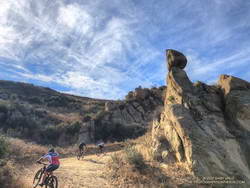
Mountain bikers in the backcountry of Upper Las Virgenes Canyon Open Space Preserve
After topping out on the ridge, the service road descends to the junction of the Sheep Corral and Cheeseboro Ridge Trails. Today, I followed the Cheeseboro Ridge Trail south to the Las Virgenes – Cheeseboro connector. Once back in Upper Las Virgenes Canyon, I retraced my route from earlier in the day back to the Victory Trailhead.
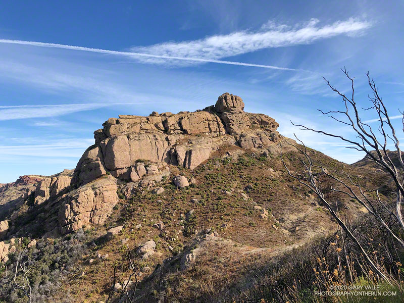
Every time I’ve run the Chamberlain segment of the Backbone Trail, I’ve looked at the intriguing rock formation near the top of the trail and wanted to climb it. Looking a bit like an aircraft carrier that’s run aground on a mountain ridge, it’s one of the most prominent peaks along Boney Mountain’s western escarpment. Named “Boney Bluff” by rock climbers, several sport climbing routes were established on the southeast side of the peak in the early 2000s.
Located just northwest of the junction of the West Tri Peaks Trail and the Backbone Trail, the peak is visible from many points in Pt. Mugu State Park. According to lidar-based 1-meter resolution 3DEP data, its elevation is 2985′, which is slightly higher than the 3DEP elevation of nearby Exchange Peak.
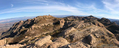
Boney Mountain plateau. Click for larger image.
Boney Bluff is one of many small peaks and rock formations that are found across the Boney Mountain plateau. Comprised of a fused mishmash of volcanic breccia, the rock quality of these formations ranges from very good to quite bad. Seemingly solid handholds or footholds can break, and because of the way the rock erodes, low-angle sections are often littered with granular rocks that can be very slippery.
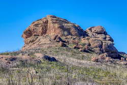
Boney Bluff from the east.
Having climbed the Western Ridge on Boney Mountain, I approached Boney Bluff from the north, via the Tri Peaks Trail. My route climbed a slope to the east side of the peak, then traversed right to the base of a jumbled face with several oddly eroded ledges. A short, steep crack and grassy ramp provided access to the ledges above. NOTE: There may be a better way to climb the peak. I was trying to do a relatively direct route and avoid bushwhacking. The route is somewhat manky, but worked for me.
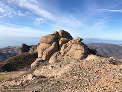
Summit block of Boney Bluff.
The high point of the peak is on top of a summit block that caps the “island of the carrier.” Many of the formations on Boney Mountain have summit blocks, and these are often the most difficult part of the climb. Rule #1 involving summit blocks: Don’t climb up anything you can’t 100% for sure climb down! This one looked like it might be tricky, but with careful route-finding was pretty straightforward.
Because Boney Bluff is perched on the edge of the Boney Mountain plateau, on a clear day there are outstanding panoramic views of Pt. Mugu State Park and the Boney Mountain area from its summit. Today, the visibility was excellent and Mt. Baldy was visible, 75 miles to the east.
Lidar-based 3DEP Elevation Estimates of Some Boney Mountain Peaks
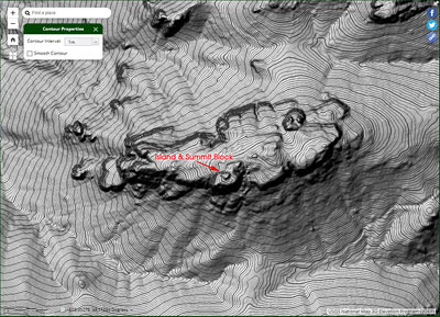
Lida-based 3DEP elevation contours of Boney Bluff. Click for a larger image.
The resolution of the 3DEP Elevation Data is very impressive. While checking the elevation of Boney Bluff, I also noted the 3DEP elevation of several other peaks in the Boney Mountain area. For more info about 3DEP see this U.S.G.S. website.
Sandstone Peak 3116′
Tri Peaks 3039′
Boney Bluff 2985′
Boney Crest 2974′ (Accessed via Western Ridge or Cabin Trail)