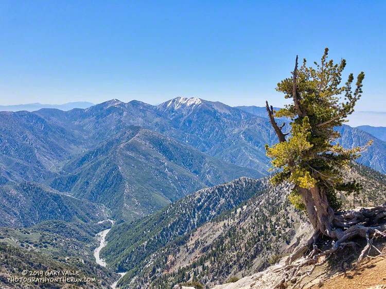
Each year, around Memorial Day, I like to do the out and back on the Pacific Crest Trail from Islip Saddle to Mt. Baden-Powell. It’s fun to see how much snow (if any) remains on Mt. Baden-Powell and to get an idea of how much snow there is on Mt. Baldy, San Jacinto Peak and San Gorgonio Mountain. It’s also a good way to continue acclimating to higher elevation.
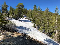
Snow at 8750′ near the junction of the PCT and Dawson Saddle Trail
This year I was a couple of weeks late getting to Baden-Powell, having done runs on Mt. Wilson Memorial Day weekend and Mt. Waterman the weekend after. That’s OK, over much of the holiday weekend it was cold and snowy at the higher elevations of the local mountains. The temperature at the Big Pine RAWS (6964′) was in the thirties all day Sunday, May 26, and it was certainly much colder than that at 9400′ on Baden-Powell.
There were no worries about snow flurries and cold weather today! The weather was perfect for the run. Cool in the shade and warm in the sun.
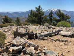
Summit of Throop Peak.
In some places between Throop Peak and Baden-Powell, there was still snow on the trail, but it could be avoided by moving to the sunny side of the crest. The last time there was more snow here in late May – early June was in 2010.
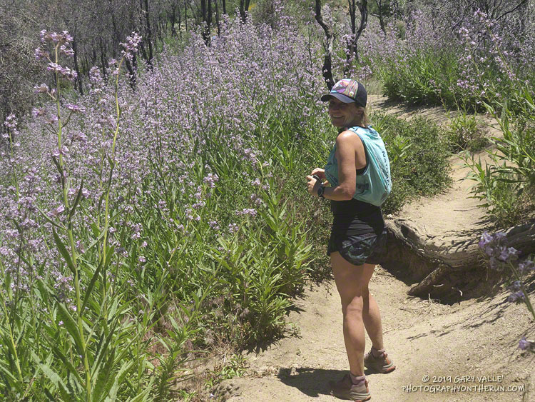
Perhaps because of the more seasonable weather, there were many (mostly) happy people on the trail that, like me, were thoroughly enjoying the wonderful day.
Poodle-dog bush near the top of the Mt. Wilson Trail. June 15, 2019.
The Mt. Wilson – Chantry Flat loop is a favorite that I run a couple times a year. Including a little bonus mileage to get to the Mt. Wilson parking lot before the gate opens, the run is about 18 miles long and gains/loses about 4500′ of elevation. The main trails in the loop are the Rim Trail, Gabrielino Trail, Upper Winter Creek Trail and Mt. Wilson Trail.
The weather was perfect for today’s run. Sunny at the beginning, then partly cloudy for the 4000′ climb from the “green bridge” below Chantry to the parking lot on Mt. Wilson. Although there was a lot of poison oak on the Rim and Gabrielino Trails, it was mostly avoidable. About 30 minutes into the run, I was surprised to hear the unmistakable gobble and rustling of a wild turkey high on the Rim Trail.
Near the end of the loop, on the section of the Mt. Wilson Trail above the Mt. Wilson Toll Road, I saw two solo hikers brush against new, vigorously growing patches of Poodle-dog bush (Eriodictyon parryi). I spoke to them, and they were unaware that, like poison oak, Poodle-dog bush can cause an itchy rash. Some people don’t react at all to the plant and others can have a severe reaction. My own experience is described in this post.
Poodle-dog bush is a fire follower that grows in the San Gabriel Mountains, and some other areas. It became very widespread following the 2009 Station Fire. There are still some diminishing patches of Poodle-dog bush on the north side of Mt. Wilson (and elsewhere) from the Station Fire, but the Poodle-dog bush on this part of the Mt. Wilson Trail is a result of the 2017 Mt. Wilson Fire.
Fire followers are plants that grow in a recently burned area in much larger numbers than before a fire. In some cases the species may rarely have been observed in the area prior to the fire.
A good example of a fire follower is Poodle-dog bush (Eriodictyon parryi), which became widespread in the San Gabriel Mountains following the 2009 Station Fire.
A wet rain season also increases the population of many species. Combine a fire and wet rain season and plant distributions and populations can be dramatically altered.
Large-flowered Phacelia near Tri Peaks. Click for larger image.
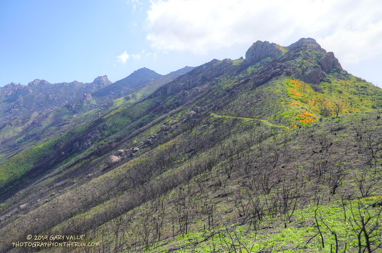
Yesterday, I did a long run in the Santa Monica Mountains that included several miles of the Backbone Trail between Sandstone Peak and the Danielson Multi-use area in Sycamore Canyon. This area was burned in 2018 Woolsey Fire and there were some stunning displays of fire followers and other wildflowers.
Star lily was one of the earliest fire followers to bloom in the area and remains prevalent, but the champion fire follower at the moment is large-flowered Phacelia. Before the Woolsey Fire it would be unusual to see this plant on this section of the Backbone Trail. Now its purple-blue flowers blanket large areas along the trail.
Although not as numerous as the large-flowered Phacelia, I’ve never seen so many fire poppies along the Backbone Trail. Its orange-red color is striking and stands out sharply against the brown, charcoal-infused soil. Also more abundant this year is the vibrant yellow collarless poppy.
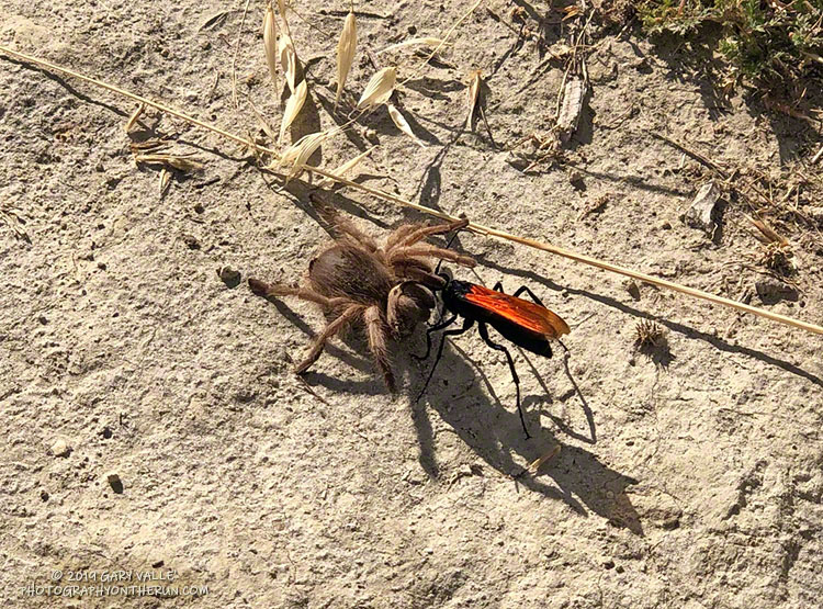
Tarantula hawk wasp drags her hapless prey to her burrow.
I was running down a narrow trail at Ahmanson Ranch, concentrating on the irregular terrain, when I suddenly found myself jumping over something on the trail. As my consciousness caught up, it asked,
“Was that a tarantula?”
“What tarantula has a stripe of orange on its back?”
Landing, I stopped and looked back up the trail. Totally unperturbed, a female tarantula hawk wasp, its bright orange wings gleaming in the sun, was diligently working to move its paralyzed prey to a nearby burrow.
The quintessential elements of a nightmare, I watched as the large wasp assessed the huge spider. I could hear the question as she turned away from the spider, and then reading the ground with her feet and antennae, determined if she could drag the beast uphill over a small bump. Then, question answered, she proceeded to do so.
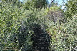
Where did the trail go? Rejuvenated by substantial Winter rains, the whitethorn on Strawberry Peak was not only impinging on the trail, but also my arms. I took my running sleeves out of a pocket of my pack and pulled them on. That helped, and I was able to push through some thorny limbs to the next clear section of the path.
Chaparral whitethorn blocking the use trail along Strawberry Peak’s northwest ridge. Click for larger image.
When following an overgrown trail I’ve learned to trust the “sense” of the trail. Even if it doesn’t look like there is a route forward, if you just take a few steps a seemingly impassible trail often becomes passable. I sometimes look at the trail behind me to confirm I’ve really been following a trail, and am continuing its path. If it doesn’t open up, I backtrack to see where I went wrong.
Winding through the thick brush along Strawberry Peak’s northwest ridge, I was happy to see that all of the Poodle-dog bush along the route had finally withered and died. Poodle-dog bush is fire-follower that causes dermatitis in many people. It became very widespread in the San Gabriel Mountains following the 2009 Station Fire. Reported reactions varied from a very mild rash to a severe rash with blistering. The troublesome plant must serve some role in the fire recovery process, but I’m glad its cycle is near its end.
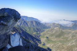
Colby Canyon from near the top of Strawberry Peak’s northwest ridge. Click for larger image.
Finally reaching the steeper part of Strawberry’s fragmented northwest ridge I climbed up the initial sandy ledges to an area of somewhat better rock, taking care not to slip on the ball-bearing grains of decomposing granite. Generally, the rock improves somewhat with height. Higher on the ridge, I enjoyed doing a couple of optional boulder moves that were a little more technical. (I’d done these before and knew they were not a dead-end.)
Reaching the top of the ridge, I could hear conversation and laughter above me. From the summit ridge I could see there were people on and near the summit. I threaded my way to the summit, greeting the hikers along the way. On the summit, a small dog said hi, and I treated my new friend to an obligatory neck scratch.
In nearly five decades of doing the peak, I’d never seen so many people on the peak. I had forgotten that Angeles Crest Highway was closed at Red Box due to a rock slide. With snow in the high country and the great Spring weather, Strawberry Peak was a very popular place.
Running down to Red Box I’d encountered many more hikers, some smiling, some not, but most were enjoying being on the trail. That’s the thing about the outdoors, it just feels good to be out there.
The sun had not yet risen and the poppies along Danielson Road were still tightly furled against the morning’s chill. The purl of Upper Sycamore Creek resonated in the canyon below — a wonderful tone that in recent years has too often been squelched by drought.
I was running to the Old Boney Trail and the start of the ridge that follows along Boney Mountain’s western escarpment to the massif’s huge summit plateau. Several of the Santa Monica Mountains highest peaks are on this plateau, including the range’s highest peak, Sandstone Peak.
In December I’d climbed this route to check the impact of the Woolsey Fire on the area. From the top of the ridge I’d been disheartened by what I saw. Tri Peaks and Sandstone Peak and much of the top of the Boney Mountain massif were a blackened, barren mess.
Now, three months later, I was headed back to Boney Mountain and would continue to Sandstone Peak for the first time since the fire.