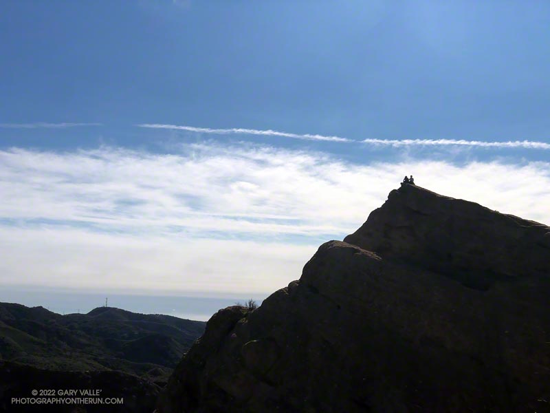
The photograph of Eagle Rock is from this morning’s meandering trail run to Temescal Peak, Temescal Lookout, Eagle Rock, and the Garapito Trail in Topanga State Park.
All of these viewpoints have sweeping views of the Santa Monica Mountains, Los Angeles Basin, and surrounding mountains.
Temescal Lookout (Peak 2036) is the site of a bygone fire lookout station. It’s located just west of Temescal Ridge Fire Road, about a mile south of the Backbone Trail junction and a half-mile north of the Trailer Canyon Fire Road junction. It’s shown on the USGS Calabasas topo map from 1944. Vestiges of the lookout are all that remain.
It was clear and cool when I started up Calabasas Peak fire road from the trailhead on Stunt Road.
Several good trail runs and hikes start here; among them are out and backs to Calabasas Peak and Saddle Peak and an adventurous loop up Topanga Lookout Ridge to Topanga Lookout and Saddle Peak. This morning’s trail run was also going to be a loop, and it was a loop that I hadn’t done before.
Two-thirds of a mile of uphill on the dirt road brought me to a bench and the top of Red Rock Canyon. This is also where the use trail up Topanga Lookout Ridge begins. This time, instead of starting up the ridge, I turned right onto the fire road and began the winding descent into Red Rock Canyon.
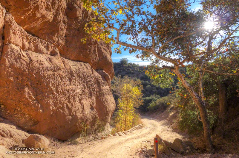
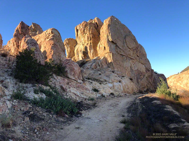
Sandstone rock formation in Red Rock Canyon.
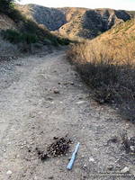
In the canyon, there are Sespe Formation sandstone rock outcrops with a variety of intriguing shapes and colors. About a mile from Calabasas Peak Mtwy is the parking area for Red Rock Canyon Park. From here, the road continues a little less than a mile to Old Topanga Canyon Road.
Running 1.5 miles on a narrow canyon road with little or no shoulder can be hazardous to your health. Doing the run early on a Sunday morning helped. There were about the same number of cyclists as cars, and there weren’t that many of either. The diciest part was a section of road with no shoulder on a blind curve. I was glad to get past that and to the Hondo Canyon Trailhead.
Hondo Canyon from the Backbone Trail
Hondo Canyon is one of the many memorable sections of the Backbone Trail. From Old Topanga, the trail climbs through oaks, grassland, chaparral, and California bay for about four miles to the Fossil Ridge Trail. The trail hides the 1600′ elevation gain well, and long sections of the trail are runnable.
Just below Saddle Peak Road, the Backbone Trail turns right and follows along Fossil Ridge three-quarters of a mile to the service road used to access Topanga Lookout. A left turn leads to the intersection of Saddle Peak Road, Schueren Road, and Stunt Road at the Lois Ewen Scenic Overlook.
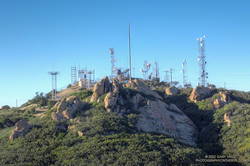
Antennae-festooned west summit of Saddle Peak.
The remainder of the loop follows the same route as the Topanga Lookout Ridge – Saddle Peak loop. Initially, it follows the Backbone Trail west, past a large water tank to a spur trail that goes to the twin summits of Saddle Peak. The West summit, with all the electronics, is slightly higher, but is now closed. The flat East summit is about a quarter-mile from the Backbone Trail.
Returning to The Backbone Trail and continuing west, it’s about 1.25 miles down to the Stunt High Trail junction. From there, it’s another 2.6 miles on the Stunt High Trail down to the Calabasas Peak/Stunt High trailhead and the end of the 14.3 mile loop.
Here is an interactive, 3D terrain view of the Red Rock Canyon – Hondo Canyon – Saddle Peak loop. The Topanga Lookout Ridge route is also shown. The map can be zoomed, tilted, rotated, and panned using the navigation control on the right. Track and placename locations are approximate and subject to errors. Poor weather and other conditions may make this route unsuitable for this activity.
As I worked up the Bulldog climb on this morning’s run, I started to reminisce about the original Bulldog 50K course. When I reached the top, instead of making the usual turn to the left on Castro Peak Mtwy, I turned right, toward Castro Peak.
Barrier marking the private property line on Castro Peak Mtwy fire road.
Prior to 2004, this was the route of the Bulldog 50K. Back then, the 50K course worked over the shoulder of Castro Peak to the top of Upper Solstice Canyon, and then followed the Backbone Trail back to the top of Corral Canyon. The course had to be changed when the landowner closed a short stretch of dirt road on Castro Peak.
Today, I ran a bit more than a half-mile before reaching the razor and barbed-wire-laced barrier blocking the road. Then it was back to running the Bulldog – Phantom Loop combo and enjoying the spectacular Fall day.
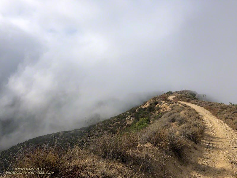
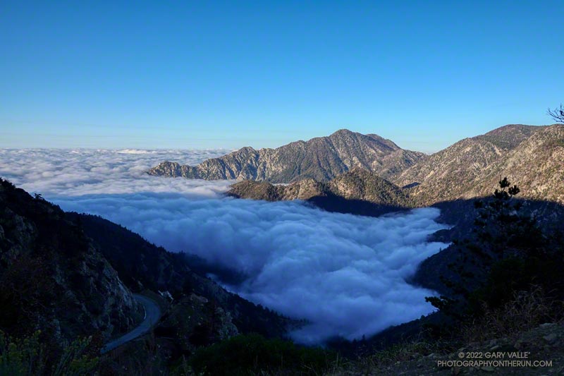
Low clouds spilling over Rocky Peak Road near the Chumash Trail.
Wait a minute… I stopped running down the hill and walked back to look at the sizable pile of scat.
I was on Rocky Peak Road, at about mile 3 of an extended version of the Chumash – Las Llajas loop, and just past the top of the Chumash Trail.
Bear scat on Rocky Peak Road. Click for a larger image.
No doubt about it. It was bear scat. The bear had been eating holly-leaved cherries, and the scat was full of cherry pits. Over several decades of running Rocky Peak Road, this was the first time I’d seen evidence of a bear in the area.
This morning, I looked for bear tracks around the scat, but thunderstorms and bike traffic had erased them. After taking a couple of photos, I continued toward the high point of the loop, “Fossil Point.”
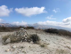
Cairn at “Fossil Point” — the highest point of the Chumash – Las Llajas Loop.
What had started as a very foggy morning was transitioning to a cool Fall day with a mix of sun and clouds. From the cairn at Fossil Point, Oat Mountain was still partially shrouded by clouds. Below the overlook, I spotted a couple of mountain bikers working up the road. The ride up Las Llajas Canyon has become a popular e-mountainbike ride, and e-bikes would be the only type of bike I would see on my way down the canyon.
The run down Las Llajas Canyon was pleasant and fast-paced. Lately, I’ve been doing a variation of the loop that jumps over to the Marr Ranch Trail using a trail that splits off the Coquina Mine trail. This route gets you up and out of the canyon and onto a ridge with good views of the surrounding terrain. It’s a bit more adventurous and adds a little mileage and elevation gain to the usual loop. The Coquina Mine trail is easy to miss — it branches off Las Llajas Road after passing the towering cliffs.
I wondered what the hikers would think when they reached this part of the Dollar Lake Trail.
A few minutes before, we had all reached the junction of the Dollar Lake and Dry Lake Trails at the same time. They hadn’t done the peak before and were debating which trail to take. When I mentioned that the Dollar Lake Trail is the shorter route to the summit, that’s the route they chose.
I guessed there might be a few choice words directed my way. About a half-mile beyond the junction, there is a long switchback on the Dollar Lake Trail that seems to never end. It’s about twice as long as any switchback on the Dry Lake Trail or Sky High Trail. With the mountain at your back, it takes the disbelieving hiker farther and farther away from their goal. How could it possibly be the shortest way to the summit?
But it is. The Dollar Lake Trail route is shorter — by about two miles. Following are the estimated mileages from the South Fork Trailhead to Gorgonio’s summit via the Dollar Lake and Dry Lake routes*:
My GPS tracks – Dollar: 9.8 Dry: 11.5 Difference: 1.7
Tom Harrison Maps – Dollar: 10.0 Dry: 12.0 Difference: 2.0
*The Dollar Lake route uses the South Fork, Dollar Lake, Divide, and Summit Trails. The Dry Lake route uses the South Fork, Dry Lake, Sky High, and Summit Trails.
The combined route — Dollar up and Dry down — is one of the best mountain trail runs in Southern California. It’s a favorite, and the route I was doing today.
This morning the sky was mostly clear, and the temperature was mild. Later in the day, there was a chance of a thunderstorm, but I expected to be off the exposed trails higher on the mountain well before thunderstorms had a chance to build.
The first cumulus clouds popped up over the mountain around 10:00 a.m. An hour later — as I was crossing the summit plateau — the clouds were more extensive but with little vertical development.
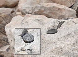
Defaced survey marker on the summit of San Gorgonio Mountain.
There were only a few people in the summit area. Some were on the west summit and some on the east. The twin summits are about 80 feet apart and nearly at the same elevation. Oddly, someone has defaced the survey marker on the west peak since the last time I was there — June 2021. With clouds all around, and 12 miles to go, I snapped a few photos and headed down.
I only saw one group of hikers on the Sky High Trail. They were working up the switchbacks at a good clip and would probably make the summit in an hour or so. Hopefully, the weather would hold for them!
It wasn’t until I was between the C-47 memorial and Mineshaft Saddle that I heard the first rumbles of thunder somewhere in the distance to the east or northeast.
As I continued down the mountain, I occasionally heard thunder in the distance but nothing nearby. There were some sizable cells to the east, but the weather behaved itself. At least where I was. I later heard it dumped at Onyx Summit, and flash flooding was reported at Joshua Tree.
For me, the weather was nearly ideal. Mild temperatures, light winds, and picturesque, sun-shielding clouds. It was short sleeves and shorts up and down. But on another day, it might not have worked out that way.
After weeks of dealing with one heatwave after another it was a strange sensation. I was cold. I had on an extra shirt and sleeves, but the slopes of Mt. Islip were deep in shadow and the wind was gusting to 20 mph. The thermometer on my pack read 41 degrees, but the “feels like” temperature had to be in the 30s.
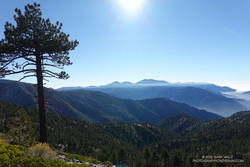
I was in the first mile of an out and back trail run from Islip Saddle to Mt. Baden-Powell. A San Gabriels classic, the route gains (and loses) about 3800′ over 16.5 miles on the PCT.
This morning I was doing the basic out and back, but Mt. Hawkins, Throop Peak and Mt. Burnham are easy peaks that can done along the way. Mt Islip is is a bit more of a detour, but can also be added to the route.
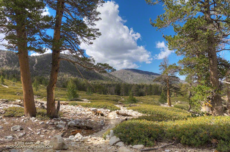
Mt. Baldy and environs from the PCT, between Mt. Hawkins and Throop Peak.
It’s also possible to start the out and back at the Windy Gap Trailhead (5836′) in the Crystal Lake Recreation Area. The distance to Baden-Powell is about the same, but the lower trailhead adds about 800′ of gain.
As I chugged up one of the initial steep sections, I thought about what it must have been like for this year’s participants in the AC100. This year, because the AC100 was an out and back from Wrightwood to Shortcut Saddle, runners got to do this tough segment after running more than 75 miles!
Here is an interactive, 3D terrain view of the out and back from Islip Saddle to Mt. Baden-Powell. The map can be zoomed, tilted, rotated, and panned using the navigation control on the right. Track and placename locations are approximate and subject to errors. Poor weather, and other conditions may make this route unsuitable for this activity.