Category Archives: running

The Color of Rain III

Rain brings out the richness of the chaparral, enlivening its inhabitants, enhancing its colors, and enriching its fragrances. But in recent weeks rain storms have been few and rainfall far below normal.

The 2011-2012 rain season started out well enough. Thanksgiving Day the water year rainfall total for Downtown Los Angeles (USC) was about an inch above normal. But between Thanksgiving and Christmas the drier weather often associated with La Nina conditions became predominant, and water year totals dropped to about normal.

Northern and Central California were actually much drier than would be expected during a La Nina. Mammoth Mountain recorded no new snow between December 5 and January 19 — about a month and a half! Our dry spell was nearly as long. Downtown Los Angeles recorded no measurable rain between December 17 and January 21.

The storms Saturday and Monday added about 1.3 inches of rain, boosting the water year rainfall total to 5.06 inches. As of yesterday this was 1.87 inches below normal and about 73% of the normal total.

The problem is this time of year we fall behind another 0.12 to 0.15 inch every day that it doesn’t rain. The deficit adds up quickly and if — as the medium range models currently project — we don’t get any rain for the next 10 days we’ll down another inch and at about 64% of normal. We’ll see!

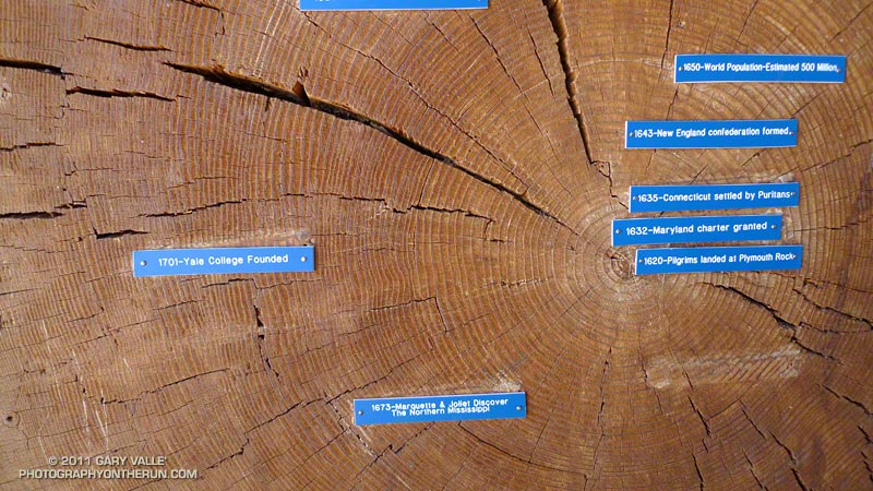
The photograph of the Ceanothus trunk is from last Sunday’s Will Rogers – Temescal loop trail run.

Related posts: The Color of Rain II, The Color of Rain

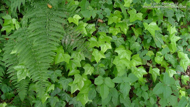
Cape Ivy on the Rivas Canyon Trail

Cape Ivy on the Rivas Canyon Trail

Did the Will Rogers – Temescal Loop this morning from the End of Reseda. It had been more than a month since we’d had measureable rain in Los Angeles and it was great to be out in the Santa Monica Mountains after a rainstorm, dodging a few mud puddles and enjoying the good running weather!

A key segment of the 21 mile loop is the Rivas Canyon Trail, which connects Will Rogers State Historic Park to Temescal Gateway Park. Each time I run the trail I’m blown away by the oceans of Cape ivy in Rivas Canyon. Having grown up in the Southeastern U.S. it reminds me of kudzu.

Both are introduced perennial climbing vines — kudzu from Japan and Cape ivy from South Africa. Both are prolific and can cause severe negative impacts to native plants and other vegetation.

More information about Cape ivy (Delairea odorata) can be obtained on the California Invasive Plant Council web site.

Related post: Christmas Eve Trail Run

Circle X Crags and the Channel Islands

Crags in the Circle X area and the Channel Islands from the Etz Meloy section of the Backbone Trail

The view above is of crags in the Circle X area and the Channel Islands from the Etz Meloy section of the Backbone Trail in the Santa Monica Mountains.

From today’s out and back run on the Backbone Trail from Kanan Road to a viewpoint on Etz Meloy Mtwy fire road. The fire road continues west about a mile and links to the Yerba Buena segment of the Backbone Trail.

The segment between Kanan Road and Yerba Buena Road includes the two remaining gaps in the Backbone Trail — the 0.1 mile Etz Meloy gap and the 0.4 mile Upper Trancas gap.

Here are a few additional photographs from the run:


Etz Meloy Motorway


Chaparral Currant


Oak Grove

El Escorpion Moonrise

El Escorpion Moonrise

Moonrise over the San Fernando Valley from El Escorpion Park.

From a late afternoon run on December 8. The moon is about 98% full, and about a day and a half away from the total lunar eclipse that occurred before sunrise on December 10, 2011.

The pink alpenglow results from sunlight passing through the Earth’s atmosphere. The dark area just below the alpenglow is the Earth’s shadow.

Here’s a larger version of the photograph.

You Ride an Elevator, but Crawl Over a Wall

The post on the XTERRA web site said the new Crystal Cove 15K course had been approved, and also mentioned something about a “gnarly” hill. I thought I better check it out, and followed a link to the course info on MapMyRun.

The elevation profile didn’t look too bad. It had the usual ups and downs you expect to see on a Southern California trail run. In Tour de France fashion, MapMyRun categorizes the more difficult climbs on a course from Cat 5 to Cat 1 with Cat 1 being more difficult.  Climbs that are crazy difficult are rated Hors catégorie (HC). A climb has to be at least 0.3 mile long to be categorized.

Two categorized climbs were noted on the MapMyRun elevation profile of the Crystal Cove 15K course: a Cat 3 that began about a half-mile into the race and climbed about 775′ over 3.4 miles, and a Cat 5 that started at about mile 4.7 and gained about 130′. The gnarly climb was supposed to be somewhere around mile 5, but the MapMyRun profile indicated that section had a grade of 2.6%??

The gnarly hill was waiting for us around a sharp corner at mile 4.75. Locals refer to it as the Elevator, but the runners I talked to call it THE WALL. Since you ride an Elevator, but have to crawl up and over a wall I’m going with THE WALL. Whatever you call the thing, it was the steepest pitch I’ve ever encountered on a race course, and steep enough that hikers often descend it on their backside. (It’s steeper than it looks in the video!)

And once you’ve clawed your way over THE WALL you’re not done — the hill continues another 0.4 mile and averages about a 15% grade. I pushed on up the climb, propelled by the thought that the MapMyRun profile showed it was nearly all downhill from around mile 5.7 to the Finish — I would have almost four miles of downhill bliss.

Or not! It was in the middle of the uphill around mile seven that I was beginning to wonder when the “good” downhill was going to begin. It had to start soon; the course was only about 9.5 miles long! After struggling to keep my pace up through a long stretch of level terrain around mile eight, I wondered — probably out loud — if the course was going to fall off the edge of the earth.


From madness comes revelation, and in this case the edge of the world. The last mile-plus of the course plummeted nearly 700 quad-numbing feet to the Finish.

Reality check: Here’s a higher resolution elevation profile generated in SportTracks using my GPS track from this year’s race. You can see there was a lot more to the course than shown in the MapMyRun profile. There are several tough climbs, ranging in grade from about 5% to 15%, and the last big hill was definitely gnarly! The course was great, and much more interesting than the MapMyRun profile suggested.

Here’s a Crystal Cove State Park Trail Map (PDF).