Category Archives: races

Skyline to the Sea – Fall 2018

Towering redwoods along the Skyline to the Sea Trail, Big Basin Redwoods State Park

Update July 20, 2020. Here’s a Google Earth image of a CZU August Lightning Complex Fire perimeter from the National Interagency Fire Center (NIFC). The date and time of the perimeter is indicated. My GPS track from the PCTR Skyline to the Sea Marathon in Castle Rock and Big Basin Redwoods State Parks is also shown. The locations of all placemarks and trails are approximate. For official information see the CAL FIRE CZU August Lightning Complex and InciWeb CZU August Lightning Complex incident pages.

There’s a reason that Skyline to the Sea is Pacific Coast Trail Run’s biggest event. Close your eyes and picture your ideal trail. The trail of your dreams might be hard-pressed to match the appeal of the Skyline to Sea Trail.

There is something magical about running in an old-growth redwood forest. Established in 1902, Big Basin Redwoods State Park was the first state park in California. It’s redwoods reach 2000 years in age, 328 feet in height and 18.5 feet in width!

The Skyline to the Sea Trail has a net elevation loss, but enough uphill to get your attention. Many miles of the trail are as smooth as a carpet, but some are rocky, root-strewn and technical. It is often cool under the dense forest canopy, but it can also be warm and humid. I was surprised to see an “Emergency Water” stash a mile before the last aid station. In some years it is well-used and much appreciated.

The Park supports a vast variety of animal and plant life. Some plant species can only be found in the Park and a seabird (Marbled Murrelet) nests in its old-growth conifers.

In some years one park species can add extra adrenaline to the race. This year Brett (my son) and I were counting down the miles to mile 4.0 of the Marathon. The R.D. had reported encounters with the beasts at that point of the 50K on Saturday. About 20 yards before mile 4.0 Brett saw what looked like a “cloud of dust” and shortly after that we heard agitated voices from the runners ahead.

In it for the full experience, we — and several other runners — plowed headlong into the cloud. The yellowjackets didn’t like that. A number of us were stung; some several times. The day before a runner in the 50K was stung 18 times.

Yellowjackets or not, running the Skyline to the Sea Marathon was like running a 26 mile nature trail and one of the finest courses I’ve done.

Many thanks to R.D. Greg Lanctot and Team PCTR and all the volunteers that helped with the event. For all the results and more info see the Ultrasignup event page, PCTR’s web site and Facebook page.

Here are a few photos taken along the way. Mileages specified are from my fenix 3 and are approximate.

Kodiak 50K 2018

Runner at about 9800' on Sugarloaf Mountain during the Kodiak Ultramarathons.

I already had my camera out and paused briefly to take the picture above. We were at about 9800′ on the rocky trail up Sugarloaf Mountain (9952′) and a little less than a half-mile from the summit. At the time, I wasn’t sure how far it was to the top. I thought we were getting close, but I’d thought that before.

Although I’ve done the Kodiak 50M a few times, I’ve always run the Siberia Creek (counterclockwise) course, so the ascent of Sugarloaf was totally new to me. The top of the peak is a stout six mile, 3000′ climb from the Sugarloaf Aid station, and for the uninitiated, there are many false summits along the way.

It was good to be feeling good. I’d run at altitude a lot this summer and it was helping. Running along the summit ridge didn’t feel much different than running on Lasky Mesa. And the weather was nearly ideal. No crazy 100 degree temps — just a few puffy, postcard clouds to dress up the day.

A five-minute jog along the crest ended on the summit. Bear Valley SAR was on top, checking runners in. Before the race they had lugged 1500 lbs. of water two-thirds of the way up the mountain. (Thank you!)

Participation in the 100M, 50M & 50K Kodiak Ultra Marathons has been increasing every year, and really jumped up this year. In 2016 the Sugarloaf Back 50K had 27 finishers and last year the Siberia Creek Back 50K had 57. This year there were 148 finishers in the Back 50K. With an average elevation of 7777′, a high point just shy of 10,000′, and around 6500′ of elevation gain, it’s one of the more challenging 50Ks in California.

It’s one thing to run the last 32 miles of a course, and quite another to run those last miles after running 70 other miles. The  Kodiak 100 milers (and 50 milers) were impressive. One trait all seemed to share was a laser-sharp focus on the task at hand. That was certainly the case for veteran Army Ranger Ben Brown, who was running his first 100M in support of 9 Week Warrior — a nonprofit started by Ben and his wife to help veterans, police officers and firefighters. Ben finished the race strong, cruising past me (again) on the dirt road down to the village.

Not all races end the way we want them to. Part way up Sugarloaf I talked to a friend of Ruperto Romero’s and was disappointed to hear that Ruperto, Tony Torres and Mario Martinez missed a turn before the Dump Aid Station (Mile 56). The three had been leading the 100M Prize Purse race since the Champion Aid Station (Mile 20.5). Ruperto won the 100M event last year.

Elan Lieber was the eventual winner in the 100M Prize Purse division in a time of 22:02:08. Daniela Seyler won The Kodiak 100M and was the fastest woman overall in the 100M with a time of 24:09:59. Robby Haas (9:31:09) and Rachel Hallummontes (10:52:48) won their respective divisions in the 50M; and Andrew Cassano (5:49:14) and Emma Delira (6:46:44) topped their divisions in the 50K. All the results are posted on Ultrasignup.

Many thanks to new Kodiak RDs Susie Schmelzer and Harald Zundel, and to Team Kodiak, all the volunteers, Bear Valley SAR, HAM operators, medical personnel, and everyone that helped put on the event.

Here are a few photos taken along the way.

Related post: Kodiak 50 Mile 2017 – Smiling at the Finish

Another Scorching Angeles National Forest/Mt. Disappointment Trail Race

Sunrise on Mt. Wilson prior to the start of the 2018 Angeles National Forest/Mt. Disappointment Trail Race

It was “déjà vu all over again” for the 12th running of the Angeles National Forest Trail Race on Saturday. When the sun rose over Mt. Wilson Saturday morning, the temperature was already in the 80s and monsoon clouds were scattered across the eastern sky. We all knew it was going to be a hot day. The only question was how hot?

Following weeks of seasonable — and often cool — weather, temps began to ramp up Thursday. On Friday many daily and some all-time record high temps were set around the Los Angeles area. Van Nuys set an all-time record high of 115°F. Downtown Los Angeles set a new daily record of 108°F and Woodland Hills set a new daily record of 117°F.

The high temperature recorded at Clear Creek for each of the ANFTR/Mt. Disappointment races. Click for a larger image.

The record-breaking heatwave continued race day with temps on the ANFTR course surpassing the torrid temps of 2017. The Clear Creek RAWS recorded hourly temperatures as high as 100°F and hourly fuel temps as high as 123°F. The highest temperature measured at Clear Creek was 105°F — five degrees higher than last year’s race.

Once again, despite the heat, there were some AMAZING performances. In the 60K, first and second place in both the Mens and Womens division finished only a couple minutes apart. Mario Martinez’s 6:41:25 just edged Rupert Romero’s 6:43:27, and Katie Asmuth’s 7:29:11 was just ahead of Teresa Kaiser’s 7:32:21. Chase Coffey ran the 50K in 4:25:26, which I believe is the fastest time for the normal 50K course. (In 2009 we ran all the way to Red Box on Mt. Wilson road.) Ana Suchey was the top woman in the 50K with a time of 6:04:30. In the 25K Victor Martinez bested the record he set last year, running the course in 2:07:27. Jennifer Sunahara was first among the women, with a time of 2:58:29. Not all the great performances were from the fastest runners. Sa Il Hong, age 80, completed the 50K in fine form.

Many thanks to Gary and Pam Hilliard and all the ANFTR staff and volunteers! It wasn’t just hot for the runners! And those setting up the event and marking the course had to endure Friday’s record-setting temps, spend a warm night on the mountain, and then work in the heat again on Saturday!

See the ANFTR web site, Facebook page and Facebook group for more info. The Angeles National Forest Trail Race is the new name for the Mt. Disappointment Endurance Run. Only the name changed. All the results for the ANFTR/Mt. Disappointment races since 2005 can be found on Ultrasignup.com.

Note: The temperature in a commercial weather station is measured inside a white, ventilated instrument housing, several feet off the ground. Mid-day temperatures in the sun, in the summer, with a cloudless sky will be much warmer than this. Some stations, such as Clear Creek, also measure the fuel temperature — the temperature of a pine dowel in direct sun about a foot off the ground. According to the NWS (and common sense) exposure to full sunshine can increase heat index values by up to 15°F. In my experience the fuel temp gives a better indication of the actual temperature a runner can experience in the sun, especially on exposed mountain slopes facing the sun.

Related post: Record Heat for the 2017 Mt. Disappointment 50K & 25K

Diablo Trails Challenge 50K 2018

North Peak from the North Peak Trail. Mount Diablo Trails Challenge 50K.

Just 48 hours before the start of the Diablo Trails Challenge the temperature on Mt. Diablo’s summit was a chilly 31°F. Gray, wind-driven clouds shrouded the summit, propelled by 20-30 mph winds. Over the 10 days preceding the race, it had rained on four, and Concord had received about two inches of rain.

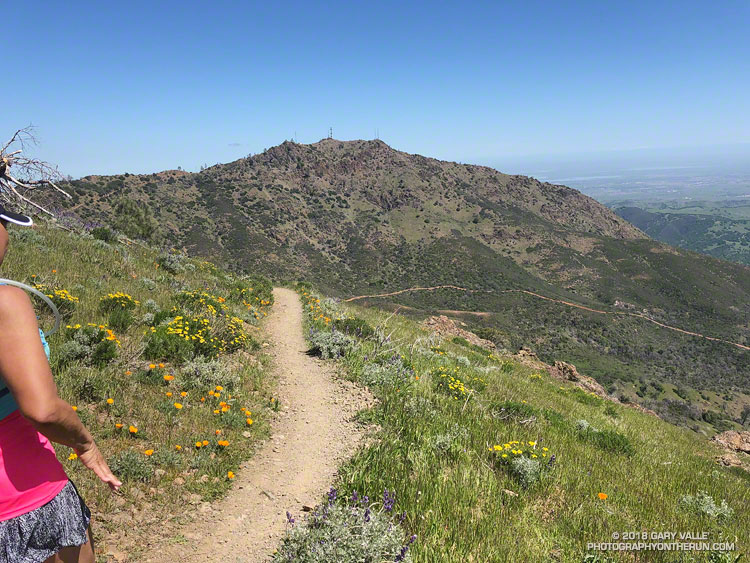
That’s the thing about Spring weather – a couple of days can make a huge difference. Today – race day – the sun is out, the hills are green and skies blue. Very little mud remains – the trails are in great shape and hills sprinkled with wildflowers. It’s the perfect day for a run on Mt. Diablo!

Diablo Trails Challenge 50K Elevation Profile

With around 7000′ of elevation gain/loss, the Diablo Trails Challenge 50K is characterized by its many ups and downs. The core of the 50K course is the 7 mile, 3000′ climb from the Curry Canyon Ranch aid station to Diablo’s main summit. But before you can enjoy this fine ascent, you have to get to Curry Canyon Ranch. And it’s on the other side of the mountain – about 12.5 miles away. Here’s a 3D interactive view of my GPS track of the 50K course.

Along the way there are several get-your-feet-wet creek crossings and many hills. Following along on the map, the course works its way past Wall Point, Artist Point, Knob Point and finally Windy Point. Did I mention the course is hilly?

Somewhere around Mile 10 you get the first good view of Mt. Diablo and North Peak. The runner in front of me exclaimed, “Holy guacamole, is that what we are going to climb?” My choice of words were similar, but not quite as polite. Yes indeed, those were the peaks, and they loomed LARGE across the valley.
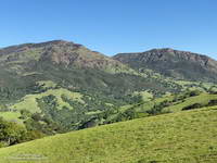
Mount Diablo and North Peak from Knobcone Pine Road.
Mt. Diablo (left) and North Peak

Elevation gained is so easily lost. After gaining about 2500′ on the way to Windy Point, a 1000′ descent leads to the Curry Canyon Ranch Aid Station. The climb of Diablo starts here, but you really don’t feel like you’re on the mountain until you reach South Gate Road and the Curry Point Aid Station, about three miles up the canyon. The grade in Curry Canyon is moderate and I tried to take advantage of that, knowing steeper terrain was ahead.

The Half-Marathoners joined the course at Curry Point — adding their enthusiasm and company – but they were soon headed back down, leaving us to cope with the Summit Trail all on our own.

“Jalapeño chip?,” I asked the runner hiking up the hill next to me. He smiled and said something like, “Maybe next time.” I did what I could to keep from constantly looking up at the summit. I munched on chips, talked to runners and hikers, read the “Trail Through Time” interpretive signs, looked at wildflowers and enjoyed the great views. As long as you keep putting one foot ahead of the other — and maybe smile from time to time – summits will eventually arrive.

Yahoo! The Summit Aid Station! There is almost no wind. In the sun it’s comfortably warm and in the shade comfortably cool. As at the other aid stations, the volunteers are great, helping me to get my hydration pack sorted and get me on my way. After seven miles of uphill, a little downhill is going to feel really good.
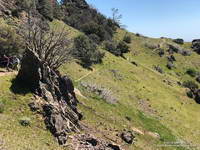
North Peak Trail near Devil's Pulpit.
North Peak Trail near Devil’s Pulpit.

The next few miles I’d done before and they are among the most interesting on the course. It helped to be familiar it – especially the notoriously steep section of North Peak Road, just before the summit. Everyone picks a different route. This time I stayed on the left going up and the right going down, and didn’t fall on my butt!

Once past the “slide” it didn’t take long to get down to Prospector’s Gap. I recalled that the running on the Bald Ridge Trail was excellent and wasn’t disappointed. At Meridian Ridge Road we left Bald Ridge and descended into Mitchell Canyon. At Deer Flat Creek, once again the course headed up. I couldn’t recall how long the climb was going to be, but it looked like we were going to have to work over a high ridge to get to the Castle Rock side of the mountain. The ridge turned out to be Moses Rock Ridge and the climb over it fit right in with the other hills on the course. Click, click goes the elevation-gained counter.

Most of the course is a big loop, but to access the peaks and aid stations there are four short out and back sections. You get to know the runners around you on these sections and we’d give each other encouragement as we passed. The runners around me were great and throughout the run we had many good conversations.

Then there was Burma Road. Somewhere around mile 26, I commented to another runner that we were running out of miles and at some point we were going to have to lose a lot of elevation. The Burma Road descent took care of that.

Many thanks to Jasmin and Sam of Brazen Racing for putting together such a superb event! And a BIG thank you to all the volunteers, ham operators, runners, park staff, sponsors and especially the Save Mount Diablo Foundation. I thoroughly enjoyed running on Mt. Diablo!

Here are a few photos taken along the way. More photos and all the results are available on the Brazen Racing web site.