Sometimes when I’ve driven to the Ahmanson Trailhead to do a run, I’ve wondered what it would be like to run there (and back) from home. Now I know.
It’s a good run. Roundtrip, it was about 8.2 miles, with an elevation gain of about 600′.
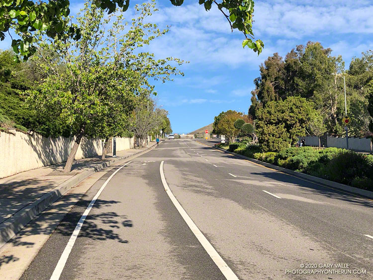
The highlight of the run is the climb up Victory Blvd from Valley Circle. There’s a nice view of the San Gabriels from the hill, but not quite as nice as the view from Lasky Mesa!
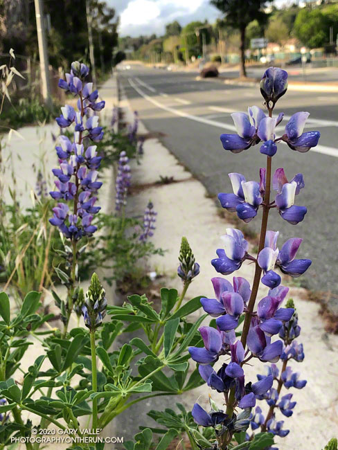
Arroyo lupine (Lupinus succulentus) is one of the first lupines to bloom in the local grasslands and open areas of chaparral. Here it’s blooming along Valley Circle Blvd. in the West San Fernando Valley.
Another early bloomer is miniature lupine (Lupinus bicolor), a tiny lupine that is best viewed on your hands and knees. On Lasky Mesa it typically begins to bloom in mid to late February, about the same time as goldfields.
From this morning’s out and back run to check out a local trailhead.
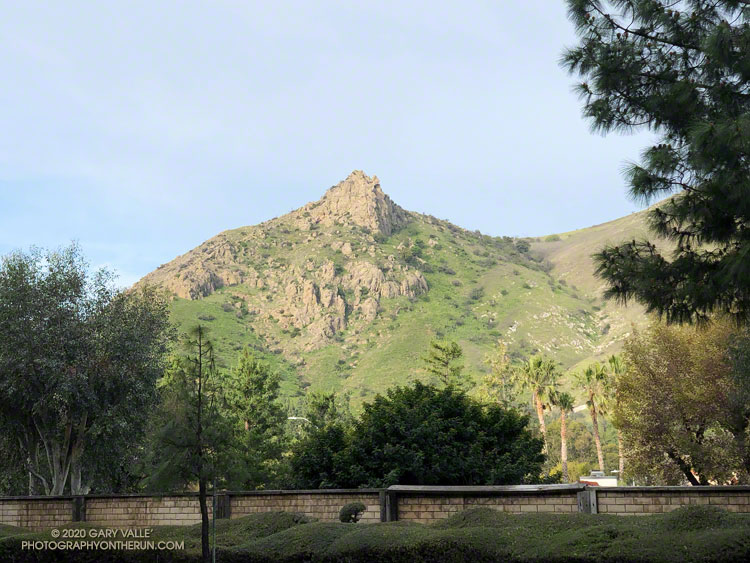
On today’s run, a muted morning sun highlighted Castle Peak in a tree-framed view from Valley Circle Blvd. This native bush sunflower (Encelia californica) was happily growing along a side street.
With MRCA/Santa Monica Mountains Conservancy lands and trails closed, local State Parks closed, and County trails closed, street views will be the norm for a while.
Related post: Castle Peak
Photography and inspiration from running and other adventures in the Open Space and Wilderness areas of California, and beyond. No ads. All content, including photography, is Copyright © 2006-2024 Gary Valle. All Rights Reserved.
