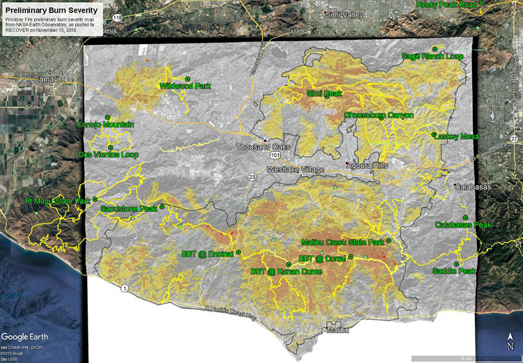
The Google Earth image above shows a preliminary burn severity map for the Woolsey Fire from NASA Earth Observatory, as posted by NASA’s Rehabilitation Capability Convergence for Ecosystem Recovery (RECOVER) web site on November 15, 2018. Here is a larger version of the map.
The initial burn severity estimate is based on a Burned Area Reflectance Classification (BARC) derived from satellite data before and after the fire. In the map above the burn severity classes are high (red), moderate (orange) and low (yellow). Note that areas within the fire perimeter that are not included in these classes may still have burned. Also note the fire was still burning when this assessment was made.
GPS tracks of the Backbone Trail and some other trails in the region have been added. Trail and placename locations should be considered approximate.
Related post: Woolsey Fire Map with Perimeter and Selected Trails
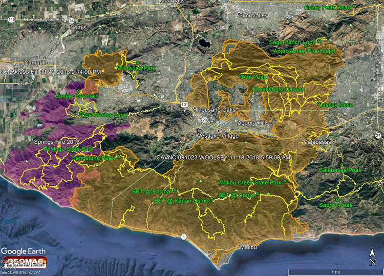
The Google Earth image above shows a recent perimeter for the 2018 Woolsey Fire along with GPS tracks of the Backbone Trail and some other trails in the region. The Hill Fire perimeter and 2013 Springs Fire perimeter (purple area) are also shown. Trail and placename locations should be considered approximate. Here is a larger version of the map.
The perimeter was was downloaded from GEOMAC and timestamped November 18, 2018 at 5:59 a.m. If the timestamp of the perimeter of the displayed map doesn’t match, try refreshing/reloading this page. The perimeter has been refined and the acreage is a slightly less than previously specified.
As of November 21, 2018 6:11 p.m., the Cal Fire Incident Page for the Woolsey Fire indicated that the fire had burned 96,949 acres and was 100% contained. The fire started on November 8, 2018 2:24 p.m.
Photography and inspiration from running and other adventures in the Open Space and Wilderness areas of California, and beyond. No ads. All content, including photography, is Copyright © 2006-2024 Gary Valle. All Rights Reserved.
