Category Archives: trails

Clouds and Crags

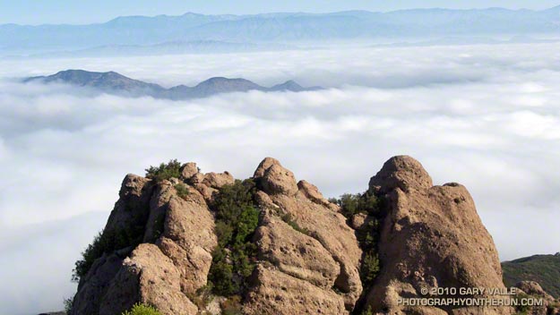
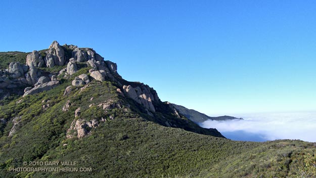
The clouds are in the Conejo Valley and the crags are a prominent highpoint on the ridge that tops the west face of Boney Mountain. Here’s a Google Earth aerial view SSE along the ridge that shows the topography. From the upper cliffs the west face drops over 2000′ to the Backbone Trail in Blue Canyon.


Ascending the western ridge, or easier eastern ridge, is an adventurous way to access the Backbone Trail from Wendy Dr. Once over Tri-Peaks and on the Backbone Trail several loop variations are possible. These range from a relatively direct return on the Boney Trail, to lengthy excursions to Serrano Valley or La Jolla Valley.

Today’s variation worked out to about 20 miles. Once on the upper section of the Backbone Trail, I followed it west down the Chamberlain, Boney and Blue Canyon trails to the Danielson Multi-use area in Sycamore Canyon. After doing a circuit in Sycamore Canyon I picked up the Upper Sycamore Trail and headed back to Danielson Road, Satwiwa, and the trailhead at Wendy Drive.

Some related posts: Boney Mountain Western Ridge & Loop, Sandstone Peak from Wendy Drive, Boney Mountain North Side Loop

Cooler Climes

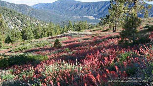
Paintbrush on the Vincent Tumamait Trail

Paintbrush on the Vincent Tumamait Trail

Thursday afternoon the temperature in Woodland Hills hit 107°F. Friday was 103°F, and Saturday 104°F. Weekdays I run in the afternoon, and after running in that heat, I needed to escape to cooler climes. One way to beat the broiling temps was to head for the high country.

There are several higher elevation areas within a couple hours drive of Los Angeles. My favorites are Mt. Baden-Powell (9399′), Mt. Baldy (10,064′), Mt. Pinos (8831′), Mt. San Jacinto (10,834′) and San Gorgonio Mountain (11,499′).


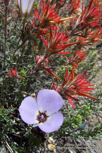
Mariposa and paintbrush
Today the choice was Mt. Pinos. It had been a few weeks since I’d run there, and the driving time to the Chula Vista parking lot on Mt. Pinos is about the same as that to Islip Saddle in the San Gabriels. Also, it’s usually cooler running between Mt. Pinos and Mt. Abel, than between Islip Saddle and Mt. Baden-Powell.

It was a little breezy and chilly up on Mt. Pinos, Sawmill Mountain and Mt. Abel. What a change from during the week. At the start of the run the temperature was about 40-50 degrees cooler than my last run at Ahmanson Ranch.

I did an extended version of the usual 14.5 mile out and back course on the Vincent Tumamait Trail. This variation drops down to Lilly Camp (6600′) on the North Fork Trail before continuing to Mt. Abel. The side trip adds about 6 miles and 1700′ of gain. It was a bit warmer down at Lilly Meadow Camp, but the air conditioning kicked back in once I returned to the main trail.

Some related posts: Running Hot & Cold, Up & Down Mt. Baldy’s South Ridge, Vincent Tumamait Trail, Autumn Trail Running on Mt. San Jacinto, San Gorgonio High Line 2009

La Nina Looming

Pacific Crest Trail Near Mt. Burnham

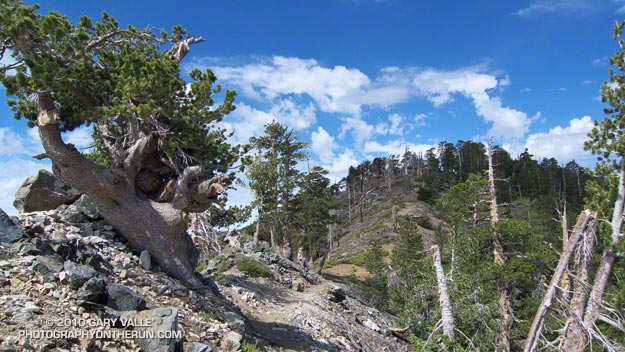
Pacific Crest Trail Near Mt. Burnham, in the San Gabriel Mountains

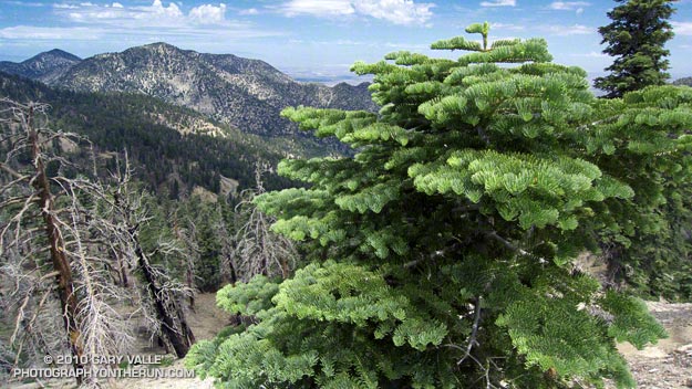
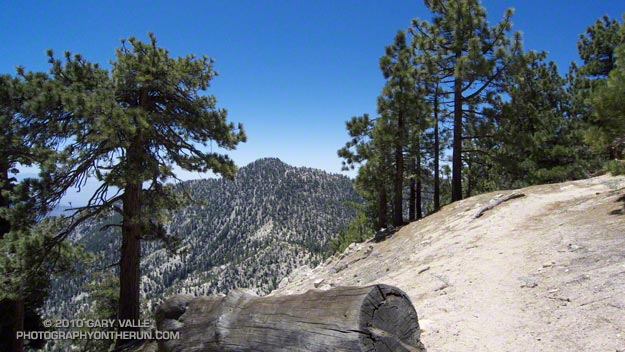
At an elevation of 9000′ the weather was sensational. Skies were partly cloudy, accentuating the terrain, and hinting of a thunderstorm later in the day. I was on the Pacific Crest Trail between Mt. Burnham and Mt. Baden-Powell, about 8 miles into a 18 mile run in the San Gabriel Mountains.


Remarkably, there was still a small patch of snow along the trail. According to seasonal summaries in Your Guide to Snowfall, the 2009-2010 season in Southern California was the best since the big Winter of 2004-2005. But it wasn’t necessary to check the snow history to know the snowfall had been above average. All that was needed was to look around, and the mountains told the story.

The remnants of snow were only part of the tale. Broken and downed trees told of strong Winter winds, and the stalks of red snow plant of a cool Spring. Now springs flowed freely and once dry seeps were damp and green. Wildflowers bloomed in profusion. Squat bumblebees waddled from flower to flower, and hummingbirds darted from patch to patch of scarlet bugler.


It had been a good Winter. Sugar pines were heavy with pine cones, and new growth decorated the limbs of the white firs. The growth of tree seedlings in the Curve Fire burn area seemed to have accelerated, and the protracted process of forest replacement was underway.

Southern California’s erratic weather demands that plants and trees be opportunistic. In time they have learned that an El Nino Winter is often followed by one that is dry, and La Nina looms.

July Fourth Trail Run to Trippet Ranch, Hondo Canyon and Saddle Peak

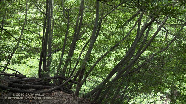
Bay trees on the Hondo Canyon Trail

It was about 9:45 a.m., and I was switchbacking up through a surprisingly dense forest of California bay on the Hondo Canyon segment of the Backbone Trail. The trail was carpeted in bay leaves, and a hint of the sharp, sweet smell of bay lingered in the still morning air. It had been four years since I had run this trail, and I had forgotten just how lush and green it was. The geology, oaks, bay trees, ferns, and poison oak were spectacular.

The run from the end of Reseda to Saddle Peak (and back) was going well. The route was a tricky one, and it really helped that I had done it before. Lower in the canyon there had been a misleading Backbone Trail marker, and that was just one of several potential gotcha’s.

Even if you know the way, the run is no gimme. Depending on the route used, its length works out to around 26 – 28 miles, and it has a legit elevation gain/loss approaching 5000′. Throw in the route-finding challenges, and it’s possible to have a long day.

The run starts at Marvin Braude Mulholland Gateway Park, on the San Fernando Valley side of the Santa Monica Mountains. The first leg of the run goes to Trippet Ranch. I usually run the fire roads out to Trippet Ranch, and then take the Musch, Garapito, and Bent Arrow trails on the way back to Reseda.

The route-finding fun begins on the Dead Horse Trail at Trippet Ranch. From Trippet Ranch to Saddle Peak the route is all on the Backbone Trail, and is (almost) all single track. Some of it is marked, and some of it isn’t. Some of it is obvious, and some of it is not.
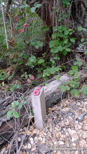


The most obscure section is between Topanga Canyon and Old Topanga Canyon. From the Dead Horse Trail parking lot, the Backbone Trail starts behind the bathrooms and follows a brushy canyon down to Topanga Canyon Blvd. The trail picks up again across Topanga, about 50 yards west on Greenleaf Canyon Road. The trail is on the left, just before a creekbed, and leads uphill. There are some nature trail markers along the steep trail, and the top of the hill is about a quarter-mile from Greenleaf. From the top of the hill, the trail zigs south and zags west, working down to a dirt road. The route continues across the road and down an overgrown slope to the north side of the water tanks. A trail leads northwest from the water tanks and down to Old Topanga. The total distance from Topanga to Old Topanga is about 0.6 mile.

I was glad to have that convoluted stretch behind me. A few minutes ago I’d reached the top of Hondo Canyon, and turned onto the Fossil Ridge Trail. When the visibility is good, the views along Fossil Ridge and the crest leading to Saddle Peak are excellent. Today the marine layer had been slow to clear, and the tops of the peaks were cloaked in fog. The chaparral plants were so wet that I was able to squeeze a gulp of water from the brush-like flowers of a laurel sumac.
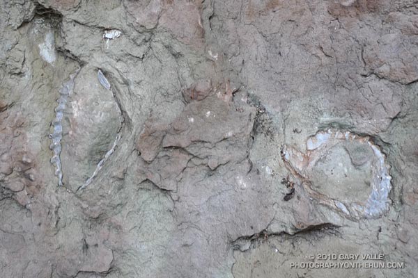


After about a half-mile on the Fossil Ridge Trail, I emerged from the chaparral, turned left on Topanga Tower Mtwy, and ran down to the popular overlook at the junction of Schuerren, Stunt, and Saddle Peak roads. Here I continued west across the highway and scrambled up to a ridgetop trail that leads to a big water tank. From the water tank it’s about  0.3 mile up the trail to the turn-off to Saddle Peak, and then another 0.4 mile to the summit. The western peak (2805′), the one with all the communications equipment, is the high point.

Keeping in mind that GPS traces are not exact, and the route I used isn’t necessarily the “official” or “best” route, here’s a Google Earth interactive view of a GPS trace of my 27.5 mile route.

Some related posts: Garapito Trail Runs, Born to Run, Musch Trail Mule Deer, Red Rock Canyon – Hondo Canyon – Saddle Peak Loop
Three Points to Waterman Mountain, the Long Way

Twin Peaks (East) from the Mt. Waterman Trail

Twin Peaks (East) from the Mt. Waterman Trail

Today was the first chance I had had to run the recently reopened stretch of the Pacific Crest Trail between Three Points and Cloudburst Summit. Originally within the Station Fire closure area, this segment of trail was reopened when the size of the closure area was reduced in late May. In addition to checking this section of the PCT, I also wanted to see the condition of the forest and trail at the current closure boundary near Mt. Waterman.


Pacific Crest Trail about a mile east of Three Points
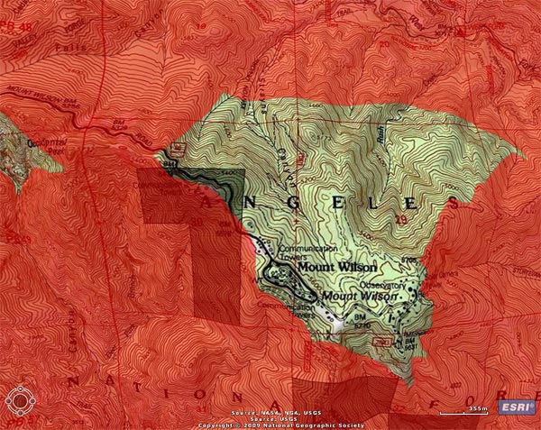
Between Three Points and Cloudburst Summit, the PCT generally parallels Angeles Crest Highway (Hwy 2), and crosses the highway several times. In general, the burn severity along the trail appeared to match the burn severity depicted in the NASA Ikhana BAER image and Angeles National Forest BAER Station Fire Soil Burn Severity Map. In the first two miles some trees were lost, but much of the forest in the immediate vicinity of the trail did not appear to be severely burned.


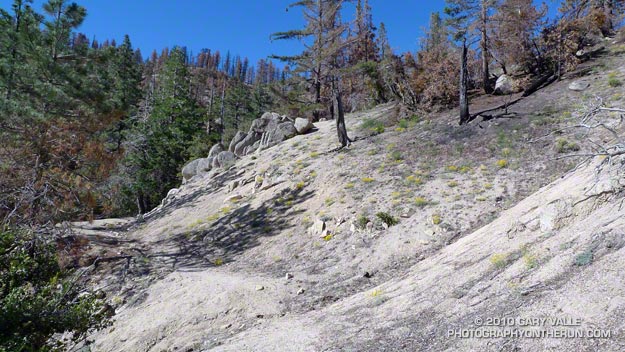
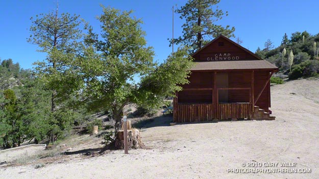
That was not the case about a half mile west of Camp Glenwood, where the PCT crosses Hwy 2 and climbs up a hill. Here the burn severity was much higher, and most of the trees were killed. The trail was in good shape and it didn’t take long to get through this section and back into the unburned forest. Remarkably, Camp Glenwood was unscathed.

The remaining 3 miles to Cloudburst Summit were not burned. Some trail work had been done on this stretch, as well as down in Cooper Canyon. As always, the running through Cooper Canyon was superb. At the PCT’s junction with the Burkhart Trail, I turned right and climbed up to Buckhorn Campground, and then followed the camp entrance road up to Hwy 2.  From here it was a short jog west to the Mt. Waterman Trail.

Most of the forest of Jeffrey pine and incense cedar on the east side of Mt. Waterman was outside of the fire area, and it wasn’t until near the junction with trail 10W04, that some damage from the fire could be seen. It looked like spot fires had run up the mountain, burning primarily in the understory. The north face of Twin Peaks, across from Mt. Waterman, appeared to be unaffected by the fire.

It is unclear why the Forest Service chose to define the updated Station Fire closure area (Forest Order No. 01-10-02) so that the trail to Twin Peaks remains closed. Based on the Forest Service’s own BAER report, the burn severity down to Twin Peaks Saddle is generally categorized as low to very low/unburned, and the north face of Twin Peaks is outside of the burn area.

Some related posts: Cooper Canyon Cascade & Falls, Mt. Wilson Area Peaks From Twin Peaks

Trail Work and Tree Rings

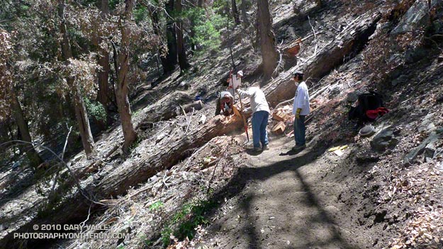
Trail work on the Kenyon Devore Trail after the Station Fire.

Last year’s Station Fire, and the Winter storms that followed, combined to damage many miles of trail in the San Gabriel Mountains. Among the volunteers working hard to restore the trails are runners that will doing the Mt. Disappointment 50K and Angeles Crest 100 mile endurance runs later this Summer.

Gary Hilliard, trail maestro and R.D. of the Mt. Disappointment runs, dedicates an astonishing amount of time to the task of preserving trails — encouraging and organizing volunteers, surveying trails, and doing the down and dirty work of maintenance and restoration. If it’s a Summer Saturday, chances are good you’ll find him in Angeles National Forest, working with a group of runners to make a trail better.


Today’s trail was the Kenyon DeVore Trail on the north side of Mt. Wilson. Originally a part of the Rattlesnake Trail, the trail was renamed in tribute to the Forest Service patrolman, hydrographer, and Angeles National Forest volunteer, Kenyon DeVore. The trail is the toughest part of infamous final leg of the Mt. Disappointment 50K and 50 mile courses, climbing about 2300′ in 3.6 miles.

There was plenty to do on the Kenyon DeVore Trail, and Gary divided us into three groups. One group was given the job of restoring a long stretch of trail that had been obliterated by debris flows, and another group was assigned the chore of clearing a rock slide. Our group’s task was removing several trees that had fallen across the trail, and working on the trail along the way.


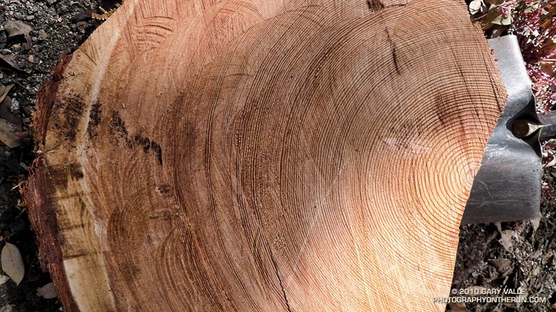
The largest of the trees blocking the trail was a sizable bigcone Douglas-fir. At the point where it was cut, the diameter of the trunk was about 26″-28″. For its size, the tree was surprisingly old. A rough count of the rings from a contrast enhanced photo gives an approximate age of 310 years. The age was not cross dated, but appeared reasonable when compared to a standard tree ring chronology.

The cut sections of the tree had no obvious fire scars. The CDF/FRAP Fire History Database indicated that, prior to the Station Fire, a large part of the canyon in which the tree was located had no reported fire history.

When we were done, about two-thirds of the Kenyon Devore Trail had been restored. No worries about the other third, Gary has trailwork scheduled most weekends through the end of July.