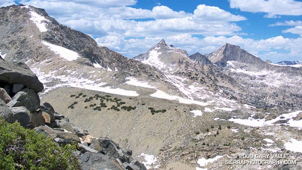
The last time I was on Glen Pass was a brisk and brilliant October morning in the late 70’s. Overnight, the first cold front of the season had covered the trail with a few inches of snow. Working up toward the pass, bright fingers of gold had reached through long shadows to illuminate the angular, lichen-covered rocks, and the new snow had sparkled in celebration of Winter’s rapid approach.
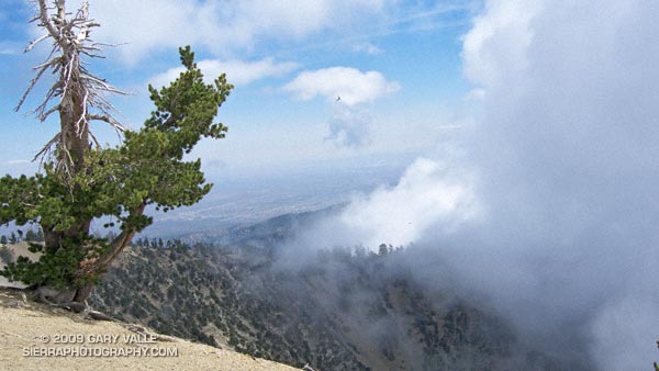
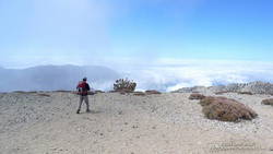
Today, I’m back on Glen Pass, once again reveling in the wildness and beauty of my surroundings. There is almost no wind, and even at 12,000′ the day is warm. Refreshed by late season storms, the remaining snow is bright and youthful, accenting the elegant lines of the rugged alpine terrain. In counterpoint to the snow, a patchwork of clouds decorate the intensely blue sky.
In the outdoors, each place and day is remarkable in its own way.
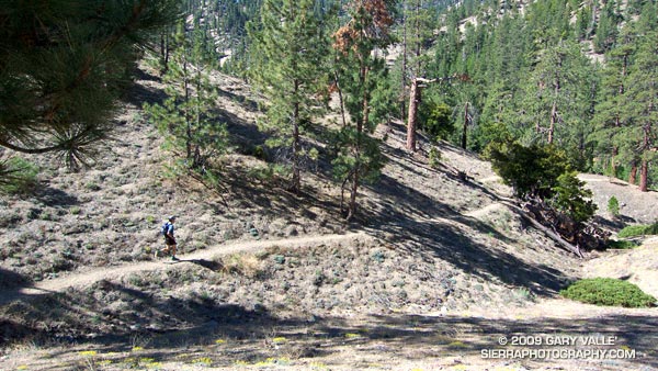
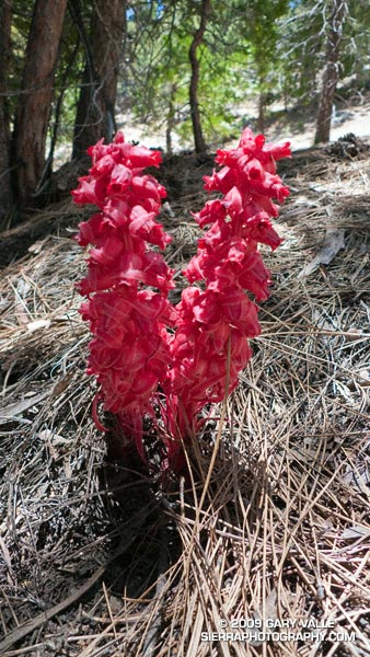
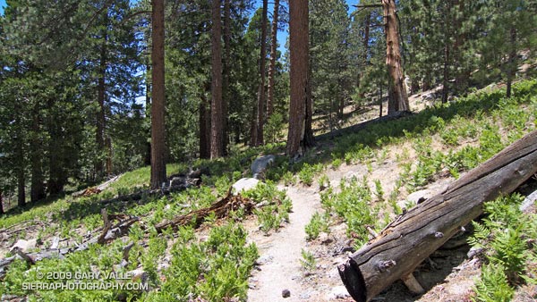
Here are a few photographs from the run:
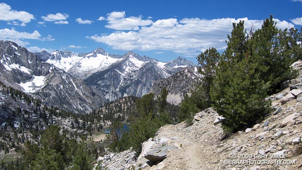
University Peak (13,589’/4142 m) from the Kearsarge Pass Trail.
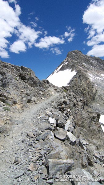
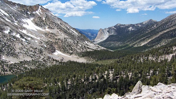
The out and back trail run from Onion Valley (9200’/2804 m), over Kearsarge Pass (11823’/3604 m), to Glen Pass (11,978’/3651 m) worked out to about 20 miles, with an elevation gain/loss of about 4750 ft. Here’s a Cesium browser View of a GPS trace of my route and an elevation profile generated in SportTracks.
Last year on this date, Southern California was in the middle of a heatwave. On June 20, 2008, Los Angeles Pierce College in Woodland Hills reached a record-setting high of 111°F, and on June 21 the temp reached 108°F!
Not so this June! So far this month, Downtown Los Angeles has not had a day when the average temperature was above normal. And it’s not only the low elevation stations that have been cool. Several times this month the overnight low at the Big Pines RAWS, near Wrightwood in the San Gabriel Mountains, has dropped into the thirties, and daytime temps have averaged more than 10 degrees below normal.
This translates to great running weather in Southern California, and near perfect weather for trail running in the San Gabriel Mountains. Today, did the Three Points – Buckhorn loop, along with a short detour up to the summit of Waterman Mountain. The route worked out to about 23 miles with a reality-checked elevation gain/loss of about 3800′. Here’s a Cesium browser View of a GPS trace of the run.
The title photo is of Dave Burke, cruising down a nice section of the PCT between Cloudburst Summit and Cooper Canyon.
Overnight the lows on the high peaks had dipped into the 30’s, and today the high temps would be 15-20 degrees below normal. If I could have ordered the perfect mix of temperature, clouds and sun for running in the Angeles high country, it would be difficult to top the weather this weekend and last.
Now that Hwy 2 was open between Islip Saddle and Vincent Gap, and we could do a car shuttle, Miklos, Krisztina and I had decided to run from Inspiration Point to Islip Saddle on the PCT. Starting at Inspiration Point instead of Vincent Gap adds about 4.5 miles to the run, but the miles are relatively easy, and the stretch is a good warmup for the 2800 ft. climb up Mt. Baden-Powell.
Here’s a Cesium browser View of a GPS trace of our approximately 18 mile route. We wandered down the south ridge of Mt. Baden-Powell, so this is a little longer than the usual route. The elevation gain was about 3300 ft., with an elevation loss of about 4000 ft. Continuing over Mt. Williamson to Eagle’s Roost would add about 4 miles and 1400 ft. of elevation gain.
Note: The speck in the summit photo is one of several violet-green swallows working lift and zooming along the top of southeast face.
I can’t think of a tougher stretch of trail in the San Gabriel Mountains. From Mt. Baldy Village, the Bear Canyon/Old Mt. Baldy Trail climbs 5800′ in 6.7 miles to the 10,064′ summit of Mt. Baldy (Mt. San Antonio). The route is as rewarding as it is difficult, with inspiring views and interesting terrain.
I had hoped for some remnant clouds from Friday’s storms, but didn’t expect to be using my windshield wipers driving to the trailhead. The dark gray clouds piled against the mountains had a scuddy, stormy look, and I had a difficult time convincing myself that it was just a deep marine layer. But the sun was shining when I parked at the bottom of Bear Canyon Rd. and began to walk up the steep, cabin-lined street.
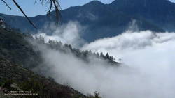
Clouds pushing up San Antonio Canyon and the southeastern slopes of Mt. Baldy.
The last time I had been on the trail was July 2004, during the Baldy Peaks 50K. That day we started at the parking lot at Icehouse Canyon, and over the course of the race climbed Mt. Baldy twice. The first time from the Village, and the second time from Manker Flats. Today I wasn’t in a race, and would be completely satisfied to climb Mt. Baldy just once.
Running up a moderate section of trail below Bear Flat, I tried to figure out the last time I had run down the Bear Canyon Trail. Sometime before the Baldy Peaks race. I wasn’t sure how long it had been, but long enough to forget how grueling steep downhill can be.
My thoughts are interrupted by a pair of hikers coming down the trail. I ask how they’re doing, and am surprised to hear, “not so good.” They look disappointed and tired, and anxious to get down to the car. I wonder if one of them is ill, or if they just underestimated the difficulty of the trail.
A half-mile later I’m crossing the creek at Bear Flat (~5500′). This is where the fun begins. Here the trail switchbacks up a steep east-southeast facing chaparral slope to Mt. Baldy’s South Ridge, gaining about 1500′ in one mile. On a warm day it can be hellish. On a cool day it isn’t easy. Today it is cool. The cloud layer has continued to crawl up the mountain, and it envelops me as I start up the switchbacks.
A little more than a year ago, these slopes were burned in the 2008 Bighorn Fire. I had expected to see black, burned and barren chaparral in the initial stage of recovery, but instead there is substantial growth, comparable to 2-3 years of recovery in chaparral at a lower elevation.
Click for video snapshot from Mt. Baldy’s South Ridge.
At an elevation of about 7000′, I climb out of the clouds and into the sun. What a day! Benign clouds lap at the mountainside, enhancing already dramatic views. Between 7000′ and 9000′, I encounter several hikers and briefly chat with one veteran hiker, who tells me this is his friend’s intro to hiking! It is a busy day for this trail, and I’m guessing I’ll see more hikers when I descend.
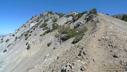
Above 9000′ the open forest of Jeffrey, Sugar and Lodgepole pine becomes more sparse and stunted. The route feels more alpine and climbs onto the rocky crest of an exposed ridge (HD Video Snapshot). A little higher, a large patch of snow accentuates the “you’re getting near tree line” feeling.
Hiker leaving the summit of Mt. Baldy, and starting the descent of the Ski Hut trail.
Approaching Baldy’s summit, I’m surprised to see a wispy cloud had also ascended the peak and is waiting for me to catch up. On top there seems to be a mix of young and old, veterans and first-timers, excitement and exhaustion. After a few minutes on the summit, I run over to West Baldy. Then it is gravity’s turn, and I take the first steps down the slope.
The descent is just as extraordinary as the ascent, with far-reaching mountain views over a sea of clouds. On an exposed section of the ridge at about the 8500′ I happen on a Sugar pine with a spiral scar from a lightning strike. Such trees are disturbingly common. There is a Jeffrey pine at about the same elevation on Mt. Baldy’s North Backbone Trail with a similar lightning scar.
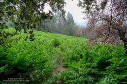
One, two, ten… Will the switchbacks ever end? Finally, through the trees I see the brilliant green of the ferns at Bear Flat. Running becomes easier. I pick up the pace, and in a few minutes turn onto the asphalt of Bear Canyon road.
Here is an interactive, 3D terrain view of a GPS trace of my route on the Mt. Baldy’s South Ridge on the Bear Canyon/Old Mt. Baldy Trail. The map can be zoomed, tilted, rotated, and panned using the navigation control on the right. Track and placename locations are approximate and subject to errors. Snow, ice, poor weather, and other conditions may make this route unsuitable for this activity.
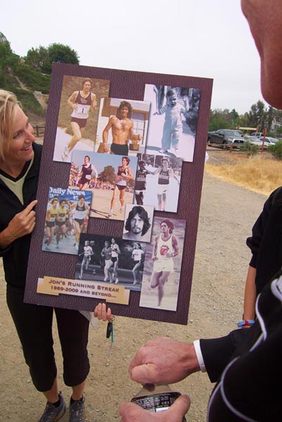
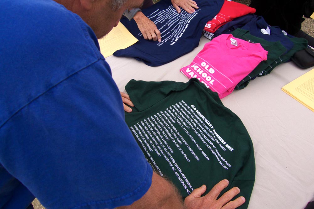
Are you an Old School Valley Runner? Read over Mark Covert’s shoulder and take the quiz. Start with the fourth question from the top:
“Whose run the most miles ever in the history of the San Fernando Valley?”
Then try,
“Which Valley runner drilled running trophies on his car hood as an ornament?”
The answer to both questions is Jon Sutherland.
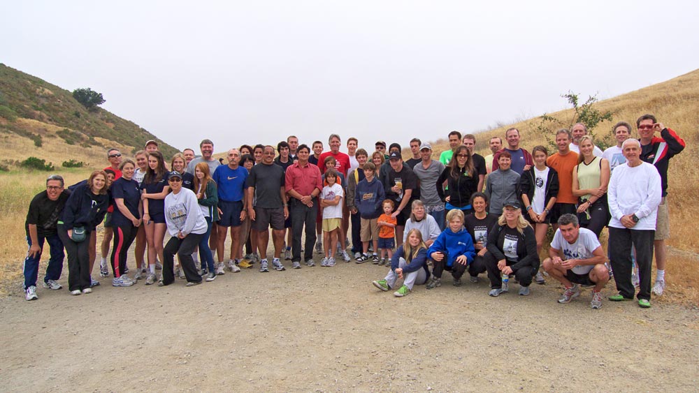
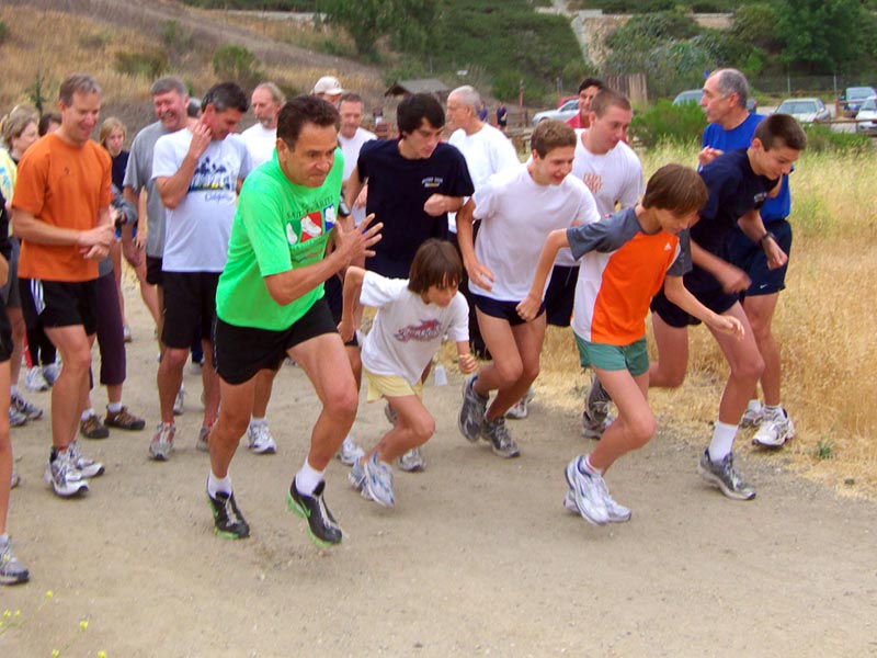
Today, Jon and a bunch of his friends (not all old school) got together at Ahmanson Ranch to celebrate an amazing benchmark: 40 years of running without missing a day.
Jon’s streak began on May 26, 1969, and since then, through injuries, illness, operations and other obstacles, he has run 14,600+ days, and more than 179,000 miles! The United States Running Streak Association maintains a Streak List with up-to-date stats of the top 350 active runners.
Among those gathered to celebrate Jon’s streak were runners that set high school, collegiate, and world records. Yep, I was the only person out there wearing trail running shoes, and a water bottle waist pack! And probably the only person out there that does the majority of their running at 10 min/mile.
Update May 30, 2009. In a Draconian measure that could close over 200 of California’s State Parks, Gov. Schwarzenegger has proposed cutting the State Parks core funding in half begining July 1, and then would eliminate ALL core funding in a year. For more information see the California State Parks Foundation web site.
Update May 18, 2008. Gov. Schwarzenegger’s revised state budget, released May 14, rescinded the funding cuts that would have resulted in the closing of 48 California state parks. For now it appears these state parks will remain open.
Following is the original post from February 2, 2008:
What a fantastic morning! Taking advantage of a break in a series of Southern California rain storms, I was running on Fire Road #30 near the entrance of Topanga State Park. The sun had found its way through a broken layer of clouds, and bright patches of sunlight highlighted the rugged terrain. Down in a steep canyon on my left, wisps of steam wafted from the chaparral.
Following an “On your left!” a group of mountain bikers swept past. Working up the hill toward the Hub, good morning’s were exchanged with other runners, hikers and cyclists.
Many of us live and work in California because of its diverse open spaces, parks and wilderness areas. Incredibly, this popular urban park, along with Will Rogers State Historic Park, Santa Susana SHP, Los Encinos SHP, Mt. San Jacinto SP, and forty-four other California State Parks have been slated for closure in the fiscal year 2008-09 California state budget.
According to an article in the Los Angeles Times, the selection was made according to the dour formula of those parks “that had the fewest visitors, produced the least revenue and would be the easiest to close off to visitors.”
This formula necessarily targets less developed parks, such as Topanga State Park, ignoring those intrinsic values that make a park a park. The formula targets walk-in parks, and the hikers, cyclists, riders, and runners that simply enjoy the outdoor experience. The formula targets day use parks in urban areas that don’t need campgrounds or additional services. And, the formula targets those with less to spend on recreation.
So is this how we are to appraise the value of our public lands? Closing our state parks would be astonishingly short-sighted. Their varied trails, terrain, and habitats are accessible to millions, providing a therapeutic escape from the rigors of city life, and experiences and insights that can only be gained from the out of doors.
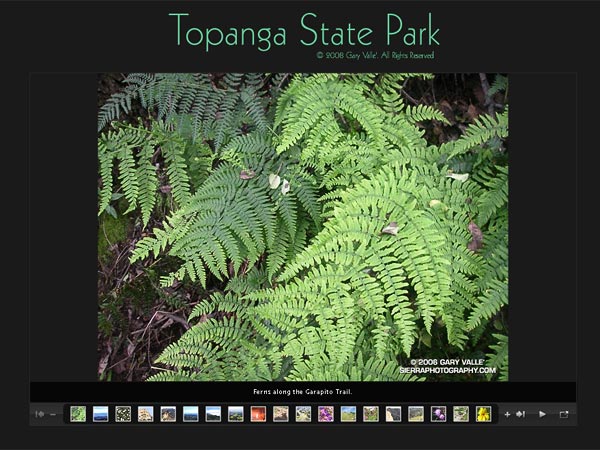
Today I was doing one of my favorite runs in Topanga State Park. It links several trails and visits several popular destinations in the park — the Hub, Parker Mesa Overlook, Trippet Ranch, Eagle Rock, and the Musch, Garapito and Bent Arrow Trails.
This two minute slide show is a compilation from a few such runs. It is a small selection of photographs from one set of trails, in just one state park.