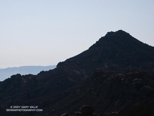
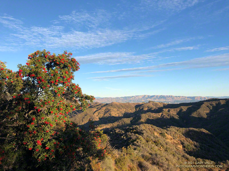
Silhouette of Rocky Peak from the Johnson Mtwy trail in Rocky Peak Park. Note the hiker on the summit. From a run last weekend.
Related post: Rocky Peak

Silhouette of Rocky Peak from the Johnson Mtwy trail in Rocky Peak Park. Note the hiker on the summit. From a run last weekend.
Related post: Rocky Peak
Due to fire concerns, Los Padres, Angeles, Cleveland and San Bernardino National Forests remained closed this weekend, so I headed back up to Kernville to meet some friends and run the Whiskey Flat Trail — a sizzling trail in the summertime that has been on my running to-do list for years.
Tucked away in a corner of the Southern Sierra on the banks of the Kern River, and only about a 3 hour drive from Los Angeles, Kernville usually brings to mind images of rafts, kayaks and exciting whitewater, but more than great paddling adventures can be had here.
Sequoia National Forest and the Golden Trout Wilderness afford an extensive array of hiking, mountain biking, climbing, fishing, trail running, and other recreational opportunities. Lower elevation adventures are generally within about a 30 minute drive of Kernville, and higher elevation adventures about an hour’s drive.
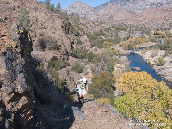
We did the approximately 15 mile Whiskey Flat Trail north to south, starting at McNally’s Restaurant and Resort, about 15-20 minutes north of Kernville on highway Mountain 99. The trail is accessed using the Fairview footbridge and is on the opposite side of the river from the highway. It is a gnarly up and down trail, best done in cool weather, with pleasant views of the river and the surrounding mountains.
On it’s way downstream to Burlando Road in Kernville, the trail crosses several creeks and canyons, gaining about 1000 ft. and losing about 1500 ft. Sometimes the trail is yards from the river and at other times so distant as to be taunting. As is the case when paddling this part of the river, the triangular form of peak 6047, near Corral Creek, is a distinctive landmark, that soberly marks progress down the river.
It is a trail that is long for its length and modest elevation gain. There are sandy stretches, rocky sections, stretches with V-ruts, steep uphill sections, and long stretches of perfectly graded downhill. About 8.5 miles into the run a striking section of trail traverses a cliff above Sock’em Dog, a class V rapid on a reach of the river named the Thunder Run.
All in all it was a enjoyable run that would be brutal in hot weather and a high sun. Even with the temperature topping out at only about 80 degrees, I was glad I took extra water!
Here’s a Google Earth image and Google Earth KMZ file of a GPS trace of our route. Near the end of the run, after crossing Bull Run Creek, various use trails have evolved. The main trail forks right and does not cross private property. The various routes can be checked out on Google Earth.
Update 08/17/10. About half of the Whiskey Flat Trail appears to have been within the area burned by the Bull Fire. Here’s a Google Earth interactive browser view of a GPS trace of the Whiskey Flat Trail (from last year’s Burger Run), and the area burned by the Bull Fire based on the most recent GEOMAC fire perimeter (dated 08/01/10). Also included is a GPS trace of the Cannell Plunge route from MountainbikeBill.com.
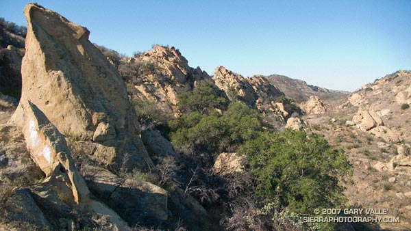
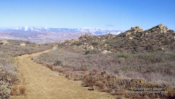
One of the most scenic and isolated areas of Upper Las Virgenes Canyon is traversed by a single track trail that links the Upper Las Virgenes Canyon fire road, northwest of Bell Canyon, to the northern extension of the Cheeseboro Ridge power line service road. The trail, shown on this Park Service map, follows an old road bed through improbable terrain.
I like to do the trail east to west. Once the power line service road is reached the most straightforward option is to turn left, and follow the road up and over the ridge and down to the 4-way junction east of Shepherds Flat. Another option is to turn right on the road and follow it a short distance to another single track that branches left from the road and leads to the Albertson Mtwy. This (dirt) road leads west to a signed intersection near China Flat. From here it is possible to work back to Shepherds Flat at the the top of Cheeseboro.
Many variations are possible, but starting at the Victory Trailhead of Upper Las Virgenes Open Space Preserve, and following the course indicated in this Google Earth image, the first route (up and over the ridge) is about 17.5 miles long. According to my GPS, an alternate route through China Flat is about 19.25 miles long. Both are interesting and challenging trail runs.
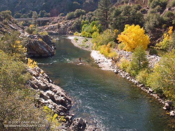
One of many excellent hikes/runs in the Southern Sierra, the River Trail starts at Johnsondale Bridge — about 19 miles north of Kernville, California on highway Mountain 99 — and follows the river north 4 miles to Four Mile rapid. Here the trail turns east and works up to the Rincon Trail.
This section of the Kern River is part of the beautiful and challenging Forks of the Kern class V whitewater run. Numerous class IV rapids and the class V rapids Carson Falls and Confusion are found on this reach. In the Spring and Summer expert kayakers and rafters may be seen maneuvering among the many boulders and drops. (A Forest Service permit is required to paddle the Forks.)
First published October 14, 2007. Updated February 4, 2021.
The numerous interconnecting roads and trails of the eastern Santa Monica Mountains can be combined to create trail runs ranging from a few miles to marathon length or more.
One of my favorite trails in this area is the Garapito Trail — a winding, up and down trail through dense, old growth chaparral. The trail connects Fire Road #30, near dirt Mulholland, to the Eagle Rock Fire road segment of the Backbone Trail, near Eagle Rock. Because it’s such a enjoyable trail, I include it in most of the runs I do from Marvin Braude Mulholland Gateway Park (Top of Reseda). The trailhead is at the southern end of Reseda Blvd., on the San Fernando Valley side of the Santa Monica Mountains.
Each run in the series starts the same way, going up to Mulholland using the single track trail that forks right off the fire road near the Reseda trailhead, and then heading southwest a short distance on Mulholland to Fire Road 30, which works south, up to the Hub.
The shortest run in the Garapito series is the 7.5 mile Garapito Loop. Somewhat longer and more strenuous is the 12+ mile Trippet Ranch Loop. A very demanding run in the series is an approximately 26 mile route out to Saddle Peak and back. The popular run out to Parker Mesa Overlook and back tacks on about 6 miles to any of these routes.
Below are links to 3D, interactive views of GPS tracks of some of the Garapito Series trail runs from the Top of Reseda. The scene can be zoomed, tilted, rotated and panned. Placemark and track locations are approximate and subject to errors.
Garapito Loop Plus Eagle Rock (8 miles)
Trippet Ranch Loop (12.3 miles)
Trippet Ranch Loop Plus Temescal Peak (14 miles)
Trippet Ranch Loop Plus Parker Mesa Overlook (18.6 miles)
Trailer Canyon – Trippet Ranch Loop (17.2 miles)
These are just a few of the many variations that are possible.
Some related posts: Trippet Ranch Loop Plus Temescal Peak; Trail Run to Trippet Ranch, Hondo Canyon and Saddle Peak; Go Figure
Los Angeles sometimes gets rain in September, but usually it is the result of tropical moisture from a dissipating hurricane, or perhaps the passage of the tail end of a weakening front. It is rare to see a low as cold, deep and energetic as the upper level low that deluged many areas of Los Angeles county Friday afternoon into Saturday.
Thunderstorms raked the San Fernando Valley Friday night, and several locations in and around the Valley recorded more than an inch of rain over the course of the storm. Los Angeles set a new rainfall record on Saturday, recording 0.40 inch of rain, and rainfall records were broken across the area.
In Southern California the first rain of the season often doesn’t occur until October or November and is always savored. Especially this year, when Los Angeles has recorded only 3.21 inches of rain in the last 15 or 16 months, and a developing La Nina threatens to put the kibosh on Winter rain.
I celebrated the rain by doing an out and back run to “Fossil Point” on Rocky Peak fire road. Based on the size of the mud puddles on the dirt road, this unseasonable storm appeared to be wetter than any in last year’s record dry rain season. Here’s a panorama of the view northwest from the fire road to Oak Ridge, the Santa Susana Mountains and beyond.
Some related posts: San Fernando Valley from Rocky Peak, Rainy Morning on Rocky Peak Road.