Category Archives: trails

Mt. Pinos Improv

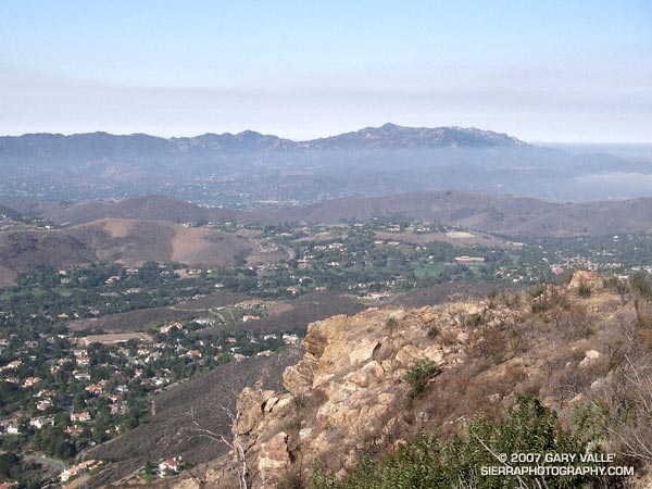
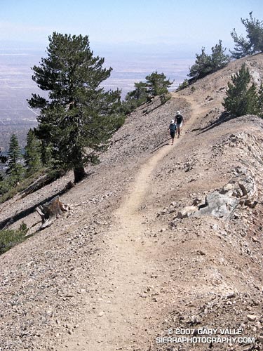
The plan had been to do a 2-3 hour run from the Chula Vista parking lot west over Mt. Pinos into the Chumash Wilderness, but due to the Zaca Fire, the trail/road to the summit of Mt. Pinos, the Vincent Tummawait trail, and all of the Chumash Wilderness were closed.

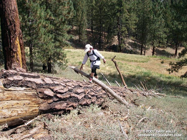
Improvising the best we could, we linked together some cross-country ski trails, use trails, a fallen tree, and the Mt. Pinos road, and were able to get in a good trail run.

Update Friday, August 31, 2007. In a press release dated August 29, 2007, the Forest Service announced that some areas within Los Padres National Forest east of Highway 33 that were previously closed to public entry because of the Zaca Fire would be reopened on August 30.

For more information regarding the Zaca Fire and related closures, see the Los Padres National Forest website.

Some related posts: Mt. Pinos – Mt. Abel Out & Back, Thunderstorm, Vincent Tumamait Trail

Simi Peak Out & Back

Sandstone Peak and Boney Mountain from Simi Peak.
Sandstone Peak and Boney Mountain from Simi Peak

I hadn’t done this course in midsummer, but a long run close to home, and an early morning ascent of Simi Peak sounded like a nice change of pace. A dawn start from El Scorpion Park put me on the peak and back to the car before temps got out of hand.

On the way out to Simi Peak I usually run up Las Virgenes Canyon and then follow a single track popular with mountain-bikers to Shepherds’ Flat. From here the Sheep Corral Trail leads west to the Palo Comado Canyon fire road, which can be followed up to China Flat. On the way back, from Shepherds’ Flat I run down the Cheeseboro Canyon trail to a connector that can be followed east back to Las Virgenes Canyon. Done this way, and tacking on a short scenic tour of China Flat, the route works out to be about 22.5 miles, with an elevation gain and loss of about 2200 ft. Here’s a Google Earth image and Google Earth KMZ file of a GPS trace of the run.

There is an extensive network of trails in Upper Las Virgenes Canyon Open Space Preserve (trail map) and Cheeseboro/Palo Comado Canyons (trail map) , and many routes to Simi Peak are possible. El Scorpion Park is the most distant trailhead from Simi Peak. Starting at the Victory trailhead will decrease the round-trip mileage by about 2.5 miles, and from the Las Virgenes trailhead by about 6 miles. Simi Peak can also be accessed from the Cheeseboro Canyon, Lindero Canyon, Lang Ranch, and Long Canyon trailheads.

Wally Waldron Limber Pine

A grizzled guardian of the San Gabriel Mountains, the Wally Waldron Tree stands defiantly astride an airy, rock strewn ridge, just below the summit of 9399 ft. Mt. Baden-Powell.

A grizzled guardian of the San Gabriel Mountains, the Wally Waldron Tree stands defiantly astride an airy, rock strewn ridge, just below the summit of 9399 ft. Mt. Baden-Powell.

Perched on the brink of the mountain’s precipitous southeast face, the weather-sculpted Limber Pine is at an elevation and in an environment similar to the 4000+ yr. old White Mountain Bristlecone Pines. Burnished and hardened, the tree’s huge, gnarled roots anchor it firmly to the mountain, helping it to resist the whims of weather and time. The tree is estimated to be 1500 years old.

We had stopped to visit the tree part way through an approximately 23.5 mile loop from Islip Saddle. Our route had descended to South Fork Campground (4560′), before climbing back up to Vincent Gap and Mt. Baden-Powell. In a few minutes we would continue to Baden-Powell’s summit, and from there follow the PCT along the crest back to Islip Saddle. Here’s a Google Earth image and Google Earth KMZ file of a GPS trace of the loop.

Water Notes: The little stream on the Manzanita Trail about 1.5 miles from Vincent Gap was still running. The flow from Little Jimmy Spring was lower than normal, but still very reasonable. We did not detour to Lamil Spring.

Related posts: Vincent Gap – Little Jimmy Spring Out & Back, Complications, Heat Wave

Mt. Wilson Area Peaks From Twin Peaks

Mt. Wilson, Occidental Peak, Mt. Markham, San Gabriel Peak, Mt. Disappointment, and Mt. Deception from the summit of Twin Peaks, in the San Gabriel Mountains, near Los Angeles.

Mt. Wilson, Occidental Peak, Mt. Markham, San Gabriel Peak, Mt. Disappointment, and Mt. Deception from the summit of Twin Peaks, in the San Gabriel Mountains.

Mt. Markham (5742′) is the craggy peak along the skyline, just right of the centerline of the photograph. The bump to the left of Mt. Markham is Occidental Peak (5732′). To the right of Mt. Markham is the highest peak in the group, San Gabriel Peak (6161′). To the right of San Gabriel Peak are Mt. Disappointment (5960′), and Mt. Deception (5796′). The indistinct summit of Mt. Wilson (5710′), and the observatory, are on the left.

Guardian of the rugged San Gabriel Wilderness, Twin Peaks (7761′) has an isolated, high mountain feel. Its flanks drop more than 5000 feet to Devils Canyon on the southwest, and Bear Canyon on the southeast.

We climbed Twin Peaks while doing a point to point run from Buckhorn to Three Points. Including the peak, the run/hike was about 13 miles, with an elevation gain of about 3200′. Here’s a Google Earth image and Google Earth KMZ file of a GPS trace of the route.

Related posts: Manzanita Morning, Three Points – Mt. Waterman Loop

Angeles Crest Highway Pavement Replacement

Update May 21, 2009. CalTrans Highway Conditions in California reports Hwy 2 “IS REOPENED FROM ISLIP SADDLE TO 5 MI WEST OF BIG PINES (LOS ANGELES CO) AT 1200 HRS ON 5/20/09.”

Angeles Crest Highway has been closed from Islip Saddle to Vincent Gap since 2005 when runoff, rock slides and avalanches from Winter storms damaged the road.

This section of road is being repaired as part of the larger Angeles Crest Highway (SR-2) Pavement Replacement Project.

Glimpses of the highway from the PCT suggest that much of the closed section has been repaired, resurfaced and re-striped.

The photograph of SR-2 is from Sunday’s Vincent Gap – Little Jimmy Spring Out & Back run.

Related post: PCT Above Windy Gap

Vincent Gap – Little Jimmy Spring Out & Back

Nearing the summit of Mt. Baden-Powell, in the San Gabriel Mountains.

With Southern California in the throes of a record dry year, and temps in the valleys topping 100°F, this San Gabriel Mountains course was a good way to get in a long trail run at a cooler, higher elevation and enjoy some mountain scenery. A big plus was that there would be a source of ice cold spring water at the turnaround point.

Concerned that another usually dependable water source might already be dry, we started our run from Vincent Gap in the wrong direction, headed downhill on the Mazanita Trail. A couple of drainages and about a mile and a half later we were happy to hear — and then see — a diminished, but still gurgling ribbon of water.

In a couple of weeks, I might do the Islip – South Fork – Vincent Gap – Baden-Powell – Islip loop as part of my training for the Mt. Disappointment 50K. With Lamil Spring likely very low, and the connecting segment of Highway 2 closed, the loop would be difficult to do without this key water source.

Soon we were back at Vincent Gap and switch-backing up Mt. Baden-Powell. Even though mountain temps had recently been in the 90’s, today the temperature was comfortably cool. That would be the surprise of the day. Ocean-cooled breezes would keep the mercury in check and make the running along the ridge between Baden-Powell and Little Jimmy almost Spring-like.

Including the extra bit at the start, the run worked out to be about 22 miles, with an elevation gain/loss of over 5000 ft.

Related posts: Snowless San Gabriels, Complications, Heat Wave