The paved turnout where I usually park at the Stunt Road trailhead was covered with mud, rocks, and debris. And near the entrance of Calabasas Peak fire road, two large boulders had been dragged to the shoulder to clear the road.
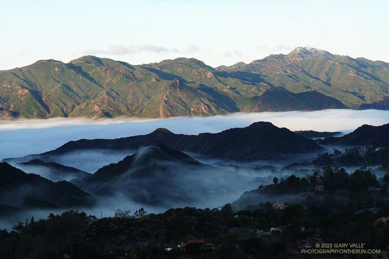
Following another big storm in a Winter of big storms, I was doing the Topanga Lookout Ridge Loop — curious to see what I could see. Nearby Stunt Ranch Reserve had recorded over 10 inches of rain the past three days, and there had been numerous reports of low elevation snow.
April 26, 2023 Update. As it turns out, the shiny, new bridge on the Crags Road Trail that made it easy to cross Malibu Creek was not washed away! According to the Malibu Creek Docents, the bridge was designed to be portable, and was removed and stored before this Winter’s rain. It is expected to be reinstalled when the threat of flooding is over — which should be soon.
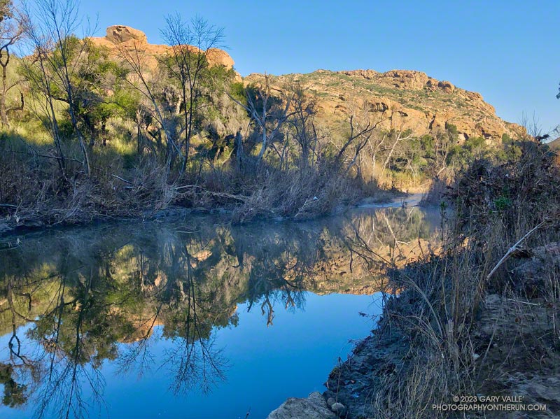
I was just a couple of miles into an extended version of the Bulldog Loop. The temperature was in the mid-30s, and once again, I was having to cross Malibu Creek on a makeshift bridge of wobbly limbs and debris.
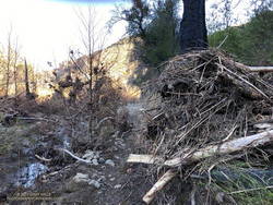
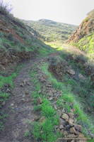
Flood debris on the Crags Road Trail
The flood was the result of a series of three increasingly wet storms between December 30 and January 10. During that period, the Malibu Canyon RAWS recorded about 13 inches of rain. In the last storm of the series, 6 inches of rain was recorded in about 33 hours.
The flooding along the Crags Road Trail from the Forest Trail junction to the M*A*S*H site was similar to the February 2017 and December 2021 events. In the January 2023 event, more debris was deposited on the trail, and sections of the trail were obliterated. That stretch of trail is popular, and a new use trail is already taking shape.
Rainfall and runoff were even higher in Santa Barbara and Ventura Counties. The Rose Valley RAWS recorded over 22 inches of rain for the three storms. According to preliminary streamflow data, the Ventura River Near Ventura reached a new record stage height of 25.42 feet on January 9. The Sespe Creek Near Fillmore gage malfunctioned at the peak flow but reached at least 20.38 feet.
Continuing the theme of checking out local trails following the December 2022 – January 2023 series of rainstorms, this morning I did a trail run/hike from the Wendy Drive Trailhead in Newbury Park.
Vernal stream on the Chamberlain segment of the Backbone Trail
I was able to check out several trails — and get in a little climbing — by doing Sandstone Peak via Boney Mountain’s Western Ridge and Tri Peaks and then returning by way of the Backbone Trail, Big Sycamore Canyon, and the Upper Sycamore Trail.
The surprising headline is that the trails on this route held up better than expected. Although there was a lot of rain, the rain rates in this area must not have been excessive. Generally, it looked like streams were able to handle the runoff.
It didn’t come out of it unscathed, but the Blue Canyon segment of the Backbone Trail was less damaged than usual. Some route-finding through the cobble was required, but a new use trail was already starting to emerge. I was also surprised to see that several oft-repaired sections of the Upper Sycamore Trail were mostly intact. There was a lot of creek hopping on these trails, but it was good to hear the burble and gurgle of the rejuvenated streams.
Section of the Old Boney/Backbone Trail repaired by the SMMTC that withstood the Dec 2022 – Jan 2023 storms.
Work done by the Santa Monica Mountains Trails Council prevented additional damage. In the past, a section of Old Boney segment of the Backbone Trail between the Chamberlain Trail junction and Blue Canyon has always had significant problems following rainstorms. Water would run down the trail, eroding ruts and exposing rocks. In one place, most of the trail had collapsed into the canyon. Thanks to the SMMTC, I ran it today without a second thought. A steep section of the Backbone Trail above Chamberlain Rock, repaired by the SMMTC, also held up well.
Speaking of which… As I was running down the Chamberlain Trail, I’d noticed some shoe tracks that were also headed down. This was a bit odd because there weren’t any tracks coming up. The puzzle was solved when I caught up to three hikers near Chamberlain Rock. They had also done the Western Ridge of Boney Mountain and were going to complete the loop via Sycamore Canyon.
Here is an interactive, 3D terrain view of a GPS track (yellow) to Sandstone Peak from Wendy Drive via Boney Mountain’s Western Ridge and Tri Peaks, then returning via Big Sycamore Canyon and the Upper Sycamore Trail. Two alternate routes are also shown (red). To change the view, use the control on the upper right side of the screen. Track and placename locations are approximate and subject to errors. Poor weather and other conditions may make this route unsuitable for this activity.
The forecast for the Los Angeles area (Saturday, December 10) was for a chance of rain in the afternoon, with rain developing overnight and continuing into Sunday morning. There was also a slight chance of light rain or drizzle in the Santa Monica Mountains in the morning.
It was overcast in the West Valley as I drove to the trailhead, and I wondered if my run would be dank and drizzly. But as I drove up Reseda Blvd. toward Marvin Braude Mulholland Gateway Park, I was surprised to find patches of blue sky overhead.
Hondo Canyon, Topanga Lookout, and Henry Ridge from the top of Fire Road 30.
I started the run a little before 7:00 a.m. and headed up the connecting single-track trail to dirt Mulholland and Fire Road 30. Many runs from the Top of Reseda start this way, and I turned onto Fire Road 30 and continued up to the Hub — about 2.5 miles from the trailhead.
For the first couple of miles, I wasn’t sure how long a run I would do or where I was headed. But as I neared the Hub, I had to make a decision. To a large extent, a decision that depended on the weather.
What had been partly cloudy skies had coalesced into a layer of clouds that just touched the top of the highest peaks. I’d been thinking about doing an out-and-back to High Point (Goat Peak), but if the weather continued to deteriorate, the only view I would see from the peak would be the interior of a cloud. I finally decided to give it a go and hope the peak didn’t get socked in with clouds and fog.
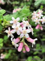
Chaparral currant
Turning left at the Hub onto the Temescal Ridge Fire Road segment of the Backbone Trail, I ran about a half-mile to where the Backbone Trail forks left off the fire road and becomes a single-track trail. This is the popular Rogers Road segment of the Backbone Trail that eventually ends at Will Rogers Historic State Park.
From Temescal Ridge Fire Road, it’s about 4.25 miles on the Backbone Trail to the unsigned junction with the High Point use trail. It’s on the right and easy to miss. The turnoff is about a half-mile before “The Oak Tree” landmark on the Backbone Trail.
The High Point trail is an unofficial, unmaintained path but is usually in decent shape. There are a couple of short, steep, loose sections on the way to the peak. Nothing is signed, and some side paths diverge from the main trail.
Summit of High Point (Goat Peak)
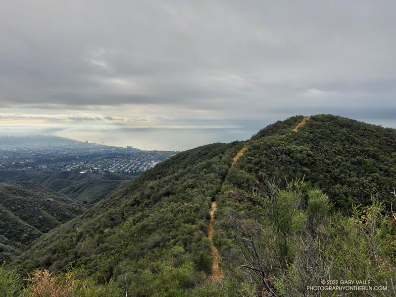
When I reached High Point’s summit, the weather was holding but looked more threatening. Even so, the view was excellent. Panning from east to west underneath the ceiling of clouds, the view included the San Gabriels, Downtown, West L.A., the South Bay, Santa Monica, Palos Verdes Peninsula, Santa Monica Bay, and Catalina.
There were a couple of rogue sprinkles on the way back to the Top of Reseda, but the rain held off in the West Valley until late in the day.
Here is an interactive, 3D terrain view of the High Point (Goat Peak) Out and Back from the Top of Reseda. The map can be zoomed, tilted, rotated, and panned using the navigation control on the right. Track and placename locations are approximate and subject to errors. Poor weather and other conditions may make this route unsuitable for this activity.
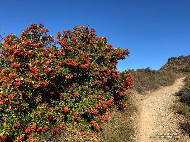
Last November and December there were almost no Toyon bushes in the Santa Monica Mountains with berries. This year the colorful orange-red “Christmas berries” are everywhere.
The heavily-laden bush pictured above (and many others) were along the Rogers Road segment of the Backbone Trail, between Will Rogers State Park and Temescal Ridge Fire Road.
It was clear and cool when I started up Calabasas Peak fire road from the trailhead on Stunt Road.
Several good trail runs and hikes start here; among them are out and backs to Calabasas Peak and Saddle Peak and an adventurous loop up Topanga Lookout Ridge to Topanga Lookout and Saddle Peak. This morning’s trail run was also going to be a loop, and it was a loop that I hadn’t done before.
Two-thirds of a mile of uphill on the dirt road brought me to a bench and the top of Red Rock Canyon. This is also where the use trail up Topanga Lookout Ridge begins. This time, instead of starting up the ridge, I turned right onto the fire road and began the winding descent into Red Rock Canyon.
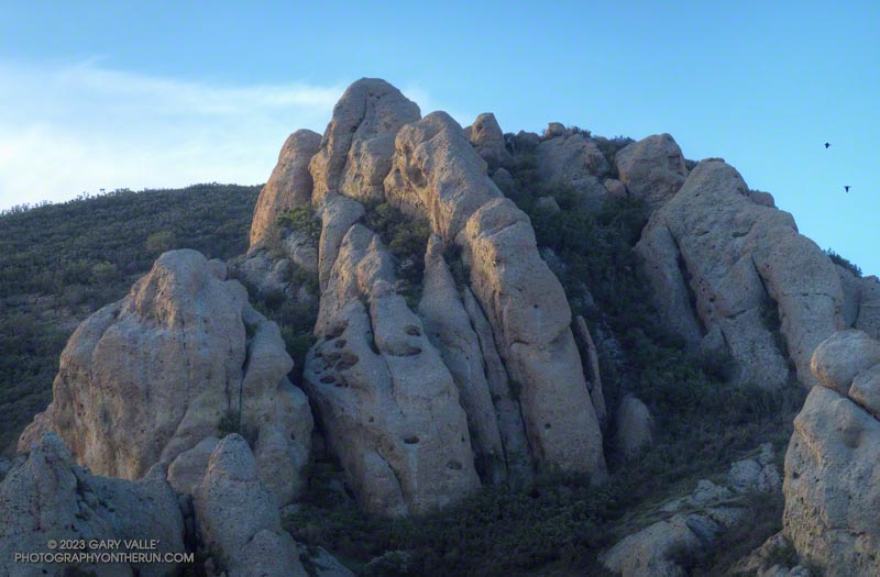
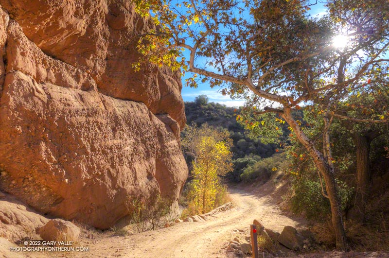
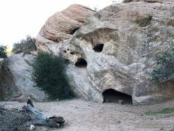
Sandstone rock formation in Red Rock Canyon.
In the canyon, there are Sespe Formation sandstone rock outcrops with a variety of intriguing shapes and colors. About a mile from Calabasas Peak Mtwy is the parking area for Red Rock Canyon Park. From here, the road continues a little less than a mile to Old Topanga Canyon Road.
Running 1.5 miles on a narrow canyon road with little or no shoulder can be hazardous to your health. Doing the run early on a Sunday morning helped. There were about the same number of cyclists as cars, and there weren’t that many of either. The diciest part was a section of road with no shoulder on a blind curve. I was glad to get past that and to the Hondo Canyon Trailhead.
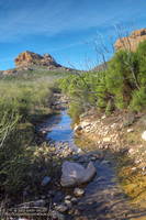
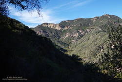
Hondo Canyon from the Backbone Trail
Hondo Canyon is one of the many memorable sections of the Backbone Trail. From Old Topanga, the trail climbs through oaks, grassland, chaparral, and California bay for about four miles to the Fossil Ridge Trail. The trail hides the 1600′ elevation gain well, and long sections of the trail are runnable.
Just below Saddle Peak Road, the Backbone Trail turns right and follows along Fossil Ridge three-quarters of a mile to the service road used to access Topanga Lookout. A left turn leads to the intersection of Saddle Peak Road, Schueren Road, and Stunt Road at the Lois Ewen Scenic Overlook.
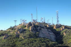
Antennae-festooned west summit of Saddle Peak.
The remainder of the loop follows the same route as the Topanga Lookout Ridge – Saddle Peak loop. Initially, it follows the Backbone Trail west, past a large water tank to a spur trail that goes to the twin summits of Saddle Peak. The West summit, with all the electronics, is slightly higher, but is now closed. The flat East summit is about a quarter-mile from the Backbone Trail.
Returning to The Backbone Trail and continuing west, it’s about 1.25 miles down to the Stunt High Trail junction. From there, it’s another 2.6 miles on the Stunt High Trail down to the Calabasas Peak/Stunt High trailhead and the end of the 14.3 mile loop.
Here is an interactive, 3D terrain view of the Red Rock Canyon – Hondo Canyon – Saddle Peak loop. The Topanga Lookout Ridge route is also shown. The map can be zoomed, tilted, rotated, and panned using the navigation control on the right. Track and placename locations are approximate and subject to errors. Poor weather and other conditions may make this route unsuitable for this activity.