Another spectacular morning for a Southern California trail run.
The temperature on Saddle Peak was in the high-60s, with light winds out of the north.
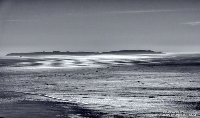
The distance to Two Harbors from Saddle Peak is about 45 miles.

Another spectacular morning for a Southern California trail run.
The temperature on Saddle Peak was in the high-60s, with light winds out of the north.
The distance to Two Harbors from Saddle Peak is about 45 miles.
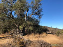
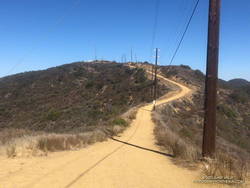
The previous weekend I’d done an out and back run from the “Top of Reseda” to the Oak Tree on the Rogers Road segment of the Backbone Trail. It’s an enjoyable run I could do on one bottle of water and get back by mid-morning. Including Temescal Peak, the run was about 14 miles roundtrip, with about 1800′ of elevation gain/loss.
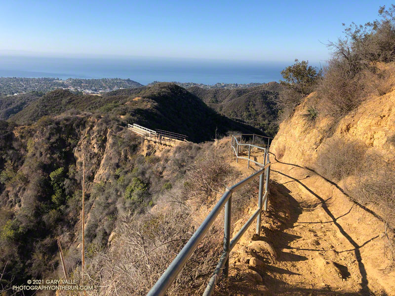
This weekend, I hadn’t expected to be back on the Backbone Trail and headed for the Oak Tree again, but last weekend’s run reminded me that I hadn’t done the Will Rogers – Rivas Canyon – Temescal Canyon/Ridge loop in a couple of years.
The 20+ mile loop is an outstanding trail run that is both challenging and scenic. Done clockwise from the Top of Reseda, the run down Rogers Road is as enjoyable as the climb out of Temescal Canyon is difficult. On paper, the elevation gain/loss is around 3400′, but for me the run is usually a bit more strenuous than that stat would suggest.
On the way out I usually do a short side trip to Temescal Peak, and on the way back a short detour to Temescal Lookout. With good visibility, both points have extensive, 360-degree views. Temescal Peak can be accessed from the Backbone Trail about 0.1 mile east of Temescal Ridge Fire Road via a use trail. Temescal Lookout is just off the Temescal Ridge Fire Road, about 0.5 mile north of the Trailer Canyon/Temescal Ridge Fire Road junction.
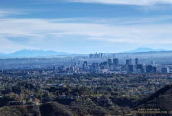
On a clear day, there is a long list of places and peaks visible along the route. Among them are Century City, Downtown, Santa Monica Bay, Palos Verdes, Catalina, Boney Mountain, Hines Peak, San Gabriel Mountains, Mt. Baldy, Santiago Peak, and sometimes San Gorgonio Mountain and San Jacinto Peak.
Water is usually available at Will Rogers State Historic Park at the restrooms adjacent to the main parking lot and polo field. I’ve also topped off my water at the Temescal Canyon trailhead. The Rivas Canyon Trail is used to connect Will Rogers SHP to Temescal Canyon.
Here’s an interactive, 3D terrain view of the Will Rogers – Temescal trail run. The map can be zoomed, tilted, rotated, and panned. To change the view, use the control on the upper right side of the screen. Track and placename locations are approximate and subject to errors. Poor weather, and other conditions may make this route unsuitable for this activity.
Some related posts: Will Rogers – Temescal Loop, Christmas Eve Trail Run, Chilly Los Angeles, Century City Clouds and Sun, Downtown Los Angeles and San Jacinto Peak
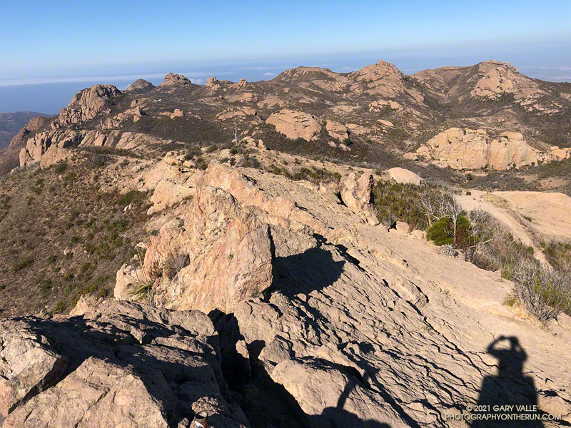
With the closure of Los Padres, Angeles, San Bernardino, and Cleveland National Forests until Thursday, I did not expect to find the summit of the highest peak in the Santa Monica Mountains empty. Even if it was by happenstance, I’ve rarely found the summit of Sandstone unoccupied on a Saturday or Sunday morning.
Like last weekend’s run, this morning’s trail run started at the Wendy Drive Trailhead on Potrero Road in Newbury Park. But today’s route had a lot more elevation gain, and some steep scrambling up the rocks of Boney Mountain’s Western Ridge. It’s an adventurous way to do Boney Mountain, Tri Peaks, and Sandstone Peak, and get in some excellent running on a very scenic stretch of the Backbone Trail.
Overall, the route was in the best shape I’ve seen since the 2018 Woolsey Fire. The path that works up the north side of Tri Peaks and around the east side of its summit blocks was relatively clear. Following trailwork by the Santa Monica Mountains Trails Council, the Chamberlain Trail segment of the Backbone Trail was once again an enjoyable downhill run.
Here’s an interactive, 3D terrain view of a GPS trace of my usual route (yellow) to Sandstone Peak from Wendy Drive via Boney Mountain’s Western Ridge, and return via Big Sycamore Canyon. A GPS track of the Cabin trail is also shown. Variations of the route include doing the Mishe Mokwa loop after climbing Sandstone Peak; and returning to Sycamore Canyon via Serrano Valley/Canyon instead of Blue Canyon.
Some related posts: Sandstone Peak from Wendy Drive, Over Boney Mountain to Sandstone Peak and Serrano Valley, An End of Year Boney Mountain Adventure, Too Many Flowers on the Chamberlain Trail
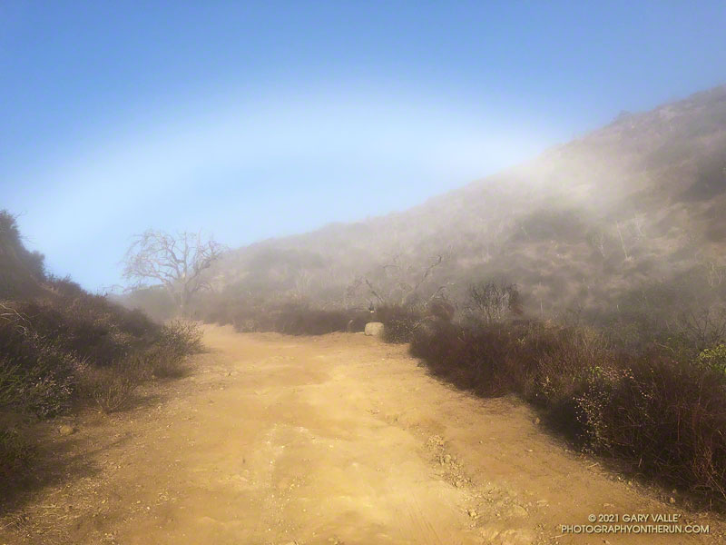
Fogbows form opposite the sun in a manner similar to rainbows, except the water droplets that create a fogbow are much smaller than raindrops. Because a fog droplet is so small, the physics of the interaction is different. The result is often a diffuse, primarily white bow.
The photograph of the fogbow was taken Sunday morning on an out and back run from Wendy Drive to Mugu Peak. The sun was about 14 degrees above the horizon. More about fogbows and other atmospheric phenomena can be found on Les Cowley’s Atmospheric Optics website.
Some related posts: Rainbow Colors in Cirrus Clouds Over Los Angeles, Out and Back Trail Run to Mugu Peak
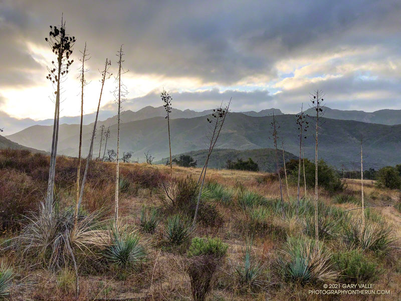
The Hidden Pond – Old Boney Loop is a variation of the XTERRA Boney Mountain Trail Run 21K course. The route is about a half-mile longer and has a couple hundred feet more of elevation gain, but all the key trails are the same. It starts/ends at the Wendy Drive & Potrero Road Trailhead.
Here is an interactive 3D terrain view of the Hidden Pond – Old Boney Loop and a few photos taken along the way.
Related post: Boney Mountain Half Marathon
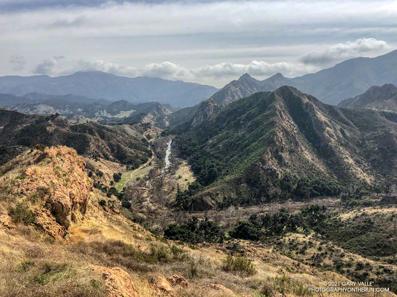
This morning’s running plan morphed from doing a loop I’ve done many times, to exploring a trail I hadn’t done, and hiking along a ridge to the top of a butte with a sweeping view of Malibu Creek State Park.
My run started at the Cistern Trailhead on Mulholland Highway. After descending the Cistern Trail, I picked up the Lookout Trail and headed west to the top of the Cage Creek Trail and the start of the Yearling Trail. Continuing on the Yearling Trail, I turned left (south) up the Deer Leg Trail, and continued west on the enjoyable, up-and-down single track.
I usually run the Deer Leg trail in the opposite direction and was a little surprised when I happened upon the Lake Vista Trail. How had I managed to run past this trail junction so many times and not notice it? Any trail with “Vista” in the name is worth exploring, so there was little choice but to turn onto the trail and see where it led.
As it climbed toward an obvious ridgeline, the enjoyable single-track trail wound in and out of several small canyons. About 0.7 mile from the Deer Leg Trail junction, the Lake Vista Trail topped out at a very pretty overlook of Malibou Lake (not a typo). My watch showed the mileage to the overlook from the Cistern Trailhead was about 2 miles.
From the overlook an unofficial “use” trail worked back east along a broad ridge to the top of a prominent butte that has an unique exceptional of Malibu Creek, Century Lake and Goat Buttes. Because of the area’s volcanic origins, the use trail is rough and rocky in places, and the trail is not always obvious. It’s a little under a half-mile from the overlook to the summit of the butte. Even though it was Winter, I kept a wary eye and ear out for rattlesnakes.
Once back at the overlook, I made a loop of it by descending the Lake Vista Trail to the Reagan Ranch parking area, and then working back east on the Yearling and Lookout Trails to the Cistern Trail. Here’s an interactive, 3D terrain view of my GPS track of the run and hike.