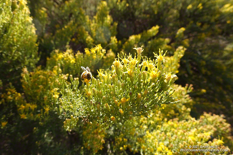
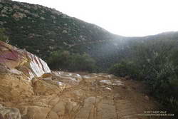
If you’re a bee in the Ahmanson Ranch area, your Fall menu of wildflowers is usually pretty sparse; particularly when the previous rain year has been below normal.
But life has a way of carving out a niche for itself in the toughest of circumstances. One plant you’ll find blooming in the oak grasslands of Ahmanson Ranch following a long, hot, dry summer is goldenbush. In the case of the title photo, it’s Palmer’s goldenbush.
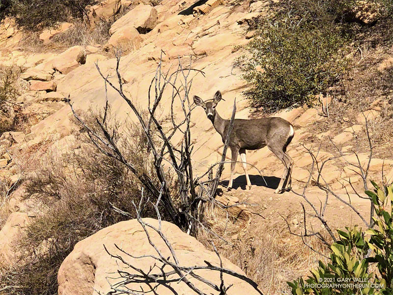
I saw a flash of brown through the bushes on the trail ahead. I stopped as a deer emerged from a switchback. The doe was walking slowly up the trail with her mule-like ears turned back toward me. I said something like, “Where are you going?”
She turned toward me and stared quizzically. As I slowly pulled the phone from my pack, I continued to talk. Her expression was a mix of caution and curiosity. It was as if she couldn’t quite make up her mind what I was about.
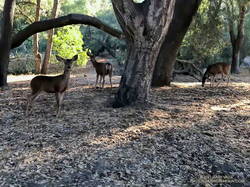
Mule deer at Trippet Ranch
This was peculiar behavior for a deer in this area. It wouldn’t be so strange if I was at Trippet Ranch. The deer there graze around the oaks and grasslands near the parking lot and are used to seeing people. But in decades of running the Chumash Trail, I’ve only occasionally seen deer, and they have always been skittish and quick to react.
This doe watched me as I slowly walked around the bend and toward her. I was reminded of a friend’s experience, when he was hit on the shoulder by a spooked deer. Not wanting to force a reaction, I stopped. The deer casually stepped off the trail and disappeared down the ravine.
Later, running down Las Llajas Canyon, I was startled by the sound of something large moving in the brush. This time I got only a fleeting glimpse, as the deer bounded uphill through the trees, rocks, and brush.
Was that thunder? I warily eyed the dark clouds over the mountains and pondered the situation.
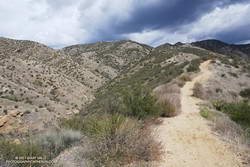
I was about halfway to the top of the Chumash Trail and was planning to run along the crest to Rocky Peak. The run had started in short sleeves and sunshine, but it was pretty obvious that wasn’t going to last.
Chumash Trail about a mile from the trailhead
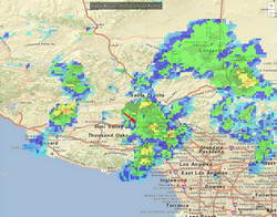
A cold upper-level low had brought badly needed rain to the area for the past two days. The low was moving off to the east, but there was still a chance of afternoon showers and maybe even a thunderstorm.
It was the “thunderstorm” part that I needed to pay attention to. I had enough gear to deal with a downpour and cooling temps, but electrical storms are no fun at all.
I decided to continue to the top of the Chumash Trail and reassess. As I worked up the trail, I pictured the counterclockwise circulation around the low, and how convective cells develop over the mountains and then dissipate as they drift south. The concern was that the cells don’t always dissipate.
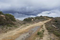
Rocky Peak Road near Rocky Peak
It looked like things weren’t getting any better at the top of the Chumash Trail, but it wasn’t worse either. I hadn’t heard any thunder for a while, and most of the activity seemed to be a few miles to the west and east. Having been starved of stormy weather for much of the rain season, I turned right on Rocky Peak Road and headed south toward Rocky Peak.
The run from the Chumash Trailhead to Rocky Peak is a challenging mix of technical single-track trail and hilly fire road. There are wide-ranging views of Simi Valley & Simi Hills, the San Fernando Valley, Santa Monica Mountains, Ventura County mountains, and San Gabriel Mountains. On a clear day, the view can extend to the Channel Islands, Saddleback, and San Jacinto Peak.
NOAA radar mosaic at the time I was on Rocky Peak
The actual turnaround point for a run to “Rocky Peak” varies. Some like to turnaround at the high point of Rocky Peak Road that is near Rocky Peak. Most of the time, I turnaround at a viewpoint that is at the end of a spur trail that branches off from the high point of Rocky Peak Road. From time to time, it’s fun to hike over to Rocky Peak and scramble to the top. That’s a bit more involved and requires some route-finding.
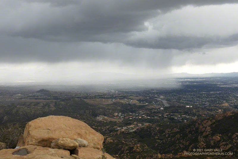
I felt the first raindrops as I reached the high point on Rocky Peak Road and turned onto the spur trail that leads to the overlook. There was some increased development to the east, but it looked like there would be enough time to get over to Rocky Peak, take a couple of pics, and then head back.
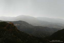
Oat Mountain, shrouded by rain
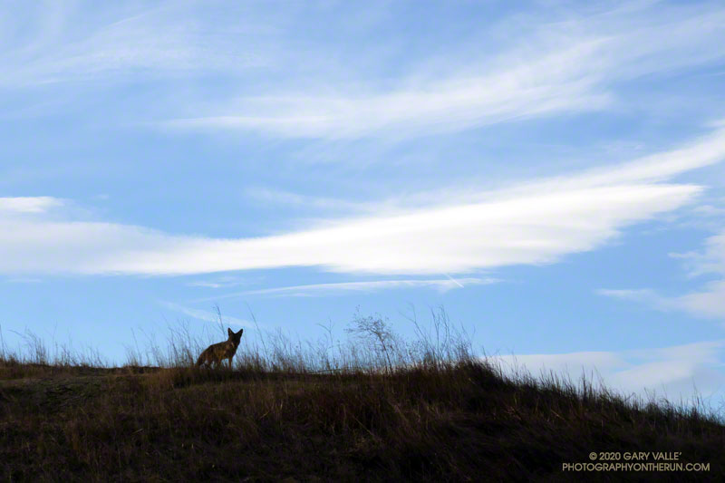
I felt a little exposed on top of Rocky Peak. I hadn’t heard any thunder for the past hour, but a cell to the east was spouting heavy rain over the San Fernando Valley, which meant there was probably enough development to produce lightning. I took the title photo and a couple of others and hurriedly descended from the peak.
Back on Rock Peak Road, the sprinkles increased, and the showers became more steady as I ran north toward the Chumash Trail. Under the dark clouds, a raven perched on a large pinnacle cawed incessantly, either enjoying the rain or complaining about it. In the distance, a siren wailed down in the valley. It was cold, and I was very glad to have an extra shirt, sleeves, gloves and a light rain shell.
Mix of sun and rain on the Chumash Trail.
As I began the descent of the Chumash Trail, the sun briefly broke through the clouds, reflecting brightly on the wet sandstone rocks. I breathed deeply, relishing the smell of the cleansed air and wet chaparral, and continued down the trail.
This afternoon I was running down a single-track trail at Upper Las Virgenes Canyon Open Space Preserve (Ahmanson Ranch), when I noticed a coyote on a parallel track across a small ravine. From time to time I would stop and watch the coyote, and from time to time it would pause and watch me. After a few minutes, it went its way, and I went mine.
Earlier in the run I’d been in the same area when a coyote, running at full speed, came blasting down a single-track trail. It turned into the brush about 30 yards in front of me. I’d seen similar behavior once before when one coyote was chasing another. In this case a hiker followed the coyote down the trail. In my experience, it usually take more than a simple encounter with a hiker to panic a coyote.
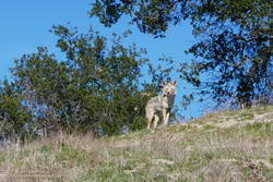
Another curious coyote. Click for a larger image.
Update February 18, 2021. The coyote pictured on the right was in the same area as the coyote in the title photo. When I first encountered the coyote, it had just crossed the trail and was below me. For some reason it reversed its course and climbed to a viewpoint above me, and watched as I ran up the trail. After a few moments it ran back down hill, retracing its original course across the trail. It was one of the most well-conditioned coyotes I’ve seen out at Upper Las Virgenes Canyon Open Space Preserve (Ahmanson Ranch).
I have had a couple of unusual encounters with coyotes out at Ahmanson. One time, a coyote decided to run with me, as if on a leash.
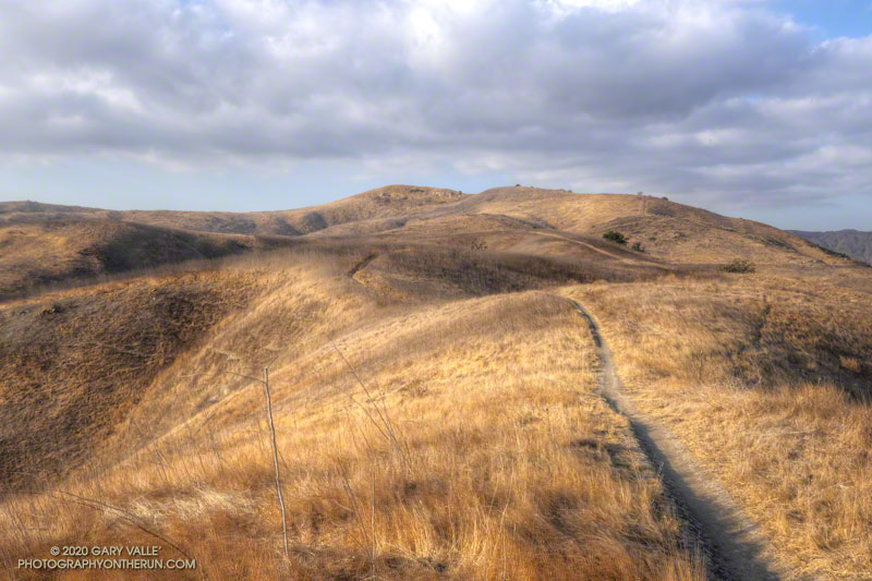
The hill marked with an elevation of 1842′ on the USGS 7.5 minute Calabasas quadrangle appears to be the highest point of the portion of the Ahmanson Ranch property that was going to be developed.
I usually start the 2+ mile trail run to the peak by ascending the Hill Climb Trail — a short, steep hill a little west of the kiosk at the Victory Trailhead. A less steep trail can be found a little farther to the west.
Once at the top of this initial 120′ high hill, I try to run — without walking — all the way to the ridgeline just west of the peak. Whether I walk or not, it’s a fun run with excellent views of the area.
From the ridgeline at the top of the single-track trail, there is usually some sort of a use trail to the top of the peak. The location and clarity of the path varies from year to year. The area can be very overgrown. It’s worth taking the time to find and stay on a use trail. Earlier this December, I encountered a rattlesnake while trying to follow an old route through the brush.
Note: The Ahmanson Ranch project property and Upper Las Virgenes Canyon Open Space were combined to create Upper Las Virgenes Canyon Open Space Preserve.
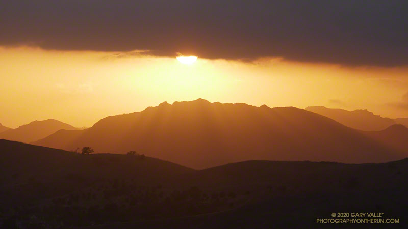
The photograph of Ladyface and the setting sun was taken from Lasky Mesa during an afternoon run in Upper Las Virgenes Canyon Open Space Preserve (Ahmanson Ranch).