As I approached Musch Camp, a scrub jay flew from a trailside faucet and into a nearby eucalyptus. There had been a little rain the day before, but the birds at the closed camp were still thirsty. Less than a quarter-inch of rain had fallen, and nearby creeks were still dry.
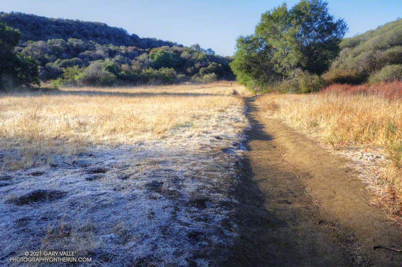
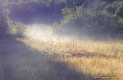
Melting frost “steaming” at Musch Meadow
I was doing a run from the “Top of Reseda,” and on a warmer day would have topped off my water bottle at the camp. I stopped at the faucet and briefly turned on the spigot. Maybe that would make it easier for the jay.
In another mile I reached the Trippet Ranch trailhead, and then begin the six mile run back to the Valley. At several points on the run there had been wintry views of the local mountains. On the way back the best view of the snowy mountains was from the Hub, where Mt. Baldy could be seen gleaming white in the morning sun.
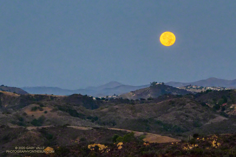
Halloween’s full Moon is the second full Moon of the month, giving it the distinction of being a “Blue Moon.” The next Blue Moon won’t occur until Aug 31, 2023.
The title photo of the setting Moon was taken a few minutes before sunrise on Halloween, from Fire Road 30 & dirt Mulholland, in the Santa Monica Mountains.
I was doing an out and back trail run from the “Top of Reseda” to somewhere on Rogers Road segment of the Backbone Trail. With about three hours and one bottle of water available, “somewhere” turned out to be the Lone Oak above Will Rogers State Park.
Including short side trips to Cathedral Rocks and Temescal Peak, the roundtrip totaled about 14.5 miles of enjoyable trail running.
On recent weekends I’ve enjoyed running some of the less-used trails in Angeles National Forest. With trails reopening in the Santa Monica Mountains, this weekend I decided to do an old favorite — the out and back run from the Top of Reseda to Trippet Ranch.
Overgrown path to the top of Temescal Peak.
Even with an early start, more cars than usual were parked at Marvin Braude Mulholland Gateway Park. After hiking up the hill to the trailhead, I took the single-track connector to dirt Mulholland, and then ran a quarter-mile west and turned left (south) onto Fire Road #30.
The fire road starts with a warm-up downhill and then over about 1.5 miles ascends to the Hub, ending the stretch with a strenuous hill. The distance from the trailhead to the Hub by this route is about 2.5 miles. (On May 17, the pit toilet at the Hub was closed.)
View toward Eagle Rock from Temescal Peak
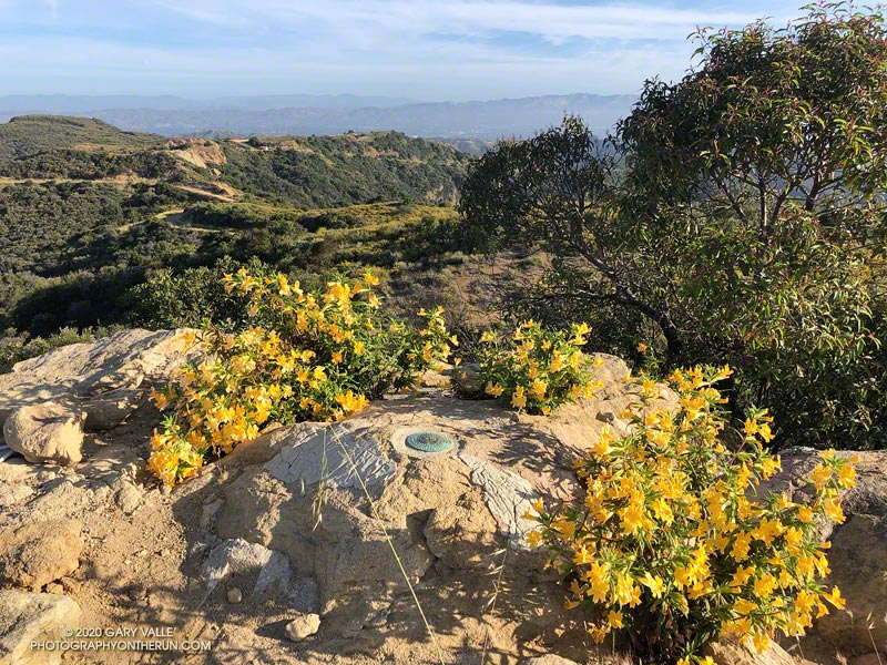
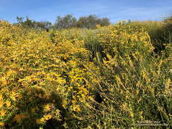
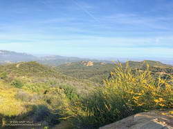
At the Hub, I took a quick detour over to Temescal Peak, the little peak with a big view. The path to its summit is on the south side of the peak. It takes off from the Rogers Road segment of the Backbone Trail, just east of Temescal Ridge Fire Road. Usually a well-defined path, today it was totally overgrown with monkeyflower and deerweed. The morning was a bit hazy, but there were still good views toward Eagle Rock, the Hub, and other areas of the Santa Monica Mountains.
The side trip to Temescal Peak added about 1.6 miles to the run. After returning to the Hub, I turned left onto Eagle Springs Fire Road and continued (mostly downhill) to Trippet Ranch.
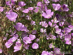
Farewell-to-Spring along the Garapito Trail
The return from Trippet Ranch was mainly on single-track trails. There were maybe a dozen hikers on the Musch Trail and a couple of hikers on each of the Garapito and Bent Arrow Trails. I had my InknBurn mask handy for when I passed others on the trail. As might be expected, the trails were a little overgrown. (On May 17, water was available from the spigot at Musch Camp.)
Right from the start of the run, it was evident that several species of wildflowers were blooming in a big way. Some of the most prolific were monkeyflower, yarrow, deerweed, and canyon sunflower. There were several large patches of farewell-to-spring along the Garapito Trail. Plus, there was a trickle of water in Garapito Creek.
It was about 15 minutes before sunrise when I started my run from the trailhead at the “Top of Reseda.” After running up to Mulholland and partway down Fire Road #30, I could see a batch of tropical-looking clouds to the southeast. These were associated with a cutoff upper-level low that had formed off the coast of Southern California on Halloween.
The behavior of cutoff upper-level lows is difficult to forecast. They are usually separated from the general west to east flow and typically wobble around like a spinning top. A cutoff low can remain off the coast for several days or more. Just where they wobble can dramatically impact the weather. So far this morning, the only effect of this weak low had been to embellish the sunrise with a few clouds, but such lows can be capricious, and this one was no exception.
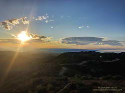
My first stop was going to be Temescal Peak, and I picked up the pace a bit, curious to see how the clouds and sunrise might look from that viewpoint. Temescal Peak is just off the Backbone Trail, near its junction with Temescal Ridge Fire Road. On a clear day this tiny peak affords an exceptional 360-degree view that can include Mt. Baldy, San Gorgonio Mountain, San Jacinto Peak, Mt. Pinos, Hines Peak, and other area landmarks.
Sunrise over West L.A. from Temescal Peak in the Santa Monica Mountains.
Turning left at the Hub, it didn’t take long to get to Temescal Peak. Westward from the peak, a veil of smoke could be seen in the vicinity of the Maria Fire. Nearby, some of the canyons in the area of the Getty Fire were filled with a smoky haze. In the distance, a few mercurial clouds were scattered across the eastern sky.
At the time, I couldn’t tell if the clouds were approaching or receding, developing or dissipating. Returning to the Hub, I turned left on Eagle Springs Fire Road and began the descent toward Trippet Ranch. On the way, it became clear the clouds were headed my way. By the time I’d run to Trippet Ranch and up to the top of the Musch Trail, the band of clouds covered much of the eastern sky. Virga streamed from the bases of some of the clouds, and I wondered if a few rogue drops might be reaching the ground.
Developing clouds from near the top of the Musch Trail.
Over the remainder of the run — past Eagle Rock and through Garapito Canyon — the clouds continued to move overhead. A few drops of rain found me near the end of the run, but the most pleasant surprise occurred on the drive home, when showers dampened the streets of the western San Fernando Valley.
There had been no rain in the Los Angeles area this October, and the showers reminded me of the erratic nature of Autumn precipitation in Los Angeles. Even though “normal” rainfall in October at Downtown Los Angeles (USC) is 0.66 inch, no one familiar with L.A. weather is surprised when October is dry. Over 143 years, Downtown Los Angeles has recorded no October rainfall 26 times, 0.10 inch or less 54 times, and 0.25 inch or less 74 times.
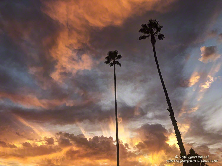
The upper-level low continued to influence the day’s weather, and while the low remained mostly offshore and didn’t generate any more showers in the West Valley, it did produce a colorful sunset!