Category Archives: trails|pt mugu state park

Boney Mountain Eclipse Run

Narrative about 2012 solar eclipse

Some things in nature are supposed to be constant. The ground shouldn’t move; a mountain that is here today should be here tomorrow; and if skies are clear and blue, the sun shouldn’t grow mysteriously dim.


Imagine the consternation of our early ancestors, keenly attune to nature, feeling the sun dim and then looking for a cloud they could not find. There is still much of them in us. When the earth shakes or the sun fades, even moderately, we can’t help but react at the most visceral level.

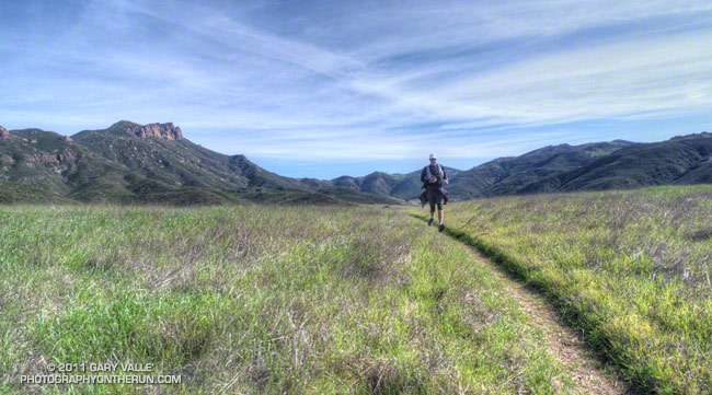
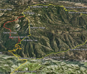
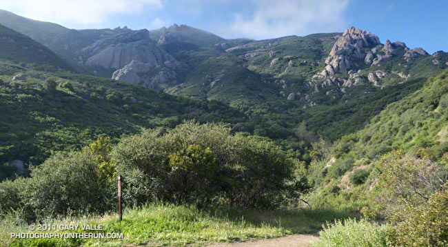
While ee still can’t predict an earthquake with any certainty, we can predict eclipses. Fred Espenak’s NASA Eclipse Web Site includes maps and tables for several millennia of solar and lunar eclipses. Using the web site’s JavaScript Solar Eclipse Explorer you can find the solar eclipses that will be (or have been) visible at a particular location, as well as the type of eclipse, it’s magnitude, and when it will start, end, and reach its maximum. In 2002 I used the Eclipse Web site to plan a trail run to coincide with the June 10 solar eclipse. This afternoon I was doing another eclipse run — the north side loop on Boney Mountain.


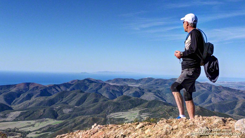
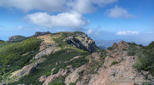
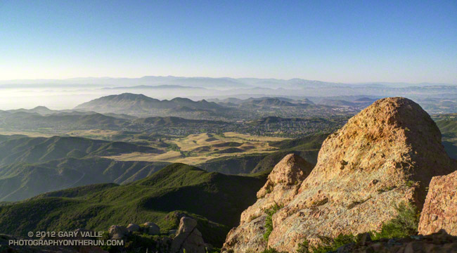
Perched on rocky ledge on the western ridge of Boney Mountain, I watched as the light on the landscape became increasingly muted. At the eclipse’s maximum almost 80% of the sun’s area would be obscured and about 85% of its width. The descending veil was tangible. I could not only see it, I could feel it. Even though I understood what was occurring, and that it would not last, ancestral fears were welling up and whispering, “Something is wrong…”


As the time of maximum eclipse approached, bird songs increased as if it was dusk. The wind, which had been blowing in fits and starts began to blow steadily from the west. The temperature dropped another degree or two.

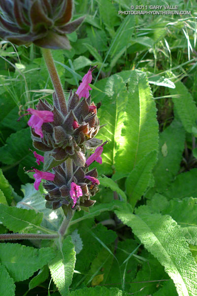
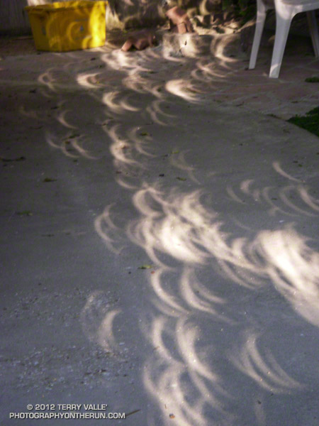
Once the eclipse’s maximum had passed, I continued to work up the ridge, enjoying the extraordinary light. I hoped my wife was getting some good shots of the eclipse in our backyard. Many eclipse viewers are so focused on the sky, they don’t notice the spectacular lensed images projected on the ground and elsewhere by sunlight filtering through trees. The gaps between the leaves of a tree work like a giant pinhole lens, with a focal length of many feet. In the case of the trees in our backyard this produced images of the eclipsed sun 10 inches or more in diameter. Lensed eclipse images were also projected by  sunlight filtering through the chaparral on Boney Mountain.

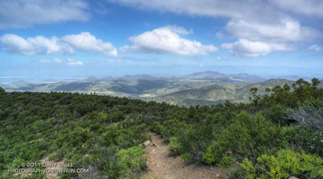
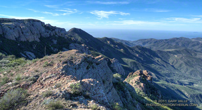
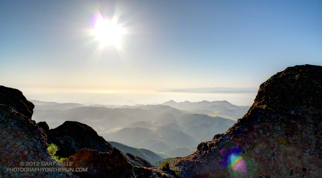
I topped out on the western ridge around 7:10 and jogged up to the high point between the western and eastern ridges. Across the way three fellow eclipse watchers were on Tri-Peaks, and it sounded like there was a party over on Sandstone Peak. Even with the sun low on the western horizon, you could feel its intensity returning. Only about one-third of the sun was now obscured, and minutes before sunset — about 7:43 — the eclipse would end.


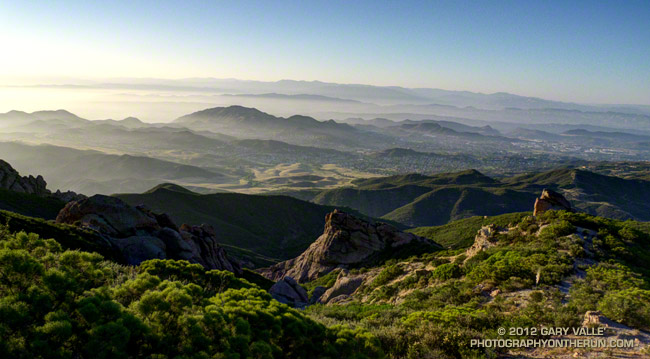
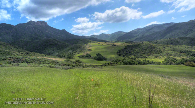
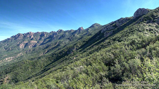
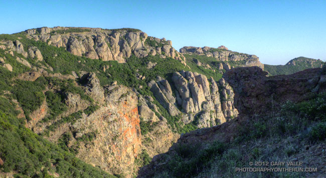
Marine layer haze and long shadows were filling the valleys as I began the second half of my eclipse adventure — running down the eastern ridge and trying to reach the trailhead before it was pitch black. Much of the route was illuminated by the setting sun, and I was able to get past most of the technical running and down to the Danielson cabin site before it became difficult to see. Once on Danielson road the bright western sky provided enough light to run. I made good time down to the creek in Upper Sycamore Canyon and then pushed up the road to Satwiwa. Just enough light remained to run the connecting single track back to the Wendy Drive trailhead.

Boney Mountain – Serrano Valley Adventure Run

Craig running in Serrano Valley

Craig had never done any rock climbing, but was doing a great job of scrambling up the steep gullies, and climbing the short sections of knobby, low angle volcanic rock. We were climbing up through a maze of brush and rock formations on the steep ridge that follows Boney Mountain’s western escarpment. The scramble up the western ridge would be well worth the effort. The route is a shortcut to the Backbone Trail and some of the most spectacular running in the Santa Monica Mountains.


Our run had started at Wendy Drive & Potrero Road in Newbury Park. We were doing a 20 mile loop that was about as varied as a trail run can be. In addition to the 1.5 mile ascent of Boney Mountain, there would be about 13 miles of single track trail, 4.3 miles of dirt road, and even 1.7 miles of paved road.

After getting through the maze to the Backbone Trail we would do the classic run down the Chamberlain Trail to the Old Boney Trail. From the bottom of the Chamberlain Trail there are four major variations. Three of these lead to Big Sycamore Canyon and one loops directly back to the start of the climb up Boney Mountain:

– Turn left (west) on the Old Boney Trail and at the junction of the Serrano Valley & Old Boney trails follow the Serrano Valley Trail and then the Serrano Canyon Trail to Big Sycamore Canyon. This was the route we were doing today.

– Turn left (west) on the Old Boney Trail and follow it all the way to Big Sycamore Canyon.

– Turn right (east) on the Old Boney Trail and at the junction of the Blue Canyon & Old Boney trails, continue down the Blue Canyon Trail to the Danielson Multi-use area in Big Sycamore Canyon.

– Turn right (east) on the Old Boney Trail and at the junction of the Blue Canyon & Old Boney trails, turn up the Old Boney trail and  follow it  over the shoulder of Boney Mountain and back to the point where the ascent of Boney Mountain began.


In Big Sycamore Canyon there are many options. Today we would run up Sycamore Canyon Rd to Wood Canyon Rd and pick up the Two Foxes Trail. This trail continues up-canyon and eventually rejoins Sycamore Canyon Rd, which would take us to the Upper Sycamore Trail, and from there to Danielson Road and Satwiwa. Here’s an interactive Cesium browser View of a GPS trace of our route. And here are archived maps of Rancho Sierra Vista/Satwiwa and Pt. Mugu State Park originally from the NPS Santa Monica Mountains web site.  Also see the Pt. Mugu State Park maps on VenturaCountyTrails.org.

Note: There is an easier alternative to the western ridge route on the north side of Boney Mountain. The route starts near the Danielson Memorial, and ascends a use trail up the eastern ridge on the north side of the mountain. In places the (unmaintained) trail is very steep, eroded, and rubbly but it is more straightforward and less technical than the western ridge.

Some related posts: What a Great Day for a Trail Run, Sandstone Peak from Wendy Drive, Boney Mountain Views

Wow, What a Great Day for a Trail Run!

Ridge near summit of Tri Peaks

The Wendy Dr. trailhead in Newbury Park is a gateway to some of the most scenic and spectacular trail runs in the Santa Monica Mountains. Runs, hikes and rides on the extensive and diverse network of trails can range from a few minutes, to many miles and hours.

Today my run was of the “few hours” variety. The weather in Pt. Mugu State Park was perfect for a longer run — partly cloudy, light winds, and the temperatures ranged from the high 40s in the morning to the high 60s midday.

La Nina or El Nino, rain seasons as wet as the 2010-11 season are relatively rare. The wet weather produces a cascade of effects, resulting in conditions that might not be seen again for years. Streams that had not run for years were flowing; numerous wildflowers were blooming; the chaparral and other plant communities, and their inhabitants, were flourishing. I did not want to miss anything.

With that thought in mind, my route took me up and over Boney Mountain and Tri Peaks to the Backbone Trail, and then down the Chamberlain Trail and Old Boney Trail to the Serrano Valley Trail. After running through resplendent Serrano Valley, I continued down Serrano Canyon, crossing the creek 15 times, all the while trying to avoid the lush growth of poison oak along the trail. Even the miles returning up Sycamore Canyon were enjoyable, and involved a few stream crossings. The Upper Sycamore Trail and Danielson Road led back to Satwiwa and the trailhead.

On this particular day it was as fine a trail run as I have done, and probably the most scenic loop I’ve done in the Santa Monica Mountains.

Some related posts: Western Rim of Boney Mountain, Conejo Valley Sun and Boney Mountain Clouds

Here are a few additional photographs from the run:


Boney Mountain NW Ridge


Chamberlain Trail


Serrano Valley Loop Trail
                  
Fuchsia Flowered Gooseberry


Puffball


Hummingbird sage

Western Rim of Boney Mountain

Western rim of Boney Mountain

The plan had been to do a run similar to last week’s Serrano Valley run, with more of an emphasis on distance, than elevation gain. As I worked up the long switchbacks on the Old Boney Trail I debated the benefits and disadvantages of more — or less — elevation gain. Just two weeks before the Bandit 50K would additional elevation gain hurt or help in that hilly race?


It really didn’t matter. Now was now, and the race was a distant two weeks away. The route up the westernmost of Boney Mountain’s two north ridges was one of my favorites — especially when the weather was clear and the views from the mountain were far reaching. I’d done the Old Boney Trail last week. This week I’d hang a left at the ridge and go up and over the peak.

Anticipating a warm day I’d left my pull-on sleeves in the car. Bad choice. Strong Santa Ana winds scoured the ridge, and the weak morning sun was lukewarm at best. The thick chaparral and tall rock formations provided some protection from the wind, but from time to time the trail would emerge onto a rocky prominence or exposed ridge and remind me just how cold 60 degrees can be!


Contrary to experience, the wind moderated a little as I worked up the ridge. It was still very windy, but the buffeting winds I’d expected at the saddle north of Tri Peaks didn’t happen. Even so, it felt great to work around the east side of Tri Peaks and into the full sun on the south side of the peak! The change in the “feels like” temperature must have been 25 degrees! It would be shorts and short-sleeves comfortable for the remainder of the run.

As it turned out the elevation gain going up and over Boney Mountain and down the Chamberlain Trail wasn’t that much more than the up, down, up route along the Old Boney Trail — and the running was oh so good down the recently repaired Chamberlain/Backbone trail!

Some related posts: Boney Mountain Morning, Conejo Valley Sun and Boney Mountain Clouds