Category Archives: trails|san gabriels

Angeles High Country

Angeles High Country

Of all the faces of Los Angeles perhaps the least well known is the Angeles High Country. Entirely within the County of Los Angeles, the lofty peaks and chiseled canyons extend from Mt. Waterman on the west to 10,064′ Mt. Baldy on the east. It is rugged and wild — the home of ancient trees, bighorn sheep, black bears and mountain lions.

This view of the crest is from the Rim Trail, on the steep eastern shoulder of Mt. Wilson. From left to right the prominent peaks are Mt. Waterman (8,038′), Twin Peaks (7761′), Mt. Baden-Powell (9,399′), and Mt. Baldy (10,064′). The lack of snow is indicative of the meager amount of precipitation we’ve had this Winter.

We were running the Rim Trail as part of an approximately 22-mile loop from Shortcut Saddle on Angeles Crest Highway to Mt. Wilson and back. The loop incorporates several segments of the new 50-mile course that is part of the Angeles National Forest Trail Race (formerly Mt. Disappointment).

The segments of the loop that are on the 50-mile course are the Silver Moccasin Trail, Gabrielino Trail, Kenyon DeVore Trail, and the Rincon-Edison Road. Here are a Google Earth image and Google Earth KMZ file of a GPS trace of the route.

Much of the winding 5.6 mile climb out from the W.F. San Gabriel River on the Rincon-Edison Road is steep and shadeless. Rincon-Edison Road is also used (under permit) by off-road vehicles — we encountered two dirt bikes and a jeep.

Strawberry – Bear Canyon Loop

Trail runner in Bear Canyon, in the San Gabriel Mountains.

The Strawberry – Bear Canyon loop trail run is a longer, more adventurous variation of the run around Strawberry Peak described in the post Strawberry Peak Circuit.

The photograph Fall Leaves On Bear Creek was taken on this loop in November 2005. As described in that post, instead of descending directly to Switzer’s from Red Box, this route descends the West Fork to Valley Forge Campground and then climbs up and over the shoulder of Mt. Wilson, and down into Bear Canyon, eventually working its way back to Switzer’s and Clear Creek.

Without any wrong turns or other route finding issues the loop works out to about 25.5 miles with an elevation gain and loss of about 5500-6000 ft. The running (and hiking) is extremely varied, including fire roads, old road beds, easy trail, technical trail, and lots of up and down. Bear Creek’s lush canyon is gorgeous, but 20 miles into the run, it’s winding course and many creek crossings can prove demanding.

I attempted to obtain a GPS trace of this route in 2005, but the steep, narrow canyons defeated my Foretrex 201. Not so with my Forerunner 205. I continue to be amazed at the 205’s performance. Here’s a Google Earth image and Google Earth KMZ file of the GPS trace of my route.

Related posts: Spring Growth, Fall Leaves On Bear Creek, Forerunner 205.

Strawberry Peak Traverse

Josephine Peak from the northwest ridge of Strawberry Peak.

When I broke through the top of the stratus layer, bright sun glared from the jagged granitic rocks along the ridge. To the west, Josephine Peak (5558′) was nearly immersed in an ocean of clouds.

The route I was doing was a variation of the Strawberry Peak Circuit described in the posting Spring Growth. Instead of going around the peak on the Colby Trail, this 13-mile loop climbs up and over Strawberry’s summit (6164′), ascending the class 3 northwest ridge, and then rejoins the circuit at Lawlor Saddle. Although a couple of miles shorter than the circuit around the peak, this route has more elevation gain, and the class 2 and class 3 sections of the ridge require careful route-finding.

Class 2, class 3 – what’s that about? Basically, class 1 is hiking, class 2 is easy scrambling where the hands are used for balance, and class 3 is when the scrambling gets serious, and handholds are required. Another element of class 3 climbing is that staying on route can be important. Deviating from an established route may significantly increase the difficulty or hazard. This is certainly the case on the northwest ridge of Strawberry.

Like much of the San Gabriel Mountains, the rocks of Strawberry Peak are old and fractured. Large landslides have originated from the northwest face of the peak. (The Colby Trail passes through the moraine-like debris of one of these slides.) Because of its friable nature, extra care is required when climbing the northwest ridge. Hand or footholds can break, or footing can be lost on a sandy shelf. Or, as described in a story by pioneering aerodynamicist Paul MacCready, the climber can be trapped in a situation where they cannot climb up or down.

The northwest ridge of Strawberry is by far the most frequently climbed class 3 route in the San Gabriel Mountains. Done with care and appropriate skill, the climbing on the ridge can be an enjoyable and unique experience.

On the summit ridge, I admired the steep northwest face of Strawberry Peak as it plunged through the morning shadows to Strawberry Potrero nearly 1500′ below. Did I hear voices down there, or was it just the wind…

Here are a Google Earth image and Google Earth KMZ file of a GPS trace of the route.

North Backbone Trail Revisited

Wind-swept Jeffrey pine near Dawson Peak

I was cold — but not cold enough to do anything about it. I was chugging up the final steep step on Mt. Baldy’s exposed northern flank and didn’t want to stop. Strong winds were gusting out of the northeast, and the effective temperature had to be in the thirties. Mountain wave clouds paralleled the San Gabriels, stretching in a line from southwest of Mt. Baldy to beyond Mt. Williamson.

At the trailhead I’d seen the lens shaped clouds hovering over the mountains and expected it to be windy and cold. I’d changed my single layer long sleeve top for a more wind resistant double layer top and also pulled on some warmer shorts. I had started the climb with lightweight gloves and a  3 oz. rain shell in my pack. The gloves were out of the pack by the first peaklet, but I was still resisting putting on the rain shell.

So why repeat the same adventure on back-to-back weekends? The main reason is that I really enjoyed the route. But there were several more obtuse reasons as well. Last week, my Garmin Forerunner 205 would not turn on*. This is a known issue with an otherwise excellent GPS. However the usual workaround, pressing Mode + Reset + Power simultaneously, would not bring mine to life. So I didn’t get a a GPS trace of the route. The trace is not only useful for determining the approximate length of the route and elevation gain, but for documenting where photographs were taken and the location of interesting features.

This week I used my older Garmin Foretrex 201 GPS. It isn’t as compact or comfortable to wear as the Forerunner 205, and isn’t quite as sensitive, but at least it could be powered on. There were two trees in particular that I wanted to georeference. The first was a Jeffrey pine that had been recently struck by lightning. As it turns out, it didn’t require a GPS to determine its location because it is already marked on the topo as point 8555. The second was a gnarled and ancient Sierra Juniper on Pine Mountain.

Here’s a Google Earth image and Google Earth KMZ file of a GPS trace of the route. The title photograph is of a wind swept Jeffrey Pine on a south facing slope near Dawson Peak, with mountain wave clouds in the background.

*Garmin promptly replaced the unit. As a precaution, I now check that the unit can be powered on after it is removed from the recharging cradle.

Some related posts: Mt. Baldy North Backbone Trail, Mt. Baldy Run Over the Top

Mt. Baldy North Backbone Trail

Lodgepole Pine and distorted mountain wave clouds near Dawson Peak.

As I drove under the ski lift on the narrow dirt road, I wondered if I was in the right place. I had turned off of Angeles Crest Highway a few minutes before, and hoped I was still on Blue Ridge Road. My intended destination was an isolated turnout that serves as the trailhead for the North Backbone Trail. This classic trail follows a roller-coaster ridgeline to Mt. Baldy’s broad 10,064′ summit.

Bouncing along the dirt road, I surveyed the sky. The forecast had been for partly cloudy skies, but the morning had dawned overcast and crimson red, and now there was talk of rain. Autumn in the mountains is like that.

The North Backbone Trail is usually not as busy as the usual routes that ascend Mt. Baldy (Mt. San Antonio). One of the reasons is the bumpy six mile, back country drive to the trailhead. Another is the undulating round-trip route gains (and loses) about 4750′ over about eight miles. It climbs over – or nearly over – three highpoints: Point 8555, Pine Mountain (9648′), and Dawson Peak (9575′).

Rounding a corner, I’m surprised to see a small turnout jammed with cars. It’s not hunting season yet, so there must be a group already on the ridge. Squeezing into the last available space, I check that I’m not blocking the road or the car behind me, grab my pack, and jog down the trail to a saddle. To the east Mt. San Jacinto is sandwiched between low clouds and high, and I wonder what the day will bring…

As I reach the summit, the sun breaks through the clouds for the briefest instant. As if driven by my efforts on the ups and downs of the trail, the blues, whites and grays of the sky and clouds have been continuously changing. In turn, the intricacy of the clouds and their motion has energized me. It has been a extraordinary ascent, full of exertion, discovery, wonder, and awe.

A hiker on the summit smiles and waves, and walks over to me. Excited, he tells me that he is 57 and just started climbing peaks two years ago. This is his 57th summit. Days like today are why.

The North Backbone Trail is a treat for the fit and experienced adventurer. In fair weather, and without any snow and ice, it is a strenuous, but relatively straightforward climb. The ups and downs are generally quite steep and there are a few loose, rubbly sections. I hiked the ups, and jogged the flats and downhills. It is not a place to be in a thunderstorm.

The photograph of a Lodgepole Pine and mountain wave cloud was taken on the slopes of Dawson Peak, on my way back from Mt. Baldy. About an hour later, as I descended from Peak 8555, it started to rain. Autumn in the mountains is like that.

Here’s a Google Earth image of a GPS trace of the route from North Backbone Trail Revisited.

Some related posts: Mt. Baldy Run Over the Top, Pine Mountain Juniper, Mt. Baldy Runner

Heat Wave

As I turned into the Vincent Gap parking lot and pulled to a stop, a few sprinkles of rain dotted my windshield. Opening the car door, I wanted to close it again. It was 7:30 in the morning and the temperature was already nearing 70 degrees. It shouldn’t have been a surprise. The previous two days the National Weather Service office had issued an “excessive heat warning” for much of the Los Angeles area, including the lower elevations of the mountains.

Angeles Crest Highway was closed 2.6 miles west of Islip Saddle, so my plan was to do the Islip Saddle – South Fork – Mt. Baden-Powell loop from the Vincent Gap side. (Update May 21, 2009. Angeles Crest Highway has since been re-opened to Islip Saddle, and through to Wrightwood.) This difficult 23 mile loop, and some of its logistical issues, were described in the posting Complications.  The day was really too warm to be doing this route, but with a chance of thunderstorms in the forecast maybe some clouds would help keep temps in check. I’d run at least to Little Jimmy Spring. If it was too hot, I could always head back.

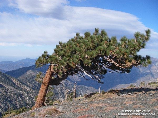
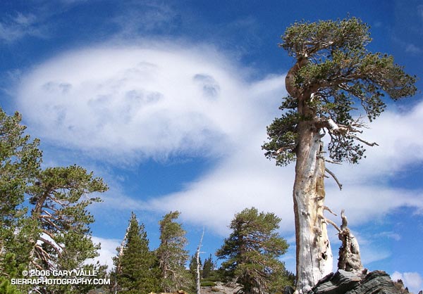
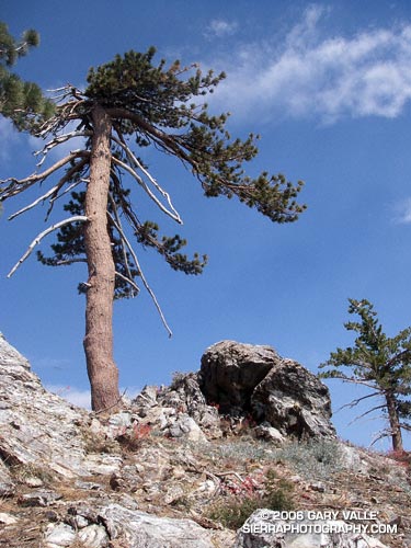
It didn’t take long for the clouds that had spritzed my windshield to move off to the west. Except for a smoky haze from the Sawtooth Fire, mostly clear skies prevailed as I worked up the numerous switchbacks of Mt. Baden-Powell.  Near the summit of of the peak, I paused for a moment to admire the Wally Waldron Tree. At an elevation and in an environment similar to the 4000+ yr. old White Mountain Bristlecone Pines, this gnarled and weather-beaten Limber Pine is estimated to be 1500 years old. Clearly ancient, it has survived wind and weather too extreme to imagine. According to the Forest Service, some Limber Pines in this area may be as much as 2000 years old. Extended longevity doesn’t appear to be limited to Limber and Lodgepole pines; a stunted White Fir near the summit also looks unusually old.

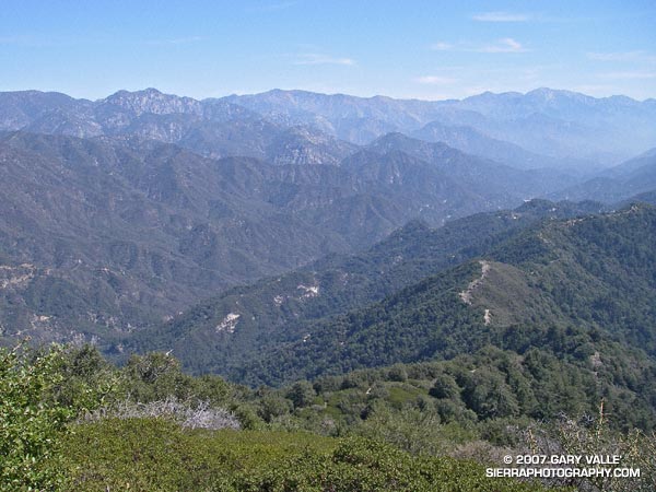
Down from the summit, and back on the Pacific Crest Trail, the running along the ridge was outstanding. Near Mt. Burnham, I stopped to take a few photographs, and watch a bumblebee working through a batch of Grinnell’s Penstemon (Penstemon grinnellii). The throat of this particularly bulbous penstemon perfectly accommodates the bumblebee, and perhaps is an example of a flower adapting to a preferred pollinator. Continuing along the crest, between Throop Peak and Mt. Hawkins, red accents among the rocks marked patches of Bridge’s Penstemon (Penstemon rostriflorus). From time to time, sparse clouds masked the sun, but as I descended toward Windy Gap, the temperature climbed inevitably higher.

One of the pros of doing the loop from Vincent Gap is that it is great to have fresh legs for the exceptional trail running down to Islip Saddle. Except for a short climb over the shoulder of Throop Peak, the running is generally downhill from the summit of Baden-Powell  (9399′), all the way to South Fork Campground (4560′). This is a distance of over 13 miles, with an elevation loss of nearly 5000′. The major con is having to do the lowest elevation segment of the loop, and the climb back to Vincent Gap (6565′), during a warmer time of the day.

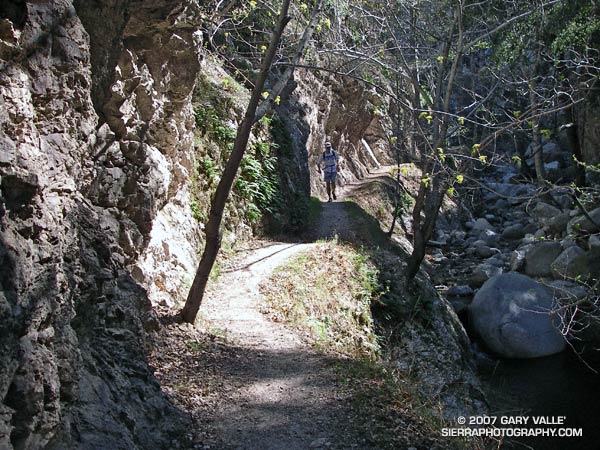
Aside from the heat, another concern had been nagging at me. What if the trail was impassable? This wasn’t heat induced paranoia. Last year, several sections of the South Fork trail were buried in small rock slides, and a couple of places where the Manzanita Trail crossed steep erosion gullies were in very bad shape. A Winter had passed, and who knew what recent thunderstorms had done to the trails?

Switchbacking down to Little Jimmy Spring, I had already decided to continue to Islip Saddle. In the battle of “do, or do not” I knew that once at Islip Saddle, “do” would win again. Maybe some clouds would help me on my way…

Epilogue: In sun-baked South Fork canyon, even the downhill was difficult, but the rock slide plagued trail was still passable. Some clouds provided temporary relief at South Fork Campground, but didn’t last. The damage to the Manzanita Trail was worse than last year, but with care I was able to get through. In nearby Valyermo, midday temps reached over 100°F. Here’s a Google Earth image and Google Earth KMZ file of a GPS trace of the route, and a Forest Service diagram of area trails that’s at Vincent Gap.