Category Archives: trails|san gorgonio

Hitting the (Big) Hills of Southern California


Comparison of Whitney (Trail), San Gorgonio (Vivian Creek) and San Jacinto (Devils Slide)

Updated November 12, 2014. Added Register Ridge on Mt. Baldy and the Siberia Creek Trail in Big Bear.

Southern California is noted for its foothills and mountains. It’s so hilly here that most trail runs have at least one good climb. Even if you aren’t a high mileage runner, the elevation gained on those hills can add up fast. So far this year SportTracks puts my cumulative elevation gain at about 320,000 feet.

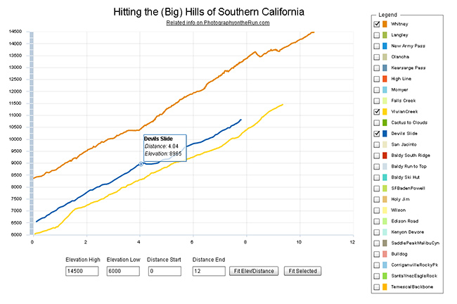
I was curious to see how some of the “hills” in Southern California compare, so I wrote a Flash application that interactively displays the elevation profiles of a selection of SoCal ascents. Generally trails were picked that could be done in day from L.A. The selection includes some East Side Sierra ascents, routes up most of the major Southern California peaks, and some hills from some Southern California races.

The profiles and other stats are based on DEM corrected data from GPS tracks. All distances, elevations, elevation gains and elevation profiles are approximate. Elevations have been corrected and elevation gains (conservatively) calculated using SportTracks.

The Flash app is loading a lot of data, so it may take a while to load. The app is best viewed on a desktop, laptop, or tablet. It can’t be viewed on an iPad/iPhone unless a browser that supports Flash, such as Photon, is used. Here is the updated selection of elevation profiles and the selection from 2012. The “Fit Selected” button is used to fit the chart to the currently selected set of elevation profiles. The “Fit Elev/Distance” button is used to format the chart according to user specified elevations and distances.

In this selection of hills Cactus to Clouds is the longest (14.7 miles) and has the most altitude gain (10,812 feet). Register Ridge on Mt. Baldy has the steepest mile (1745 fpm) and is the steepest overall (1127 fpm). Mt. Whitney has the highest finishing elevation (14,505 feet).

Following are some additional details about each of the ascents, including the length of the climb, elevation gain, average gradient and steepest mile. The distance specified is just for climb described — not the entire run. The headings below are the shorthand name of the climb used in the legend of the app.
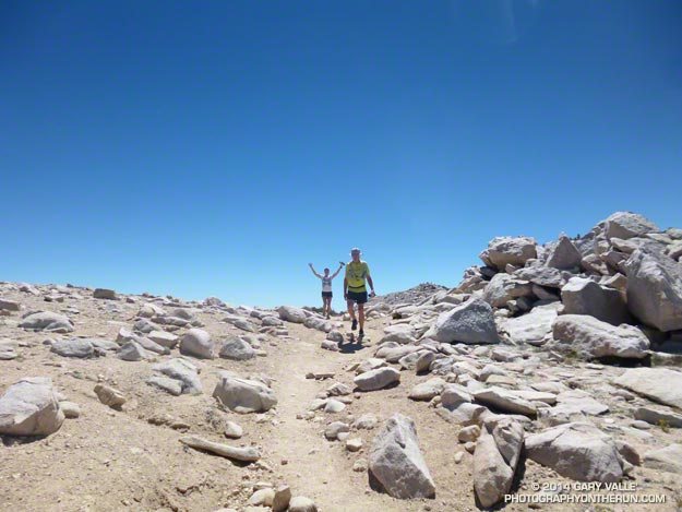
Whitney

Mt. Whitney via the trail from Whitney Portal.
Distance: 10.5 mi – Gain: 6657 ft – Avg Gradient: 632 fpm – Steepest Mile: 900 fpm @ mile 4.5

Requires permit. The 1991 Los Angeles Times story about Marty Hornick’s 2:08:30 ascent of Whitney via the Mountaineers Route mentions a 2:17 time via the trail. According to the China Lake Mountain Rescue Group’s Talus Pile December 2002, Issue # 126, Jason Lakey did the roundtrip via the Mountaineer’s Route in a record 3:10:07.

Related post: East Face Mt. Whitney, Tower Traverse

Langley

Mt. Langley via Army Pass from Horseshoe Meadow Cottonwood Lakes Trailhead.
Distance: 10.2 mi – Gain: 4161 ft – Avg Gradient: 408 fpm – Steepest Mile: 1275 fpm @ mile 8.8

Army Pass is often choked with snow. New Army Pass is used as an alternative. Last couple of miles is on use trails and depending on your route could involve a little scrambling.

Related post: Mt. Langley in a Day from L.A.

New Army Pass

New Army Pass from Horseshoe Meadow Cottonwood Lakes Trailhead.
Distance: 8.4 mi – Gain: 2409 ft – Avg Gradient: 274 fpm – Steepest Mile: 617 fpm @ mile 7.4

Related post: New Army Pass – Cottonwood Pass Loop

Olancha

Olancha Peak via the Sage Flat Trail and “cow driveway”.
Distance: 9.2 mi – Gain: 6213 ft – Avg Gradient: 676 fpm – Steepest Mile: 1437 fpm @ mile 8.2

Last mile or so to the summit is not on a trail and involves some scrambling up rocks.

Related post: Olancha Peak Sierra Panorama

Kearsarge Pass

Kearsarge Pass from Onion Valley.
Distance: 4.9 mi – Gain: 2610 ft – Avg Gradient: 531 fpm – Steepest Mile: 641 fpm @ mile 1.0

Various runs can be done from the pass.

Related post: Up and Over Kearsarge Pass

High Line

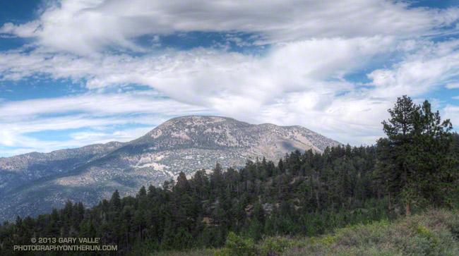
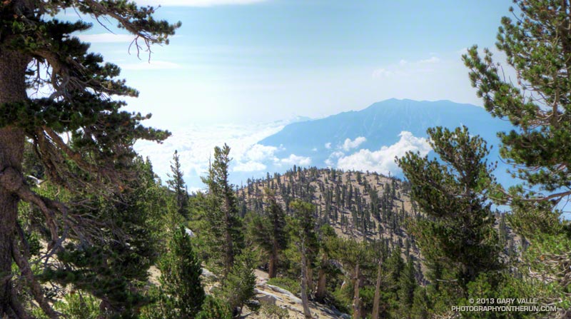
Mt. San Gorgonio via Momyer and San Bernardino Divide Trail.
Distance: 15.0 mi – Gain: 7146 ft – Avg Gradient: 478 fpm – Steepest Mile: 1119 fpm @ mile 4.0

Requires permit. Total distance starting/ending at Momyer is about 26 miles.

Related post: San Gorgonio High Line 2009

Momyer

The Momyer Trail to the San Bernardino Divide Trail.
Distance: 7.1 mi – Gain: 5023 ft – Avg Gradient: 707 fpm – Steepest Mile: 1119 fpm @ mile 4.0

Requires permit. Once up to the San Bernardino Divide Trail there is a choice of around ten peaks over 10,000′.

Related post: San Gorgonio High Line

Falls Creek

Mt. San Gorgonio via Momyer and Falls Creek Trails.
Distance: 15.0 mi – Gain: 6397 ft – Avg Gradient: 481 fpm – Steepest Mile: 872 fpm @ mile 1.7

Requires permit. Total distance starting/ending at Momyer is 24 miles.

Related post: San Gorgonio Mountain – Falls Creek Loop 2011

Vivian Creek

Mt. San Gorgonio via Vivian Creek Trail.
Distance: 9.4 mi – Gain: 5464 ft – Avg Gradient: 585 fpm – Steepest Mile: 920 fpm @ mile 7.7

Requires permit. This is the descent route for High Line and Falls Creek loops.
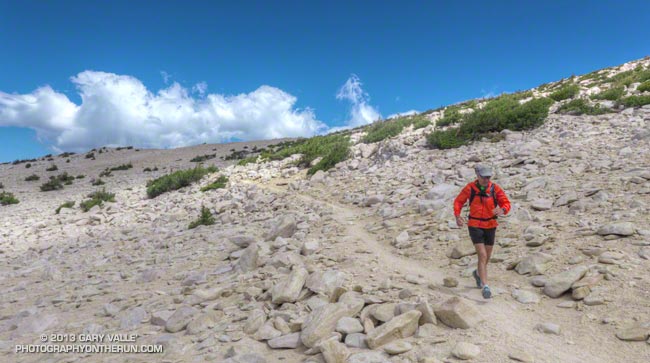
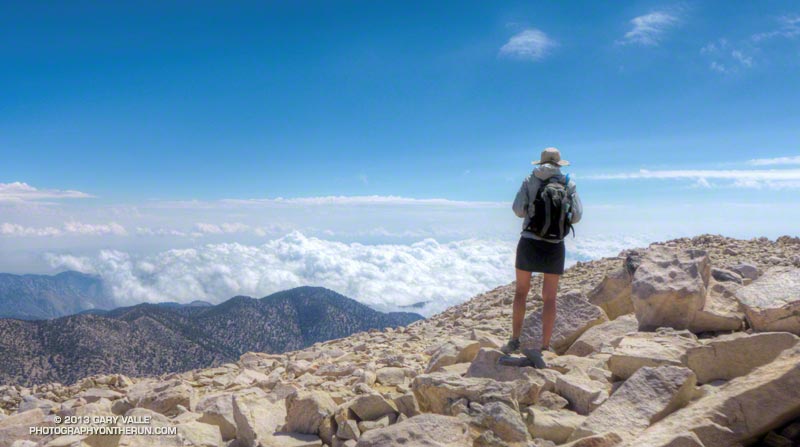
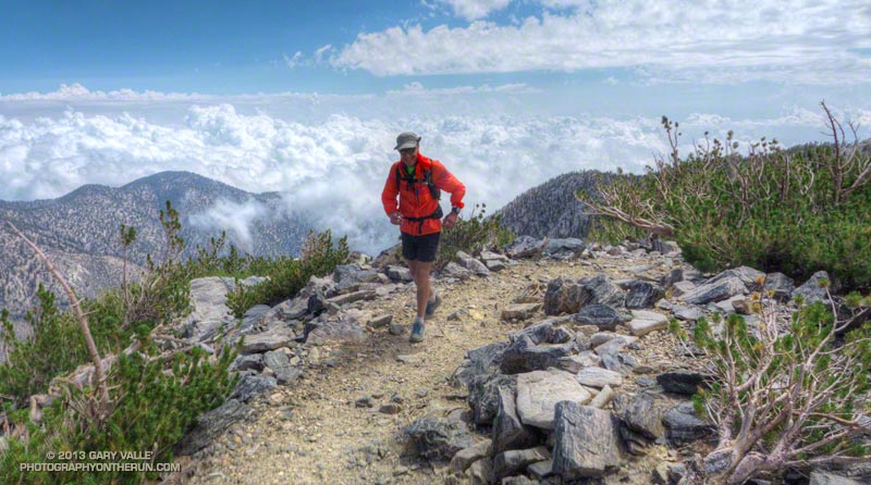
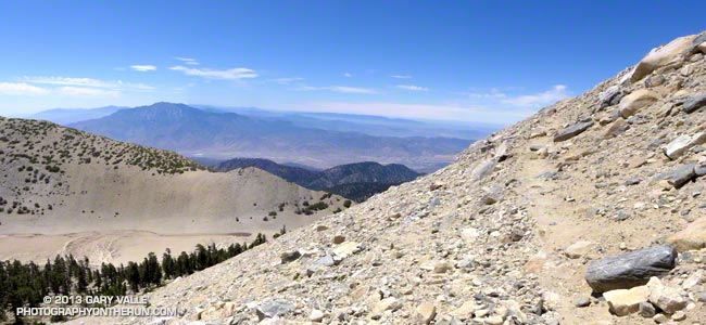
Cactus to Clouds

Mt. San Jacinto via the Skyline Trail, Round Valley Trail and San Jacinto Peak Trail.
Distance: 14.7 mi – Gain: 10812 ft – Avg Gradient: 736 fpm – Steepest Mile: 1499 fpm @ mile 7.3

Requires permit. The biggest hill in Southern California.
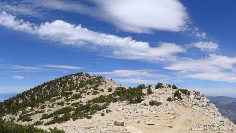
Devils Slide

Mt. San Jacinto from Humber Park via Devils Slide Trail, PCT and San Jacinto Peak Trail.
Distance: 7.8 mi – Gain: 4407 ft – Avg Gradient: 566 fpm – Steepest Mile: 716 fpm @ mile 2.9

Requires permit.

San Jacinto

Mt. San Jacinto from the Long Valley Tram Station via the Round Valley Trail and San Jacinto Peak Trail.
Distance: 5.4 mi – Gain: 2520 ft – Avg Gradient: 470 fpm – Steepest Mile: 709 fpm @ mile 4.4

Requires permit.

Related post: Summery San Jacinto, Smoky Tahquitz Peak

Baldy South Ridge

Mt. Baldy from the Village via Bear Canyon and South Ridge on the Old Mt. Baldy Trail.
Distance: 6.8 mi – Gain: 5811 ft – Avg Gradient: 850 fpm – Steepest Mile: 1273 fpm @ mile 2.1

Related post: Up & Down Mt. Baldy’s South Ridge

Baldy Run to the Top

Mt. Baldy from base of ski lift parking lot.
Distance: 6.9 mi – Gain: 3868 ft – Avg Gradient: 558 fpm – Steepest Mile: 799 fpm @ mile 4.9

Last 0.6 mi to summit is approximately 1090 fpm.

Related post: Mt. Baldy Run to the Top 2009

Baldy Ski Hut

Mt. Baldy from Manker Flat via the Baldy Bowl Trail — aka the Ski Hut Trail.
Distance: 4.4 mi – Gain: 3883 ft – Avg Gradient: 891 fpm – Steepest Mile: 1201 fpm @ mile 2.8

Related post: Back to Baldy

Baldy Register Ridge (New)

Mt. Baldy from Manker Flat via the Register Ridge Trail.
Distance: 3.5 mi – Gain: 3909 ft – Avg Gradient: 1127 fpm – Steepest Mile: 1745 fpm @ mile 0.9

SFBadenPowell

Mt. Baden-Powell from South Fork Campground via Manzanita Trail and PCT. Vincent Gap is at about mile 5.75.
Distance: 10.0 mi – Gain: 5074 ft – Avg Gradient: 510 fpm – Steepest Mile: 805 fpm @ mile 8.6

Part of a 23.5 mile loop from Islip Saddle

Related post: San Gabriel Mountains Running Adventure

Siberia Creek (New)

The Siberia Creek climb starts at Bear Creek and climbs to Forest Service Road 2N11 via the Siberia Creek Trail and a short segment of the Champion Lodgepole Trail. It is part of the Kodiak 100M and 50M courses.
Distance: 6.9 mi – Gain: 3008 ft – Avg Gradient: 435 fpm – Steepest Mile: 698 fpm @ mile 1.4

Related post: Kodiak 50 Mile 2014

Holy Jim

Holy Jim Trail from Trabuco Canyon to Santiago Peak. Was part of Twin Peaks 50K.
Distance: 8.0 mi – Gain: 3921 ft – Avg Gradient: 489 fpm – Steepest Mile: 691 fpm @ mile 5.3

Related post: Blue Skies and Sunshine for the 2010 Twin Peaks 50K & 50M Trail Runs
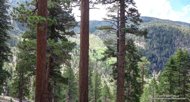
Wilson Trail

Mt. Wilson from Sierra Madre via the Mt. Wilson Trail. Orchard Camp is at about mile 3.5.
Distance: 7.1 mi – Gain: 4720 ft – Avg Gradient: 662 fpm – Steepest Mile: 925 fpm @ mile 4.0

Edison Road (In 06/08/2012 selection.)

Edison Road from the West Fork San Gabriel River to Angeles Crest Highway at Shortcut Saddle. Part of Mt. Disappointment 50K.
Distance: 5.5 mi – Gain: 2027 ft – Avg Gradient: 372 fpm – Steepest Mile: 520 fpm @ mile 3.3

Related post: Mt. Disappointment 50K 2011 Notes

Kenyon Devore

Gabrielino and Kenyon Devore Trails from West Fork to Mt. Wilson. Part of Mt. Disappointment 50K.
Distance: 4.9 mi – Gain: 2622 ft – Avg Gradient: 532 fpm – Steepest Mile: 801 fpm @ mile 1.9

Related post: Trail Work and Tree Rings

SaddlePeakMalibuCyn (In 06/08/2012 selection.)

Saddle Peak from Piuma Road near Malibu Canyon via the Backbone Trail.
Distance: 6.3 mi – Gain: 2350 ft – Avg Gradient: 372 fpm – Steepest Mile: 680 fpm @ mile 4.9

Related post: Bulldog Loop or Saddle Peak Out & Back?

Bulldog

Bulldog Lateral and Motorway from Crags Rd. to Castro Motorway. Part of Bulldog 25K/50K, XTERRA Malibu Creek Challenge and other races.
Distance: 3.4 mi – Gain: 1727 ft – Avg Gradient: 514 fpm – Steepest Mile: 732 fpm @ mile 2.0

Related post: Bulldog 50K 2010 Notes

CorriganvilleRockyPk (In 06/08/2012 selection.)

Corridor Trail from Corriganville to Rocky Peak Rd. Then Rocky Peak Rd to high point near Rocky Peak. Part of Bandit 15K/30K/50K. Does not include initial loop in Corriganville. 50K descends to Santa Susana Pass.
Distance: 3.3 mi – Gain: 1547 ft – Avg Gradient: 464 fpm – Steepest Mile: 836 fpm @ mile 0.6

Related post: Bandit 30K 2009

SantaYnezEagleRock (In 06/08/2012 selection.)

Eagle Rock from Vereda De La Montura via the Santa Ynez Canyon Trail, Musch Trail and East Topanga Fire Road.
Distance: 5.6 mi – Gain: 1292 ft – Avg Gradient: 230 fpm – Steepest Mile: 643 fpm @ mile 1.0

Related post: Clouds, Canyons and Wildflowers

TemescalBackbone (In 06/08/2012 selection.)

Temescal Canyon to the Backbone Trail Junction via Temescal Canyon and Temescal Ridge Trails.
Distance: 5.4 mi – Gain: 1709 ft – Avg Gradient: 318 fpm – Steepest Mile: 760 fpm @ mile 0.8

Related post: Will Rogers – Temescal Loop

Las Llajas (In 06/08/2012 selection.)

Las Llajas Canyon from near Evening Sky Drive to high point above oil field. Part of Bandit 30K/50K
Distance: 4.9 mi – Gain: 1418 ft – Avg Gradient: 290 fpm – Steepest Mile: 625 fpm @ mile 3.1

Related post: Bandit 50K 2011 Notes

Running San Gorgonio: Dollar Lake – Dry Lake Variation

That’s Art and Ann just west of the summit of San Gorgonio Mountain, which can be seen behind them. The peak is the highest in Southern California, with a summit elevation of about 11,500′.

The ascent of the peak had gone well. Including a stop a South Fork Meadows to top off our water, and another quick stop to talk to Dan the Ranger, we’d left the car just after 7:00 and made it to the summit about 10:30 am. With the short-sleeves and shorts summer weather and zero chance of thunderstorm, the summit was a busy place.

We were doing a variation of the South Fork – Dollar Lake Trail – Dry Lake Trail keyhole loop. The variation was that instead of descending the Dry Lake Trail from Mine Shaft Saddle, we continued over to Fish Creek Saddle and descended a “use trail” past (dry) Lodgepole Spring, rejoining the Dry Lake Trail at the Dry Lake outlet.

It seems to me that doing the loop counterclockwise — going up the Dollar Lake Trail — maximizes the runnability of the route as a whole. With spectacular trails and scenery the route is every bit as enjoyable as a run in the Sierra, and is my favorite route up Gorgonio from the South Fork trailhead.

Some related posts: Dollar Lake – Dry Lake Trail Run, Falls Creek Loop August 2013, San Gorgonio High Line 2009

Sugarloaf Mountain from the South Fork Trail

Sugarloaf Mountain from the South Fork Trail just above Horse Meadows, on the way down from an ascent of San Gorgonio Mountain

Sugarloaf Mountain (9952′) is the high point of the Kodiak 100 Ultramarathon, a new ultra being run this Friday, Saturday & Sunday, Sept 20-22, 2013, in Big Bear. A 50 mile course is also being offered.

The 100 mile race begins Friday at 6:00 p.m. at The Village of Big Bear Lake. The summit of Sugarloaf Mountain is at about mile 17.5 of the course. Assuming clear skies, runners will ascend the peak under the light of a 98% full moon. According to the U.S. Naval Observatory data, sunset on Friday will be at 6:47 p.m., with “civil twilight” ending at 7:12 p.m. Moonrise will be at 7:30 p.m. At 9:00 p.m. the moon will be about 18 degrees above the eastern horizon.

The 50 mile race begins Saturday at 6:00 a.m. at about the half-way point of the 50 mile course. Saturday, civil twilight begins at 6:10 a.m., with sunrise at 6:35 a.m. Sunset is at 6:45 p.m., with civil twilight ending at 7:10 p.m. Moonrise Saturday evening will be at 8:08 p.m.

The photo of Sugarloaf Mountain is from the South Fork Trail just above Horse Meadows on the way down from an ascent of San Gorgonio Mountain this August. The south face of Sugarloaf Mountain drops about 3800′ to the Santa Ana River east of Barton Flats.

Note: Sun and moon rise and set times depend on the altitude and location of the observer, and other factors, so may vary a few minutes from the times mentioned above.

San Gorgonio Mountain: Dollar Lake – Dry Lake Trail Run

Craig running on the Sky High Trail on San Gorgonio Mountain

As we rounded the shoulder of Jepson Peak the pyramidal form of San Jacinto Peak came into view. A strong southerly flow was pushing a layer of cumulus clouds up the Coachella Valley, into Banning Pass, and toward San Gorgonio Mountain. Above, a higher layer of clouds was beginning to coalesce.

Moisture from the remnants of Tropical Storm Ivo was being drawn into the monsoonal flow, and if the weather models had it right the increasingly strong flow would result in an increasing chance of thunderstorms over the next few days. Even today the NWS Zone Forecast indicated a slight chance of a showers and thunderstorms:

SAN BERNARDINO COUNTY MOUNTAINS-
330 AM PDT SAT AUG 24 2013
…FLASH FLOOD WATCH IN EFFECT FROM SUNDAY MORNING THROUGH MONDAY
EVENING…
.TODAY…MOSTLY SUNNY IN THE MORNING…THEN PARTLY CLOUDY WITH A
SLIGHT CHANCE OF SHOWERS AND THUNDERSTORMS IN THE AFTERNOON.
WARMER. HIGHS 76 TO 86 ABOVE 6000 FEET TO 88 TO 98 BELOW
6000 FEET. SNOW LEVEL ABOVE 8000 FEET. AREAS OF WINDS SOUTH
15 MPH. GUSTS TO 25 MPH IN THE AFTERNOON. CHANCE OF MEASURABLE
PRECIPITATION 20 PERCENT.


We had left South Fork trailhead a few minutes late, but were making good time. Including stops for photos and a wilderness permit check it had taken us about 2 1/4 hours to reach Dollar Lake Saddle. A quick calculation put us on the summit of Gorgonio around 11:00-11:15. Based on what I was seeing over and around the mountain I thought that we would probably get to summit before weather became an issue. The key word was “probably.” Experience has taught that computer weather models don’t always get it right, and mountain weather often seems to have a mind of its own.

Craig and I were doing the reverse a route I’d done three weeks before. This time at South Fork Meadows we’d turned right at the fork and gone up the Dollar Lake Trail to Dollar Lake Saddle. I was curious to see if the counter-clockwise version of the loop was a better trail run than the clockwise loop.

On the way up to Dollar Lake Saddle we’d stopped to take a closer look at a tall pine I’d noticed on my last run here. It had been struck by lightning. Judging from the width of the scar and its ragged, pitch-covered margins, the stroke had been a strong one and had occurred within the last couple of years. Based on the tree’s elevation (about 8400′), the size of the cones, and the shape of the prickles on the cones, the tree was a Jeffrey pine.


Now we were on the San Bernardino Divide Trail, about 1 1/2 miles beyond Dollar Lake Saddle and about 2 miles from the summit. After doing the peak we would descend via the Sky High and Dry Lake Trails to South Fork Meadows, where we’d refill our hydration packs and continue down the South Fork Trail to the trailhead. We’d be descending directly to Dry Lake, rather than taking the route via Fish Creek Saddle and Lodgepole Spring.

It was chilly! For the first time in several weeks of mountain running I pulled on my sleeves. There was a different feeling about the mountain today. A fitful wind streamed through the branches of the lodgepole and limber pines, its flow noisy and turbulent, and its speed and direction unsettled.


As we worked toward the summit, it was evident the top of the cumulus cloud layer was rising and the clouds in all layers were starting to show more development. On top, I was surprised to see how far the cumulus had pushed up Whitewater Canyon. Everyone on the summit was in good spirits — some more so than others. Now that we were on top we could talk about how spectacular the weather was, rather than how threatening.


The run down from the peak on the Sky High Trail was absolutely superb — and far less rocky than running down to Dollar Lake Saddle on the Divide Trail. At about 10,600′, and a couple of switchbacks above the C-47 crash memorial, we were suddenly surrounded by clouds. This was a treat for us — we were headed down — but for the people headed up the peak it posed a quandry that has faced mountaineers for millennia: Continue up, or go down?


This time, as this Aqua/MODIS satellite image from 2:15 pm shows, San Gorgonio Mountain was on the margin of the monsoon flow. Although there was a lot of cumulus around and over the mountain, most of the major thunderstorm development was to the east and southeast of the peak. The closest automated weather station I could find with measurable rainfall was the Burns Canyon RAWS, 13 miles to the northeast. It recorded 0.17 inch between 2:00 pm and 4:00 pm. The Yucca Valley RAWS, 22 miles away, recorded 0.18 inch between 1:00 pm and 2:00 pm. In the big storms to the southeast, Fish Creek Mountain recorded nearly one inch in one hour.

So which direction of the loop was the better trail run? I’d have to give the edge to the counterclockwise loop — up the Dollar Lake and Divide Trails and down the Sky High and Dry Lake Trails. There is still a lot of very rocky, technical trail — particularly on the Dry Lake Trail, but the outstanding running on the Sky High Trail between 11,400′ and 10,000′ more than makes up for it!

Some related posts: San Gorgonio Mountain: Dry Lake – Fish Creek Saddle – Dollar Lake Loop, San Gorgonio Mountain: Falls Creek Loop August 2013

San Gorgonio Mountain: Falls Creek Loop August 2013

Plummer Meadows on the Falls Creek Trail

Sitting on the summit of Gorgonio I shook hands with Cole and said “Hi” to his friends. They had run up Gorgonio from the Fish Creek trailhead and we were comparing notes. He’d asked how far I’d run from Momyer. I told him “about 13” and commented that I was surprised by the amount of water in the creeks. He commented, “There’s no water on the way up from Fish Creek.” I looked down, and in his pack was a gallon jug of water. One gallon of water weighs 8.3 pounds, but put it in your pack and it feels like a hundred!

Other than a Southern Pacific rattlesnake encounter and a finicky UV pen the ascent from Momyer had gone well. Alger Creek had enough water I had to pick my way across the creek, and the small streams below Saxton Camp and at Plummer Meadows had more than adequate water for filtering. The creeks were lined with with ferns and flowers and there was little hint of the past year’s meager snowpack and rainfall.

One reason might be that the on-again, off-again summer monsoon had been on much of the latter part of July. This resulted in 0.04 inch of rainfall in Downtown Los Angeles July 26 — enough for a record — and rainfall totals of over two inches in some mountain areas. The Fawnskin RAWS, at Big Bear Lake recorded 1.3 inches of rain over the period July 20-26.


The encounter with the rattlesnake had been dicey. After an hour of steep climbing on the Momyer Trail I’d turned east onto the Alger Creek Trail and was running at about 7200′ on a more or less level stretch of trail in an area of gray rocks. Earlier the possibility of a rattlesnake had flitted through my mind, but I’d become lost in a reverie of early morning sun, tall pines, cool temperatures and easy terrain.

The dark gray Southern Pacific rattlesnake might as well have been invisible. As I began an elongated stride over a large gray rock, something moved just beyond the rock. My brain registered “SNAKE!” and then a microsecond later “RATTLESNAKE!!” Adrenalin turned my already elongated stride into an awkward leap that carried me just over the moving reptile.

The snake had been sunning itself on the trail and was as startled as I was. In a panicked movement it wriggled onto a flat rock on the side of the trail and stopped. My momentum had carried me a few feet past the snake and I turned as quickly as I could to try and get a photo. Rattlesnake for sure — heavier body, triangular head with BIG venom glands. When I took a couple of steps toward the snake to get a shot, it said “no way” and slithered into an opening in the talus.


The title photo was taken at Plummer Meadows. The spot is a favorite, and the water source has never failed me. It looked no different today than in any other year. Although the stream is small, the flow was good. The area along the stream was lush and green and decorated with yellow sneezeweed, white ranger’s buttons and magenta fireweed. Tracing the path of the stream up the drainage, it lead to High Meadow Springs; about 1000′ higher and just below the divide.

The pine in the foreground of the photo is interesting. The upper part of its trunk was snapped off some years ago, probably by an avalanche in a very big snowpack year. Given the age of the tree, the big winter of 1968-69 (44 years ago) seems like the most likely candidate.

According to the California DWR report “California High Water 1968-69” during the period January 18-27, 1969, Lake Arrowhead recorded 25.66 inches of precipitation. Given the south-facing aspect and the 9000′-10,500′ altitude of the Plummer Meadows drainage, 30-40+ inches precipitation — much of it in the form of snow — is a possibility. The DWR report indicates that Mt. Baldy (village) recorded 41.6 inches of precipitation during the period January 24-27, 1969! Additional heavy precipitation was recorded in February. This could have translated to 25 feet or more of snow.

From Plummer Meadows the trail climbs about 1000′ over 1.5 miles to Dollar Lake Saddle. Much of the climb is on a well-shaded, northwest-facing slope that can be quite cool. There is a stand of limber pines along this section of trail.


The stretch from Dollar Lake Saddle to the summit is outstanding with far ranging views along and to either side of the divide. I had expected to see a pall of smoke from the Silver Fire and while the visibility wasn’t perfect, it could have been much worse. Including stops for photos and a wilderness permit check it took about an hour and a half to get to the summit from Dollar Lake Saddle. This is about normal for me and I was glad to still have some legs after doing the peak from South Fork the previous week.


How do the three trail runs I’ve done on San Gorgonio compare? Outside of the Sierra, I don’t think there is a better mountain run in Southern California that can be done as day trip than the Falls Creek Loop. The South Fork Dry Lake – Dollar Lake loop is also excellent, but the downhill running on the Dollar Lake Trail isn’t quite as good as on the Vivian Creek Trail. The Highline/Divide loop is the most adventurous and includes the most running above 10,000′, but sections of the trail below the divide are usually overgrown and you have to go off the Divide Trail to get water.

San Gorgonio Mountain: Dry Lake – Fish Creek Saddle – Dollar Lake Loop

Sky High Trail on San Gorgonio Mountain

Sky High Trail a Mile from the Top of San Gorgonio Mountain

Time flies when you’re having fun, and except for kayaking the upper Santa Ana River and a ski ascent or two, the last time I’d been on the north side of San Gorgonio was before Poopout Hill closed in 1988. Curious to refresh my memory of the area and compare a South Fork trail run to those on the Forest Falls side of the mountain, I started thinking about what would be an interesting route to do.


Running in shorts and short sleeves, I’d left the South Fork trailhead about 7:30 and was now about a half-hour into the run. Up ahead was the turn-off to Poopout Hill and not far beyond that the wilderness boundary. I’d been doing a mix of fast hiking and running and enjoying the morning. A black-capped chickadee had stopped on a branch to say hi, and a Steller’s jay was complaining loudly from the top of a pine. Earlier I’d passed Horse Meadows, an iconic scene with sunlight filtering through the trees, green meadows and rustic brown cowboy cabins.


About a quarter mile past Poopout Hill my jaw dropped as I rounded a corner and was suddenly in a sizable avalanche path. A tumult of interleaved  firs and pines lay in a hundred yard wide swath that extended thousands of vertical feet up the mountain.

This avalanche likely occurred within a few days of January 23, 2010, following (or during) a multi-day rain and snow event in Southern California. Over the seven day period from January 17 to January 23, the rain gauge at Mill Creek recorded 7.82 inches of precipitation. According to a NWS report, Mt. Baldy recorded 7′ of snow at the 8600′ level. The source area of the avalanche appears to have been in a cirque near peak 10,230.


Working up the hill toward South Fork Meadows I stopped to chat with a Ranger, who checked my wilderness permit and mentioned a group of day hikers had left South Fork very early and were ahead of me.

At the Dry Lake/Dollar Lake fork at South Fork Meadows I turned left onto the Dry Lake Trail. I already heard water, so one question was answered — there was plenty of water at South Fork Meadows. Comments on the Water Info Collector had said Lodgepole Spring was low, but “flowing OK,” so the plan was to top off my water there.


Dry Lake was indeed dry, but the meadow in its place and backdrop of sculptured mountains was still impressive. The next stop was Lodgepole Spring; I just had to find the use trail leading to it. This was one of those situations where it’s important to note the details of the topography. There are two areas that people camp at Dry Lake (noted on a sign) and the use trail is in the drainage above the second, more southerly camp.


After talking to some campers I followed the trail around the east side of Dry Lake and into the primary camping area.  After working up the drainage a couple tenths of a mile I found a small spring flowing out of some willows. Rather than taking the time to use a UV pen, I used a makeshift cup to fill a one liter  collapsible water bottle with a built-in filter. Hopefully that, and what was left in my pack, would get me up to the peak and back down to South Fork Meadows.


The “use” trail from Lodgepole Spring was not too difficult to follow and it took about 30 minutes to get up to Fish Creek Saddle. The trail between Fish Creek Saddle and Mineshaft Saddle more or less follows the 9880′ contour line and was reasonably runnable. It passes through an area of lodgepole pines killed by the mountain pine beetle.


In a few minutes I rejoined the regular Dry Lake route at Mine Shaft Saddle and started up the increasingly scenic Sky High Trail. About a mile up the trail from Mine Shaft Saddle is wreckage and a memorial to the personnel of a Douglas C-47 that crashed in a snowstorm on December 1, 1952. The C-47B “Gooney Bird” was a military version of the venerable DC-3 airliner.

The Sky High Trail earned its name as it switchbacked up to 11,000′, and wrapped around the south side of Gorgonio’s summit. From the  airy trail there are stunning views past The Tarn to Banning Pass and Mt. San Jacinto. The Sky High Trail joined the Divide Trail a little east of the Vivian Creek Trail junction and in a couple of minutes I was jogging east across the summit plateau to the blocky summit of San Gorgonio Mountain.

According to the Trail Mileage Handout (PDF) from the San Gorgonio Wilderness Association the descent from the summit by way of Dollar Lake Saddle and the Dollar Lake Trail is about 10.7 miles — which is a little shorter than the 11.4 miles listed using the regular Dry Lake route. (Mileage doesn’t include the side trip to Lodgepole Spring.) Even so, I think the Dry Lake route is the preferred route from South Fork Meadows. It’s more scenic and aesthetic.


The running was technical, but good down to Dollar Lake Saddle. Below Dollar Lake Saddle the trail was often very rocky. This lightning-scarred pine was on one of the last switchbacks before South Fork Meadows. I was happy to get down to South Fork Meadows, get some water, and get onto a better trail! By about 3:30 pm I was back at the car and enjoying an ice cold bottle of water.

Some related posts: Falls Creek Loop 2012, San Gorgonio High Line 2009