Category Archives: trails|san gorgonio

San Gorgonio Mountain – Falls Creek Loop 2012

Falls Creek Trail on San Gorgonio MOuntain

Models didn’t show the upper level cutoff low affecting Southern California until Monday or Tuesday at the earliest. But upper level lows tend to be notoriously unpredictable, so I’d been checking the computer weather models and NWS forecasts every day. The NWS forecast for today’s run/hike to the summit of San Gorgonio looked pretty good:

“Partly cloudy. Highs 59 to 69 above 6000 feet to 69 to 79 below 6000 feet. Areas of winds west 15 mph in the morning becoming light. Near ridge tops and along desert slopes… Areas of winds southwest 15 mph…Gusts to 25 mph in the morning.”

The weather was even better than suggested in the forecast. It was short-sleeves and shorts all the way up to the top and back down. Temps were pleasant and winds light on the 11,503′ summit. (NAVD88 elevation – PeakBagger.com.) It was warmer at the higher elevations and cooler at the lower elevations than last year’s run and about as good as it gets for a trail run encompassing an elevation range of 6000 feet.

The title photo is from about 8000’on the Falls Creek Trail — only 3500′ of elevation gain to go! Here are a few more photos:


Falls Creek Trail Near Saxton Camp


Divide Trail Near Jepson Peak


Chutes on Jepson Peak


Summit & San Jacinto


Top of San Gorgonio


Starting the descent


Some related posts: San Gorgonio Mountain – Falls Creek Loop 2011, San Gorgonio Mountain – Falls Creek Loop

San Gorgonio Mountain – Falls Creek Loop 2011

Falls Creek Trail near Plummer Meadows

I don’t say this very often, but it was great to be running on pavement — smooth, even, consistent pavement. All I had to do was put one foot in front of the other and chug on down the blacktop.

I was running down Valley of the Falls Drive from the Vivian Creek trailhead to the Momyer Creek trailhead after ascending San Gorgonio Mountain (11,499′). San Gorgonio is the highest peak in Southern California, the nearest higher peaks being Charleston Peak (11,916′) west of Las Vegas, and Olancha Peak (12,123′) in the Sierra Nevada.


The Momyer Creek and Vivian Creek trailheads are in Mill Creek Canyon, near Forest Falls, on the south side of San Gorgonio Mountain. It only takes me a few minutes longer to drive to the Momyer Trailhead than to drive to Islip Saddle in the San Gabriels, or the Chula Vista trailhead on Mt. Pinos. Momyer is another great option for a scenic, challenging, higher altitude trail run that’s relatively close to home.

There are two routes I like to do on the Forest Falls side of the mountain — the High Line and the Falls Creek loops. Both start/end at Momyer and descend via the Vivian Creek Trail.

Today I’d done the Falls Creek route. This adventurous run features 24 miles of mostly technical trail that gains and loses about 6600′ and tops out at 11,499′. It’s comparable in effort and time to a tough SoCal style 50K. The High Line route is even more of a challenge.

The day had been one of those perfect, cloudless, crystalline days you get in the Autumn, with hundred mile visibility, empyrean blue skies, rich yellow leaves, and long cold shadows.

Following last Winter’s good snowfall and runoff, and the unseasonably strong storm earlier this month, springs and streams were flowing well. On the way I stopped for water at Plummer Meadows, and on the way down at High Creek. Even though I’ve been doing adventures in the mountains for decades, it’s still a little surprising how much water is needed on a higher altitude run, especially when the humidity is low.

Recently someone asked me what kind of water filter I use with a hydration pack. I’ve used three approaches for water treatment when the water source is a “good” one and treatment is a precaution.

Updated September 19, 2017

– UV light pen. SteriPen appears to be the most widely used outdoor UV water purifying pen, and several versions are available. I’m currently using the Steripen Adventurer.
– Inline filter. Before UV pens were widely available and accepted I would occasionally use an inline filter. When dry, the filter was lightweight, however its flow rate was barely adequate. The brand I used to use is no longer available, but the Sawyer 3 Way Water Filter looks similar. Specs say it weighs 1.8 oz.
– No treatment. This is the lightest and fastest option, but having watched a climbing friend fight giardia for a year and lose a shocking amount of weight and strength, I can’t recommend it.

In the Wikipedia overview of portable water purification a writer comments that “studies have shown that UV doses at the levels provided by common portable UV units are effective at killing Giardia and that there was no evidence of repair and reactivation of the cysts.”


The range of temperatures on today’s run was extraordinary. It was cool on the summit — in the low forties — but the coldest temperature was on the shaded slopes below Dollar Lake Saddle (10,000′). Here the temperature had been a chilly thirty-something. Down in Mill Creek Canyon at the end of the run the temperature felt like it was in the mid-eighties. The Mill Creek RAWS, near the ranger station, recorded a temperature of 92 degrees  in the mid afternoon with a relative humidity of only 12%.

One of the highlights of today’s run is that there were still patches of snow above 10,000′ from the storm on October 5th! One big patch at 11,000′ was beginning to become sun-cupped. I don’t think I’ve seen sun-cupped new snow in Autumn before!

The title photograph is from the Falls Creek Trail near Plummer Meadows. Dollar Lake Saddle and Charlton Peak loom above.

Some related posts: San Gorgonio High Line 2009, San Gorgonio Mountain – Falls Creek Loop

San Gorgonio High Line 2009

San Bernardino Mountain Divide from near Charlton Peak

San Bernardino Mountain Divide from near Charlton Peak

As I approached the spur trail to High Meadow Springs, I tried to convince myself I had enough water to continue. The problem wasn’t the third of a mile detour down to the spring, or even the 280′ loss of elevation. The problem was the interruption. Having to get water was like having to stop to remove an annoying little rock from your shoe. You know you should, but one mile passes, then two… The running along the 10,500′ crest on the Divide Trail was just so spectacular, I didn’t want to stop!

I reached behind my back and squished the Camelbak reservoir with my hand. Yea, there’s plenty of water, I don’t have to stop. I can make it to the summit of Gorgonio, and then get water at High Camp on Vivian Creek on the way down.


But hadn’t I nearly run out of water the last time I did this? I did a rough calculation of the distance… about four miles to the peak, with a gain of 1500′, and then another four miles to the creek. Reluctantly, I slowed, and turned off the Divide Trail

At the spring, I pulled the reservoir from my pack. Only about 25 oz. of water remained. The little spring burbled and gurgled energetically, and it didn’t take long to replenish my water supply. East of Shields Flat, the trail to High Meadow Springs is about a quarter-mile below the point marked 10,500 on the topo, and about half a mile above Red Rock Flat. At an elevation of 10,120′, the springs sit near the top of a steep canyon that drops down to Plummer Meadows. It’s an airy location with an expansive view.

Earlier, I had chugged up the Momyer Creek Trail to the San Bernardino Peak Divide Trail. Once past the turn to Alger Camp, this trail becomes more of a  footpath, weaving its way through a middle elevation forest of pine and fir, around innumerable bark beetle felled Jeffrey pines, and up to a high mountain habitat of chaparral and Lodgepole pine.


If stretches of trail with a 30% grade are not enough of a challenge, the last couple of miles to the divide include overgrown sections that will not only slow the shorts clad hiker or runner, but over time become annoyingly painful. Chinquapin is your friend, manzanita an adversary, and whitethorn your archenemy. And there is a lot of whitethorn.

After visiting High Meadow Springs, I continued down to Dollar Saddle. Beyond this point I expected to see an increasing number of hikers. The previous Saturday it had been exceptionally busy on Mt. San Jacinto, and the weather was even better today. Eventually, near Jepson Peak, I encountered a couple of hikers returning from the summit, and then passed a couple more working up the trail. But that was it — and the summit of San Gorgonio was empty. Unusual for such a perfect Autumn day.

Here’s a Cesium browser View of a GPS trace of the 26 mile route, and an elevation profile generated by SportTracks. The approximate elevation gain and loss was about 7000′.

Related post: San Gorgonio High Line, San Gorgonio Mountain – Falls Creek Loop

San Gorgonio Mountain – Falls Creek Loop

Falls Creek trail on Mt. San Gorgonio.

Lowland blues got you down? Are you beginning to think faux pine tree cell towers aren’t that ugly? Do you gaze longingly at distant mountains and then realize you’re looking at a billboard?

When I feel that way, one of the close-to-home hikes/runs that satiates the alpine craving is the Falls Creek loop on Mt. San Gorgonio. The ‘Falls Creek up, Vivian Creek down’ route has been a high mountain favorite of mine for a number of years. It is as rigorous as it is beautiful. About 24.5 miles long, it gains approximately 6600′ on the way to the 11,499′ summit of San Gorgonio.

Even at 7:30 in the morning, the climb out from the Momyer trailhead on the steep, south-facing slope of Mill Creek canyon had been warm, but in about an hour we were in the firs and pines, and contouring into the shaded drainage of Alger Creek. Another 30 minutes and the trail has joined the route of the original Falls Creek trail — climbing to the eastern side of the divide between Alger Creek and Falls Creek and turning north as it entered the Falls Creek drainage. (A spur trail descends to Dobbs Camp.)


Small stream below Saxton Camp.
The trail up the Falls Creek drainage has few switchbacks and is deceivingly steep, but the segment is one I always enjoy. Near Saxton Camp its course works back into a lush side canyon, where it crosses an idyllic stream in a pastoral mountain setting. Above Saxton Camp, the area has an isolated, big sky, big mountain feel. Bright green slopes of manzanita extend upward for miles, and stale flatland sights, smells and sounds are displaced in favor of deep blue skies, the minty fragrance of pennyroyal, and the raucous shouts of Stellar’s jays.

Just get me to Dollar Lake Saddle… Please! I don’t know what it is about this section of trail, but the short 1000′ climb from Plummer Meadows to Dollar Lake Saddle is always tougher than I expect. Maybe it’s the altitude, maybe it’s the miles I’ve run during the week, or maybe it’s a gravity anomaly — whatever, it’s a relief to get to the saddle.


Lodgepole pine above the Jepson - Little Charlton Peak Saddle.
Above the saddle, the trail becomes more airy and alpine, and at times there are views of the summit area of Gorgonio and down Gorgonio’s north face. Adrenalin flows and the effort required seems to ease. Sometimes running, sometimes hiking, we continue up the rocky path.

About an hour above Dollar Lake Saddle, we jog across a nice flat stretch of trail just below Gorgonio’s summit. It’s around noon when Andrew and I weave our way through a final few boulders to the summit. Relaxing on the summit, we chat with others about their routes, and talk about running and the mountains.

In February, Andrew caught the trail running bug. In May he completed his first ultra — a fifty miler. Now he’s training to run the Angeles Crest 100 mile endurance run in September. Today’s ascent of San Gorgonio is the first of two long mountain trail runs he will do this weekend.

After about 15-20 minutes on the summit, we jog back to the Vivian Creek trail, jump on the escalator and head down. There are the usual stops to get water at Upper Vivian Creek (the last water was at Plummer Meadows), and to take a few photographs. There’s also a quick stop to have our wilderness permit checked.

Around 2:50 we’re off the mountain and crossing Mill Creek, and in a few minutes we’re running down the blacktop and back to Momyer.

Here’s a Google Earth image and Google Earth KMZ file of a GPS trace of the loop. Surprisingly, it is only about 1.5 miles shorter than the “high line” loop that ascends East San Bernardino Peak before traversing to Mt. San Gorgonio.

Related post: San Gorgonio High Line

Google Earth KMZ Files of Southern California Trail Runs

Introduced around 2000, the Garmin eTrex was the first GPS unit I used to trace a trail run. The GPS tracks were imported into TOPO! where the length of a run could be measured, an elevation profile generated, and the topography of the run examined.

Since the eTrex was designed to be used in an “orienteering” position — flat in your hand in front of your body — it would frequently have trouble receiving GPS satellite signals if hand-carried while running or hiking. About the time enterprising hikers and runners began to resolve this issue with creative hats, holsters and harnesses, Garmin released the Forerunner 201, greatly simplifying the task of tracing a route.

In 2005, while preparing a presentation about kayaking Piru Creek for a meeting with the Forest Service, I stumbled onto Keyhole.com. To say I was blown away by this bit of “Eureka” technology would be an a gross understatement. Now, in addition to seeing Piru Creek in photographs, and on a topo map, you could get a “before you paddle” preview using Keyhole — even if you couldn’t paddle class IV whitewater! Google acquired Keyhole in late 2004 and launched Google Earth on June 28, 2005.

Shortly after Google Earth was launched, SportTracks added the ability to launch Google Earth and view the GPS trace of a run or other activity. Since SportTracks could also directly import data from Garmin’s Forerunner, the software made it very easy to view a run in Google Earth.

I’ve been working on updating the posts on Photography on the Run that reference a trail run to include a link to a Google Earth KMZ file. A KMZ file is just a zipped KML file, and either can be opened in Google Earth. A list of the trail runs with KMZ file links can be found by clicking “Google Earth KMZ Files of Trail Runs” in the sidebar.

These are actual tracks recorded by a GPS during a trail run and may contain GPS errors, route-finding errors, and wanderings that are difficult to explain. In a few instances tracks have been modified to correct errors, or to remove side excursions that are not part of the usual route, but not all errors have been corrected. No claim is being made regarding the appropriateness or suitability of the routes indicated.

San Gorgonio High Line

Mt. San Jacinto from the summit of San Gorgonio Mountain

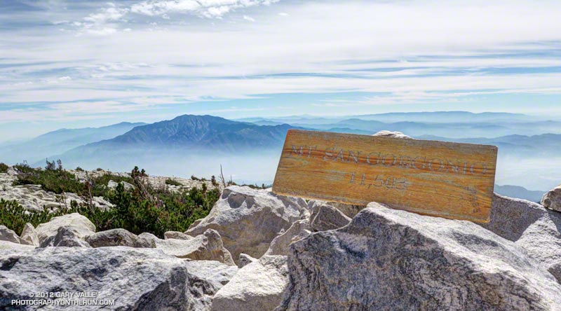
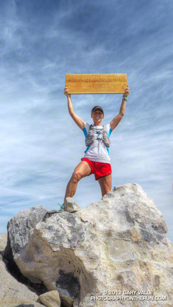
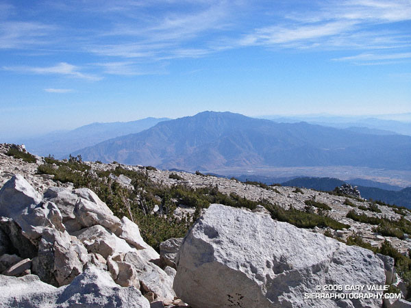
One of the other climbers commented, “It’s almost eerie.” And it was. On the 11,499′ of San Gorgonio Mountain there was not a breath of wind and the temperature was a comfortable 50-something degrees. Wisps of cirrus accentuated the azure sky, and to the southeast San Gorgonio’s ever-present companion, Mt. San Jacinto, stood quietly above Banning Pass.


San Bernardino Peak and the Mt. Baldy area from the summit of East San Bernardino Peak.
A couple of hours before I had been sitting on the summit of East San Bernardino Peak, debating whether to continue my planned trek to San Gorgonio. I was considering running over to San Bernardino Peak instead, and then calling it a day. For sure I couldn’t do both. I didn’t have enough water, and the only nearby water source might be dry.

A month old report from the Water Collector had noted water “barely trickling” out of the pipe at Trailfork Springs. I wasn’t familiar with the spring, and given the pessimistic report probably wouldn’t do the required detour to check it out. So whatever I did, my remaining water would have to do. If I didn’t push too hard, it would get me to San Gorgonio, but probably not over to San Bernardino Peak and then to Gorgonio. (Note: A better late season water source is High Meadow Springs. The springs and camp site is about 1/3 of mile below the Divide Trail, east of Shields Flat. The turn off to the spring is between high point 10500 and Red Rock Flat. On a run of this course in late October 2009 the spring had a good flow.)

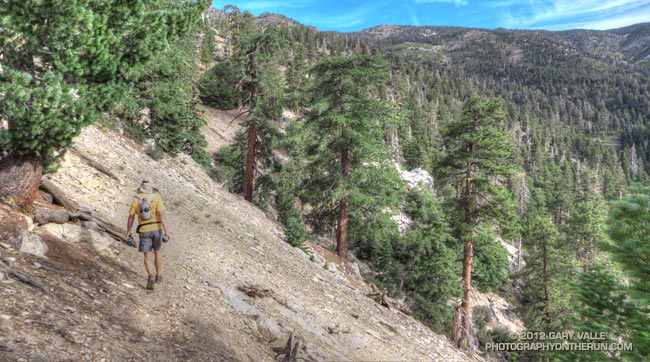
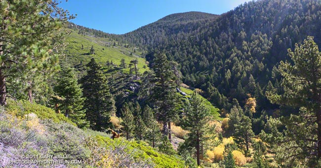
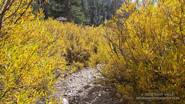
The hike up from Momyer had been unrelenting – a gain of 5250′ in elevation over about 7.5 miles. It was kind of like going up the Palm Spring Tram, without the tram. Beyond the turn-off to Alger Camp the character of the trail changed from obvious and well-trodden, to a schizophrenic path that in places was the kind of trail that only the really adventurous enjoy.

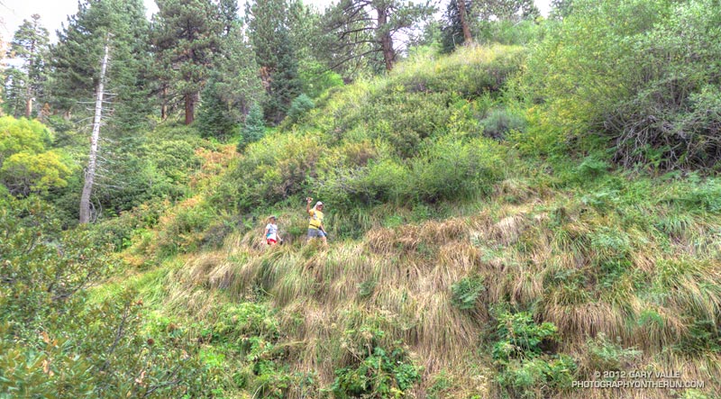
There were numerous downed trees, stark evidence of the bark beetle infestation. Although most could be bypassed or clambered over, one recently downed tree required a face in the dirt belly crawl. In other areas the manzanita, chinquapin, and whitethorn were so thick that the trail, though nearly invisible, could not be lost. Upward progress was possible by only one route.


Saddleback (Santiago Peak) from slopes below East San Bernardino Peak.
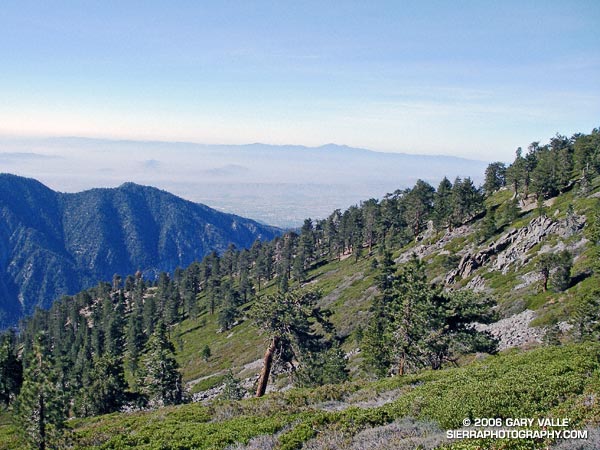
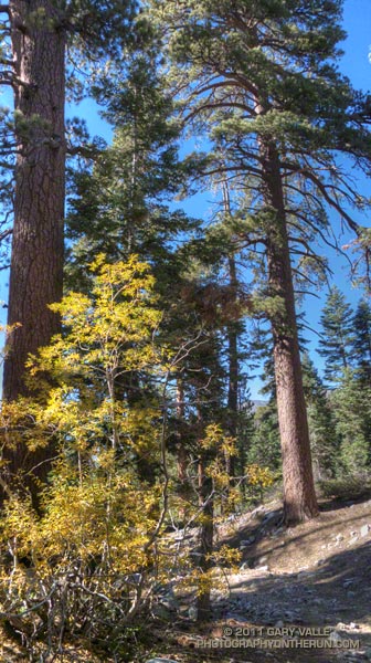
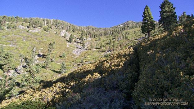
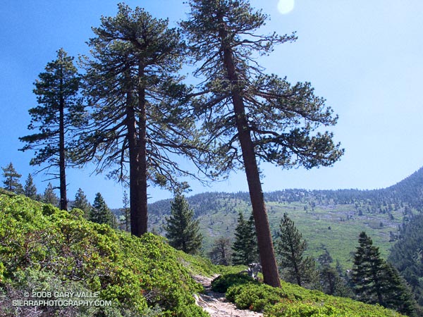
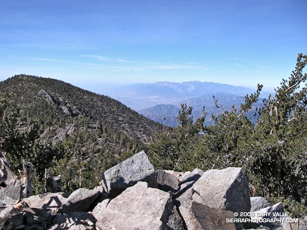
In counterpoint to these inconveniences were the early morning views of Mill Creek Canyon, idyllic sections of forested trail, Clark’s Nutcrackers and gnarled Lodgepole pines on the high mountain slopes, and outstanding views of Saddleback and Mt. San Jacinto. Near one fallen tree an opportunistic red paintbrush bloomed as if it were Summer. It is better to be positive…

Back on East San Bernardino Peak, I needed to make a decision – San Bernardino Peak or San Gorgonio? Instead I wandered about the peaklets in the area, not really heading in the direction of either peak, but evaluating how I felt and thinking through scenarios… Feel OK… Full moon tonight… Enough water to get to the peak… Water at Vivian Creek… Weather great… Know the route… After a few minutes, I found myself bearing slowly to the east, picking up the Divide Trail and starting to run.


San Gorgonio Mountain from East San Bernardino Peak.
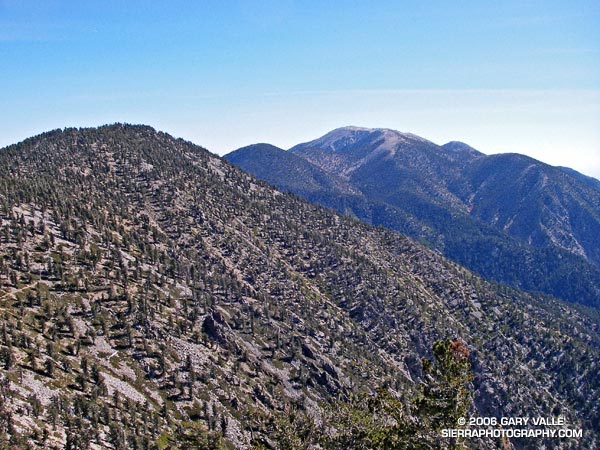
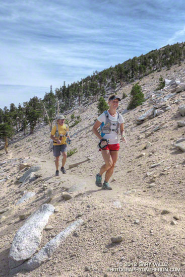
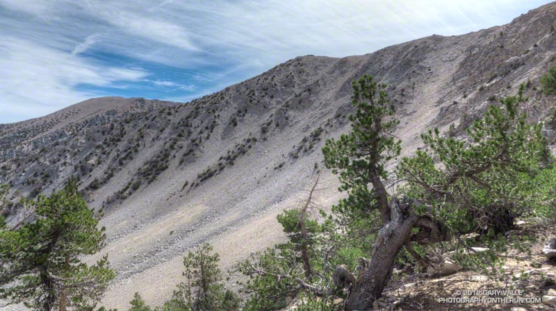
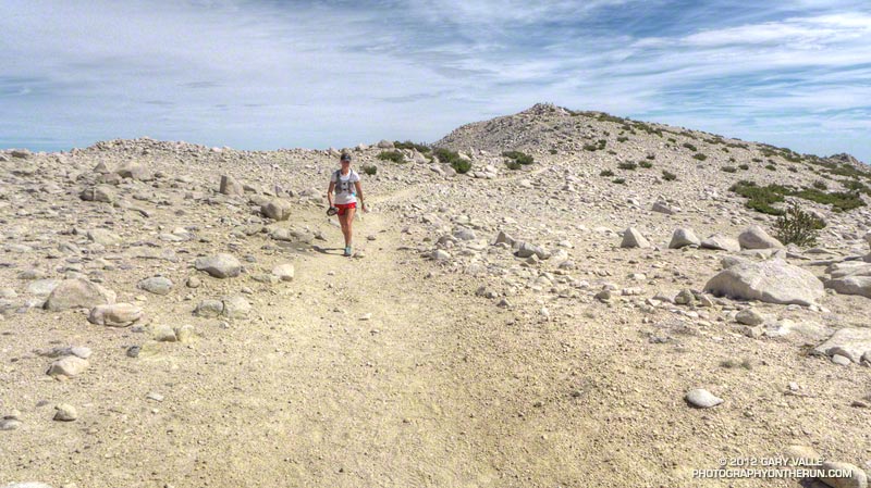
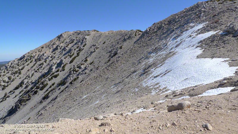
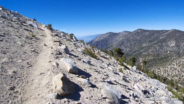
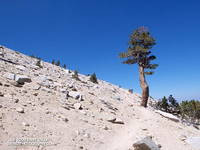
The distance by trail from East San Bernardino Peak to Mt. San Gorgonio is about 8 miles. Virtually all of route is above 10,000′ and along a spectacular mountain divide. The running on this high line is unmatched in Southern California. Once on the Divide Trail and headed in the direction of San Gorgonio there was no thought of turning back. Perhaps the biggest difficulty was resisting the ascent of the many named peaks along the way. Without more water, most of these would have to wait until a another day.


Epilogue: The climb from Momyer (5500′) to East San Bernardino Peak (10,691′) took about 3 hours, and the traverse over to Gorgonio (11,499′) about 2.5 hours. I reached the summit of Gorgonio at about 1:00 p.m, and after running down the Vivian Creek trail, and through Forest Falls, made it back to Momyer at about 4:00 p.m.

The distance to the summit of Gorgonio from Momyer via East San Bernardino Peak is about 15.5 miles, and the total length of the loop is about 26 miles. About 11 miles of the route is above 10,000′ and the total elevation gain and loss is on the order of 7000′. If you include Alto Diablo, there are nine named peaks above 10,000′ along the route. Dobbs Peak is somewhat further from the trail than the others, but rounds out the total to ten. Here is a Google Earth image and Google Earth KMZ file of a GPS trace of the loop.

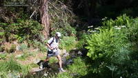
Note: Mill Creek can be difficult and dangerous to cross.

Related post: San Gorgonio High Line 2009

Google search: $g(trail running), t$(San Gorgonio Mountain)