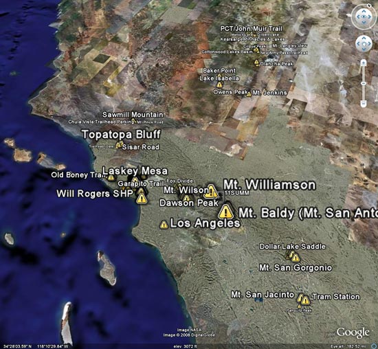
If you were going to pick the most pleasant conditions possible to ski San Jacinto Peak (10,834′), today’s weather would be hard to top. The midday temperature on the summit of the peak was around 40-45 degrees. Winds were light, and it was pull-up-your-sleeves warm — but not broiling — most of the way up the peak.
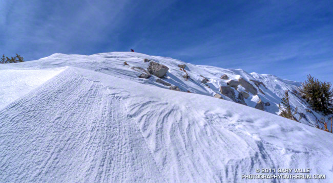
There was still a lot of untracked snow from last week’s storm, and overall the snow conditions were very good, especially on the steeper, sun warmed slopes southeast of the summit, and in the trees lower on the peak. Here are a few additional photos. Click for a larger image and description:
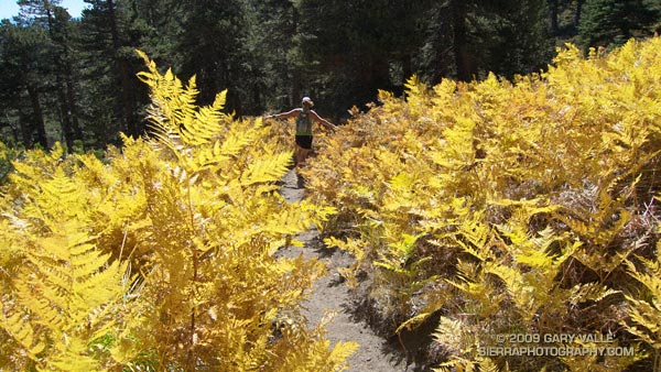
Spectacular Autumn trail running along Wellman Cienega in the San Jacinto Wilderness.
Lush with ferns and corn lilies in the summer, Wellman Cienega is a mountain seep high on the eastern slopes of Marion Mountain. It’s a couple of miles into an excellent 5 mile downhill segment from the top of San Jacinto to Saddle Junction.
From today’s trail run to San Jacinto Peak (10,834′) and Tahquitz Peak (8828′) from the top of the Palm Springs Tram at Long Valley.
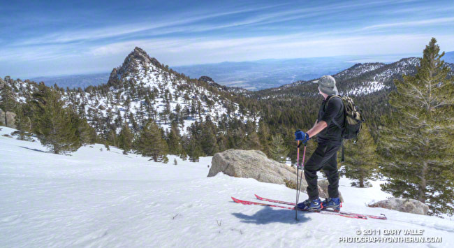
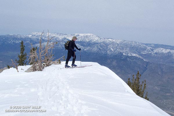
The wind had been blowing in fitful gusts, but calmed as I approached the precipice. Despite its foundation of granite, I felt exposed out on the narrow promontory of snow. Just beyond the tips of my skiis, the north face of San Jacinto Peak dropped 8500 dizzying feet to the desert floor.
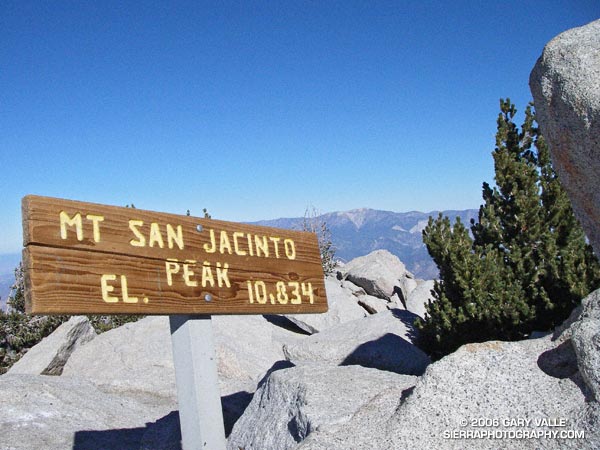
The summit of San Jacinto (10,834′) is always spectacular, but with the addition of snow it is transformed into a peak with a high mountain character — a wild and wintry landscape shaped by wind and weather.
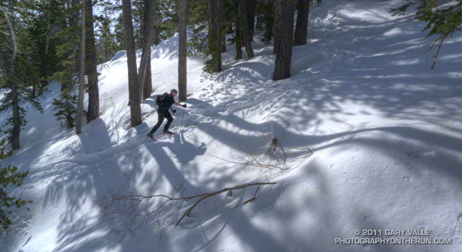
Our route to the summit was only four miles long, but with 8 lbs. of ski, boot and binding latched to each foot, the 2400 ft. ascent from the Long Valley ranger station had been strenuous. Rather than following the trail southwest toward Round Valley, we chose to ascend the east-west trending drainage that leads to Tamarack Valley. The steep maze of snow pillows, rocks and trees is a more direct alternative to the well-used Round Valley trail.
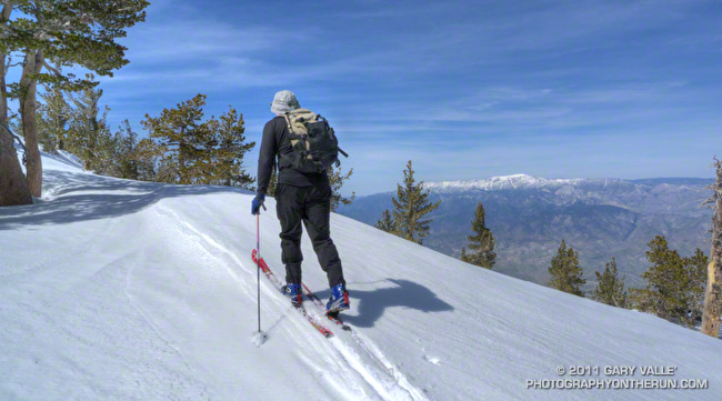
Once out of the maze, we continued west past Tamarack Valley, eventually working up onto the slopes below Miller Peak. From here we switchbacked up the bowl to the saddle between Miller and San Jacinto. From the saddle it was a scenic half mile up the broad east ridge to the summit. Here’s a Google Earth image, a Google Earth KMZ file, and a Cesium ion view of a GPS trace of our route.
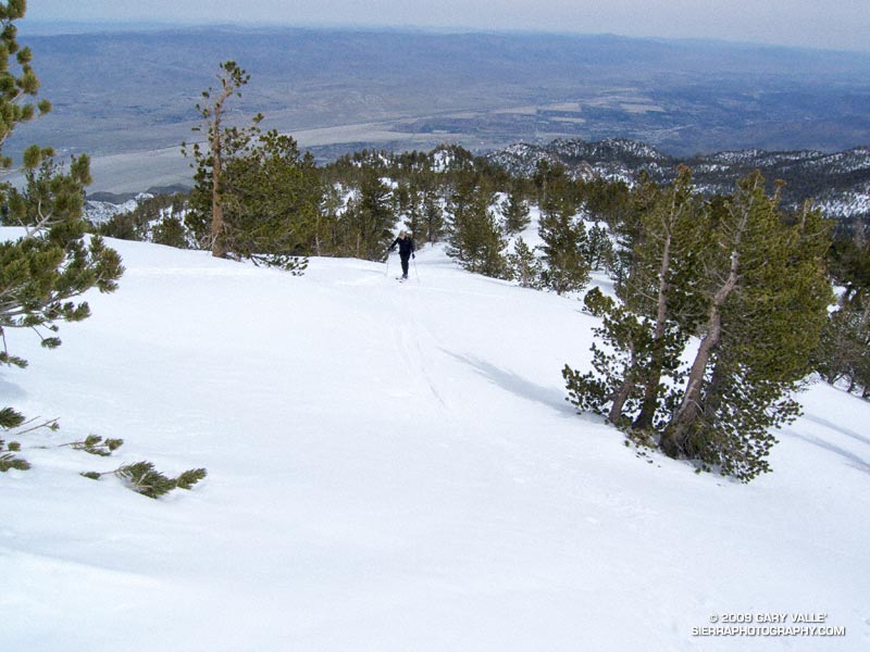
Like any real world mountain, the snow conditions on San Jacinto are not always the best. However, today the snow was pretty good — maybe a 7 or 8 out of 10. It had snowed a few days before, and temps were just starting to warm up. The top 4-5 inches of the pack were dense, and the surface was soft. The sun was muted my a thin veil of high clouds, so the snow did not vary much in and out of the trees.
As we removed our climbing skins and prepared to ski down, Charles and I reminisced about skinny ski descents of San Jacinto, and other peaks. Like sticky rubber on rock climbing shoes, shaped skiis had changed the sport. Easier to manage and turn, shaped skiis handle crud so much better than long, narrow skiis with little side cut.
My initial turns off the summit were a bit tentative, but improved as we skied down through the Lodgepole pines on the east ridge. By the time we dropped into the big bowl southeast of the summit, I was getting my ski legs back, swinging turns, and feeling like it had been 3-4 weeks, rather than 3-4 years, since I had skied here.
Introduced around 2000, the Garmin eTrex was the first GPS unit I used to trace a trail run. The GPS tracks were imported into TOPO! where the length of a run could be measured, an elevation profile generated, and the topography of the run examined.
Since the eTrex was designed to be used in an “orienteering” position — flat in your hand in front of your body — it would frequently have trouble receiving GPS satellite signals if hand-carried while running or hiking. About the time enterprising hikers and runners began to resolve this issue with creative hats, holsters and harnesses, Garmin released the Forerunner 201, greatly simplifying the task of tracing a route.
In 2005, while preparing a presentation about kayaking Piru Creek for a meeting with the Forest Service, I stumbled onto Keyhole.com. To say I was blown away by this bit of “Eureka” technology would be an a gross understatement. Now, in addition to seeing Piru Creek in photographs, and on a topo map, you could get a “before you paddle” preview using Keyhole — even if you couldn’t paddle class IV whitewater! Google acquired Keyhole in late 2004 and launched Google Earth on June 28, 2005.
Shortly after Google Earth was launched, SportTracks added the ability to launch Google Earth and view the GPS trace of a run or other activity. Since SportTracks could also directly import data from Garmin’s Forerunner, the software made it very easy to view a run in Google Earth.
I’ve been working on updating the posts on Photography on the Run that reference a trail run to include a link to a Google Earth KMZ file. A KMZ file is just a zipped KML file, and either can be opened in Google Earth. A list of the trail runs with KMZ file links can be found by clicking “Google Earth KMZ Files of Trail Runs” in the sidebar.
These are actual tracks recorded by a GPS during a trail run and may contain GPS errors, route-finding errors, and wanderings that are difficult to explain. In a few instances tracks have been modified to correct errors, or to remove side excursions that are not part of the usual route, but not all errors have been corrected. No claim is being made regarding the appropriateness or suitability of the routes indicated.
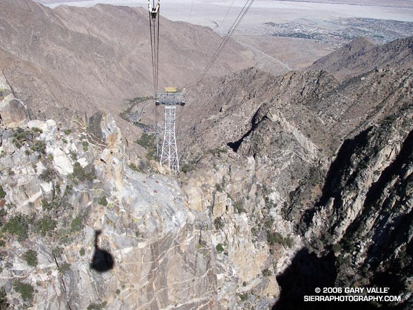
The intimidating canyon rose steeply above me. Towering rock precipices lined the canyon walls, their summits glistening in the morning sun. I was at an elevation of about 2600′ and it was already warm. A little unsteady, and moving slowly at first, I started the ascent. Gaining speed, I passed the first rock face, and after a minute or two, turned to gaze at Palm Springs and the Coachella Valley. In what seems like a matter of minutes, yucca and creosote transitioned to mountain mahogany and juniper, and then to pine and fir. Suddenly my pace slows, there is a bump, a jostle, and a pause. The operator announces, “Welcome to the mountain station of the Palm Springs Tram. The elevation is 8516’…”
Palm Springs Tram
A 10 minute ride from the desert to the pines on the Palm Springs Tram isn’t a bad way to start a run. A couple of weeks before I had seen Mt. San Jacinto from the North Backbone Trail and it reminded me that I hadn’t done that peak in a while. As the weekend approached it looked like the weather would be perfect for a long mountain run.
Mt. San Jacinto State Park and Wilderness contains a network of over 50 miles of trails, including a segment of the Pacific Crest Trail. The resourceful runner or hiker can put together an adventure ranging from a few miles to 30 miles or more. I hoped to beat the worst of the Sunday going home traffic, so opted for an approximately 20 mile route that would get me back to the tram in the early afternoon.
Stopping at the ranger station in Long Valley, I filled out a wilderness permit. Cool air had pooled in the valley overnight, and the deck of the station was still in shade. The ballpoint pen protested the 40-something degree temperature, but with repeated attempts, I scratched in my destinations: Mt. San Jacinto and Tahquitz Peak.
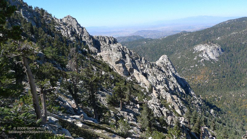
The summit of Mt. San Jacinto, with Mt. San Gorgonio (11,499′) in the distance.
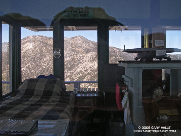
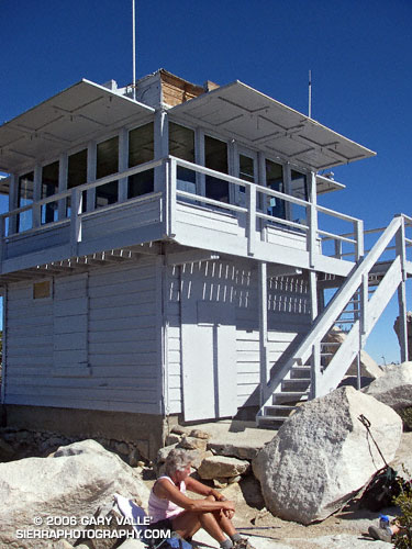
My route would take me to the summit of Mt. San Jacinto (10,834′), back down to the junction at Wellmans Divide, and then continue down to the Pacific Crest Trail. The PCT would be followed through Saddle Junction to the junction with the South Ridge Trail, and then continue on this trail to the historic fire lookout on Tahquitz Peak. I would return to Long Valley via Skunk Cabbage Meadow and Hidden Divide. Here’s a Google Earth image and Google Earth KMZ file of a GPS trace of the route.
The run and the running were outstanding – a blue skies and sunshine kind of day, with Autumn shadows, light winds, pleasant temperatures, and nearly unlimited visibility. Much of route was through spectacular old-growth forests of Jeffrey Pine, Lodgepole Pine and White Fir. The uphills were generally very well graded, with long runnable sections. And the downhills – ah the downhills – some rocky and technical, and some that make you feel as if you’re blazing down the trail on a Star Wars speeder bike.
Walking up the stairs in the mountain station, I glance at my watch. It’s 2:00 p.m. and the next tram is just about to depart. I’m back to my car and headed down the hill by 2:30, but it’s still not early enough to miss the traffic on I-10.