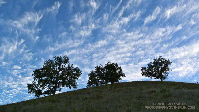
The cirrus clouds were a couple of days ahead of a cold front that brought rain to much of Southern California.
From a trail run on October 27th that looped through Las Virgenes Canyon.

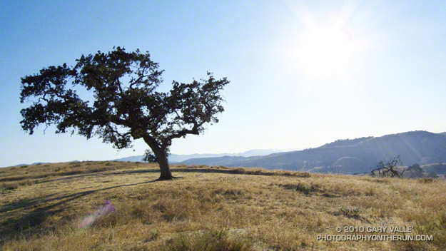
The cirrus clouds were a couple of days ahead of a cold front that brought rain to much of Southern California.
From a trail run on October 27th that looped through Las Virgenes Canyon.
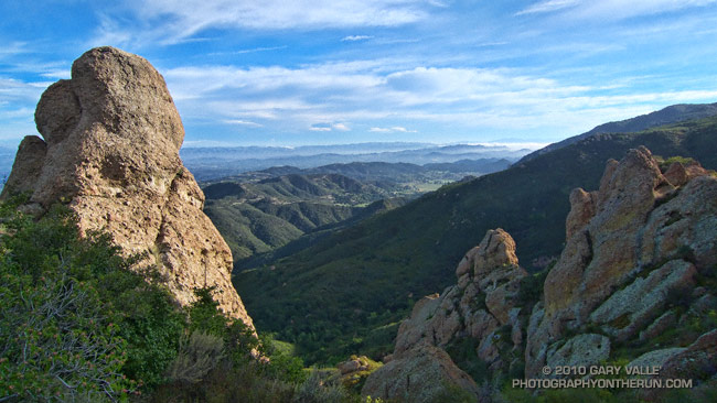
The face was not steep, but I was glad the pockmarked volcanic rock had big holds. Rainwater filled some of the pockets, and patches of lichen and moss on the face were saturated and slippery. It wasn’t a runout climb at the Needles or Tuolumne Meadows, but gravity still worked the same way. I reminded myself not to do something “stoopid.”
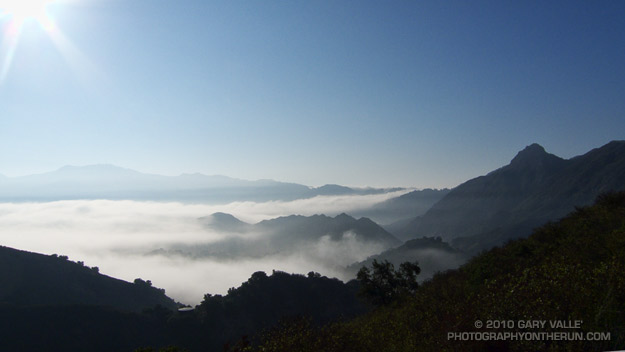
At the top of the face I looked around and sighed, and then looked around and sighed again. It was another stunning morning on the western ridge of Boney Mountain. To the west a nearly full moon struggled to remain above the hills, its brightness veiled in a mix of clouds. Another storm was expected in the evening, and the sky told of its approach. Broad strokes of cirrus brushed the blue above, and here and there fingers of tattered stratus reached into the coastal canyons and clung to the wet hillsides.
Today’s forecast for the Santa Monica National Recreation Area had called for mostly cloudy skies, and a high in the 60s. At the moment it was mostly sunny, but already there were hints of clouds developing on the ridges and mountaintops. At some point in the day the clouds would envelop the mountains, and transform the morning’s expansive vistas into a dimensionless gray. I hoped to get up the ridge, over Tri-Peaks, and to Sandstone Peak before that happened.
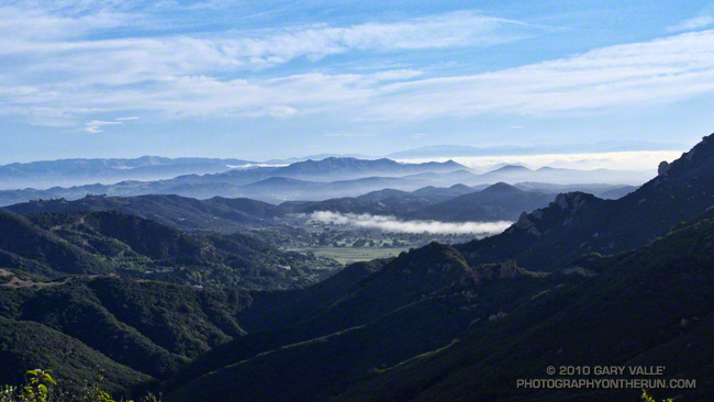
By chance the clouds behaved, and the splendid views and weather continued all the way to Sandstone Peak, and beyond. The run back to the Wendy Drive trailhead on the Backbone, Sycamore Canyon, and Upper Sycamore trails could not have been better.
As I climbed the final little hill to the parking area I noticed I had no shadow. Over the course of the afternoon the cloud deck would continue to lower and thicken, and by evening light rain would begin across the area.
Some related posts: Clouds and Crags, Conejo Valley Sun and Boney Mountain Clouds, Sandstone Peak from Wendy Drive
The second of two vigorous upper level lows to batter Southern California this Autumn has pushed the water year rainfall totals for many stations around the area to above normal. Does that mean we’re likely to see the wet weather continue through the 2010-2011 rain season?
![]()
Probably not. Since last Winter, ENSO conditions in the equatorial Pacific have flip-flopped. The Multivariate ENSO Index (MEI) has plunged from the fifth strongest El Nino for Feb/Mar to the strongest La Nina for Aug/Sep. The Aug/Sep value of the MEI is the lowest since Jul/Aug of 1955. Generally, El Nino conditions result in wetter weather in Southern California, and La Nina drier.
A precipitation composite for eight years in which ENSO was transitioning from El Nino or Neutral conditions to La Nina indicates that “on average” the coastal Southern California climate division recorded about 4 to 5 inches less precipitation than normal for the period November through March. The percent of normal water year rainfall recorded at Downtown Los Angeles (USC) ranged from a low of 53% (1988, 8.08″), to a high of 99% (1973, 14.92″). The average rainfall for these years was 77%, or 11.7″.
Maps generated using the ESRL/PSD page Risk of Seasonal Climate Extremes in the U.S. Related to ENSO do not indicate a higher than normal risk for an extremely dry rain season in Southern California when La Nina conditions are present.
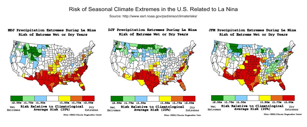
La Nina composites from CPC’s ENSO Temperature & Precipitation Composites page suggest the period Jan-Feb-Mar may be particularly dry, but this is not reflected in CPC’s official seasonal precipitation forecasts.
CPC’s Three-Month Precipitation Outlooks and NOAA Winter Outlook were updated yesterday. The precipitation outlook for Nov-Dec-Feb in the Coastal Southern California climate division shows equal chances of above average, near average, or below average precipitation. As the rain season progresses, these probabilities become only slightly skewed toward below normal precipitation. The skew becomes more pronounced in Feb-Mar-Apr when the probability of below normal precipitation increases to 45%.
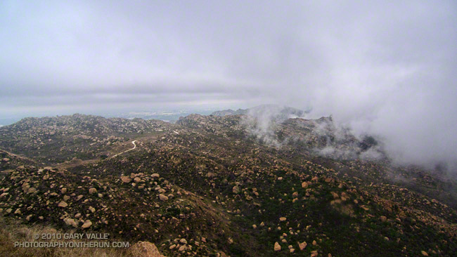
The title photograph is from Sunday’s out and back run from Chatsworth Reservoir to Rocky Peak.
Did a variation of the “Phantom” loop in Malibu Creek State Park this morning. The basic loop links together the Grassland, Liberty Canyon, Phantom, Cistern, Lookout, Yearling, Deer Leg, and Cage Creek Trails, as well as Crags Rd.
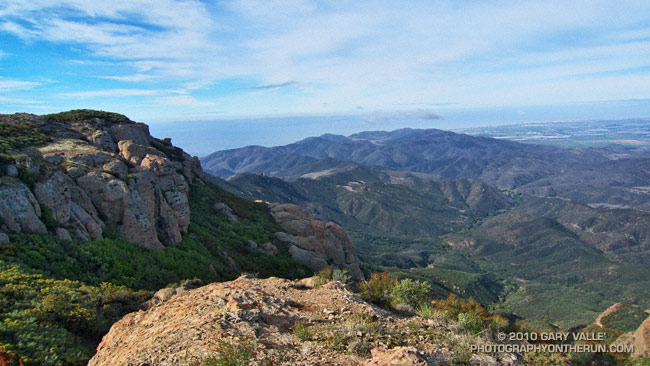
The peak in the haze on the left of the photograph in the distance is Saddle Peak. The peak on the right is Brent’s Mountain.
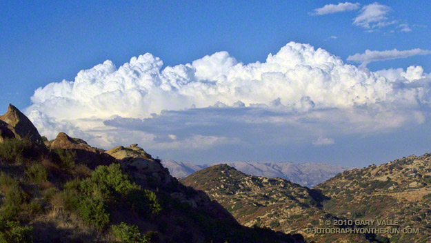
Hot on the heels of our record setting Autumn heatwave, an upper level low off the coast has been spinning subtropical moisture into Southern California. The unstable weather has produced some impressive clouds, isolated showers, strong thunderstorms, as well as a few rainbows. This thunderstorm development is north of Los Angeles.
From today’s run in the Simi Hills.
Today at 12:15 p.m. PDT the temperature at Downtown Los Angeles (USC) reached 113°F (45°C), which is the highest temperature recorded downtown since weather recordkeeping began in 1877.
It wasn’t quite as hot in the San Fernando Valley. The high temperature at Pierce College reached 110°F.
When I started my run at Ahmanson Ranch it was 106°F. I took two bottles with ice water. One was used to keep my arms, legs and head/neck wet. With the relative humidity low, this was very effective for cooling. I picked a 45-50 minute course that was not too strenuous, and kept the pace moderate.
It was a surprisingly moderate run, but I sure wouldn’t want to run out of water or have some other problem when the temperature is that high!