Category Archives: southern california

Looking For Christmas Berries

Toyon heavily-laden with berries
Toyon along the Garapito Trail (Winter 2019-2020)

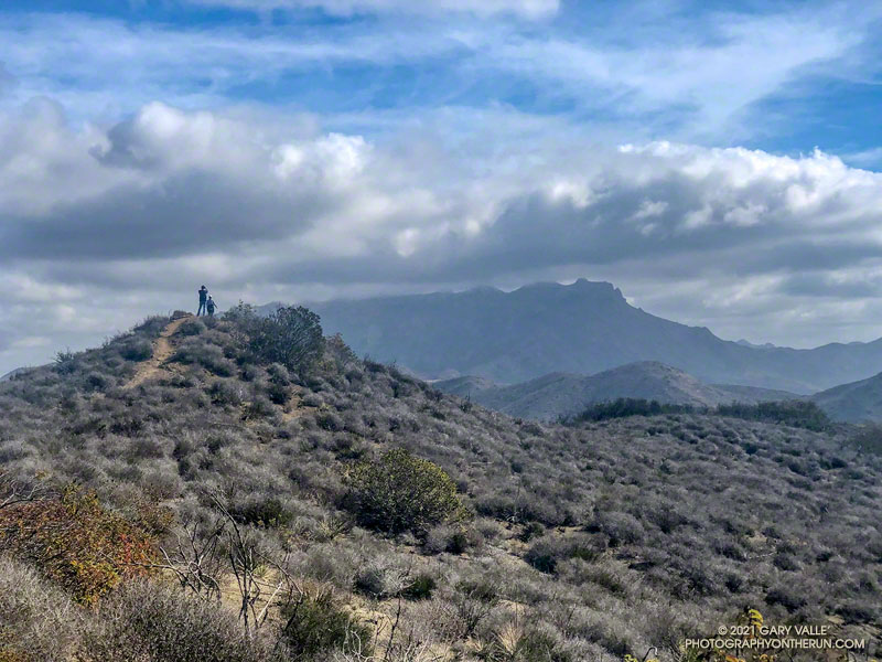
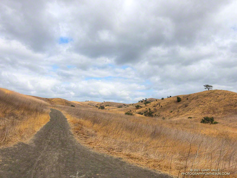
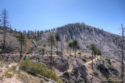
A week after doing the out and back run to the Ray Miller Trailhead, I was back in the Santa Monica Mountains and doing another popular trail run — the Trippet Ranch loop. Near the top of the Garapito Trail it dawned on me I’d seen no berries on the toyon shrubs and trees along the way. These red-orange berries usually add a bit of Holiday color to the chaparral, and at one time were so sought after that a law was passed to protect them.

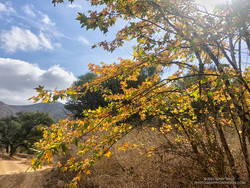
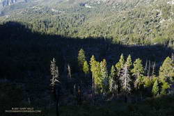
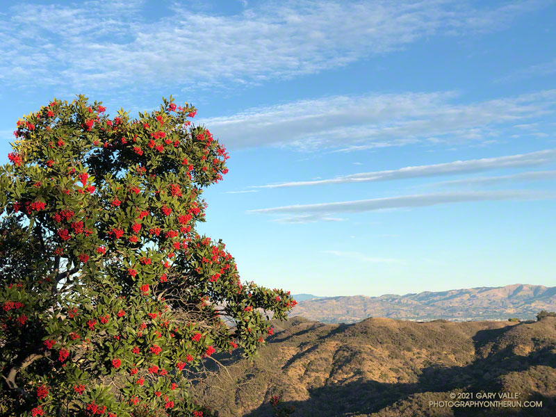
Toyon usually blooms in the Summer, producing green berries that slowly turn red-orange by the holidays. The title photo — of a toyon heavily loaded with berries — is from last Winter.

For the remainder of the run I checked most of the toyon along the trails back to the Top of Reseda. Not a single toyon had any berries.

How widespread was this? The following two weekends, I did runs in other areas of the Santa Monica Mountains. One was an extended version of the Bulldog Loop, and the other an out and back run from the Top of Reseda to the Oak Tree on Rogers Road segment of the Backbone Trail.

On those three runs I must have passed hundreds (thousands?) of toyon along the trail. Out of all of those I checked, only one had berries. It was near the water tank on Mesa Peak Mtwy fire road, at the top of the climb up from Tapia.

As you might expect, the most likely explanation for the lack of berries is the drought. Precipitation records for Downtown Los Angeles (USC) show that in 2019-2020, the rain season lasted about 5 months — from about mid November to mid April. Leading up to the flowering period for toyon the accumulated rainfall was a little above normal. The result was what you see in the title photo.

On the other hand, in 2020-2021, the rain season effectively began at the end of 2020 and ended in mid March. Less than half of normal rainfall was recorded going into the flowering period of toyon.

The toyon on Mesa Peak fire road that managed to produce some berries is situated near the crest of east-west oriented ridge. It probably benefits from enhanced precipitation because of its location.

Some related posts: Christmas Berry on the Garapito Loop, Best Trailhead to Start the Bulldog Loop, Will Rogers – Rivas Canyon – Temescal Canyon Trail Run

Out and Back Trail Run to the Ray Miller Trailhead from Wendy Drive

Hikers enjoy the spectacular scenery of California's Point Mugu State Park

When I parked at the Wendy Drive trailhead, there was just enough light to see a wide band of high clouds overhead. That was good news. With a well-advertised storm expected to move through the area the next day, I hadn’t been sure what weather to expect for today’s run.

Colorfully illuminated clouds a few minutes before sunrise on the Wendy Connector Trail

The general forecast was for low clouds and fog in the morning, giving way to partly cloudy skies in the afternoon. I was going to be running one of the more scenic trails in the Santa Monica Mountains — the Ray Miller Trail. High clouds and sunshine were a much better option than running in the fog or with gloomy, overcast skies.

Shortly after leaving the trailhead, the band of high clouds became underlit by the reds, oranges and yellows of the rising sun. It was going to be a good run.

The route-finding on this run is relatively straightforward. From the Wendy Drive trailhead on Potrero Road, run over to the Satwiwa Native American Indian Culture Center (see Satwiwa map). From the Culture Center run 4+ miles on Big Sycamore Canyon Road/Trail toward the beach. Some of this is paved.

La Jolla Canyon, PCH and Mugu Peak from the Ray Miller Trail

Once past the junction of Sycamore Canyon and Wood Canyon fire roads, take either the Wood Canyon Vista Trail (Backbone Trail) or Fireline Trail up to the Overlook fire road. From the top of the Wood Canyon Vista Trail turn left on Overlook fire road, or from the top of Fireline turn right, and follow the road to the top of the Ray Miller Trail. The Fireline option is about 0.4 miles longer. Here’s a map from the State Park website. Note that the La Jolla Canyon Trail is closed.

The Ray Miller Trail drops about 1000′ over 2.6 scenic miles. There is usually water available at the parking lot at the trailhead. Today the conditions were about as good as they get. The trail was in excellent condition. The temperature was in the mid-70s. The marine layer was holding offshore and a few puffy clouds had formed over the higher peaks.

One of the things about the Ray Miller Trail is that run/hike up it is almost as enjoyable as the run down. It is a very popular, and there are almost always runners and hikers on the trail. Running up a section of trail, I thought I recognized someone going down. It was nine-time Badwater finisher Chris Frost. We talked for a while about trails, running and races.

Fall color on a California sycamore along Wood Canyon Fire Road

From Overlook Fire road the route back to Wendy was a familiar one — Hell Hill, Wood Canyon Fire Road, Two Foxes Trail, Big Sycamore Canyon Road, Upper Sycamore Canyon Trail, Danielson Road, and the Satwiwa Loop Trail. Including a short jog over to PCH the run was a little over 24 miles with about 3100′ of elevation gain.

Here’s an interactive, 3D terrain view of the Wendy Drive – Ray Miller Out & Back trail run. The map can be zoomed, tilted, rotated, and panned. To change the view, use the control on the upper right side of the screen. Track and placename locations are approximate and subject to errors. Poor weather, and other conditions may make this route unsuitable for this activity.

Some related posts: A Windy Run, Walk, Ride, for Wildlife Research; Running to Ray Miller; Ray Miller Training Run

Cool Running at Ahmanson Ranch

East Las Virgenes Canyon Trail in Upper Las Virgenes Canyon Open Space Preserve

Hikers, riders, and runners reveled in the unseasonably cool afternoon temperatures at Ahmanson Ranch (Upper Las Virgenes Canyon Open Space Preserve) yesterday.

According to the NWS, the high temperature of 75 degrees at Woodland Hills (Pierce College) was the lowest for the date on record. The temperature at the Cheeseboro RAWS didn’t reach the 70s until around 1:30 p.m., and finally hit 75 around 4:30 p.m. Earlier in the day, the station recorded 0.03 inch of light rain.

I took advantage of the cooler weather to do an out and back trail run from the Victory Trailhead to Cheeseboro Canyon. The nine mile run has an elevation gain/loss of around 1000′. Except for a couple of hills, it’s a relatively fast-paced route, particularly on the way out to Las Virgenes Canyon. There are two creek crossings in Las Virgenes Canyon. These dried up earlier this year, but in some years the crossings have enough water to get your shoes wet.

It’s not a good run to do when it’s hot, and in the Summer Ahmanson is almost always hot. In-the-sun temperatures are typically above 100 degrees, and sometimes reach 110 degrees or more. More than once I’ve encountered people on Ahmanson area trails that misjudged the conditions and were out of water. And sadly, dogs are especially susceptible to heat.

Here’s an interactive, 3D terrain view of the run. The map can be zoomed, tilted, rotated, and panned. To change the view, use the control on the upper right side of the screen. Track and placename locations are approximate and subject to errors. Poor weather, and other conditions may make this route unsuitable for this activity.

Those that recreate at Ahmanson will recognize the title photo as East Las Virgenes Canyon, about 1.1 mile from the Victory Trailhead. This is where a trail/road to Lasky Mesa forks off the main road.

Some related posts: Run to the Cheeseboro Remote Automated Weather Station, Classic Cheeseboro Canyon, Big Southern Pacific Rattlesnake at Ahmanson Ranch

Return to Ross Mountain

South Ridge of Mt. Baden-Powell about a mile from Ross Mountain

When I started up the trail from Vincent Gap (6585′), the thermometer on my pack read 36°F. For the first few switchbacks, the trail was immersed in cloud. Beneath the tall conifers, the sandy soil was dotted with droplets of moisture extracted from the fog.

Google Earth image of GPS track down the South Ridge of Mt. Baden-Powell to Ross Mountain

I was on my way to Ross Mountain (7402′), one of the most isolated peaks in the San Gabriel Mountains. At the end of a rugged, 3-mile ridge extending south from the summit of Mt. Baden-Powell, the peak overlooks the vast canyons of the Sheep Mountain Wilderness.

This morning, the canyons were filled with a 7000′ deep layer of stratus clouds. With a weak upper low over the Southern Sierra, the question of the day was whether the cloud deck would work up the ridge from Ross Mountain and completely envelop Baden-Powell.

Summit of Mt. Baden-Powell. May 16, 2021.

Well acquainted with the trail up Baden-Powell, a combination of fast-hiking and slow-jogging put me on top in a relatively comfortable 90 minutes. I’d tried not to overdo the pace, knowing from previous experience that the return from Ross Mountain would be the tough part of the day.

From the summit of Baden-Powell, I gazed across the sea of clouds to Mt. Baldy. There was almost no snow on its steep north face. San Gorgonio Mountain was visible in the haze to the left of Pine Mountain and San Jacinto Peak in the gap between Dawson Peak and Mt. Baldy.

South Ridge of Mt. Baden-Powell with Ross Mountain partially visible in the clouds

Walking a little down the south side of Baden-Powell, I got my first good look at the South Ridge. Ross Mountain was nearly covered in clouds. Guessing that the deck of clouds might deepen, and a few minutes might make the difference of being in the clouds or out, I started to jog-lope-shuffle down the initial steep slope.

The title photo was taken a bit past Peak 8375, about 1.7 miles from Baden-Powell and 1.2 miles from Ross Mountain. At that time the clouds were spilling over the ridge near Peak 7407 and Peak 7360+, and around Ross Mountain.

Just north of Peak 7407 on the South Ridge of Mt. Baden-Powell
Into the clouds near Peak 7407

The clouds added an aesthetic element to the adventure, as well as a little uncertainty. They accentuated and embellished the terrain, while threatening to make the conditions wet, cold and disorienting. Being familiar with the route helped me to enjoy the experience more than the concerns.

After navigating the false summits along the final stretch of ridge, I finally reached Ross. And, of course, it was in the clouds. That was the tradeoff for the spectacular views of the clouds along the ridge.

I didn’t spend much time on the summit. The more time I could spend out of the clouds, the more enjoyable would be the 2200’+ climb back to Baden-Powell.

It took a little over two hours for the clouds to chase me back up the ridge, but only an hour to run the four miles down from Baden-Powell to the foggy trailhead.

Related post: Excursion to Ross Mountain

A Hawkins Ridge Loop Adventure

Twin Peaks and Mt. Waterman from the Hawkins Ridge Trail on South Mt. Hawkins
Twin Peaks and Mt. Waterman from the Hawkins Ridge Trail

Don’t let there be a headwall… Don’t let there be a headwall… That’s what I kept muttering to myself as I climbed up the decomposing granodiorite rib. The topo map showed the rib connecting directly to the crest, but from my vantage point I couldn’t tell if that was actually going to happen.

So far the the difficulties had been manageable. The route had been steep and loose, but for the most part it was at an angle that probably wouldn’t result in a long fall or slide. Probably. But if it got any steeper it could be a problem, and I really didn’t want to downclimb 1200′ of crumbly rock and loose debris.

Working up the rib I had gone from “secure spot to secure spot,” trying to minimize my exposure in between. In a few places a climbing move had been required to avoid disturbing fractured or delicately balanced rocks. On one section it had been necessary to crawl through a mountain mahogany, its stiff limbs poking fun at my route-finding. Higher up, the solid handholds of a massive gray boulder had helped to ascend a particularly loose section.

Crystal Lake Recreation Area from the crest near Peak 8426

As I climbed, I considered alternative routes, surveying the terrain to my left, right, and along the crest. I couldn’t help but wonder if there was a better line. But I needed to be patient. The rib was working and I just needed to stay on it.

I tried to recall if I’d ever been on anything like this. I’d certainly done a  few class 2 descents on Sierra peaks that were loose. The closest comparison might be some of the “knapsack passes” in the Sierra. These are usually class 2 or class 3 routes that go over notches and connect one high basin to another. They are often steep, loose and wet, and can hold snow or ice throughout the Summer.

And then suddenly I was on top. There was no more rib to climb. While I enjoyed the problem solving, it’s not a climbing route I would recommend, and I probably won’t repeat it.

South Mt. Hawkins and Sadie Hawkins from the Hawkins Ridge Trail

Climbing the rib was my overly-creative way of doing a loop that included the Hawkins Ridge Trail. I’d done Middle Hawkins (Peak 8505′) as a side trip on a run from Islip Saddle to Baden-Powell, but had not gone down the ridge as far as Sadie Hawkins (Peak 8047′).

It was the perfect day to be running the Ridge Trail. The weather was far better than during my last run in the area. Temps were about 20 degrees warmer, and while it was still breezy, the wind was nowhere near the strength of a couple weeks ago. A sea of marine layer stratus filled the valleys and extended into San Gabriel Canyon, providing an “above the clouds” backdrop befitting of a mountain trail.

Pines on Hawkins Ridge that survived the 2002 Curve Fire

It didn’t take long to get down to Sadie Hawkins and to follow a use trail to its rounded top. From the top, Mt. Islip and Windy Gap could be seen to the northwest, and Mt. Wilson area peaks to the southwest. On the south-facing slopes below Sadie Hawkins there was a stunning number of young pine trees — a veritable tree farm of regrowth from the 2002 Curve Fire.

Winding down the use trail from Sadie Hawkins, I rejoined the main Hawkins Ridge Trail and followed it down to the saddle between Sadie Hawkins and South Mt. Hawkins. Two weeks ago, I’d followed the road up to South Hawkins and then descended the north ridge directly. This time I ascended the Hawkins Ridge Trail, carefully following the trail. I was surprised to find it didn’t ascend the north ridge directly, but wrapped around the west side of the peak.

Later, as I ran down South Mt. Hawkins Trail/Road, I thought about the amount of rocky debris along and on the road. It emphasized the friable nature of the rock above, and how often there are larger rockslides. When I reached the point on the road where I could see the route I’d climbed, I just shook my head. Who the heck would want to go up there?

Related post: Windy Windy Gap and Sunny South Mt. Hawkins

Windy Windy Gap and Sunny South Mt. Hawkins

As shown on fire maps, Windy Gap was not burned in the 2020 Bobcat Fire.
Windy Gap

There was hardly any wind on the drive out to Azusa, and I wondered if the offshore wind event forecast to peak this morning was going to happen. But after winding up Highway 39 to the Windy Gap Trailhead, all doubts vanished. The wind was blowing in powerful gusts that shook the car and my enthusiasm.

Morning light on Islip Ridge from low on the Windy Gap Trail in Crystal Lake basin
Morning light on Islip Ridge

Not only was it windy, it was cold. I briefly debated going down to warmer climes — temps were forecast to be in the 80s and 90s in the valleys — but decided to at least run up to Windy Gap and see what it was like there.

As is often the case, once I got moving, it wasn’t too bad on the Windy Gap Trail. It was very windy in some spots and nearly calm in others – just what you would expect on the lee size of a mountain ridge. One thing was consistent — there was almost no sunlight on the trail.

A ribbon of sunlight illuminates conifers along the Windy Gap Trail
Ribbon of sunlight on trees along the Windy Gap Trail.

I’d been curious to see how the run/hike to Windy Gap (7588′) from the Windy Gap Trailhead (5836′) in the Crystal Lake Recreation Area compared to starting at the Islip Saddle Trailhead (6650′) on Hwy 2. It turns out the distance using either approach is the same — a little over 2.5 miles. But, the Windy Gap Trailhead is lower, so starting there adds a little over 800′ of gain. Today, that extra gain was helping to keep me warm.

As I worked up the last long switchback I could see and hear the trees on the crest being buffeted by the wind. Reaching Windy Gap I’d was relieved to see that it looked the same as it always has. As shown on fire maps, Windy Gap was not burned in the Bobcat Fire.

Working up toward Windy Gap (7588') on the Windy Gap Trail
Mt. Islip (left) from the Windy Gap Trail

That relief was short-lived as I was just about knocked down by a gust of wind. I’ve passed by Windy Gap many times, and the wind this morning was the strongest I’ve experienced there.

Later I found that several gusts over 50 mph were recorded at Chilao that morning. Because of terrain effects, I would not be surprised if the gusts at Windy Gap were 60 mph or more. The gusts were “stop you in your tracks, blow you over” strong. And it was cold. The temperature sensor on my pack read 34°F.

Twin Peaks and Mt. Wilson from the South Mt. Hawkins Trail

Out of curiosity, I ran a short distance along the PCT to see if conditions improved. That was a bad idea. I turned around and got the heck off the crest.

Running back down the Windy Gap Trail, I wasn’t ready to call it a day. It occurred to me that I could run down to the South Mt. Hawkins Trail — the old South Hawkins Lookout service road — and then run up to South Mt. Hawkins. Maybe the old road would be more wind-protected than the Windy Gap Trail.

Path through Jeffrey pine cones along the South Mt. Hawkins Trail/Road
Jeffrey pine cones along the South Mt. Hawkins Trail

And maybe not! Looking at the topography, I could not figure out why the wind on some sections of the South Mt. Hawkins road was so strong. Some gusts were as strong as at Windy Gap. The noise from the wind in the trees was deafening, and amplified my concern about falling trees and flying debris. I did not want to have a “Weather Channel” moment.

Although the wind was strong, the sun was now higher, and some sections of the road were warmed by the sun. This made a big difference. As I wound into and out of the side canyons, the temperature varied from the high 30s to the low 50s. In two places there were small, dirty patches of icy snow.

The old lookout service road follows a circuitous path to South Mt. Hawkins
South Mt. Hawkins

The South Mt. Hawkins Lookout was destroyed in the 2002 Curve Fire. Many, many thousands of trees were killed in that fire and the process of (natural) reforestation can be seen on the slopes above the road.

Ironically, the wind and temperature were relatively moderate on the summit of South Mt. Hawkins! After taking a few photos, I descended the “Ridge Trail” to the South Mt. Hawkins trail/road, and made my way back to the Windy Gap Trail and the trailhead.

Some related posts: Did Lightning Start the 2002 Curve Fire?, Crest of the Angeles