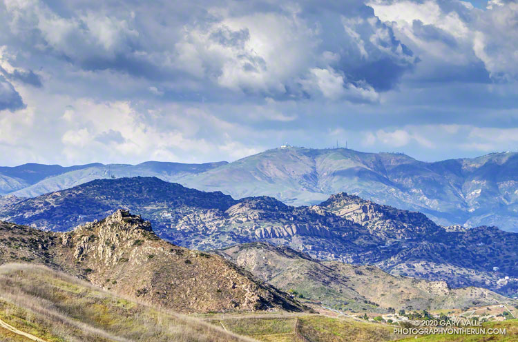
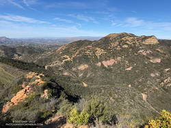
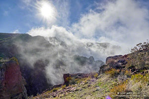
Clouds, sun and shadow accentuate the rugged topography of the northwest rim of the San Fernando Valley.
Castle Peak is the rock-capped summit on the left of the photo. Chatsworth Peak (2314′) is in shadow and behind Castle Peak. The prominent rock bands are Chatsworth Formation sandstone formed more than 65 million years ago. Oat Mountain (3747′) is the sunlit peak in the distance.
Following a December with twice normal rainfall, Downtown Los Angeles (USC) experienced the fourth driest January-February on record. Now it seems the spigot has been turned back on, and March rainfall for L.A. might very well be above normal.
As of 3:00 p.m. today, March 13, Downtown Los Angeles (USC) has recorded 2.05 inches of rain this March, boosting the rain year total (since July 1) to 9.40 inches. This is about 75% of normal for the date.
More rain is forecast over the next week or so, but the major weather models differ on the projected amounts. To make up for the January-February rainfall deficit and finish the rain year close to 100% of normal, Los Angeles needs another 5.5 inches of rain by June 30.
Not impossible, given some of the forecasts, but that would be a lot of rain for this time of year. Well see!
Update July 6, 2020. Remarkably, Downtown Los Angeles (USC) ended the rain year, July 1 to June 30, within 0.07 inch of normal rainfall. It was a tumultuous rain season that saw copious rainfall in December, and then almost none in January and February — usually the wettest months of the year. Just when we started to think “drought,” the wet weather returned. Combined, Match and April precipitation was 221% of normal. That and a little rain in May brought the Los Angeles rain year total up to 14.86 inches, just short of the normal of 14.93 inches.
Update April 12, 2020. Over six consecutive days, from April 5 to April 10, Downtown Los Angeles (USC) recorded 2.96 inches of rain. This is about 325% of the normal amount for the whole month. The precipitation totals of 14.66 inches for the rain year and 14.63 inches for the water year are now above normal for the date and within about one-third of an inch of the normal annual rainfall for Downtown Los Angeles.
Update April 10, 2020. April rainfall picked up right where March left off. As of April 9, Downtown Los Angeles (USC) has recorded 2.80 inches of rain this month. This is more than three times the normal amount of rain for the entire month of April. This brings the rain year and water year totals to 14.50 and 14.47 inches, respectively. For the first time since February 1 the rainfall totals for Los Angeles are above normal for the date. Los Angeles is now within a few tenths of an inch of normal rainfall for the year, and it is still raining today.
Update March 24, 2020. On March 22, Downtown Los Angeles (USC) set a new rainfall record for the date of 1.51 inches. As of March 24, Downtown Los Angeles has recorded 4.35 inches of rain this month. This is 179% of the normal amount of rain in March. The current rain year/water year total of 11.70/11.67 inches is about 88%/90% of normal for the date. The magic number for 100% of normal rainfall is 14.93 inches — either by June 30 (Rain Year) or September 30 (Water Year).
Update March 17, 2020. As of March 16, Downtown Los Angeles (USC) has recorded 2.80 inches of rain this month. This already exceeds the normal amount of rainfall for the entire month of March, which is 2.43 inches. The current rain year/water year total of 10.15/10.12 inches is about 79%/81% of normal for the date.
The range of temperatures had been remarkable. At the Secret Trail trailhead in Calabasas, where I left my car, it had been a balmy 60 degrees. Near the start of my run from the Tapia Trailhead in Malibu Canyon, it had been a very chilly 32 °F. Near the end of the run, the temp topped out at 79 °F. That’s SoCal Winter running!
On the way to Saddle Peak, I was surprised to see how wet it was on some sections of the Backbone Trail. There has been very little rain this January, but marine layer dew, the trail’s north-facing aspect, the low sun angle, the canopy of bays and oaks, and relatively cool temps have kept the trail damp. In places it looked like it had just rained yesterday.
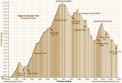
Elevation profile for trail run from Tapia to Secret Trail via Topanga Lookout and Ridge.
Because there’s about 1000′ less elevation gain, I usually do this run in the opposite direction, starting on the Secret Trail and ending at Tapia. This is the route described in the venerable guidebook, 50 Trail Runs in Southern California. But I’d run it in that direction a bunch of times — so here I was, chugging up the Backbone Trail, nearing the end of a 2600′, seven-mile climb from Tapia to Saddle Peak.
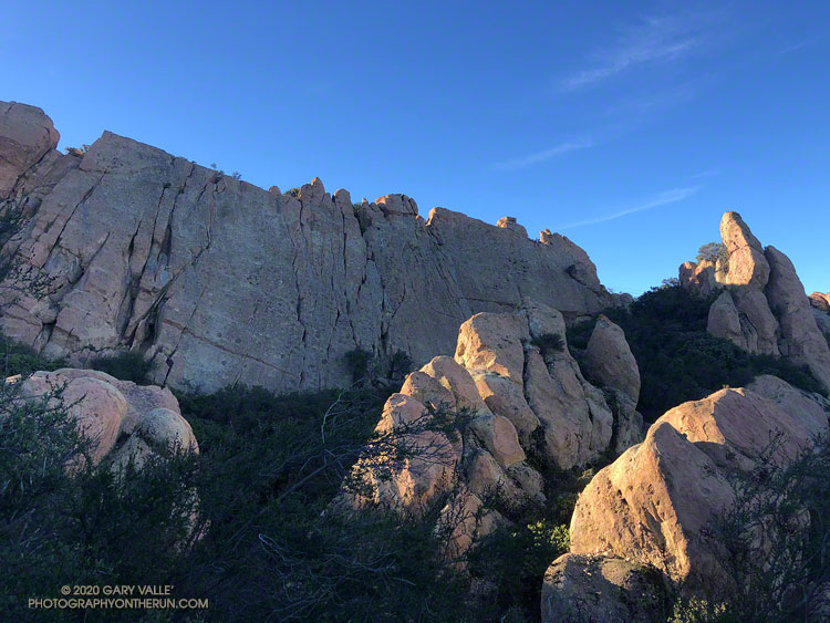
The area around Saddle Peak is yet another spectacular section of the Backbone Trail. (There are so many!) Just west of the peak, the trail winds through a narrow passage with massive sandstone rocks on either side. As the trail levels out, there is a short spur trail to the peak’s antennae-infested summit.
Even if a little obstructed, views from the top extend to Catalina, Boney Mountain, Mt. Pinos, and Mt. Baldy. Sometimes San Gorgonio Mountain and San Jacinto Peak can be seen beyond Mt. Baldy. The round trip to the summit of Saddle Peak adds about 0.8 mile. The eastern summit is slightly lower, but no antennae obstruct the view.
Getting to Saddle Peak from the Tapia trailhead is relatively straightforward, if a bit strenuous. Getting to Calabasas Peak and the Secret Trail from Saddle Peak is not as simple.
The “normal” way to get from Saddle Peak to Calabasas Peak would be to run back down the Backbone Trail to the Stunt High Trail and then follow that trail to the parking area on Stunt Road. Calabasas Peak Mtwy is across the highway and slightly downhill (west) of the parking area and leads to Calabasas Peak and the Secret Trail.
If doing the regular route, note that the Stunt High Trail crosses Stunt Road twice on the way down. In each case turn right and follow the road east about 100 yards to pick up the trail on the other side of the road. There are also various side trails to avoid.
Calabasas Peak from Topanga Lookout Ridge.
I had been planning to do the regular route, but as I was returning to the Backbone Trail from Saddle Peak, it occurred to me there was a way to avoid backtracking. Instead of turning left on the Backbone Trail and descending to the Stunt High Trail, I turned right and continued east, past the water tank, to the Lois Ewen Overlook. From there, I ran over to the Topanga Lookout and then scrambled down Topanga Lookout Ridge to Calabasas Peak Mtwy.
This option is more adventurous, but requires good route-finding skills and being comfortable clambering down a rocky ridge. This 3D Cesium interactive view shows a GPS track of my route. The yellow track is today’s route. The red track is the usual route between the Backbone Trail and Calabasas Peak Mtwy. The view can be zoomed, tilted, rotated and panned. Placemark and track locations are approximate and subject to errors.
Scrambling down the ridge put me at “The Bench,” at the junction of Calabasas Peak Mtwy and Red Rock Road. This is a little more than a mile from Calabasas Peak. Once on Calabasas Peak, it was only about 0.6 mile to the top of the Secret Trail, and from there about 1.3 miles of mostly downhill running to the trailhead.
With about 4000′ of gain over 14 miles, it was a demanding route, with challenging route-finding and a fun scramble down a rocky ridge. Here are a few photos taken along the way.
Rocky Peak Road is one of my go-to wet weather running spots. The sandy soil — thanks to the Chatsworth Formation sandstone — doesn’t cake on your shoes when it’s wet. It isn’t entirely mud-free, but as long as you don’t mind a few steep hills, it’s a good choice when the weather turns wet.
According to preliminary rainfall totals tabulated by the NWS, Rocky Peak recorded 1.22 inches of rain during the Christmas storm. The snow level had been forecast to drop to 2000′-2500′ in some areas, so as the storm was breaking up I headed over to Rocky Peak to get in a run, and see what I could see.
I’d dressed for a cool and breezy run, and was comfortable as I worked up the first steep hill. But I hadn’t run half a mile when I stopped and put on some gloves and a pair of stretch shorts. That helped, but the higher I went the colder it got. Up top, a little past Rocky Peak, my thermometer registered a chilly 38 degrees and the wind was gusting 10-15 mph. According to the NWS Wind Chill chart, that put the effective temperature at around 30 degrees.
And that’s what it felt like. Part of the problem was that I was running into the wind, which increased the chill. I had a wind shell in my pack, but once I’d reached my turnaround point and had the wind at my back, it wasn’t needed.
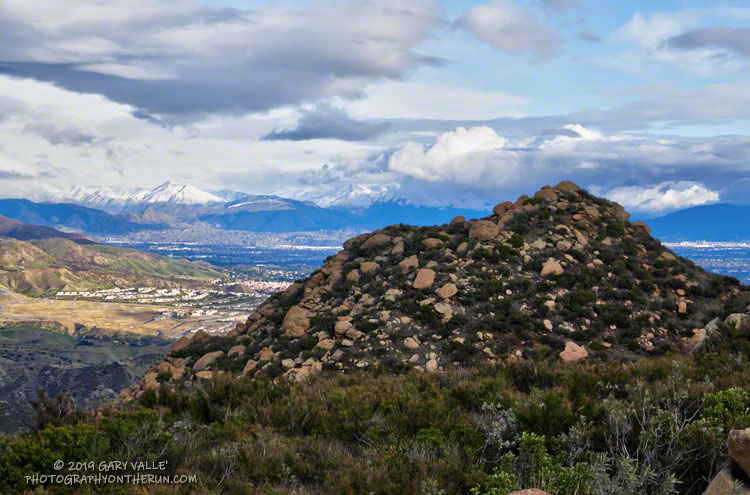
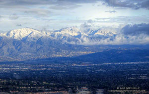
Mt. Lukens, Mt. Disappointment, San Gabriel Peak and Mt. Lowe.
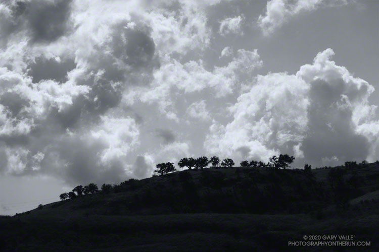
There was no snow on Rocky Peak Road or Oat Mountain, but from time to time the setting sun broke through the clouds and highlighted the snow on the nearby mountains. It was a far different scene than on the usual Rocky Peak run.
December has been wet in the Los Angeles area. As of December 27, Downtown Los Angeles (USC) has recorded 4.84 inches of rain this December, which is nearly three inches above normal. Rain year and water year precipitation totals are also well above normal, and at the moment, ahead of last year. We’ll see what the new year brings!
Update January 24, 2020. Well, the new year hasn’t brought us much in the way of precipitation. January in Downtown Los Angeles has been about as dry as December was wet. So far, Downtown Los Angeles has recorded only 0.32 inch of rain this January, well below the climate normal for the date. If there is no additional rain this month, Los Angeles will end the month with about normal rainfall to date for the Rain Year (Jul 1 – Jun 30) and Water Year (Oct 1 – Sep 30). Then we’ll have to see if there is a pattern change in February, or if it is also drier than normal, as most guidance suggests.
If you look at the traditional USGS 7.5 minute Triunfo Pass and Newbury Park topographic maps, BONEY MOUNTAIN refers to the large, mountainous plateau that extends roughly from Peak 2417 on the west; to Peak 2793 on the north; and to Sandstone Peak on the east. However, when people say they are climbing “Boney Mountain,” they are usually referring to a high point north of Tri Peaks, on the northwest corner of the plateau, above Newbury Park. This illustration shows these features.
This high point has an elevation of about 2935′ and is typically reached by ascending the Upper Cabin Trail or Western Ridge route. When climbing to this point, most start at one of the Satwiwa trailheads, such as at Wendy Drive and Potrero Road. The high point is NOT the same as “Boney Peak,” which on recent maps is ascribed to a peak adjacent to Inspiration Point, and has an elevation of about 2825′.
Today’s running adventure ascended the Western Ridge route to point 2935 and then worked over to the Backbone Trail, by way of Tri Peaks. Part of today’s adventure was to investigate a peak near the top of the Chamberlain Trail that is labeled peak 2880 on traditional topo maps, but is labeled “Boney Mountain” on many online, GIS-based maps.
The traditional, hand-crafted USGS 7.5 minute topographic maps were produced from about 1945 to 1992, with map revisions continuing until 2006. These maps are now part of the USGS Historical Topographic Map Collection (HTMC) and still widely used. The intended replacements are the GIS-based “US Topo” maps, first released in 2012. The USGS topoView application can be used to view historical and current USGS topo maps.
The USGS “US Topo” maps are digitally produced from GIS data. As a result, some features traditionally included in USGS topographic maps — such as trails, landmarks, buildings and recreational features — may not be included. It also appears there have been some issues with geocoding placenames.
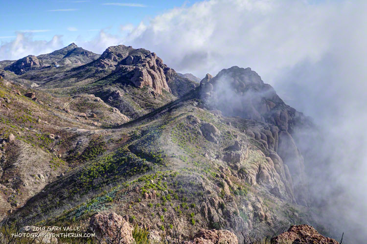
The conditions for today’s run were fantastic. Wind-driven clouds condensed along Boney Mountain’s western escarpment, spilling and tumbling over its edge in dramatic fashion.
Clouds spilling over the lip of Boney Mountain’s western escarpment.
As for the other Boney Mountain — Peak 2880 — it was brushy and the rock wasn’t the best, but climbing it did provide some fresh views of the Boney Mountain area. My guess is that the “BONEY MOUNTAIN” label, which described an area on the traditional maps, was treated like a point feature when geocoded. The nearest point happened to be Peak 2880, which speciously became “Boney Mountain.”
In the 2018 edition of the Triunfo Pass US Topo, the Boney Mountain label was moved to Tri Peaks, and the label for Tri Peaks was moved to another, unnamed, peak. In the current online version of the map, the Boney Mountain label and Tri Peaks label are at Tri Peaks. Over time the maps should improve, but until then, I’ll continue to use the traditional 7.5 minute USGS maps, or commercially produced maps that have been field verified.
And what about point 2935 – the high point on the crest that so many people climb? It really deserves a name. Given it overlooks the Danielson Monument and cabin site, maybe something like “Danielson Peak” would be fitting.
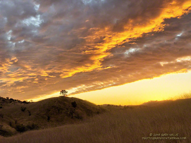
This time of year, I’m often “racing the sun” on my afternoon runs. Especially on longer runs, when the additional miles quickly consume any remaining daylight. There are benefits. Colorful sunsets are just one of them.
Tuesday’s run was one of those longer runs — from the Victory Trailhead of Upper Las Virgenes Canyon Open Space Preserve (Ahmanson Ranch) to Cheeseboro Canyon and back. One of the reasons for doing this particular run was to follow up on the reemergence of water in upper Las Virgenes Creek. As Fall has progressed, there has been a notable increase in the size and number of pools, and the amount of water in the creek. I’ve observed this in the Fall before, except during periods of drought.
This comparison shows a crossing of upper Las Virgenes Creek about one-third mile north of the junction of Las Virgenes Canyon and East Las Virgenes Canyon. It shows the intriguing reemergence of water in this reach of the creek, despite a dry Summer, and — as of Tuesday — meager Autumn rainfall. The increase in water in the reach seems to have resulted from seasonal reductions in daylight, temperature, evaporation, plant transpiration, and other factors.
Update October 22, 2019. A run over to upper Las Virgenes Creek supported the 0.46 inch of rain reported by the Cheeseboro RAWS on October 20. The ground appeared to have absorbed more rain in the Las Virgenes Canyon area, compared to the area near the Victory Trailhead. It also looked like the amount of water in the creek bed had increased.
Update October 21, 2019. The Cheeseboro RAWS, on the ridge just west of upper Las Virgenes Creek, recorded 0.46 inch of rain on October 20, the day after this run. Today, I’ll be running out that way again to see how the rain affected the creek.