Category Archives: weather|southern california

Running from the Wind

Windblown stratus on Santa Monica Bay with Palos Verdes Peninsula in the distance

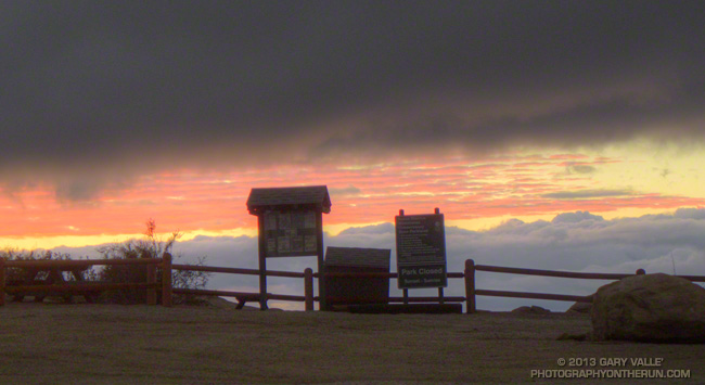
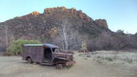
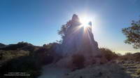
The tinge of frost on the rusty M*A*S*H ambulance wasn’t so much of a surprise, but that there was not even a breath of wind at the M*A*S*H site was astonishing.

Overnight unrelenting winds had rushed and roared through the palm trees above the house and I’d steeled myself for what would surely be a difficult run.

A cold December morning at the M*A*S*H site in Malibu Creek State Park.

But when I arrived at the Cistern trailhead on Mulholland Drive there was almost no wind. A layer of cold air trapped against the crest of the Santa Monica Mountains in the Malibu Creek drainage was shielding the area from the wind. At least for a while.

When I’d left the house in the West Valley the temperature had been a balmy 64 degrees. As I turned onto Mulholland Highway from Malibu Canyon Road my car’s thermometer had read 32 degrees and at the trailhead it had been 46 degrees. Along Malibu Creek at the M*A*S*H site I’d guess the temperature was in the mid-thirties.

California fuscia along the Bulldog Motorway fire road.

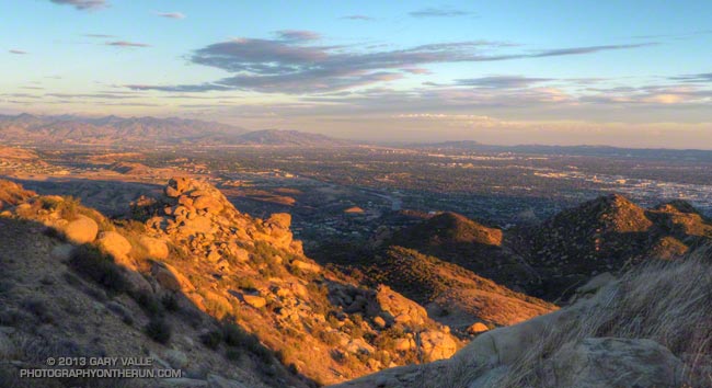
Incredibly, the climb up Bulldog Motorway was one of the most pleasant I’ve done. Near freezing temperatures gave way to warming Winter sunshine, and as I worked up the grade I wondered how long the respite from the wind would last. To the northeast I could see the telltale dusty haze from strong offshore winds in the San Fernando Valley. At some point those winds would scour out the protective layer of cold air or I would climb above it.

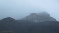
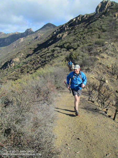
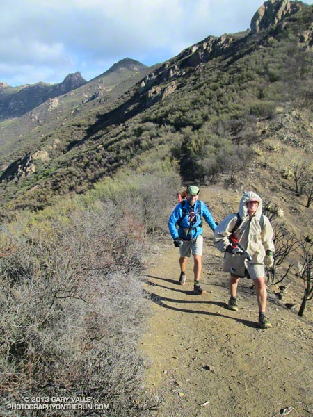
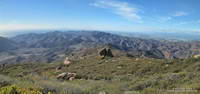
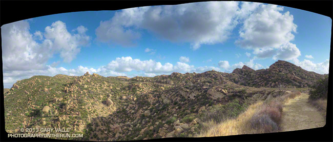
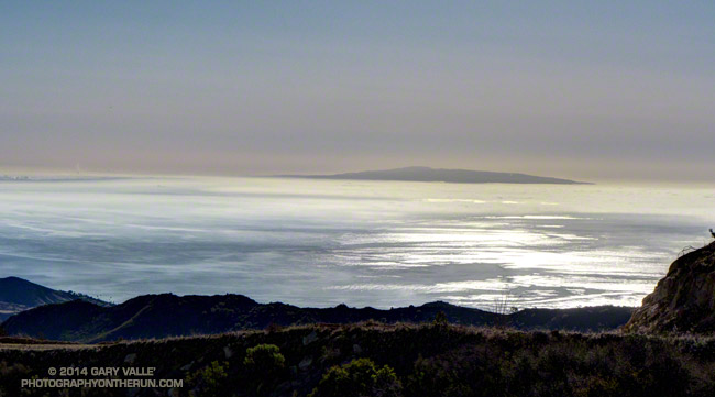
It wasn’t until about halfway up the Bulldog climb that the wind started to pick up. But it was still far less windy than I had expected. Several sections of Castro Peak and Mesa Peak fire roads were in the lee of the crest, and the running was excellent. The variegated patterns of sun, stratus and wind on the Pacific was spectacular.

Rocks along the Backbone Trail near the top of Corral Canyon in the Santa Monica Mountains.
Rocks along the Backbone Trail near the top of Corral Canyon.

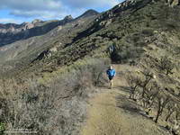
Once I was off the crest the wind diminished to little more than a zephyr. In many areas — such as at Tapia Park and along Crags Road there was no wind at all.

But it was still windy in the West Valley. When I got home from the run I checked the Cheeseboro RAWS, which is about 6 miles NNE of Malibu Creek State Park. Between 9:30 and 10:30, when it had been dead still on Crags Road, the Cheeseboro RAWS had recorded steady winds of 30 mph, gusting to as high as 50 mph!

The title photo is of windblown stratus on Santa Monica Bay with Palos Verdes Peninsula in the distance.

Some related posts: Malibu Creek State Park Scenic Loop, Vertical Relief

Run, Lop and Shiver – Trail Work with the SMMTC on the Chamberlain Trail

No big deal, so the temp was in the low 40s and it was a little windy… and rainy… and my work gloves were sopping wet… Yes, Victoria did say she hadn’t been this cold since leaving Russia, but how bad could it be — Mike and Jeanne were wearing SHORTS. I quietly whimpered and lopped off another limb of encroaching chamise. If I kept lopping maybe no one would notice how much I was shivering.

Logistically, the Chamberlain Trail segment of the Backbone Trail is one of the more challenging trails in the Santa Monica Mountains to maintain. It’s difficult to get all the tools and people to the trail and out again and still have time to do a few hours of work.

Coordinating with the Santa Monica Mountains Trails Council, Howard Cohen, RD of the Coyote Backbone Trail Ultra, rounded up a bunch of trusting folk that will do just about anything if running in the mountains is involved.

Starting at the Wendy Drive trailhead runners hoofed it over Boney Mountain to the top of the Chamberlain Trail — about a two hour run/hike — then lopped, and sawed and cleared their way down the trail until told to stop. Then they ran back to their cars.

If the smiles (of relief?) at the end of the day were any indication, good, clean fun was had by all — even if it was a little damp and chilly.

Here are a few additional photos from the adventure. Click for a larger version of the photo.


Boney Mountain


Front Moving In


Soups On


Chamberlain Trail


Wrapping It Up


Clearing Clouds


After Work


Scott


Jeanne & Howard


Clearing Clouds Panorama


Chamberlain Rock Panorama

Still One of the Driest Calendar Years on Record in Los Angeles

Sunset at Sage Ranch Park

It’s been great to get a little rain the last couple of weeks. Since November 20th Downtown Los Angeles (USC) has recorded 0.62 inch of rain, bringing the calendar year total through November 30th to 3.40 inches.

During our showery rainstorm on Friday the few extra raindrops that made it into the rain bucket at USC moved 2013 from 4th driest to 5th, behind 1947 (2.51), 1971 (2.69), 1894 (2.89) and 1984 (3.37).

Rainfall totals can change dramatically in December, which is normally about twice as wet as November. Of the dry years listed above only 1947 continued to be unusually dry and finish the year as one of the nine driest on record.

Rainfall amounts were compiled from NWS and NCDC data. In a couple of instances differences were noted in daily and monthly data. Monthly data was used in rankings.

The title photo is from a run at Sage Ranch on November 21.

San Fernando Valley from Near Rocky Peak

San Fernando Valley from Near Rocky Peak

In short sleeves and shorts it was cold. The wind gusts were so strong that I could not hold the camera steady. Dropping down on one knee helped, but I still had to time the shots for the 10-15 mph “calm” between the 20-30 mph gusts.

After generating some rain and snow in Southern California, a blustery upper level low was finally exiting the area. Had I not known it had rained a couple days before, I’m not sure I would have been able to tell. The dessicated soil had quickly absorbed most of the moisture and the chaparral plants still looked drought stricken.

From today’s late afternoon run on Rocky Peak.

Seventh Driest January 1 to November 1 On Record in Los Angeles

Oak and clouds on the El Escorpion loop near West Hills, California

Updated November 5, 2013. My mistake — a spreadsheet range error — thanks for the heads up Reg! The driest January 1 to November 1 for Downtown Los Angeles was in 1972 with 0.92 inch. Here are the driest ten years for that period:

1. 1972 0.92
2. 2002 1.62
3. 1984 1.93
4. 1961 2.37
5. 1971 2.39
6. 1947 2.45
7. 2013 2.78
8. 1894 2.89
9. 1953 2.89
10. 2007 3.37

As much as I enjoyed running in the showery weather Monday, I barely got wet. What Los Angeles needs is a good soaking.

Year to date Downtown Los Angeles (USC) has only recorded 2.78 inches of rain. This is the seventh driest January 1 – November 1  in Los Angeles over the past 135 years! To get out of the bottom ten for calendar year rainfall Los Angeles needs about 3.5 inches of rain by December 31. Normal rainfall for November is 1.04 inches and for December is 2.33 inches.

Although it’s still early in the rain season Downtown Los Angeles (USC) is already 0.83 inch below normal for water year rainfall. The water year extends from July 1 to June 30.

Dowsing for Rain: The 2013-14 Southern California Winter Precipitation Outlook

Rocky Peak Road near its junction with the Chumash Trail

Updated October 17, 2013.

As I started up the Chumash Trail, a patchwork of clouds filled the sky, and the fresh smell of a recent shower filled my lungs. A strong and unseasonably cold low pressure system was producing the first widespread rainfall of Southern California’s 2013-14 rain season.

I hoped there would be another shower during my run. The plants and animals needed it and I needed it. It had been many months since I had run in the rain on a local trail.

As I worked up the trail I thought about how dry it had been. Downtown Los Angeles’ 2012-13 water year (Jul 1 – Jun 30) was the sixth driest on record. Rainfall in Los Angeles since January 1 has been about 25% of normal. The 2012-13 Sierra snowpack was one of the worst on record.

Will this rain and snow season be any better? For months I’ve been monitoring climate data and forecasts looking for something on which to base a 2013-14 Winter Outlook. Historically, ENSO has been the big dog in Southern California rain season weather with El Nino conditions generally producing wetter weather and La Nina conditions generally drier.

But ENSO conditions are currently Neutral and are expected to remain so through the end of the year. Most climate models forecast there will be slow warming of SSTs in the equatorial Pacific (NINO 3.4 region) over the next several months, but at this time of the year it would be very unusual to have substantial warming. The CPC/IRI ENSO Forecasts from IRI’s October Quick Look indicate the probability of an El Nino developing before the end of the year is less than 20% — and 20% seems high.

One computer model that at times has been forecasting above average precipitation this Winter in Southern California is the Climate Forecast System version 2 (CFSv2). The CFSv2 is fully coupled ocean-atmosphere-land-sea ice model used to forecast parameters such as sea surface temperature, temperature and precipitation rate. While skillful at predicting tropical SSTs, the CFSv2 generally performs very poorly when forecasting precipitation over land, so forecasts such as this one for Dec-Jan-Feb must be viewed somewhat skeptically.

Another glass half-full observation is that the Madden-Julian Oscillation (MJO) has been relatively active this year and if this activity continues it provides recurring opportunities for enhanced U.S. West Coast precipitation. The downside is that it can result in periods of dry weather as well.

With the ocean and atmosphere neutral there’s just not much on which to base a rain season forecast. According to the Climate Prediction Center, the current winter precipitation outlook for most of Southern California calls for an equal chance of below average, average, or above average rainfall. I know — that’s no help at all — you might as well flip a three-sided coin!

Update October 17, 2013. The Climate Prediction Center released its updated U.S. Dec-Jan-Feb Precipitation Outlook today. The outlook now indicates an equal chance of below average, average, or above average precipitation for all of Southern California. The October CPC outlook is usually the basis for the initial official NOAA U.S. Winter Outlook.

The title photo is of Rocky Peak Road, near its junction with the Chumash Trail. Here’s a larger version of the panorama.