Category Archives: weather|southern california

Eagle Rock – Topanga State Park

Eagle Rock in Topanga State Park.

Mammoth Mountain reports more than a foot of snow fell over the Memorial Day weekend but that translated to cool, puffy white clouds and blue sky weather in the Los Angeles area, seldom seen this late in May.

Taking advantage of the great weather on Sunday my son and I ran the Garapito figure-eight course in Topanga State Park.  We did a slight variation that climbs Eagle Rock before descending the Garapito Trail.

Gov. Schwarzenegger’s revised state budget, released May 14, rescinded the funding cuts that would have closed 48 California state parks, including Topanga State Park. For now, it appears these state parks will remain open.

Some related posts: Eagle Rock Silhouette, Eagle Rock and Clouds

San Gabriels High Five

Snow on the Pacific Crest Trail west of Mt. Baden-Powell, May 18, 2008.

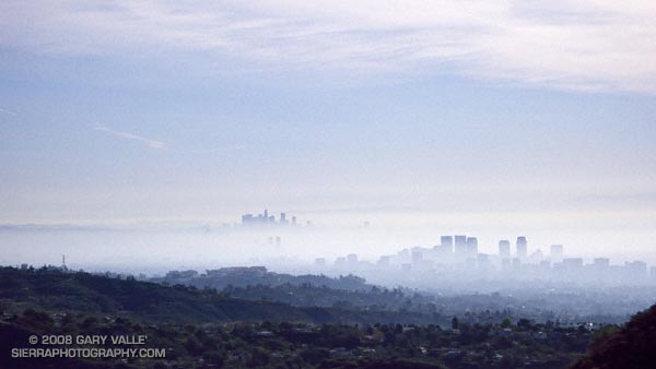
When considering where I might run this weekend, the words “snow” and “altitude” had a certain appeal. Record high temperatures had been set in the Los Angeles area on Friday and Saturday, and there was little doubt that more temperature records would fall today.


Angeles Crest Highway and the Islip Saddle parking area from the northwest ridge of Mt. Islip.
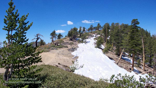
A couple of weeks before I had dodged a few remnant snow drifts on Pleasant View Ridge. From that vantage point you could see that there was much more snow on the steep, north facing slopes along the ridge between Mt. Islip and Mt. Baden-Powell. The S-shaped ridge spans a distance of several miles and links five peaks over 8000 ft: Mt. Islip, Mt. Hawkins, Throop Peak, Mt. Burnham, and Mt. Baden-Powell. Two of the peaks, Mt. Baden-Powell and Throop Peak, exceed 9000 ft. Today, the plan was to do these five peaks as part of an approximately 17 mile out and back route from Islip Saddle, enjoy the snow before it melted, and try to escape the triple digit temps of the lowlands.


Cabin on the summit of Mt. Islip.
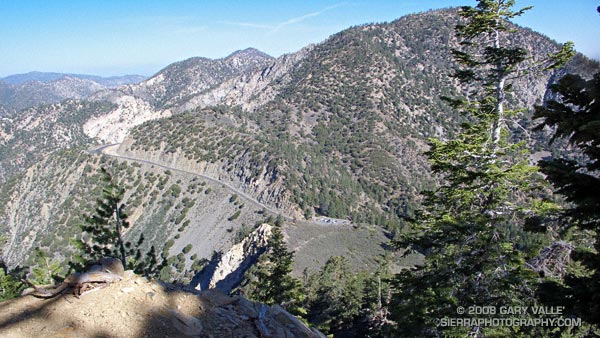
Logistically, the difficult peak is Mt. Islip. While the other peaks can be done with relatively minor deviations from the trail, Mt. Islip stands alone, more than a mile from the PCT at Windy Gap. This time I opted to climb Mt. Islip from Islip Saddle via the northwest ridge. I’ve been investigating stunted Jeffrey and Sugar pines found along the windswept ridges of the San Gabriels, and this direct approach would give me the opportunity to check out more trees.

That was this morning, now I was on by way back from Mt. Baden-Powell, and about a quarter-mile east of Throop Peak. Hot, thirsty, dispirited, and nearly out of water, I had stopped to dig into the side of a dirty snowbank– attempting to get to snow that at least looked clean. The air temperature was eighty-something, but my fingers were stinging with cold as I scooped the coarse crystals into my Camelbak.

It’s amazing what a few sips of chilled water and an icy cold pack against your back can do for your demeanor. A few minutes before I had been debating whether I should just skip Throop Peak and Mt. Hawkins, and get down to Little Jimmy Spring ASAP. Now I could do these peaks and continue to enjoy a very warm — but beautiful — day in the San Gabriel Mountains.

Here’s a Google Earth image and a Google Earth KMZ file of a GPS trace of my route. GPS reception was poor climbing the ridge to Mt. Islip.

Related post: Snowless San Gabriels

Sun Burnished Hills

Sun burnished hills along Lasky Mesa in Upper Las Virgenes Canyon Open Space Preserve.

The greens of Southern California’s rain season have given way to the sun burnished colors of Summer.

Increasing temperatures over the next few days should also result in an increase in rattlesnake encounters, such as this one today on the “main drag” at Ahmanson Ranch (Upper Las Virgenes Canyon Open Space Preserve).

Note: Jon Sutherland nicknamed the main road that connects the Victory trailhead to Las Virgenes Canyon the “main drag.” Jon has run out at Ahmanson for more than 30 years. He is second on the Running Streak List for most consecutive days run. As of March 1, 2008 his streak was 14,160 consecutive days (38 years 281 days)!

Related posts: Southern California Greenscape

La Nina Fades as SoCal Rain Season Nears End

Sun-parched mustard leaf at Ahmanson Ranch.

It’s been late February since Southern California has had a good soaking rain. As of May 1, the water year rainfall total for Downtown Los Angeles (USC) stands at 13.42 inches. This is 90% of the 1921-2006 average of 14.87 inches. According to the NWS 1921-2006 dataset, the average amount of precipitation in May and June is 0.3 inch and 0.1 inch, respectively. We’ll see if we get that much this year!

La Niña appears to be winding down.  In it’s April 30 ENSO Wrap-Up, the Australian Bureau of Meteorology characterizes Pacific climate patterns as being generally neutral, “with the majority of indicators returning to near-normal levels.” The April 28 ENSO Update from the CPC suggests that La Niña will continue through May-July 2008, but many of the factors discussed indicate general weakening of La Niña. Based on the ONI and MEI, La Nina conditions have existed since about August of 2007.

The photograph of the sun-parched mustard leaf is from a run at Ahmanson Ranch on April 29, 2008.

Google search: $g(la nina), $g(Los Angeles weather)

A Long Run Kind of Day

Saddle Peak from the Backbone Trail, in the Santa Monica Mountains, near Los Angeles. Mt. Baldy can be seen in the distance.

The beauty and intensity of the day was infectious. Hours before a cold low pressure trough digging down from the Pacific Northwest had carried showers, thunder, hail, and chilly temps into Southern California. Its rainfall had refreshed the greens of the hills, and accentuated the yellows, purples and reds of the wildflowers along the trail. Its blustery winds had cleansed the sky.

A few minutes before I had completed one run, and now was starting another. I wasn’t certain how much farther I would run — I just knew I had to run.

The day had begun with friends on the Secret Trail in Calabasas. We had run up and over the shoulder of Calabasas Peak, and then ascended Saddle Peak via the Stunt High Trail and Backbone Trail. The view from the summit of Saddle Peak had extended beyond Santa Monica Bay and Palos Verdes Peninsula to the South Bay and Saddleback Mountain. New snow glistened on Mt. Baldy, and to the west the rocky summits on Boney Mountain stood in bold relief.

That 14.5 mile run had ended at Tapia Park. Now I was on the Tapia Spur Trail on the first climb of the Bulldog Loop. On the wind sheltered slope the bright yellow blossoms of tree poppy had begun to unfurl, absorbing the warmth of the midday sun. Distant peaks loomed to within an arm’s reach, and my legs seemed to draw energy directly from the trail. It was a long run kind of day.

Notes: The title photograph is of Saddle Peak from the Backbone Trail, in the Santa Monica Mountains, near Los Angeles. Mt. Baldy can be seen in the distance. The combined length of the runs was about 29 miles with an elevation gain of about 5000 ft.

Some related posts: Tapia Bound, Bulldog Loop and the Corral Fire, Fog Along Malibu Creek

Los Angeles Basin Fog

An offshore wind scours out low-lying fog trapped in the Los Angeles basin by a low altitude temperature inversion.

This photograph of downtown Los Angeles and Century City was taken Sunday morning from the Backbone Trail in Topanga State Park while doing the Will Rogers – Temescal Loop from the “end of Reseda” in the San Fernando Valley.

At the time an offshore wind was scouring out low-lying fog trapped in the Los Angeles basin by a low altitude temperature inversion.

Related posts: California State Park Closures, Will Rogers – Temescal Loop