Gary Valle's Photography on the Run

Gary Valle's Photography on the Run

Search
Skip to content
  • About
  • Contact
  • Warning
  • Search
nature, photography, photography|landscape

home » nature » Lasky Mesa from Hill 1842

Lasky Mesa from Hill 1842

published March 24, 2009 Gary Valle
Click on thumbnails for more info & larger image.

Lasky Mesa from Hill 1842

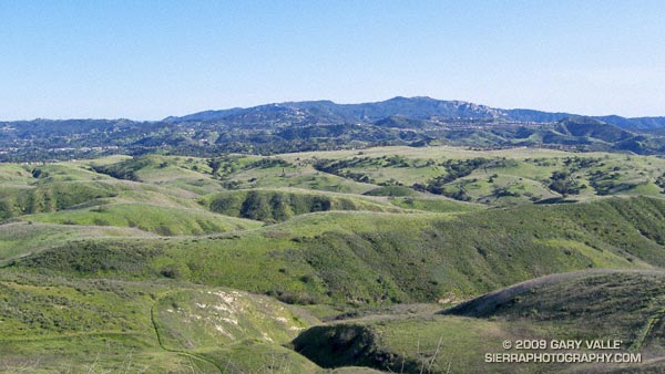
From what I can tell looking at the topo, Hill 1842 is the high point of Ahmanson Ranch — now Upper Las Virgenes Canyon Open Space Preserve. Here’s a wider view of Lasky Mesa from this vantage point, and then here’s what Hill 1842 looks like from Lasky Mesa.

Post navigation

Previous PostSugar Pine & CloudsNext PostSpring on the Bent Arrow Trail

Photography and inspiration from running and other adventures in the Open Space and Wilderness areas of California, and beyond. All content, including photography, is Copyright © 2006-2022 Gary Valle. All Rights Reserved.

Subscribe: RSS

Twitter Feed

Photo Albums

Recent Posts

  • Interactive 3D Terrain View of Sheep Fire Perimeter, Near Wrightwood
  • Not So Flat Las Llajas Canyon
  • Forest Run
  • Dawn Songs, Wildflowers, and a Rocket Launch from the Phantom Trail
  • Encelia Eruption
  • Exploring the Santa Clarita Ultra & Trail Runs 50K Course
  • High Point (Goat Peak) Via the Rivas Ridge Use Trail
  • Old Boney to Serrano Valley, Plus Fireline and Overlook
  • Revitalized Valley Oak at Ahmanson Ranch
  • A Lot of Bluster, But Not Much Rain
  • Is This the Future of Trail Use?
  • Malibu Creek December 2021 Floods

Archives

Categories

June 2022
M T W T F S S
 12345
6789101112
13141516171819
20212223242526
27282930  
« May    

Meta

  • Log in
  • Entries RSS
Running WordPress