Serrano Valley – La Jolla Valley Loop

Boney Mountain and Serrano Valley from the Ray Miller Trail.

The idea was to do an interesting trail run that wasn’t quite as long and strenuous as last week’s Bandit 30K Course Preview. That was the idea. I could have calculated the mileage and elevation gain of our projected route, but sometimes part of the fun of trail running is not knowing the exact route, how long it will take, or how strenuous it might be.

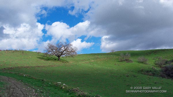
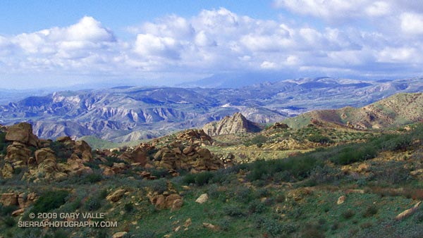
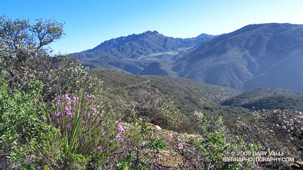
This particular exploration would visit two of the most scenic areas in the Santa Monica Mountains — Serrano Valley and La Jolla Valley. Many variations of this loop are possible. Our base route included the Ray Miller/Backbone Trail, Fireline Trail, Serrano Canyon Trail, Serrano Valley Trail, Old Boney Trail, Wood Canyon Vista Trail, La Jolla Valley Loop Trail, La Jolla Canyon Trail and connecting roads.

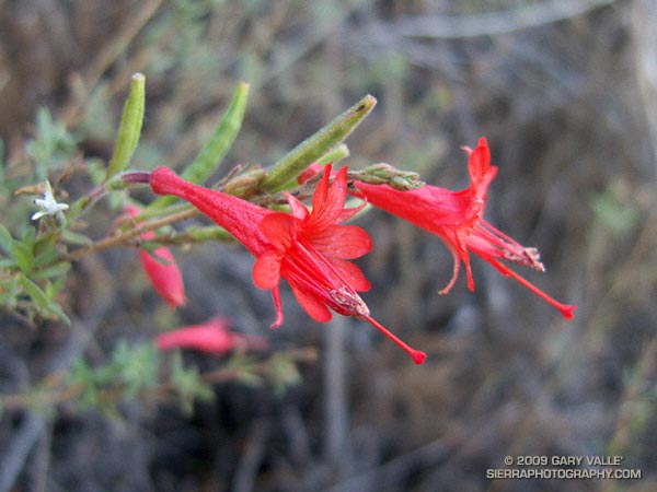
In addition to its wonderful scenery, this course is characterized by moderate uphills that are generally very runnable. The side trips to to the old ranch site in Serrano Valley, and to Mugu Peak pushed the route beyond the 30K mark, but were worth every step. Here’s a Google Earth image and Google Earth KMZ file of a GPS trace of the route. Since none of us had done the eastern leg of the La Jolla Valley Loop Trail, this time we did Mugu Peak from the east. The route around the valley to the western side of Mugu Peak is also shown.

Here is a Live Browser View of the run.

Some related posts: Serrano Valley from Wendy Drive; La Jolla Valley & Mugu Peak from Wendy Drive; Laguna Peak, La Jolla Valley, and the Channel Islands

Bandit 30K Course Preview

View on Bandit 30K course in Rocky Peak Park.

Because of a scheduling conflict, two friends weren’t going to be able to enter a challenging new Southern California trail race — the Bandit 30K/14K — so today we previewed the 30K course.

The race starts in Corriganville Park in Simi Valley, and incorporates several of my favorite local trails in Rocky Peak Park. With an elevation gain in excess of 3200 ft., and varied terrain, the race promises to be a memorable test of trail running skill and endurance. A plus is that it is being run in March, when the hills are green; there is water in the creek crossings; and wildflowers along the trails.

So how was the 30K course? In a few words — strenuous, scenic and technical — and more difficult than either the Boney Mountain 21K or Bulldog 22K.

Note: The Bandit Trail Runs are now Rocky Peak Trails.

Related post: Bandit 30K 2009

Blue Skies and Short Sleeves on Strawberry Peak

Mt. Baldy from near the summit of Strawberry Peak, in the San Gabriel Mountains.

My legs were still pretty worked from the Boney Mountain Half Marathon. Instead of backing off of the pace on my weekday workouts, I had continued to experiment with a change in running technique that was resulting in faster paced runs. I was excited about the increase in speed, but logging fast times on oft-run courses after a strenuous race doesn’t equal recovery. Neither does blasting up a peak in the San Gabriel Mountains.

But it was one of those impossible to ignore, blue sky, short-sleeved Southern California Winter weekends. This would be an unprecedented eighth straight January day that the high temperature in Los Angeles exceeded eighty degrees. In the yin yang of weather, the western half of the U.S. has been enjoying unusually warm temps, while the eastern half of the country shivered.

Taking maximum advantage of the good weather, yesterday I had done a little kayaking on the Kern River, this morning some rock climbing at Stoney Point, and now we were huffing and puffing up Strawberry Peak (6164′) — and doing it “for time.”

We had started at Red Box, the shortest and technically most moderate way to climb the peak. By this route it’s about 3.4 miles to the summit, with an elevation gain of roughly 1600 ft. About two-thirds of that distance is well-graded trail, the rest is steep use trail up a broad, brush covered ridge.

About halfway between Lawlor Saddle and the summit of Strawberry it became plainly and painfully evident that my legs had given their all. I complain. Miklos — always sympathetic — asks why I can’t go any faster.

On the final steep push to the summit ridge I try a different tactic to slow the pace, and tell a story about an unbelievably angry and aggressive raccoon I once encountered near here. But like President Jimmy Carter’s rabbit incident, it loses something in the telling. Redlined, we crest the summit ridge and sprint (relatively speaking) toward the summit.

On the summit, there is not a breath of wind. The view is exceptional. To the southwest, sunlight gleams on the waters of the Pacific near Palos Verdes, and to the west snow gleams white on Mt. Baldy. Some 90 miles distant, near Palm Springs, is the asymmetric silhouette of Mt. San Jacinto.

Soon we’re headed down. As I drop below the summit ridge, a snowball whizzes past my ear, crashing on the trail ahead. It has been warm and dry for weeks, but remarkably, there are a few patches of snow. It is a reminder that Winter is not over, and like the snow, is lurking in the shadows.

Green and Growing

Greening grass at Sage Ranch Park

Green beneath Summer’s bleached stalks, the growth of this grass at Sage Ranch reflects the near normal rain season we’ve had to date in the Los Angeles area, and over much of Southern California. Since the start of the water year on July 1, Downtown Los Angeles (USC) has recorded 4.66 inches of rain. When this photograph was taken, January 11th, 4.66 inches was almost exactly normal rainfall for the date.

However, as is so often the case in Southern California, this apparent normality is the sum of offsetting wet and dry periods. December’s precipitation was generally well above normal, but January has been dry, dry, dry. Today, the Los Angeles rainfall total is about 0.5 inch below normal, and every day it doesn’t rain, our deficit increases by about 0.10 inch.

So when might it rain? A very strong 200 kt Pacific jet stream has pushed up a high pressure ridge over the West Coast, blocking storms and warming temperatures. Big upper level ridges such as this are consistent with La Nina, and have been a recurring theme this Fall and Winter. Much of our rainfall and cold weather this season has occurred when an extended Pacific jet collapses or contracts, and a blocking ridge shifts west, opening the door to cold storms plunging down the backside of the ridge from the north.

Over the next 1-2 weeks, this is expected to happen again, but this time there is a wildcard in the mix. One of the reasons the Pacific jet is so strong is the active phase of the Madden-Julian Oscillation (MJO) is present in the Western Pacific. As described in this Climate Prediction Center document, this scenario sometimes leads to a heavy West Coast precipitation event.

It’s too far out for the medium range models to be of much help in assessing the likelihood of such an event developing. At the moment, about the only thing that can be said with some certainty is that a pattern change is in the works, and by the end of January there is a chance of some rain in California and the West. We’ll see!

Related post: Southern California 2008-2009 Winter Precipitation Outlook, Snow on Oat Mountain

Winter Bloom

A California fuchsia in deep shade blooming in December in the Santa Monica Mountains.

Deep in shade on a north-facing chaparral slope, this California fuchsia (Epilobium canum ssp. canum) has not savored direct sunshine for weeks. Overnight temperatures in the Santa Monica Mountains have dropped to freezing several times this Winter, and frosts have been common. But this hardy plant continues to bloom.

According to the Jepson Manual this subspecies ranges up to about 5000 ft. in elevation, and the parent species up to about 10,000 ft. As a genus, Epilobium is well represented by species that grow at higher latitudes and elevations, and must have developed adaptations that help it flourish in cooler climes.

From a run on the Old Boney Trail on December 27, 2008.

Photography and inspiration from running and other adventures in the Open Space and Wilderness areas of California, and beyond. No ads. All content, including photography, is Copyright © 2006-2024 Gary Valle. All Rights Reserved.