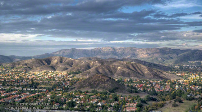
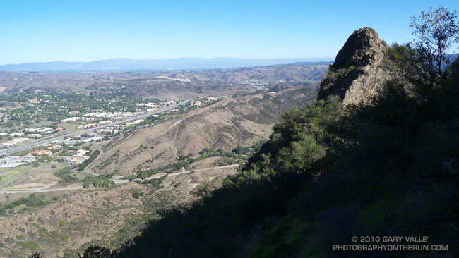
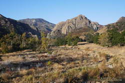
Simi Peak and the city of Agoura Hills from Ladyface. Simi Peak is the high point of the Simi Hills.
Some related posts: Ladyface Loop, Sunny Sunday

Simi Peak and the city of Agoura Hills from Ladyface. Simi Peak is the high point of the Simi Hills.
Some related posts: Ladyface Loop, Sunny Sunday
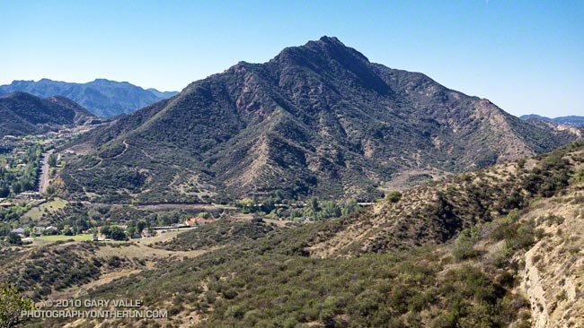
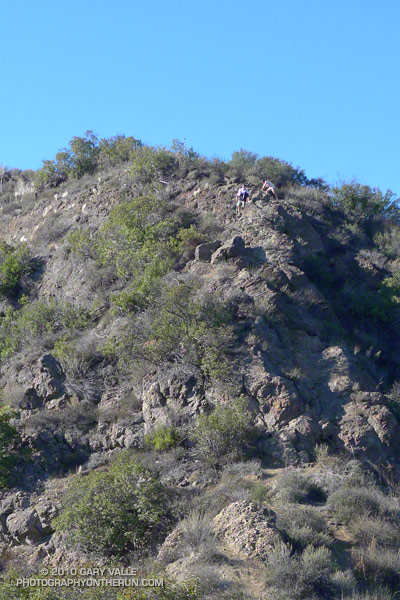
Like many good peaks that are mostly “walkups,” the ascent of Ladyface requires a bit of scrambling. By that I mean some use of the hands is required. And some care. Some of the rock is sound, and some of it isn’t. A few short sections on the frequently used east/southeast ridge are very loose and manky.
I like to do the 2.5 mile loop counterclockwise — ascending the northeast ridge, and descending the east/southeast ridge. The route generally follows the ridges, but the route-finding can be quirky in places.
The path up the northeast ridge doesn’t appear to be as popular as the east/southeast ridge route, but is cleaner overall. Sections of the northeast ridge are brushy, but no significant bushwhacking is required — if you stay on route. The northeast ridge ends a couple hundred feet below the top of the peak. A zig-zag path up the steep north face winds its way through knobby volcanic rocks to the summit.
The volcanic rocks on Ladyface include several components of the Conejo Volcanic Suite, and tell a story of volcanism associated with plate subduction, rifting, and continent-building.
If you don’t pay too much attention to the cars zooming along the 101 Frwy a thousand feet below, the Ladyface loop in Agoura Hills is one of the more scenic and interesting short hikes/climbs in Southern California.
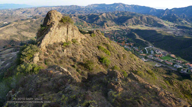
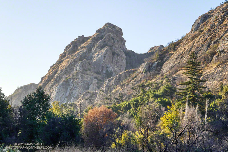
The title photo is of a subsidiary crag, east of the summit of Ladyface. In the background is Saddle Peak, Malibu Creek State Park and Brent’s Mountain.
Related post: Ladyface the Long Way
I wasn’t familiar with the routes on Ladyface, and wasn’t certain I could get to the peak directly from the Heartbreak Ridge trail. But that’s part of the fun of an adventure run. I had a general idea of what I wanted to do — an out and back from the Phantom trailhead in Malibu Creek State Park to the top of Ladyface. And I had an idea of the time available to do it — about four hours. The details would sort themselves out along the way.
Or at least that was the theory. It was now three in the afternoon, and I was one hour and 56 minutes into sorting out those details. Theoretically, I was supposed to be on the summit of Ladyface in about four minutes.
Earlier, I had run out of trail descending Heartbreak Ridge, and had used a network of coyote paths to get down to Cornell & Kanan roads. But then I chosen the wrong “trail” to start the climb of the peak.
For sure the route would follow one of the prominent ridges on the east side of the mountain. Since the descent of Heartbreak Ridge left me on the northeast side of the peak I had looked for a route there. One car was parked at the start of a dirt road, and a street vendor had indicated he’d seen people start the climb there. My thought was that maybe an established trail would work up the canyon and onto the northeast ridge.
Wrong Charlie Brown! The trail, which (ha!) turned out to be a freeride course, was a dead end. Following it burned about 10 minutes and a good chunk of elevation gain. I ran down and jumped up onto the northeast ridge, where I found a use trail.
Low on the ridge it looked like this trail might go to a subsidiary peak and not the true summit of Ladyface. Whatever it did, I was now short on time, and committed to this approach. I would follow it until either I ran out of time, or reached a summit.
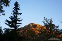
The face was deep in shadow and wet from Friday night’s rain. Still a couple hundred vertical feet below its top, I zig-zagged up through the steep outcrops of Conejo volcanic rock. It wasn’t how I had pictured the trail on Ladyface, and I hadn’t expected to be climbing on wet, mossy holds for the second weekend in a row.
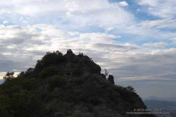
Two hours and 3 minutes into the adventure I scrambled onto the summit. A surprised hiker asked, “Where did you come from?” I explained, and he commented, “I’ve never climbed Ladyface that way.”
I jogged down the well-used, but somewhat manky trail on the east/southeast ridge, followed Kanan back to Cornell Rd., climbed back up Heartbreak Ridge, and made it back to the car a couple of minutes after five o’clock.
I checked my watch — it was 6:13 a.m. I was part way up the Phantom Trail in Malibu Creek State Park, and had stopped to see if I could hear the launch of the Falcon 9 at Vandenberg Space Force Base.
I’d hoped to see the launch, but low clouds obscured the view skyward. Even so, there was a chance that a thin spot in the cloud deck might reveal the ship, as it propelled its classified payload into orbit.
All was quiet, except for the dawn songs of waking birds and the occasional car or motorcycle on Mulholland Highway. But then, just above the ambient sounds, I heard it — a constant dull roar somewhere to the west. I scanned the sky for any hint of an exhaust plume.
None was evident, but I suspect that if I had looked at the right spot at the right time, I might have glimpsed the rocket’s sun-bright flame. After searching and listening for a couple of minutes, I resumed working up the trail.
Ka-boom! Even though my attention had turned to the trail, the distinctive, two-syllable report of a sonic boom broke my reverie. It had to be the Falcon 9 booster returning to the launch site. The boom wasn’t very loud at my location, but some living closer to Vandenberg apparently mistook the launch and sonic boom as an earthquake.
The remainder of the run went well. I’d run the Ahmanson 12K the day before, and the Phantom Loop (clockwise) was a good follow-up to that run.
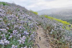
I was a bit surprised just how overgrown some sections of the trail were. Mustard wasn’t the only plant crowding the trail, phacelia was as thick along the Phantom Trail as I’ve seen.
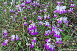
With the cloudy, cool start to the day, the poppies were mostly closed, but several other species of wildflowers added color along the trail. Among them were Elegant Clarkia, Owl’s Clover and Chinese Houses.
Note: A little higher in the Santa Monica Mountains and farther to the west, Jonathan Stewart captured this video of the NROL-85 launch from Boney Mountain.
Some related posts: Phantom Trail: Trade-offs of a Wet Rainy Season; Redwoods, Raptors, and the Phantom Loop; Ladyface Via the Phantom Trail and Heartbreak Ridge
It was a chilly 45°F as I crossed algae-covered Malibu Creek on a foot-worn log. Following a brutally hot Summer with temps in the West San Fernando Valley reaching 121°F, the chill of the cold air felt especially good.
The plan was to do the Phantom Loop, but first, I was going to run over to the Forest Trail. The side trip was not only to check on the coast redwoods along the trail but to enjoy the calm beauty of the area. To say 2020 has been unsettling is like saying a rattlesnake bite is a little annoying — and the year isn’t over yet.
After crossing the creek, I stopped to photograph the redwood near the junction of the Forest Trail and Crags Road. The sun had just risen, and behind the tree, orange-tinted sunlight illuminated the rocky ridge above the M*A*S*H site.
Continuing along the Forest Trail toward Century Lake, I counted four healthy-appearing redwoods and two struggling trees. Redwoods sometimes grow in a group of two or more trees, and these were counted as a single “tree.” Near the end of the trail is a naturally-germinated redwood that has grown to about 5.5 inches in diameter. Remarkably, this young tree survived the 2011-2015 drought and the 2018 Woolsey Fire, and appears healthy!
I had just finished photographing the young tree when a Cooper’s or Sharp-shinned Hawk flew from a nearby oak and through the trees along the trail. It landed on the limb of an oak ahead of me but was in deep shade. In a much-enlarged image, the bird looks like a Sharp-shinned Hawk, but distinguishing the two species can be challenging.
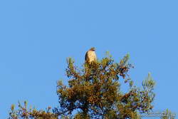
A few yards down the trail, a much larger raptor — a Red-tailed hawk — was perched at the top of the tallest redwood. The huge bird had its wings pulled back to expose more of its body to the warming sun. It looked like a giant penguin sitting atop a tree. As I approached, it began to preen its feathers, comfortable with its lofty position.
With a sigh, I left the Forest Trail behind and returned to Malibu Creek. This time I crossed the creek on a plank near the washed-out bridge. This was a more direct route than the fallen tree upstream but only worked because the creek was low. At the crossing, a passing runner asked if he was on the Bulldog Loop. I assured him he was and was a little envious that he was getting to experience that excellent run for the first time.
As usual, Crags Road and the High Road were busy thoroughfares. The easy running under the sprawling coast live oaks was pleasant, and the morning view of Malibu Creek and Goat Buttes outstanding.
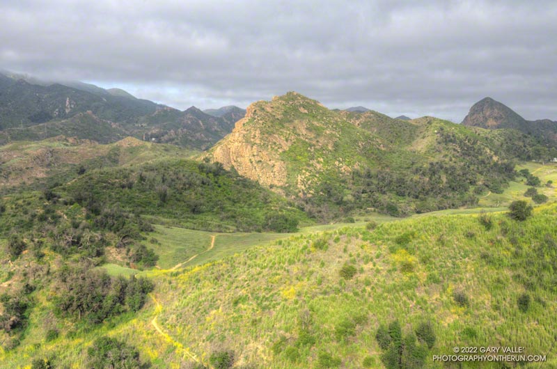
In a few minutes, I’d reached Mulholland Highway and then followed the Grasslands Trail to the Liberty Canyon Trail. From Liberty Canyon, the Phantom Trail gains about 750′ in elevation over about 1.5 miles to a high point and ridgeline with excellent views of Saddleback Peak, Las Virgenes Canyon, Brents Mountain, Goat Buttes, Castro Peak, Ladyface, and Boney Mountain.
The air quality this morning hadn’t been too bad. From up on the ridge, I could see there was far less smoke to the west of Las Virgenes Canyon than to the east. Yesterday, I’d done a run in the eastern Santa Monica Mountains and had to cut the run short because of smoke. That wasn’t a problem today, and the run had been a good one.
Some related posts: Coast Redwoods Along the Forest Trail, Urban Highlands, Saddle Peak from the Phantom Trail
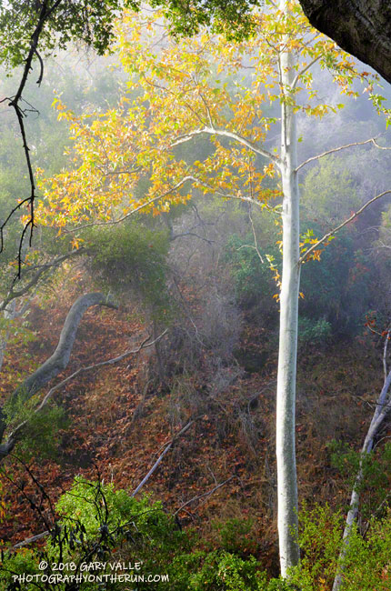
A sycamore in Dark Canyon aglow in fog-filtered morning light.
Also from Saturday’s run on the Lower & Upper Stunt High Trail and Backbone Trail.
Related posts: Saddle Peak Saddle from the Backbone Trail, After the Woolsey Fire: Ladyface from the Backbone Trail