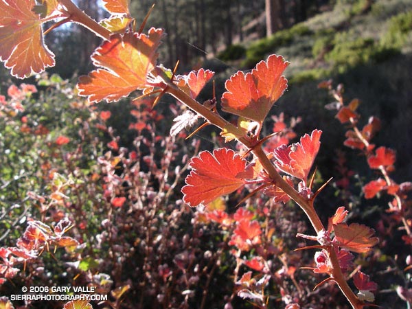
Autumn color in the leaves of gooseberry (prob. Ribes roezlii) at about 7500 ft. on the Vivian Creek trail. The photograph is from the San Gorgonio High Line hike and run.
Related post: Poison Oak

Autumn color in the leaves of gooseberry (prob. Ribes roezlii) at about 7500 ft. on the Vivian Creek trail. The photograph is from the San Gorgonio High Line hike and run.
Related post: Poison Oak
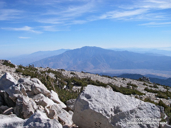
One of the other climbers commented, “It’s almost eerie.” And it was. On the 11,499′ of San Gorgonio Mountain there was not a breath of wind and the temperature was a comfortable 50-something degrees. Wisps of cirrus accentuated the azure sky, and to the southeast San Gorgonio’s ever-present companion, Mt. San Jacinto, stood quietly above Banning Pass.
A couple of hours before I had been sitting on the summit of East San Bernardino Peak, debating whether to continue my planned trek to San Gorgonio. I was considering running over to San Bernardino Peak instead, and then calling it a day. For sure I couldn’t do both. I didn’t have enough water, and the only nearby water source might be dry.
A month old report from the Water Collector had noted water “barely trickling” out of the pipe at Trailfork Springs. I wasn’t familiar with the spring, and given the pessimistic report probably wouldn’t do the required detour to check it out. So whatever I did, my remaining water would have to do. If I didn’t push too hard, it would get me to San Gorgonio, but probably not over to San Bernardino Peak and then to Gorgonio. (Note: A better late season water source is High Meadow Springs. The springs and camp site is about 1/3 of mile below the Divide Trail, east of Shields Flat. The turn off to the spring is between high point 10500 and Red Rock Flat. On a run of this course in late October 2009 the spring had a good flow.)
The hike up from Momyer had been unrelenting – a gain of 5250′ in elevation over about 7.5 miles. It was kind of like going up the Palm Spring Tram, without the tram. Beyond the turn-off to Alger Camp the character of the trail changed from obvious and well-trodden, to a schizophrenic path that in places was the kind of trail that only the really adventurous enjoy.
There were numerous downed trees, stark evidence of the bark beetle infestation. Although most could be bypassed or clambered over, one recently downed tree required a face in the dirt belly crawl. In other areas the manzanita, chinquapin, and whitethorn were so thick that the trail, though nearly invisible, could not be lost. Upward progress was possible by only one route.
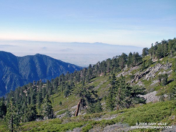
In counterpoint to these inconveniences were the early morning views of Mill Creek Canyon, idyllic sections of forested trail, Clark’s Nutcrackers and gnarled Lodgepole pines on the high mountain slopes, and outstanding views of Saddleback and Mt. San Jacinto. Near one fallen tree an opportunistic red paintbrush bloomed as if it were Summer. It is better to be positive…
Back on East San Bernardino Peak, I needed to make a decision – San Bernardino Peak or San Gorgonio? Instead I wandered about the peaklets in the area, not really heading in the direction of either peak, but evaluating how I felt and thinking through scenarios… Feel OK… Full moon tonight… Enough water to get to the peak… Water at Vivian Creek… Weather great… Know the route… After a few minutes, I found myself bearing slowly to the east, picking up the Divide Trail and starting to run.
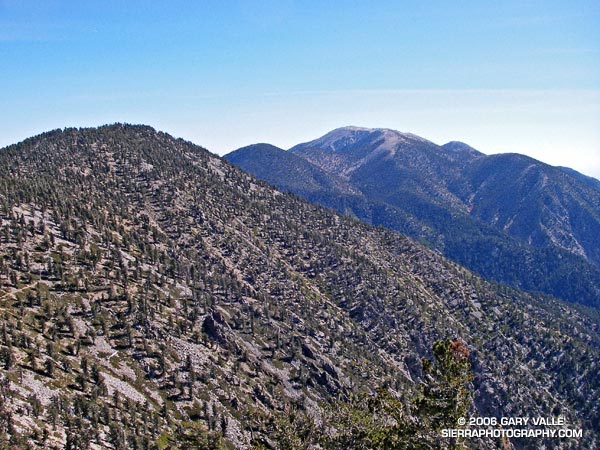
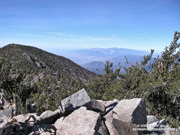
The distance by trail from East San Bernardino Peak to Mt. San Gorgonio is about 8 miles. Virtually all of route is above 10,000′ and along a spectacular mountain divide. The running on this high line is unmatched in Southern California. Once on the Divide Trail and headed in the direction of San Gorgonio there was no thought of turning back. Perhaps the biggest difficulty was resisting the ascent of the many named peaks along the way. Without more water, most of these would have to wait until a another day.
Epilogue: The climb from Momyer (5500′) to East San Bernardino Peak (10,691′) took about 3 hours, and the traverse over to Gorgonio (11,499′) about 2.5 hours. I reached the summit of Gorgonio at about 1:00 p.m, and after running down the Vivian Creek trail, and through Forest Falls, made it back to Momyer at about 4:00 p.m.
The distance to the summit of Gorgonio from Momyer via East San Bernardino Peak is about 15.5 miles, and the total length of the loop is about 26 miles. About 11 miles of the route is above 10,000′ and the total elevation gain and loss is on the order of 7000′. If you include Alto Diablo, there are nine named peaks above 10,000′ along the route. Dobbs Peak is somewhat further from the trail than the others, but rounds out the total to ten. Here is a Google Earth image and Google Earth KMZ file of a GPS trace of the loop.
Note: Mill Creek can be difficult and dangerous to cross.
Related post: San Gorgonio High Line 2009
Google search: $g(trail running), t$(San Gorgonio Mountain)
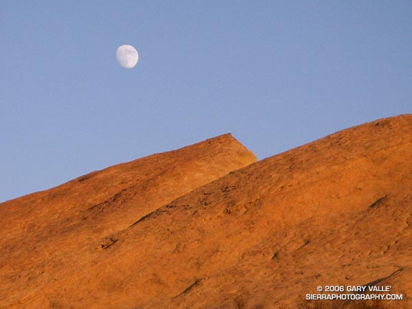
Moon rising over rocks of the Chatsworth Formation at Sage Ranch Park.
The intimidating canyon rose steeply above me. Towering rock precipices lined the canyon walls, their summits glistening in the morning sun. I was at an elevation of about 2600′ and it was already warm. A little unsteady, and moving slowly at first, I started the ascent. Gaining speed, I passed the first rock face, and after a minute or two, turned to gaze at Palm Springs and the Coachella Valley. In what seems like a matter of minutes, yucca and creosote transitioned to mountain mahogany and juniper, and then to pine and fir. Suddenly my pace slows, there is a bump, a jostle, and a pause. The operator announces, “Welcome to the mountain station of the Palm Springs Tram. The elevation is 8516’…”
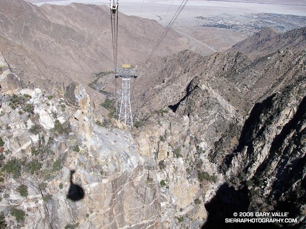
A 10 minute ride from the desert to the pines on the Palm Springs Tram isn’t a bad way to start a run. A couple of weeks before I had seen Mt. San Jacinto from the North Backbone Trail and it reminded me that I hadn’t done that peak in a while. As the weekend approached it looked like the weather would be perfect for a long mountain run.
Mt. San Jacinto State Park and Wilderness contains a network of over 50 miles of trails, including a segment of the Pacific Crest Trail. The resourceful runner or hiker can put together an adventure ranging from a few miles to 30 miles or more. I hoped to beat the worst of the Sunday going home traffic, so opted for an approximately 20 mile route that would get me back to the tram in the early afternoon.
Stopping at the ranger station in Long Valley, I filled out a wilderness permit. Cool air had pooled in the valley overnight, and the deck of the station was still in shade. The ballpoint pen protested the 40-something degree temperature, but with repeated attempts, I scratched in my destinations: Mt. San Jacinto and Tahquitz Peak.
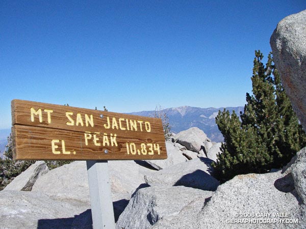
My route would take me to the summit of Mt. San Jacinto (10,834′), back down to the junction at Wellmans Divide, and then continue down to the Pacific Crest Trail. The PCT would be followed through Saddle Junction to the junction with the South Ridge Trail, and then continue on this trail to the historic fire lookout on Tahquitz Peak. I would return to Long Valley via Skunk Cabbage Meadow and Hidden Divide. Here’s a Google Earth image and Google Earth KMZ file of a GPS trace of the route.
The run and the running were outstanding – a blue skies and sunshine kind of day, with Autumn shadows, light winds, pleasant temperatures, and nearly unlimited visibility. Much of route was through spectacular old-growth forests of Jeffrey Pine, Lodgepole Pine and White Fir. The uphills were generally very well graded, with long runnable sections. And the downhills – ah the downhills – some rocky and technical, and some that make you feel as if you’re blazing down the trail on a Star Wars speeder bike.
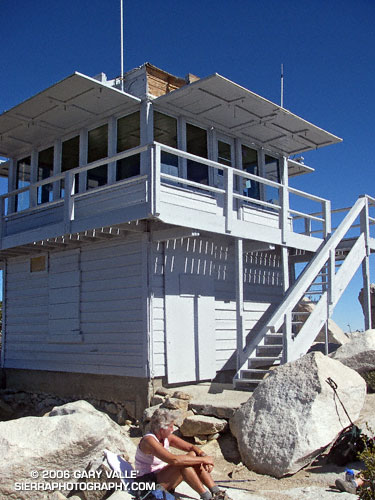
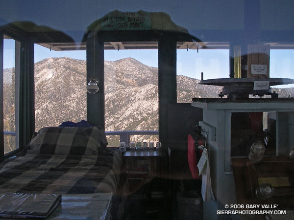
The lookout on Tahquitz Peak is a can’t miss destination. On the way, there are superb views of Tahquitz and Suicide rocks, and from the summit there are expansive views in nearly all directions. Palomar Mountain can be seen about 30 miles to the south, Saddleback about 50 miles to the west, and Mt. Baldy and its neighbors about 65 miles to the northwest. Much closer are the slopes leading to Jean Peak and the summit area of San Jacinto.
The lookout operated continuously from 1917-1993, and is listed in the National Historic Lookout Register. It reopened in 1998 and is manned by volunteer Fire Lookout Hosts.
Walking up the stairs in the mountain station, I glance at my watch. It’s 2:00 p.m. and the next tram is just about to depart. I’m back to my car and headed down the hill by 2:30, but it’s still not early enough to miss the traffic on I-10.
Related post: Skiing San Jacinto, Autumn Trail Running on Mt. San Jacinto
(Also see Manzanita, Ice and Clouds, The Shovel, and Mt. San Jacinto Summit Hut on SierraPhotography.com.)
From a run in Upper Las Virgenes Canyon Open Space Preserve (formerly Ahmanson Ranch) on October 12, 2006.
Simi Valley, Conejo Mountain, the Oxnard plain, Santa Barbara Channel, and the Channel Islands from the Chumash Trail.
Conejo Mountain is about 21 miles away, and the nearest point on Santa Cruz Island is about 50 miles distant.