
The Curve Fire started on Labor Day Weekend 2002, along Highway 39 in the San Gabriel Mountains. Between Mt. Islip and Throop Peak, the fire burned over the crest and down to Angeles Crest Highway. Between Throop Peak and Mt. Baden-Powell, the fire generally burned up to, but did not breach the crest.
The Curve Fire killed many trees, including some large, old-growth trees. The most common species along the trail between Mt. Islip and Throop Peak are white fir, Jeffrey pine, sugar pine, and lodgepole pine. Incense cedar also grows in the area, and limber pine is found on and to the east of Throop Peak. Here is a cross-section of a tree along the PCT about 3.0 miles from Islip Saddle. It is representative of the older trees killed in the Curve Fire.
Prior to the Curve Fire, the FRAP geodatabase of California fires has no record of a large fire that burned along the crest of the San Gabriels between Mt. Islip and Mt. Baden-Powell. The FRAP record extends back to the early 1900s, when the San Gabriel Timberland Reserve became Angeles National Forest. A study of mercury levels in Crystal Lake and newspaper accounts suggest the possibility that a large fire occurred in this area in 1878, or about 124 years before the Curve Fire.
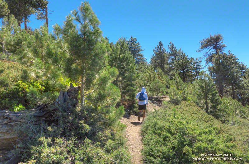
I’ve run and hiked the PCT between Islip Saddle and Mt. Baden-Powell for many years, so have had the opportunity to follow the regrowth of conifers where the Curve Fire burned over the crest. Studying conifer regrowth in this area can provide insights into regrowth in the 2009 Station Fire and 2020 Bobcat Fire burn areas, and in areas burned by more than one of these fires.
The locations of the stands are shown in this Google Earth image, along with the areas burned by the Curve and Bobcat Fires. Of these four areas, Stand #1 is the only one burned by the Curve Fire and Bobcat Fire.
Stand #1
This stand of young Jeffrey pines looked very healthy in June 2020. The area is about 1.5 miles east of Islip Saddle on the PCT, at an elevation of about 7440 ft. At that time a tree adjacent to the trail stood well overhead.
I almost ran past this area in July 2022. I had to double-check the mileage on my watch. Where were the trees? Here is a comparison of the area before and after the Bobcat Fire.
The young trees were more vulnerable than the mature trees in the area. Eighteen years of Curve Fire regrowth were completely obliterated.
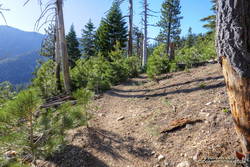
Stand #2
This area of young trees is between Windy Gap and Peak 8426, about 3.0 miles east of Islip Saddle on the PCT, at an elevation of about 7900 ft. Some old-growth Jeffrey pines were killed here. This is what the area looked like on May 30, 2010.
Now the size of the trees ranges from seedlings a few inches tall to this very robust Jeffrey pine that is well over head height.
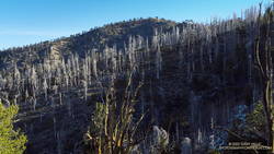
Stand #3
This area of young trees is on broad ridge, west of Mt. Hawkins, about 4.2 miles east of Islip Saddle on the PCT. The Curve Fire ran down the ridge to Hwy 2, killing hundreds of trees. The elevation at the PCT is about 8500 ft.
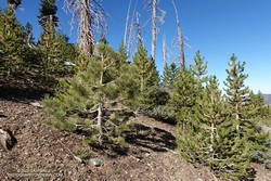
Stand #4
This area of young trees is on a south-facing slope, just west of Throop Peak, about 5.1 miles east of Islip Saddle on the PCT. The elevation is about 8900 ft. Because of its aspect, the new trees are taller than in the other areas photographed. Here’s what this area looked like in May 2012, June 2016, and July 2022.
Some related posts: Did Lightning Start the 2002 Curve Fire, 3D Terrain View of Bobcat Fire Soil Burn Severity and Some Angeles National Forest Trails