
My run to “Fossil Point” on Rocky Peak road, and side trip to Rocky Peak, was not the appalling experience I’ve come to expect when investigating a wildland area that has been overrun by a Southern California brush fire. Much of the chaparral along the fire road was not burned. Here are a few photos:
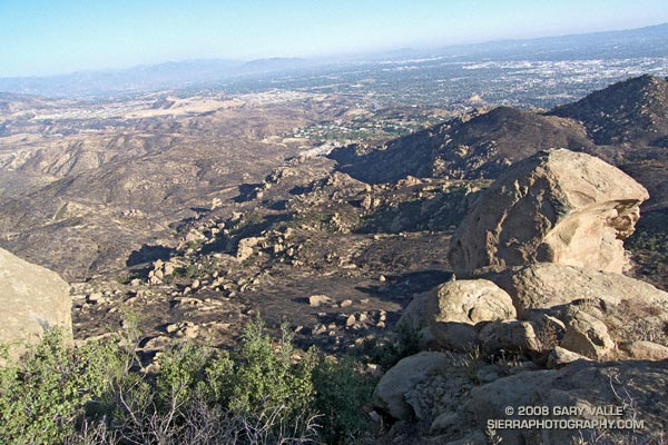
View southeast toward Porter Ranch from the summit of Rocky Peak (larger image).
View north toward Rocky Peak where the trail levels out, about 1.4 miles from the trailhead.
Burned area near viewpoint of Simi Valley about 2.3 miles from the trailhead.
View north from the summit of Rocky Peak. Rocky Peak fire road is on the far left, and the Johnson trail is on the right.
Unburned area along Rocky Peak fire road about 2.8 miles from the trailhead. Rocky Peak is the peak on the left.
False color image of slopes on the southwest side of Blind Canyon. The image has been modified to emphasize burned and unburned areas.
Some related posts: Chumash Trail – Sesnon & Simi Fires, San Fernando Valley from Rocky Peak