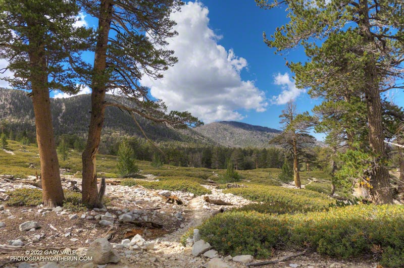
I wondered what the hikers would think when they reached this part of the Dollar Lake Trail.
A few minutes before, we had all reached the junction of the Dollar Lake and Dry Lake Trails at the same time. They hadn’t done the peak before and were debating which trail to take. When I mentioned that the Dollar Lake Trail is the shorter route to the summit, that’s the route they chose.
I guessed there might be a few choice words directed my way. About a half-mile beyond the junction, there is a long switchback on the Dollar Lake Trail that seems to never end. It’s about twice as long as any switchback on the Dry Lake Trail or Sky High Trail. With the mountain at your back, it takes the disbelieving hiker farther and farther away from their goal. How could it possibly be the shortest way to the summit?
But it is. The Dollar Lake Trail route is shorter — by about two miles. Following are the estimated mileages from the South Fork Trailhead to Gorgonio’s summit via the Dollar Lake and Dry Lake routes*:
SGWA handout – Dollar: 9.4 Dry: 11.3 Difference: 1.9
My GPS tracks – Dollar: 9.8 Dry: 11.5 Difference: 1.7
Tom Harrison Maps – Dollar: 10.0 Dry: 12.0 Difference: 2.0
*The Dollar Lake route uses the South Fork, Dollar Lake, Divide, and Summit Trails. The Dry Lake route uses the South Fork, Dry Lake, Sky High, and Summit Trails.
The combined route — Dollar up and Dry down — is one of the best mountain trail runs in Southern California. It’s a favorite, and the route I was doing today.
This morning the sky was mostly clear, and the temperature was mild. Later in the day, there was a chance of a thunderstorm, but I expected to be off the exposed trails higher on the mountain well before thunderstorms had a chance to build.
The first cumulus clouds popped up over the mountain around 10:00 a.m. An hour later — as I was crossing the summit plateau — the clouds were more extensive but with little vertical development.

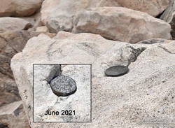
There were only a few people in the summit area. Some were on the west summit and some on the east. The twin summits are about 80 feet apart and nearly at the same elevation. Oddly, someone has defaced the survey marker on the west peak since the last time I was there — June 2021. With clouds all around, and 12 miles to go, I snapped a few photos and headed down.
I only saw one group of hikers on the Sky High Trail. They were working up the switchbacks at a good clip and would probably make the summit in an hour or so. Hopefully, the weather would hold for them!
It wasn’t until I was between the C-47 memorial and Mineshaft Saddle that I heard the first rumbles of thunder somewhere in the distance to the east or northeast.
As I continued down the mountain, I occasionally heard thunder in the distance but nothing nearby. There were some sizable cells to the east, but the weather behaved itself. At least where I was. I later heard it dumped at Onyx Summit, and flash flooding was reported at Joshua Tree.
For me, the weather was nearly ideal. Mild temperatures, light winds, and picturesque, sun-shielding clouds. It was short sleeves and shorts up and down. But on another day, it might not have worked out that way.
Here are a few photos taken along the way, and an interactive, 3D terrain view of the Dollar Lake – Dry Lake Loop.
Some related posts: San Gorgonio Mountain – June 2021; San Gorgonio Mountain Snow, Avalanches and Glaciers; San Gorgonio High Line
