Boney Mountain Morning

Crags on Boney Mountain's western ridge.

The face was not steep, but I was glad the pockmarked volcanic rock had big holds. Rainwater filled some of the pockets, and patches of lichen and moss on the face were saturated and slippery. It wasn’t a runout climb at the Needles or Tuolumne Meadows, but gravity still worked the same way. I reminded myself not to do something “stoopid.”


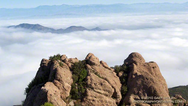
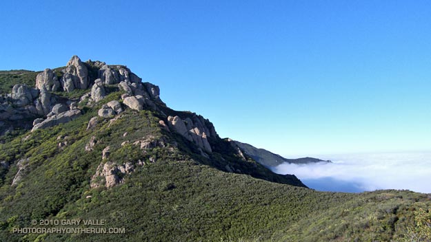
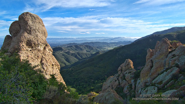
At the top of the face I looked around and sighed, and then looked around and sighed again. It was another stunning morning on the western ridge of Boney Mountain. To the west a nearly full moon struggled to remain above the hills, its brightness veiled in a mix of clouds. Another storm was expected in the evening, and the sky told of its approach. Broad strokes of cirrus brushed the blue above, and here and there fingers of tattered stratus reached into the coastal canyons and clung to the wet hillsides.

Today’s forecast for the Santa Monica National Recreation Area had called for mostly cloudy skies, and a high in the 60s. At the moment it was mostly sunny, but already there were hints of clouds developing on the ridges and mountaintops. At some point in the day the clouds would envelop the mountains, and transform the morning’s expansive vistas into a dimensionless gray. I hoped to get up the ridge, over Tri-Peaks, and to Sandstone Peak before that happened.


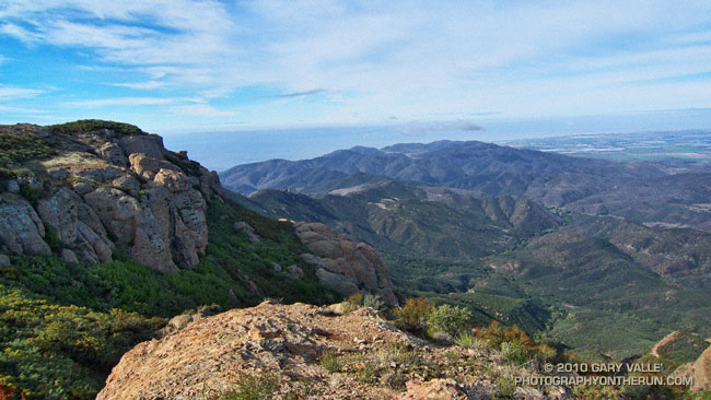
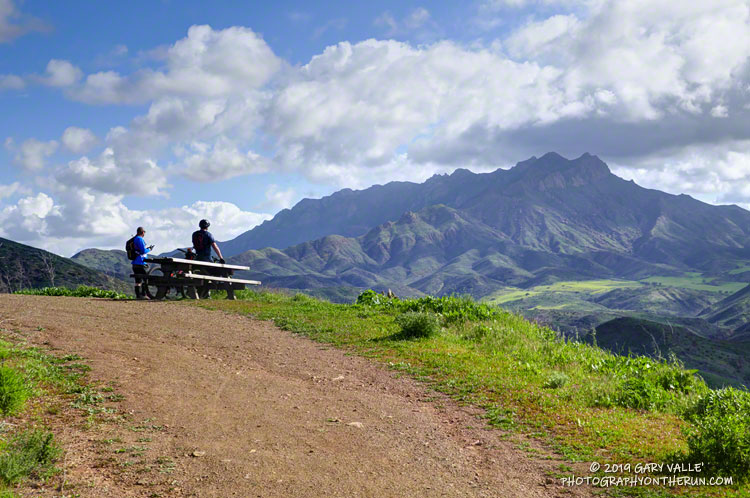
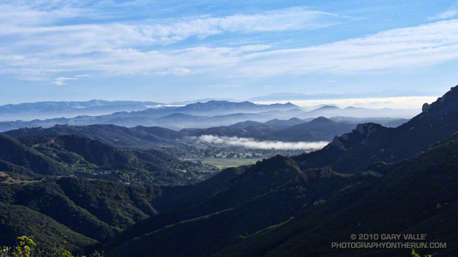
By chance the clouds behaved, and the splendid views and weather continued all the way to Sandstone Peak, and beyond. The run back to the Wendy Drive trailhead on the Backbone, Sycamore Canyon, and Upper Sycamore trails could not have been better.

As I climbed the final little hill to the parking area I noticed I had no shadow. Over the course of the afternoon the cloud deck would continue to lower and thicken, and by evening light rain would begin across the area.

Some related posts: Clouds and Crags, Conejo Valley Sun and Boney Mountain Clouds, Sandstone Peak from Wendy Drive

Clouds and Crags

The clouds are in the Conejo Valley and the crags are a prominent highpoint on the ridge that tops the west face of Boney Mountain. Here’s a Google Earth aerial view SSE along the ridge that shows the topography. From the upper cliffs the west face drops over 2000′ to the Backbone Trail in Blue Canyon.


Ascending the western ridge, or easier eastern ridge, is an adventurous way to access the Backbone Trail from Wendy Dr. Once over Tri-Peaks and on the Backbone Trail several loop variations are possible. These range from a relatively direct return on the Boney Trail, to lengthy excursions to Serrano Valley or La Jolla Valley.

Today’s variation worked out to about 20 miles. Once on the upper section of the Backbone Trail, I followed it west down the Chamberlain, Boney and Blue Canyon trails to the Danielson Multi-use area in Sycamore Canyon. After doing a circuit in Sycamore Canyon I picked up the Upper Sycamore Trail and headed back to Danielson Road, Satwiwa, and the trailhead at Wendy Drive.

Some related posts: Boney Mountain Western Ridge & Loop, Sandstone Peak from Wendy Drive, Boney Mountain North Side Loop

Running to Ray Miller

Mountain bikers enjoying the view of Boney Mountain from Overlook Fire Road in Pt. Mugu State Park.

The Ray Miller Trailhead in Pt. Mugu State Park marks the western end of the Backbone Trail, a 68-mile scenic trail along the spine of the Santa Monica Mountains. The Ray Miller Trail’s long, winding descent into La Jolla Canyon is a favorite of runners and hikers, and a fitting end to those traversing the BBT from east to west.

My run this morning was to the Ray Miller Trailhead (and back) from Satwiwa, starting at the Wendy Drive trailhead in Newbury Park. The Wendy Drive Trailhead is very popular and is the starting point for many good runs, hikes and rides. To get an idea of the route options, see the detailed trail maps on the Pt. Mugu State Park page of VenturaCountryTrails.org.

Today I was looking to do a longer run, so didn’t take the usual route. On the way down Big Sycamore Canyon, I skipped the turns at Wood Canyon (Hell Hill), Wood Canyon Vista Trail (BBT) and Fireline Trail and at Overlook Fire Road, some eight miles into the run, finally headed uphill.

View of the Pacific, Anacapa Island and Santa Cruz Island from the Ray Miller Trail
View of the Pacific, Anacapa Island and Santa Cruz Island from the Ray Miller Trail.

The top of the Ray Miller Trail is a stout 2.5 -mile climb from the bottom of Overlook Fire Road. Along the way there were excellent views of Sycamore Canyon, Serrano Valley and Boney Mountain.

About a half-mile down the Ray Miller Trail there is a popular overlook of the coast. The day was clear and there were stunning views of the Pacific and the Channel Islands. Brushed by whispers of wind, the cerulean blue Pacific filled my view for much of the descent to the parking lot.

It was an odd feeling to run down to the parking lot with runners who were cheerfully finishing their morning run, knowing that I had many more miles to go. After a quick stop at the water spigot, I turned, and sighed, and took the first steps back up the hill and toward Satwiwa.

Here are a few photos taken along the way.

Related post: Ray Miller Training Run