Tag Archives: arroyo seco

Woolly Bluecurls Blooming Out of Season Along the Ken Burton Trail

Woolly Bluecurls blooming out of season along the Ken Burton Trail, in the San Gabriel Mountains.

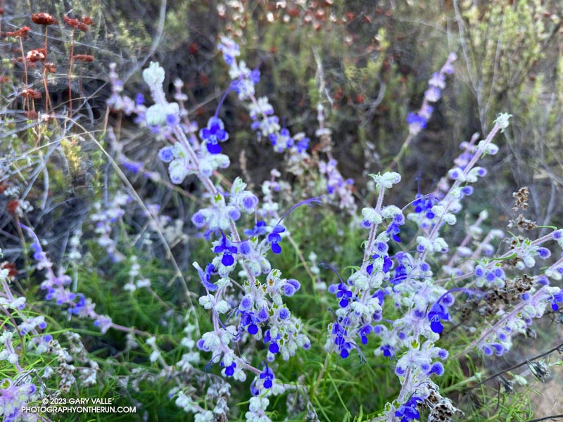
The blue of the woolly bluecurls was just stunning. The plant was along the Ken Burton Trail, in the San Gabriel Mountains, near Los Angeles.

Arroyo Seco below Royal Gorge at Gabrielino Trail crossing.

Woolly bluecurls normally flowers in the Spring, but rain from Tropical Storm Hilary, combined with Spring-like conditions caused it to bloom this Fall. Such blooms are usually not widespread and the flowers are often less robust than their Spring counterparts. Other Spring flowers that were blooming included Ceanothus, bush poppy, and golden yarrow.

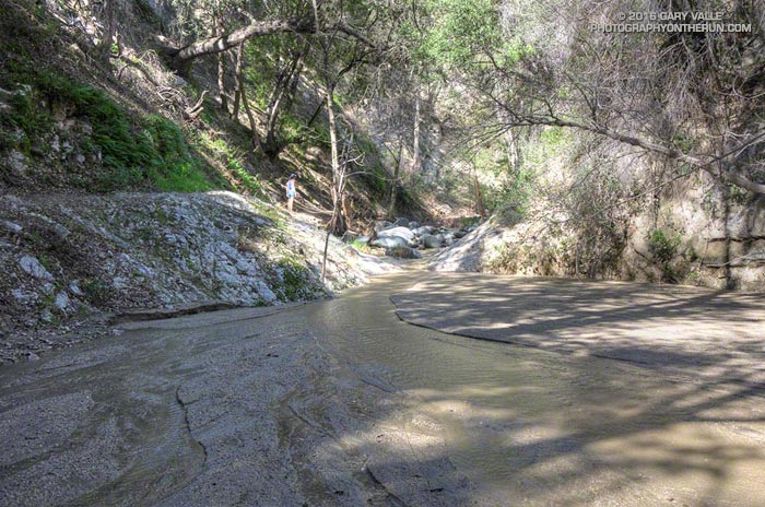
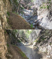
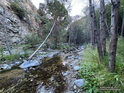
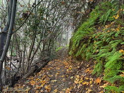
The Ken Burton Trail connects the Gabrielino Trail, near Oakwilde, to a saddle at the top of Brown Mountain Road. Today, I was doing a longish out and back trail run to Wella’s Peak from Clear Creek via Switzers and the Gabrielino and Ken Burton Trails. Wella’s Peak is a bump on the west side of the saddle. Brown Mountain towers above the east side of the saddle.

An idyllic section of the Gabrielino Trail on the segment that bypasses Royal Gorge.
An idyllic section of the Gabrielino Trail

Explore the scenery and terrain on the out and back trail run to Wella’s Peak from Clear Creek using our high resolution,  interactive, 3D viewer. The imagery is so detailed, it’s almost like being there! To change the view, use the control on the upper right side of the screen, the CTRL key and your mouse, or touch gestures. Track and placename locations are approximate and subject to errors. Snow, ice, poor weather, and other conditions may make this route unsuitable for this activity.

Related post: Red Box – Bear Canyon Loop Plus Brown Mountain

Arroyo Seco Sedimentation

Sedimentation on Arroyo Seco upstream of Bear Creek

Since kayaking Arroyo Seco with Gary Gunder during the 1997-1998 El Nino, I’ve enjoyed revisiting the many drops and falls along Arroyo Seco when running in the area.

When we did the Bear Canyon loop a couple of weeks ago, I was amazed to see many of Arroyo Seco’s stream features were nearly filled in with sediment. This image comparison shows a drop below Switzer Falls in March 2012 and in March 2016.

Arroyo Seco Sediment 2012 vs 2016.
Arroyo Seco Sediment 2012 vs 2016. Click for larger image.

Doing a little sleuthing using Yelp reviews of Switzer Falls, it looks like the creek had low sediment levels in early January 2014, but was heavily silted in mid-March 2014. Based on this, it appears that the initial sedimentation event occurred during the  storms of February 26 – March 2, 2014, when nearby Opids Camp recorded 10.95 inches of rain.

The origin of the 2009 Station Fire was in the Arroyo Seco watershed and it was one of the most severely impacted. A question that comes to mind is why did the Arroyo Seco drainage produce such a high rate of stream sedimentation in the February-March 2014 rain event, but not in the very high flows of February 2010 and December 2010, and the moderately high flows of March 2011?

Some of the factors likely include vegetative cover, rainfall rate, recent rainfall history, the soil’s hydrophobicity, the soil support provided by degrading root systems, the magnitude of the peak flow and the shape of the stream discharge curve. Our multi-year drought has been an amplifying factor, further reducing vegetative cover and soil support.

For more information regarding the history of the Arroyo Seco watershed and plans for its rehabilitation see the Arroyo Seco Foundation web site.