Tag Archives: San Gabriel Mountains

It’s Mid-July And There Is Still Snow in Los Angeles County!

Snow in the lee of the West Ridge of Mt. Baden-Powell.

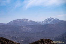
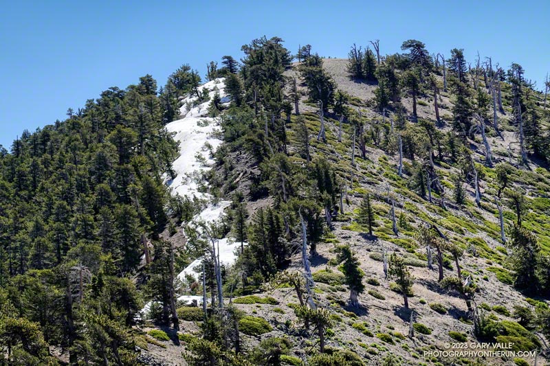
You might not see it from the Los Angeles side of the mountains, but there is still some snow on the higher, north-facing slopes of the San Gabriel Mountains.

During and after storms, snow-laden southerly winds dump their load on the backside of the crest, creating deep drifts, cornices, and compacted slabs of snow. This snow is often the last to melt, not only because it doesn’t face the sun, but because there is more of it.

Mt. Burnham, Peak 9086, and Mt. Baden-Powell from near Throop Peak.

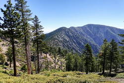
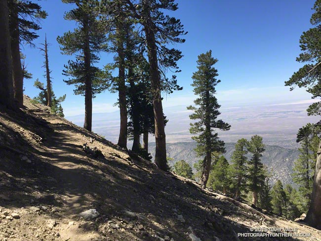
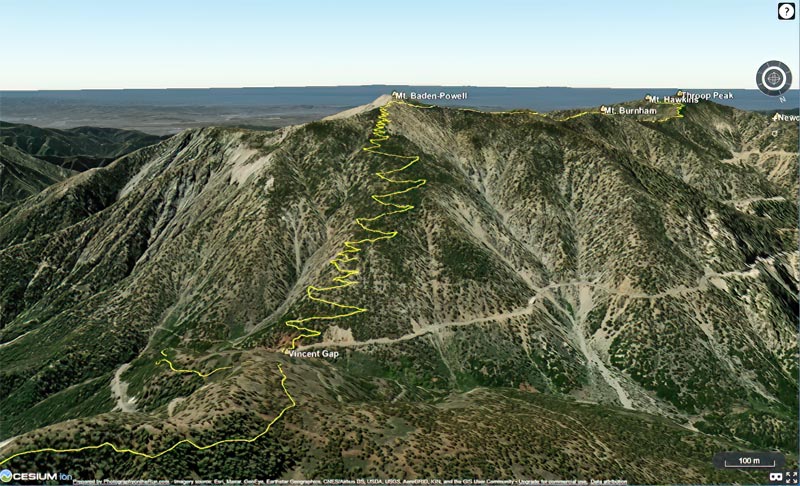
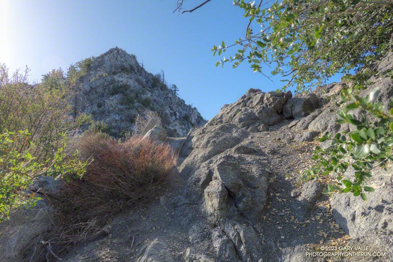
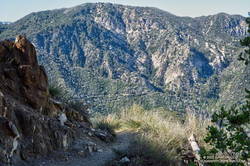
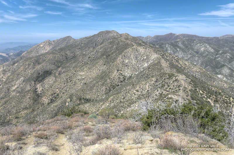
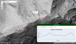
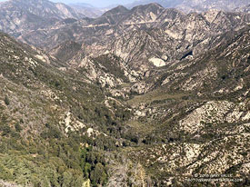
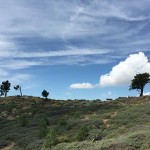
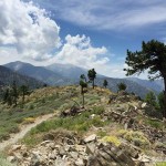
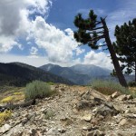
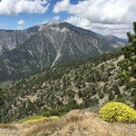
This morning, I was doing an out-and-back from the Windy Gap Trailhead in the Crystal Lake Recreation Area to Mt. Baden-Powell. The Windy Gap Trail climbs 1730′ in 2.6 miles, joining the PCT at Windy Gap. From there the trail follows the spine of the San Gabriels past Mt. Hawkins, Throop Peak, and Mt. Burnham to Mt. Baden-Powell.

I usually do this run from Islip Saddle, but with Angeles Crest Highway (Highway 2) closed between Red Box and Vincent Gap, the Islip Saddle trailhead isn’t accessible.

Snow on the west ridge of Mt. Baden-Powell. July 9, 2023.
Snow at about 9100′ on the west side of Mt. Baden-Powell.

Whether you start at Crystal Lake or Islip Saddle, the length of the run is about the same — a bit over 16 miles. The main difference is that the Windy Gap Trailhead is about 800′ lower in elevation. On the plus side, the Windy Gap Trail is very scenic; on the minus side, it faces south and can bake in the midday sun.

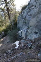
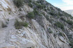
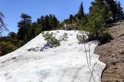
On today’s run, I encountered the first snowbanks at an elevation of 8870′, near the Dawson Saddle Trail junction. Out of curiosity, I tried to follow the trail and soon realized that was a mistake. I was more or less forced to skirt the downhill side of a lengthy and deep drift — it being too steep and icy to cross directly.

Mt. Baldy from the summit of Mt. Baden-Powell. July 9, 2023.

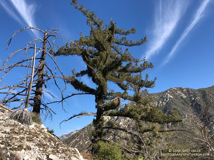
For the remainder of the run, I switched to the early season tactic of staying on the crest when the trail deviated onto shaded, north-facing slopes. These areas might have significant snow on the trail. This only happens in a few places, such as when the PCT works around Mt. Burnham. There is a use trail that ascends the west ridge of Mt. Burnham, and then returns to the PCT.

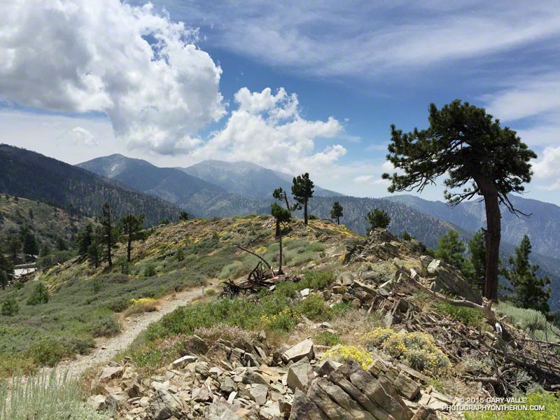
The conditions today are reminiscent of those found here in early July 2005. July 3rd of that year there was still snow on the summit of Baden-Powell, and there was deeper snow in the areas where there was snow today. We had a lot of storms this rain season, but in Rain Year 2004-2005 Downtown Los Angeles (USC) recorded about 9 inches more rain than during the 2022-2023 rain year!

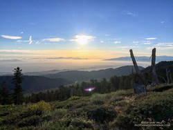
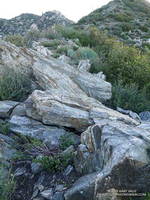
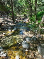
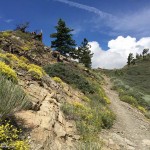
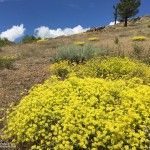
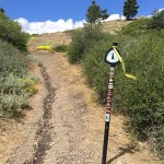
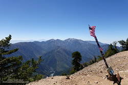
Here is a short slideshow of some photos taken on the run. I’ve also included a few photos from the run to Baden-Powell in 2005 for comparison.

The Ups and Downs of the Angeles Crest 100 Mile Run

Pacific Crest Trail on Mt. Baden-Powell

First published on June 30, 2015. Updated June 8, 2023.

June 15, 2023. According to the AC100 website the 2023 Angeles Crest 100 Mile Run has been cancelled. According to R.D. Ken Hamada, CalTrans engineers do not expect Highway 2 to open until this Winter, at the earliest.  The section from Islip Saddle to Grassy Hollow could be closed even longer.

July 29th will mark the 34th time runners from near and far gather in a small parking lot in Wrightwood, California, to start the Angeles Crest 100 Mile Endurance Run (AC100). Begun in 1986, the AC100 is one of the original five 100-mile U.S. endurance races. It has endured fires, floods, the Covid-19 pandemic, and changing trail restrictions.

There’s a tradition of running grueling endurance races in the San Gabriel Mountains. The Big Pines Trail Marathon was one of the first organized mountain ultramarathons in the U.S. First run in August 1934, its course used some of the same trails that AC100 runners enjoy today.

The AC100 is not like a road marathon. It is an entirely different kind of running event and an entirely different kind of running experience. In 2023 the L.A. Marathon had about 22,000 participants. About 1/100th of that number — around 250 runners — are expected to start the AC100.

Sunrise from Blue Ridge during the 2015 Angeles Crest 100.
Sunrise from Blue Ridge during the 2015 AC100.

For many, one of the primary reasons for running the AC100 is to be fully immersed in the beauty and majesty of the San Gabriel Mountains. Runners start at 5:00 a.m., ascend the Acorn Trail, and as the sun rises, find themselves above 8000′, reveling in the spectacular views from Blue Ridge.

Even at this early stage of the race, the field is already becoming dispersed. By the time runners reach the first checkpoint, nine miles into the run, there is an hour spread between the first and last runners. Unlike a road marathon, much of the time a runner in the AC100 will be alone.

This year’s course returns to a point-to-point format, ending in Altadena. Because of damage to the Chantry Flat area by the Bobcat Fire, runners will bypass Chantry and ascend Mt. Wilson via the Kenyon-Devore Trail, returning to the traditional course at the Mt. Wilson Toll Road above Idlehour.

As a result of this Winter’s frequent storms, many trails have been damaged or blocked by trees and debris. Ultrarunners not only spend many hours enjoying the trails in our local mountains but also do hours of trailwork that helps keep trails open and in usable condition.

Once again this year, some long stretches of the AC100 course will be run on Angeles Crest Highway. As was done for the Western State 100 Mile course, AC100 organizers have been trying to obtain an exception to use trails historically included in the event. You can help get runners off the highway and back on the trail — for more information, see the Save the AC100 page on the AC100 website.

The elevation profile for the 2023 AC100 course (PDF) was created in SportTracks from the GPX file on the AC100 website on 6/8/23. The elevation profile was corrected using 3DEP 1-meter Lidar-based DEMs. A conservative elevation data smoothing setting was used, resulting in an estimated cumulative gain of about 17,890′ and loss of 22,550′. The actual gain and loss are probably a bit more. Placemark locations, mileages, and elevation gains and losses are approximate.

Estimated Angeles Crest 100 Mile Elevation Profile (link)
Click to view/download PDF of the elevation profile.

In addition, here is an interactive, 3D terrain map of the 2023 Angeles Crest 100 Mile Race. It is based on the course GPX file downloaded from the AC100 website. The map is initially zoomed in on the climb up Mt. Baden-Powell. To change the view, use the control on the upper right side of the screen. Track and placename locations are approximate and subject to errors.

Click to view 2023 AC100 course with photographic 3D terrain.

See the AC100 website for official information and details.

Strawberry Peak Summit Loop – Spring 2023 Update

The northwest ridge of Strawberry Peak just before the Class 2-3 rock climbing segment.

Usually, I prefer to start the Strawberry Peak Summit Loop at the Colby Canyon Trailhead on Angeles Crest Highway. But it had been a while since I’d done the loop from Clear Creek, and I was feeling a little nostalgic. One of the aid stations for the ANFTR/Mt. Disappointment race is at Clear Creek, and the course climbs Josephine Fire Road.

I was also curious how my time to Josephine Saddle using the fire road would compare to the direct route up the Colby Canyon Trail. As it turned out, at a moderate pace it was about the same either way.

Foliated rock along the use trail to the northwest ridge of Strawberry Peak

The use trail up from Josephine Saddle was in decent condition. It looked like it may have recently had a snip here and there. Part way up the path, an outcrop on the ridgeline provides a good warmup for the climbing higher up. The circuitous path eventually ends at the base of the steep, jumbled northwest ridge of Strawberry Peak. I was surprised to find two small patches of snow here.

It’s difficult to describe the route on the ridge since there are many variations. It’s not fear-mongering to say that people get into trouble on this section. A common comment about this segment is, “Don’t climb anything sketchy or difficult.” But what is an easy scramble for one person may be nearly impossible for another. With 50+ years of rock climbing experience, I still remind myself not to climb up anything I’m not 100% sure I can climb down. If you don’t have “real” rock climbing experience, go with someone that knows the route.

Snow on the NW side of Strawberry Peak on April 30, 2023.
Small patches of snow on the NW side of Strawberry Peak on April 30, 2023.

Following a wet, snowy, cold Winter, I took extra care while climbing. Solid holds and blocks can sometimes be loosened over the Winter and fail unexpectedly. This morning, I didn’t notice any obvious changes on the route I climbed.

The setting changes dramatically on the east side of Strawberry Peak. You go from the cool shadows of a steep, rocky face with (typically) no one around to a sunny, sandy, busy summit and trail.

As I approached the summit, a couple of people were setting up to do a video for a vlog. Another person had just reached the top, and another hiker wasn’t far behind. With snow in the high country, Hwy 2 still closed at Red Box, and the Bobcat Fire Closure still in effect, the trail up Strawberry was a popular option. The question of the day from the people coming up was, “How many false summits are there?”

Looking across the canyon to the Gabrielino Trail below Red Box, and Supercloud Canyon

Overall, the Strawberry Peak Trail was in reasonable shape. The trail needed a little work in a few places, but as far as mountain trails go, its condition was about what you would expect. In several places, the trail was carpeted with the remnants of old yucca leaves. Very nice!

Just before reaching Red Box, I snapped a photo of the snow on Mt. Baldy. At Red Box, all but one parking space was taken, and that one was snagged by an arriving car.

As I started down the Gabrielino Trail from Red Box, LASD Air Rescue 5 began to orbit overhead. Apparently, there had been yet another vehicle accident on Angeles Crest Highway. It wasn’t long until I heard the whaling sound of sirens coming up the canyon.

Upper Arroyo Seco at Switzer's Picnic Area.
Upper Arroyo Seco at Switzer’s Picnic Area.

Some trailwork had been done on the upper half of Gabrielino Trail between Red Box and Switzer’s. Quite a few small trees and limbs had been removed from the trail, and the bushes trimmed. Most of the work (as of today) ended at mass of fallen trees halfway down the trail.

Upper Arroyo Seco was flowing. The sound of water plunging over the debris dams made the flow seem higher than it was. There were a couple of minor creek crossings.

Switzer’s was busy — as usual. To finish the loop, I walked up the stairs to the access road and hiked up to the start of Nature’s Canteen Trail. It was a bit overgrown, but I was back at Clear Creek in a few minutes.

Some related posts: Strawberry Peak Summit Loop; Plan B: Barley Flats; Strawberry Peak, Switzer’s and the Old Colby Trail

Condor Peak and Fox Mountain Adventure Run

Condor Peak from Fox Mountain

The out and back trail run to Condor Peak (5440’+) and Fox Mountain (5033′) from Vogel Flat is an adventurous 17-mile, lower elevation run in the San Gabriel Mountains.

Exposed stretch of the Condor Peak Trail

When I last did this run (May 2020), portions of the trail below Fox Mountain were washed out and overgrown. Later I learned that this was before the Condor Trail restoration project had been completed. Thanks to the hard work of the Lowlifes Trail Crew the trail has been brought back to life. Today, several groups — including hikers, bikers, and runners — were making their way to Condor Peak.

Hazy view of snow on Mt. Waterman and Twin Peaks from the Condor Peak Trail.
Snow on Mt. Waterman and Twin Peaks from the Condor Peak Trail.

As mentioned in my posts from 2007 and 2020, this adventure is best done when the weather is cool. It can really bake on the south-facing sections of trail. From the Vogel Flat Trailhead on Big Tujunga Canyon Road the trail climbs about 2600′ in 6 miles to reach Fox Divide. Much of this stretch is surprisingly runnable. As with most mountain trails, extra care is required because of steep drop-offs and other hazards.

Today, the trail was in the best shape I’ve seen in years. The weather was relatively cool and good for running. As has been the case in other low elevation areas, a colorful assortment of Spring wildflowers were blooming along the trail. With our copious Winter rain, two small streams were crossed on the traverse above Fusier Canyon. It’s hard to say how long they will last.

USGS Lidar-based 3DEP 1m contour map of Condor Peak

Condor Peak has twin summits. A register and summit sign currently reside on the west peak, but USGS 3DEP 1-meter Lidar-based data suggests the west and east peaks have virtually identical elevations – about 5441′.

This time, after climbing Condor Peak, I also climbed Fox Mountain. Although steep, it’s short, and doing Fox only added about 30 minutes to the total time.

Here are a few photos taken along the way. Additional info, photos, and an interactive map with 3D terrain can be found in the following related posts.

Some relate posts: Condor Peak Out and Back Adventure Run, Condor Peak Trail Run

After the Station Fire: Back to Bear Canyon

Bigcone Douglas-fir burned in the 2009 Station Fire. September 1, 2018.

It’s been nine years since the Station Fire burned 160,577 acres in Angeles National Forest. The Red Box – Bear Canyon – Gabrielino loop is a long time favorite adventure run that I’ve enjoyed doing many years before and after that 2009 fire.

The loop was the first I did when the area reopened in May 2011. The trails were in poor shape — overgrown and damaged from flash floods. The notorious fire-follower Poodle-dog bush had flourished in the wake of the fire and was particularly bad along the Gabrielino Trail between Switzer’s and Red Box. Thinking I was “immune” to the plant, I brazenly plowed through it, and as a result spent several inflamed nights trying to sleep in a reclining chair.

Each year Bear Canyon and upper Arroyo Seco recover a little more. Poodle-dog bush is in decline and in many areas nearing the end of its life-cycle. The chaparral, bay trees and oaks are all recovering; and the bigcone Douglas-firs that survived the fire have become more fully-foliaged.

Bear Canyon from the upper Bear Canyon Trail.
Bear Canyon from the upper Bear Canyon Trail. Click for larger image.

This year Bear Canyon was a little drier than last. The creek was a trickle, disappearing in the sand in some areas and creating small pools in others. The path in the upper part of the canyon, above Bear Canyon Camp, was better defined, but still tricky to follow in some spots.

With the dry conditions, most of the poison oak had already turned red. It was easy to spot, but difficult to avoid. The “stinging nettle” creek crossing higher in the canyon wasn’t as overgrown as last year, but I still managed to brush against a plant or two.

Bear Canyon ends at Arroyo Seco, downstream of Switzer Falls. After turning upstream on the Bear Canyon Trail, I hadn’t run far when I encountered a couple of mountain bikers. They asked me, “is this the trail to JPL?”

This wasn’t the first time that I’d encountered misplaced riders or hikers on this section of trail. Some get misplaced looking for the falls and others mistakenly follow the Bear Canyon Trail down into Arroyo Seco instead of continuing high in the canyon on the Gabrielino Trail. Because of the completion of the restoration of the Gabrielino Trail there were a few more riders on the trail than usual.

Here are a few photos taken along the way.

Some related posts: Bear Canyon Loop: If the Poison Oak Doesn’t Get You, the Stinging Nettle Will; After the Station Fire: Red Box – Bear Canyon – Gabrieleno Loop; After the Station Fire: Contact Dermatitis from Turricula parryi – Poodle-dog Bush

Inspiration

Pine Mountain and Mt. Baldy from Lightning Ridge

The day before the Angeles Crest 100, after checking in for the race in Wrightwood, I drove over to Inspiration Point to have lunch, go for a short hike, and enjoy being in the mountains. The day was exceptional.


Click an image for more info and to display the image full-size.