Google discontinued its Google Earth API/Plugin in January 2017. That technology was used on PhotographyontheRun.com for 3D visualizations of trail runs, fire data, and other data.
I’ve been looking at alternatives since then, and have recently implemented an interactive viewer using the CesiumJS and Cesium ion components of the Cesium 3D Geospatial Platform. No browser add-on or plug-in is required. The viewer uses the Cesium World Terrain high-resolution global terrain tileset, with resolutions to 0.5 meter. The West Coast of the US is one of the areas covered by this resolution.
Following are example 3D visualizations of some of my recent runs. The views are interactive and can be zoomed, tilted, rotated and panned. Click/tap the “?” in the upper right corner for help manipulating the scene. Mileages and elevation gains/losses are approximate.
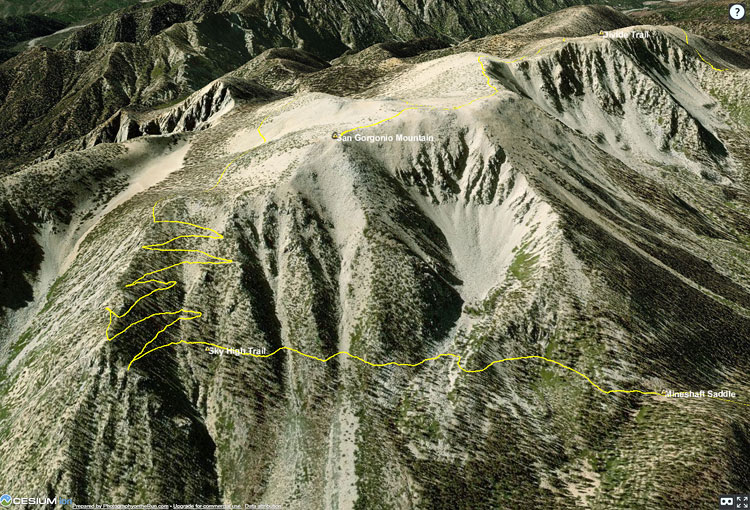
San Gorgonio Mountain Trail Run (21 mi, 4700′ gain/loss)
The initial view is of San Gorgonio Mountain from the northeast, showing the trail to the summit and the Sky High Trail. The large cirque held one of several glaciers on San Gorgonio Mountain. The GPS track is from a run in September.
San Gorgonio Mountain Trail Run and Lake Fire Burn Area
Another view of San Gorgonio Mountain with the 2015 Lake Fire burn area added. The initial view is from the northwest. The GPS track is from my run in September.
Bulldog Loop Variation (17 mi, 3250′ gain/loss)
The initial view of this popular loop is from the northeast. This variation starts/ends at the Cistern Trailhead on Mulholland Hwy. The GPS track is from a run of the loop in September.
Three Points Loop Around Mt. Waterman (20 mi, 4000′ gain/loss)
The initial view is from the Buckhorn (east) side of the loop. The loop includes a segment of the PCT in Cooper Canyon. The GPS track is from a run in October.
Top of Reseda to Parker Mesa Overlook (18.5 mi, 3100′ gain/loss)
The initial view is from the northeast, on the Valley side of the route. The Musch, Garapito and Bent Arrow Trails were done on the way back from Parker Mesa. The GPS track is from a run in October.
