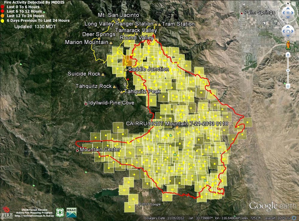
Google Earth image of 2013 Mountain Fire MODIS fire detections as of 07/21/13 1330 MDT. Also
 alt="Google Earth image of 2013 Mountain Fire MODIS fire detections as of 07/21/13 1330 MDT. Also included is the fire perimeter from GEOMAC timestamped 07/21/13 0118. Placemark locations are approximate. GPS tracks (yellow) from various runs have been added to mark some of the trails on San Jacinto Peak." border="0">
Google Earth image of 2013 Mountain Fire MODIS fire detections as of 07/21/13 1330 MDT. Also included is the fire perimeter from GEOMAC timestamped 07/21/13 0118. Placemark locations are approximate. GPS tracks (yellow) from various runs have been added to mark some of the trails on San Jacinto Peak.
Click this link to read more about this photograph.
Click on any of the following categories to see additional photography:
ABSTRACT - QUIRKY - LANDSCAPE - WILDLIFE - INSECTS - WILDFLOWERS - ADVENTURES
PHOTOGRAPHY
ON THE RUN
Copyright © 1995-2025 Gary Valle'. All Rights Reserved.
![]()