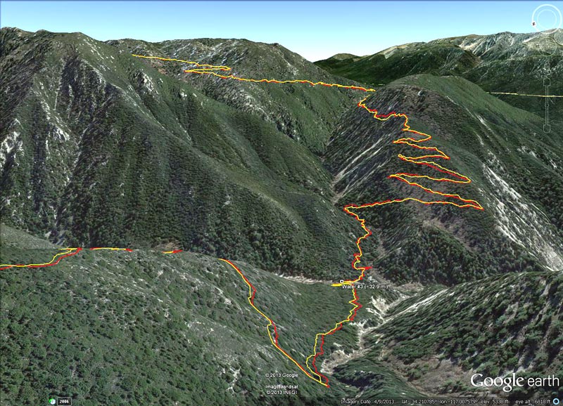
Google Earth image of the Camp Creek Trail descending to Bear Creek, then the climb out on the
 alt="Google Earth image of the Camp Creek Trail descending to Bear Creek, then the climb out on the reopened Siberia Creek Trail. The Bear Creek crossing was at about mile 32.9 of the 2013 Kodiak 50 mile and mile 82.2 of the 2013 Kodiak 100 mile." border="0">
Google Earth image of the Camp Creek Trail descending to Bear Creek, then the climb out on the reopened Siberia Creek Trail. The Bear Creek crossing was at about mile 32.9 of the 2013 Kodiak 50 mile and mile 82.2 of the 2013 Kodiak 100 mile.
Click this link to read more about this photograph.
Click on any of the following categories to see additional photography:
ABSTRACT - QUIRKY - LANDSCAPE - WILDLIFE - INSECTS - WILDFLOWERS - ADVENTURES
PHOTOGRAPHY
ON THE RUN
Copyright © 1995-2025 Gary Valle'. All Rights Reserved.
![]()