Google Earth image of 2015 Lake Fire MODIS fire detections as of 06/26/15 715 MDT and the fire
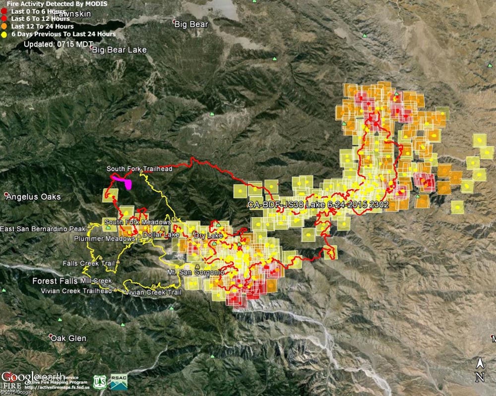 alt="Google Earth image of 2015 Lake Fire MODIS fire detections as of 06/26/15 715 MDT and the fire perimeter from GEOMAC timestamped 06/24/15 2302. Placemark locations are approximate. The yellow GPS tracks show some of the trails in the area. The small magenta area on the NW of the fire perimeter is the initial perimeter from GEOMAC timestamped about 8 hours after the fire was reported." border="0">
Google Earth image of 2015 Lake Fire MODIS fire detections as of 06/26/15 715 MDT and the fire perimeter from GEOMAC timestamped 06/24/15 2302. Placemark locations are approximate. The yellow GPS tracks show some of the trails in the area. The small magenta area on the NW of the fire perimeter is the initial perimeter from GEOMAC timestamped about 8 hours after the fire was reported.
Click this link to read more about this photograph.
Click on any of the following categories to see additional photography:
ABSTRACT - QUIRKY - LANDSCAPE - WILDLIFE - INSECTS - WILDFLOWERS - ADVENTURES
PHOTOGRAPHY
ON THE RUN
Copyright © 1995-2025 Gary Valle'. All Rights Reserved.
![]()