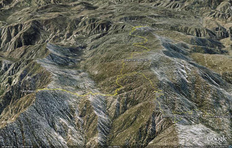
Google Earth image of a GPS trace of the Buckhorn to Three Points trail run, with an ascent of Twin
 alt="Google Earth image of a GPS trace of the Buckhorn to Three Points trail run, with an ascent of Twin Peaks." border="0">
Google Earth image of a GPS trace of the Buckhorn to Three Points trail run, with an ascent of Twin Peaks.
Click this link to read more about this photograph.
Click on any of the following categories to see additional photography:
ABSTRACT - QUIRKY - LANDSCAPE - WILDLIFE - INSECTS - WILDFLOWERS - ADVENTURES
PHOTOGRAPHY
ON THE RUN
Copyright © 1995-2025 Gary Valle'. All Rights Reserved.
![]()