Preliminary burn severity map for the Woolsey Fire from NASA Earth Observatory
 alt="Google Earth image of a preliminary burn severity map for the Woolsey Fire from NASA Earth Observatory, as posted by NASA’s Rehabilitation Capability Convergence for Ecosystem Recovery (RECOVER) web site on November 15, 2018. Burn severity classes are high (red), moderate (orange) and low (yellow). Some trails in the region have been added." border="0">
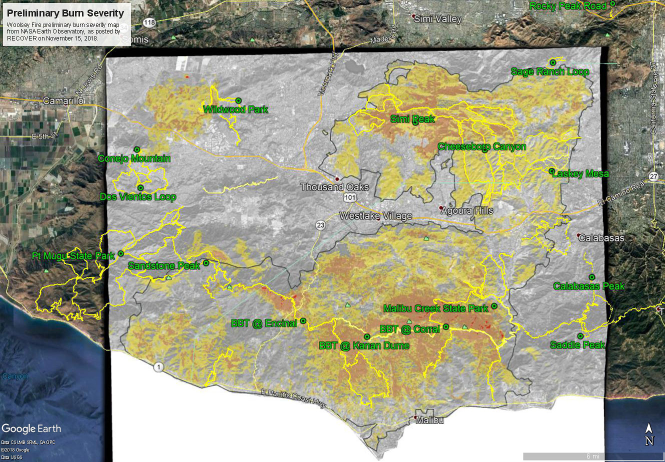
Google Earth image of a preliminary burn severity map for the Woolsey Fire from NASA Earth Observatory, as posted by NASA’s Rehabilitation Capability Convergence for Ecosystem Recovery (RECOVER) web site on November 15, 2018. Burn severity classes are high (red), moderate (orange) and low (yellow). Some trails in the region have been added.
Click this link to read more about this photograph.
Click on any of the following categories to see additional photography:
ABSTRACT - QUIRKY - LANDSCAPE - WILDLIFE - INSECTS - WILDFLOWERS - ADVENTURES
PHOTOGRAPHY
ON THE RUN
Copyright © 1995-2025 Gary Valle'. All Rights Reserved.
![]()