Satellite imagery of snow on San Gorgonio Mountain, October 21, 2019.
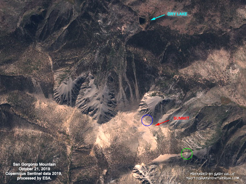 alt="Copernicus Sentinel satellite imagery of snow on San Gorgonio Mountain, October 21, 2019. The blue circle marks the remnants of the summit snow band at about 11,400', at the top of the northeast cirque. The green circle marks a snow patch in the steep gully below 'The Tarn' at about 10,360'." border="0">
Copernicus Sentinel satellite imagery of snow on San Gorgonio Mountain, October 21, 2019. The blue circle marks the remnants of the summit snow band at about 11,400', at the top of the northeast cirque. The green circle marks a snow patch in the steep gully below 'The Tarn' at about 10,360'.
Click this link to read more about this photograph.
Click on any of the following categories to see additional photography:
ABSTRACT - QUIRKY - LANDSCAPE - WILDLIFE - INSECTS - WILDFLOWERS - ADVENTURES
PHOTOGRAPHY
ON THE RUN
Copyright © 1995-2025 Gary Valle'. All Rights Reserved.
![]()