Map of CZU Lightning Complex Fire perimeter and GPS track from the PCTR Skyline to the Sea Marathon
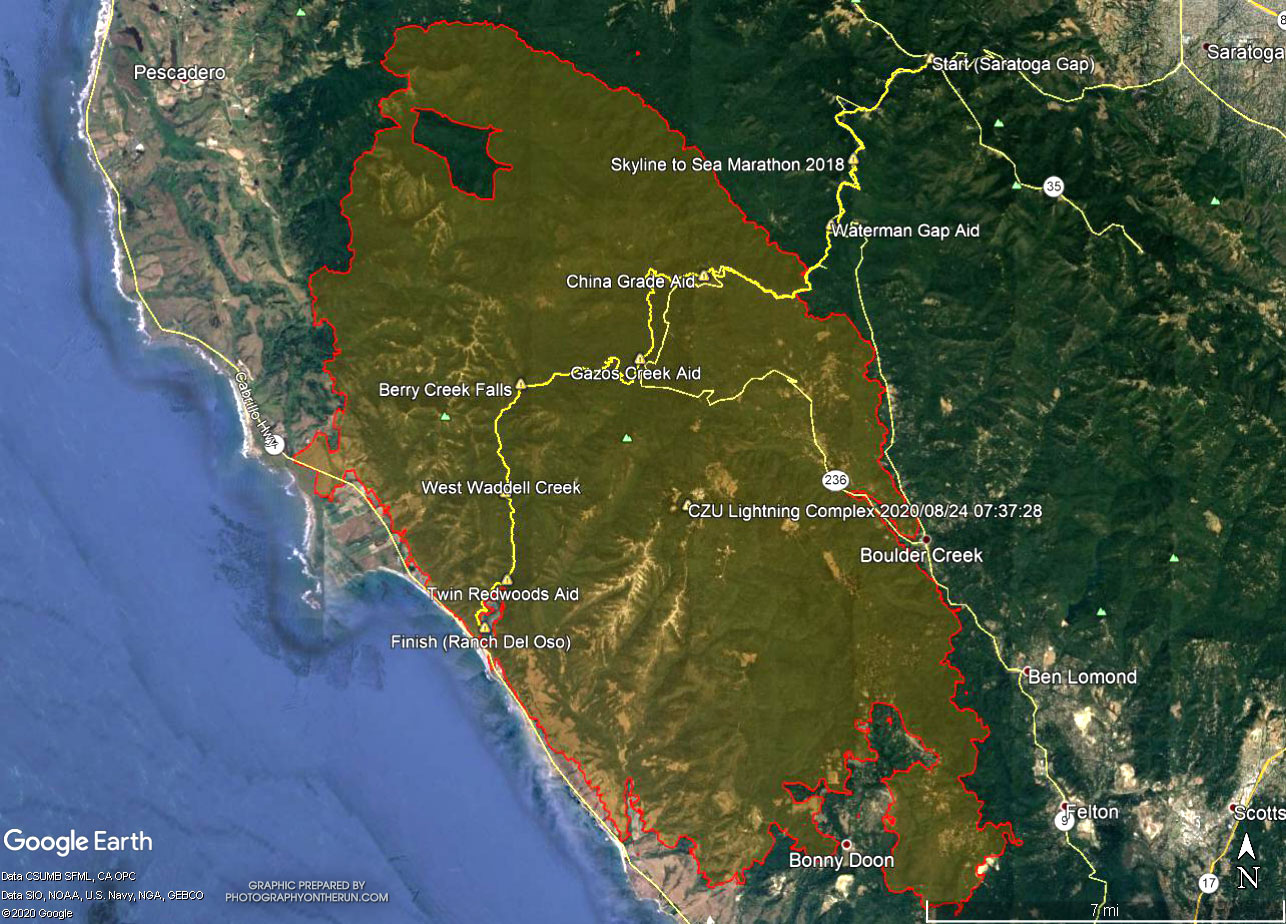 alt="A Google Earth image of a CZU August Lightning Complex Fire perimeter and my GPS track from the PCTR Skyline to the Sea Marathon. The perimeter is from the National Interagency Fire Center (NIFC) and its timestamp is indicated. The locations of all placemarks and trails are approximate." border="0">
A Google Earth image of a CZU August Lightning Complex Fire perimeter and my GPS track from the PCTR Skyline to the Sea Marathon. The perimeter is from the National Interagency Fire Center (NIFC) and its timestamp is indicated. The locations of all placemarks and trails are approximate.
Click this link to read more about this photograph.
Click on any of the following categories to see additional photography:
ABSTRACT - QUIRKY - LANDSCAPE - WILDLIFE - INSECTS - WILDFLOWERS - ADVENTURES
PHOTOGRAPHY
ON THE RUN
Copyright © 1995-2025 Gary Valle'. All Rights Reserved.
![]()