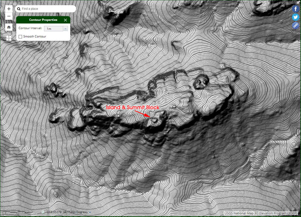
Lidar-based 1-meter resolution 3DEP elevation contours of Boney Bluff
 alt="Lidar-based 1-meter resolution 3DEP elevation contours of Boney Bluff. The location of the "Island" and summit block is indicated." border="0">
Lidar-based 1-meter resolution 3DEP elevation contours of Boney Bluff. The location of the "Island" and summit block is indicated.
Click this link to read more about this photograph.
Click on any of the following categories to see additional photography:
ABSTRACT - QUIRKY - LANDSCAPE - WILDLIFE - INSECTS - WILDFLOWERS - ADVENTURES
PHOTOGRAPHY
ON THE RUN
Copyright © 1995-2024 Gary Valle'. All Rights Reserved.
![]()